Explore WA
Gallery44
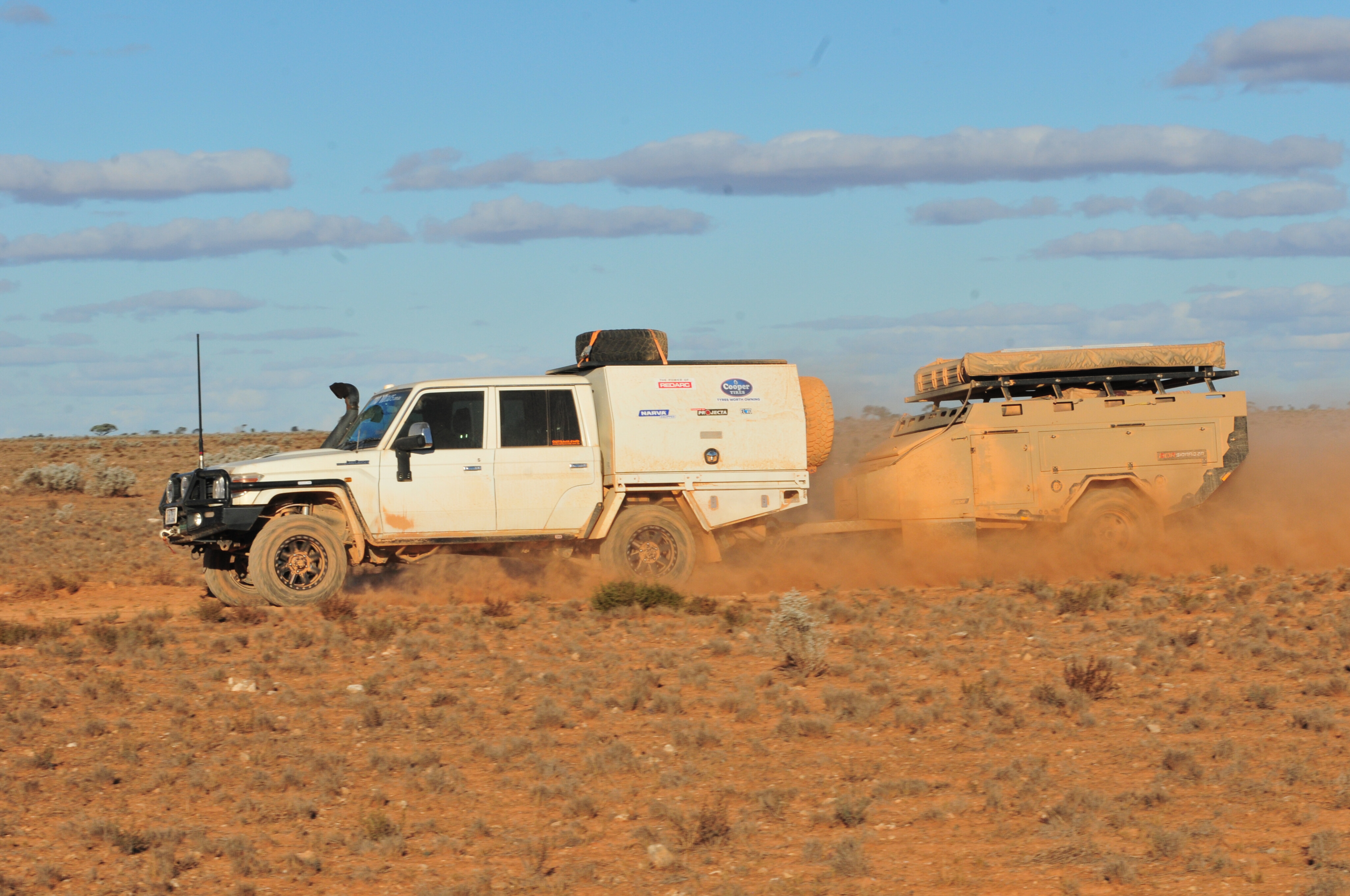
We had left the tiny outpost of Rawlinna in the mid-afternoon a little later than expected as one of the vehicles had developed alternator trouble.
While Rob had stripped said alternator in an effort to fix it, it was to no avail, so while he headed to Kalgoorlie to get a new one, we struck to the north, and would meet up with him at Warburton in a few days’ time.
Rawlinna has been a major railway siding from the time the Trans Australian Railway was established in 1917 to the demise of the steam engines in 1951 that had once necessitated a major engine support facility in the town.

44
With diesel-electric trains now hauling people and freight across the continent, the railway siding has seen less and less maintenance workers, but it is not completely abandoned with occasional telephone people and railway maintenance crews still making use of its facilities.
Today the weekly Indian-Pacific train stops here for a barbecue so passengers can get a ‘real’ taste of the remoteness. And the hamlet gets a huge influx of people during the annual Nullarbor Muster, usually held during April; the 41st running of the event is scheduled for 2024 (www.nullarbormuster.org).
Rawlinna Station, the biggest sheep property in Australia (and the world) at over 10,000 sq km (2.5 million acres), runs between 60,000 and 80,000 sheep, and has its main homestead about 11km south-west of the railway siding.
Explore


44
It was, rather surprisingly in the pastoral history of Australia, only established in 1962. That was about the same time as the first tentative steps were made to push a track, later to become the Connie Sue Highway, south from Warburton to the railway line.
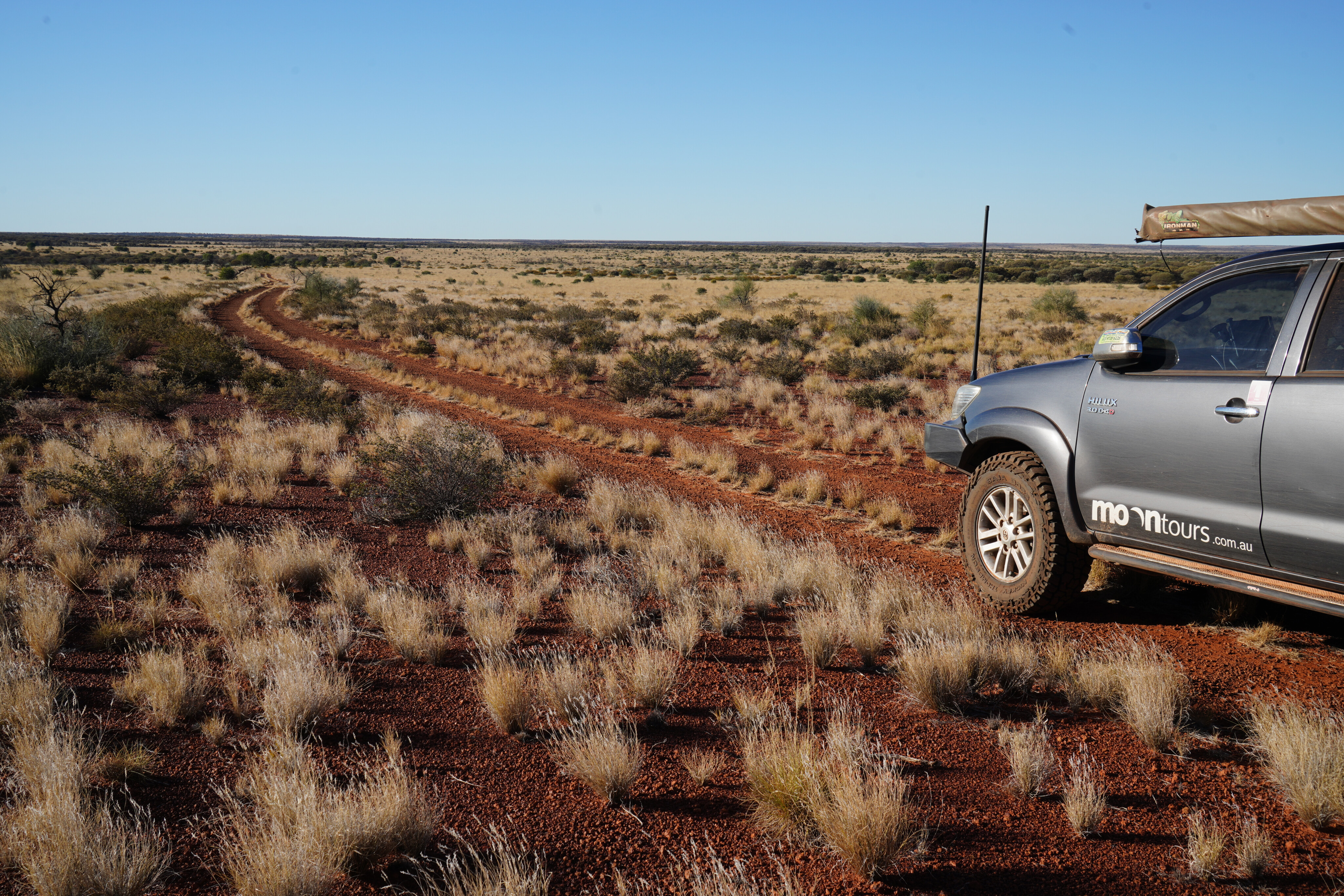
Just getting to Rawlinna is an adventure in itself. The easiest way is from Kalgoorlie where a good graded road, paralleling the railway line, runs 380km to Rawlinna. A rough track from the east also follows the railway line, while another limestone studded route heads north from Cocklebiddy on the Eyre Highway.
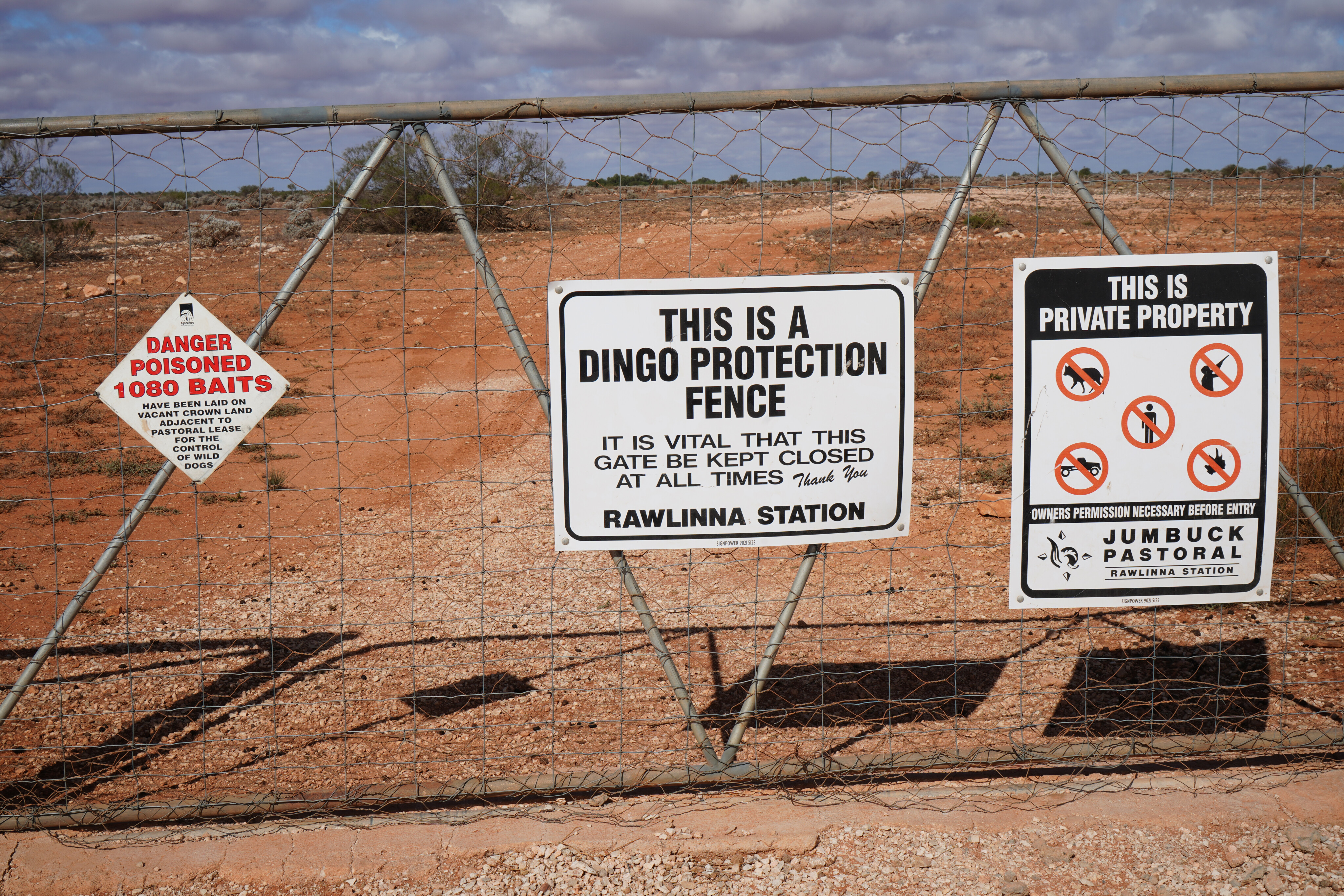
No matter which way you come though, you’ll pass along some of the 370km long dingo-proof fence that skirts the Rawlinna sheep property, recently sold to ‘Twiggy’ Forrest’s Fortescue Metals Group for supposedly future green energy and carbon-reduction projects; not sure if the fence will be of any benefit for that though!
44
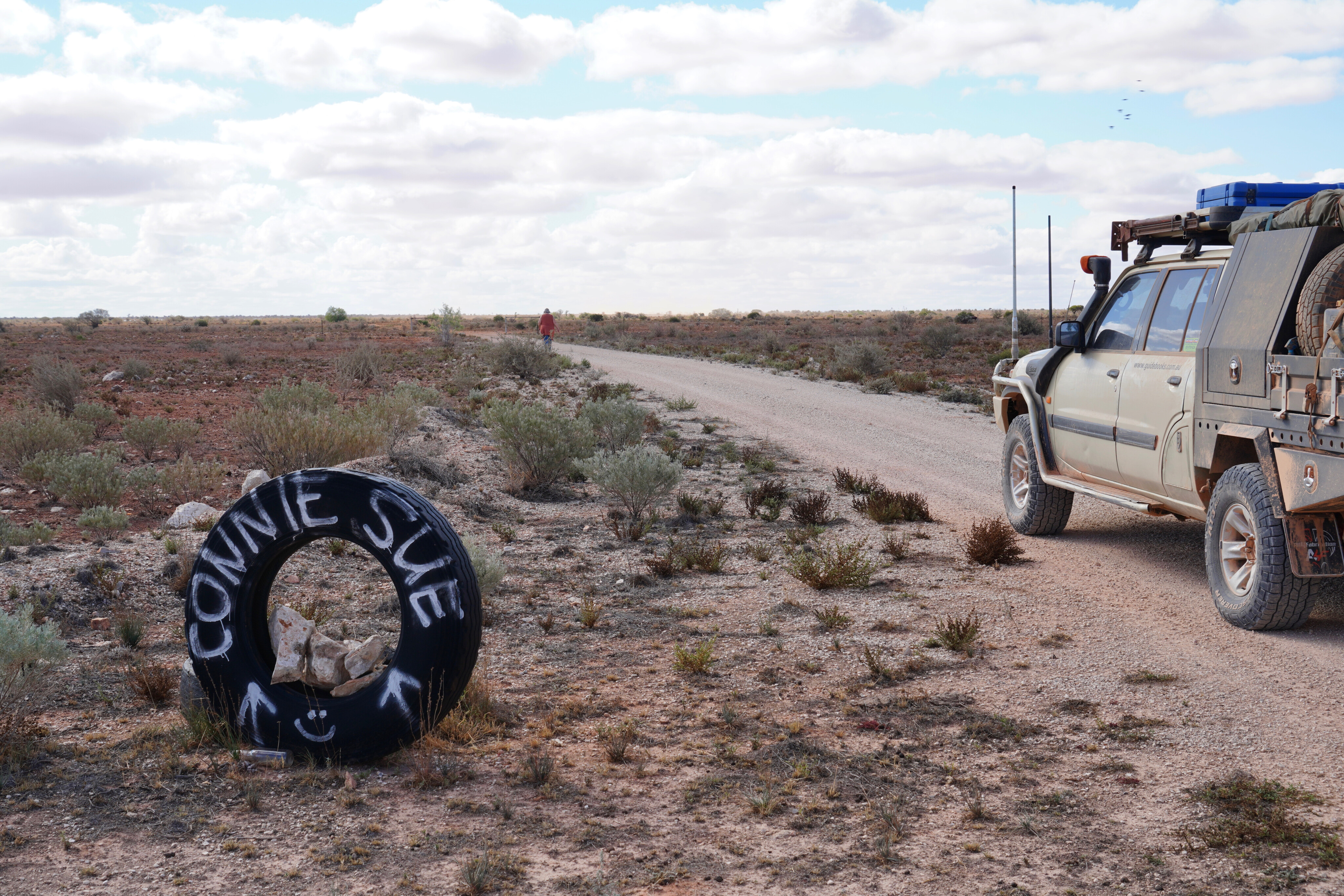
We had joined the Connie Sue Highway (CSH) on the eastern side of Rawlinna siding, where a rough sign indicated we were at the right place and heading in the right direction. The last time I had been here was over 30 years ago and the track wasn’t much different, or at least the start of it didn’t seem any different to what it was back then.
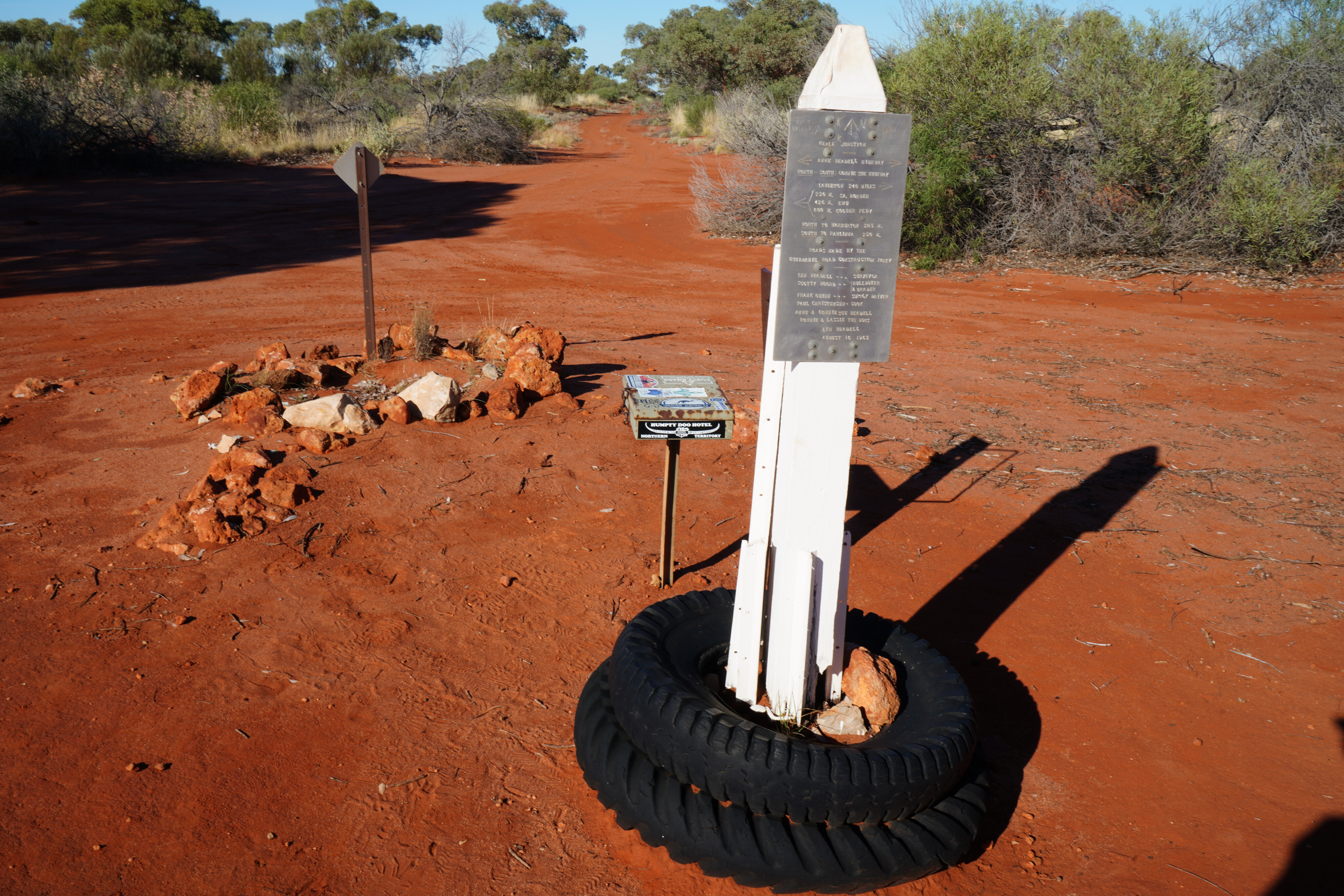
As previously indicated, the road that became the CSH had first been established when Len Beadell and his famed Gunbarrel Road Construction Party (GRCP) started pushing a track north from the Anne Beadell Highway to Warburton in August 1962.
In October of that year the party returned to what Len called Neale Junction and pushed a track south to the railway line, all his tracks being part of the A-bomb and ICBM tests that Britain was conducting in the 1950 and 60s. Today those tracks, nearly 6000km of them, make up one of the great 4x4 desert adventures in the country.
Latest Gear Guides


44
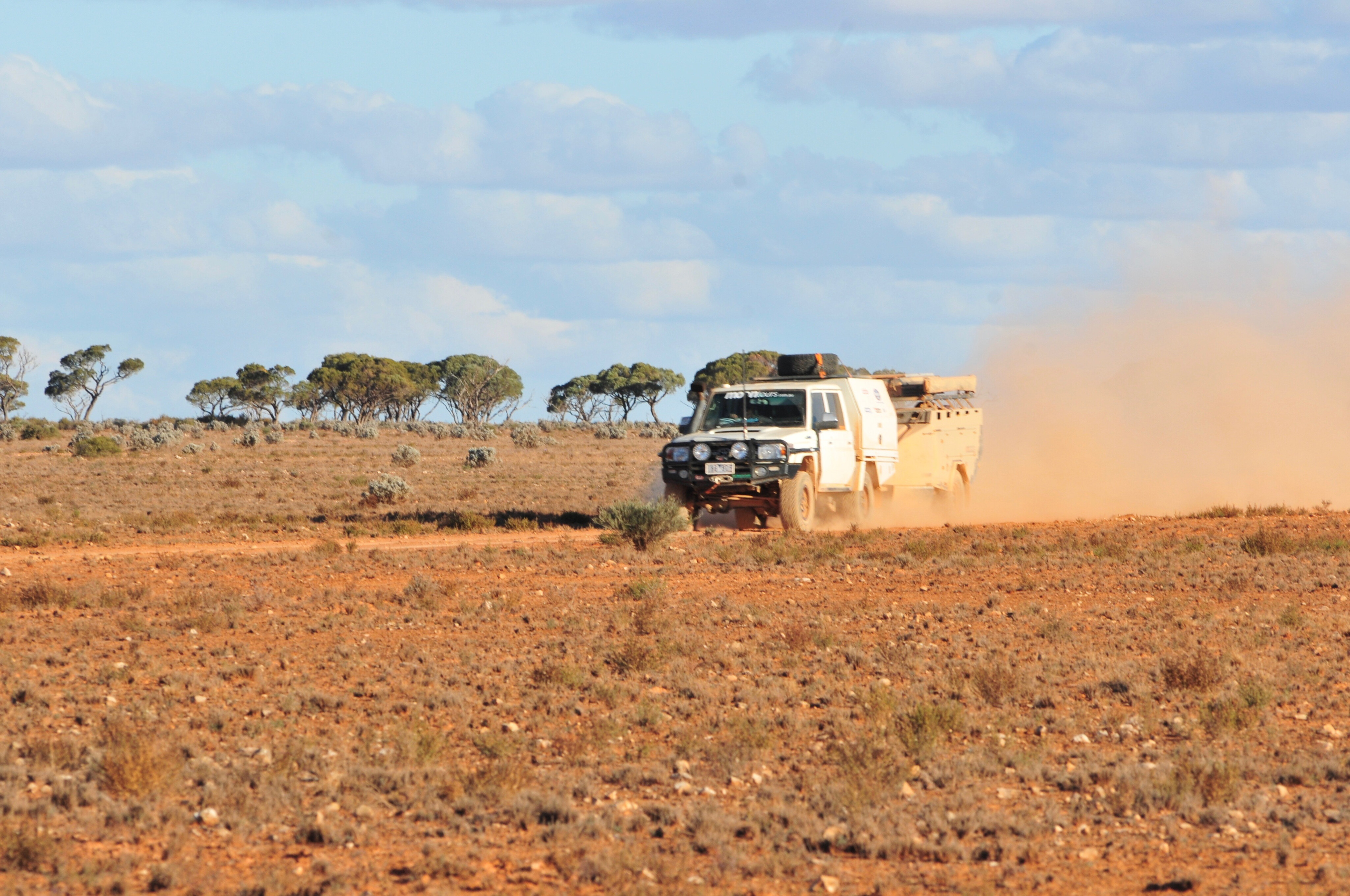
For the first 50km or so we crossed near treeless limestone plains on what was the edge of the vast Nullarbor Plain, but as we slowly pushed on, more trees and scrub began to appear.
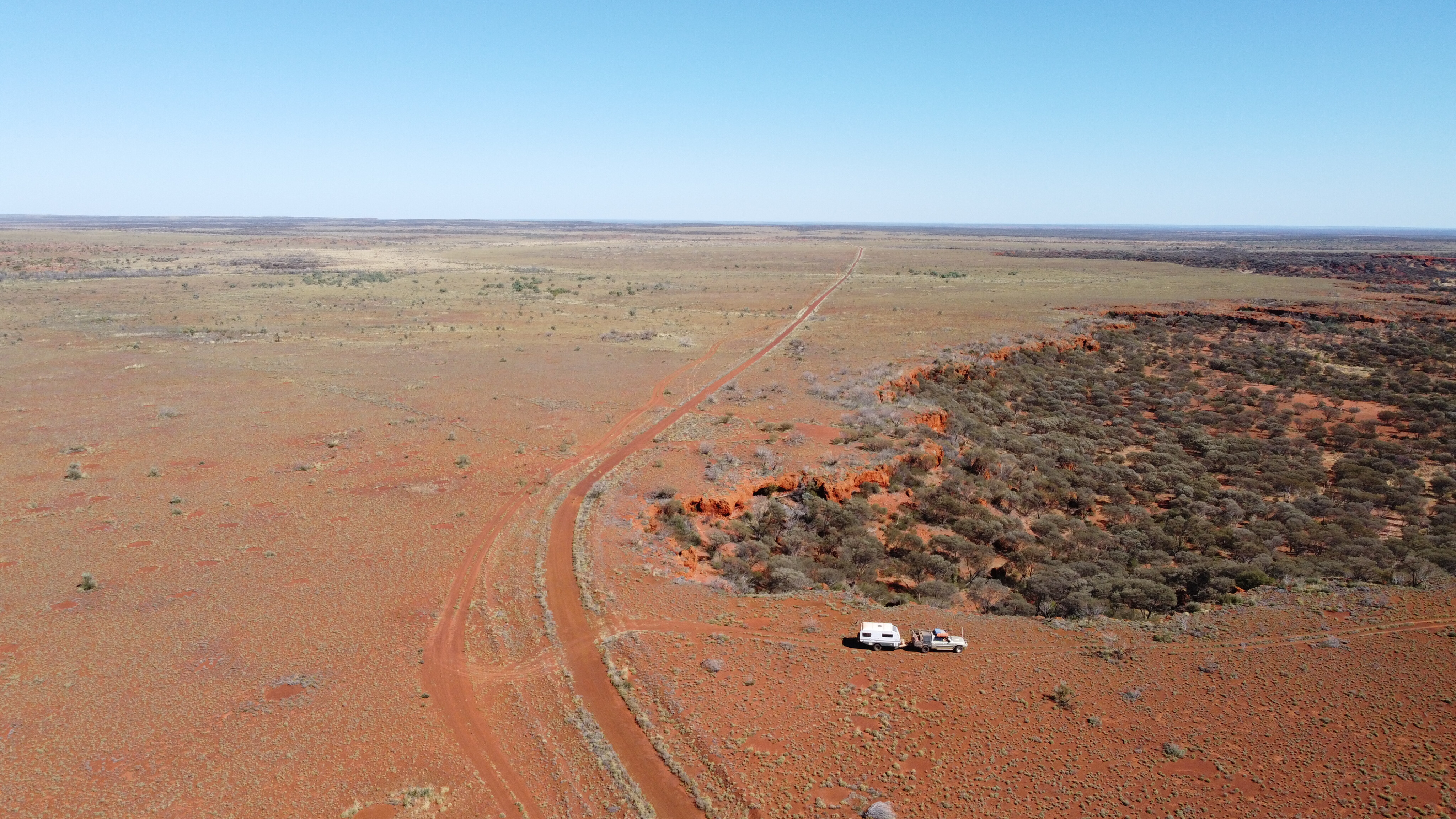
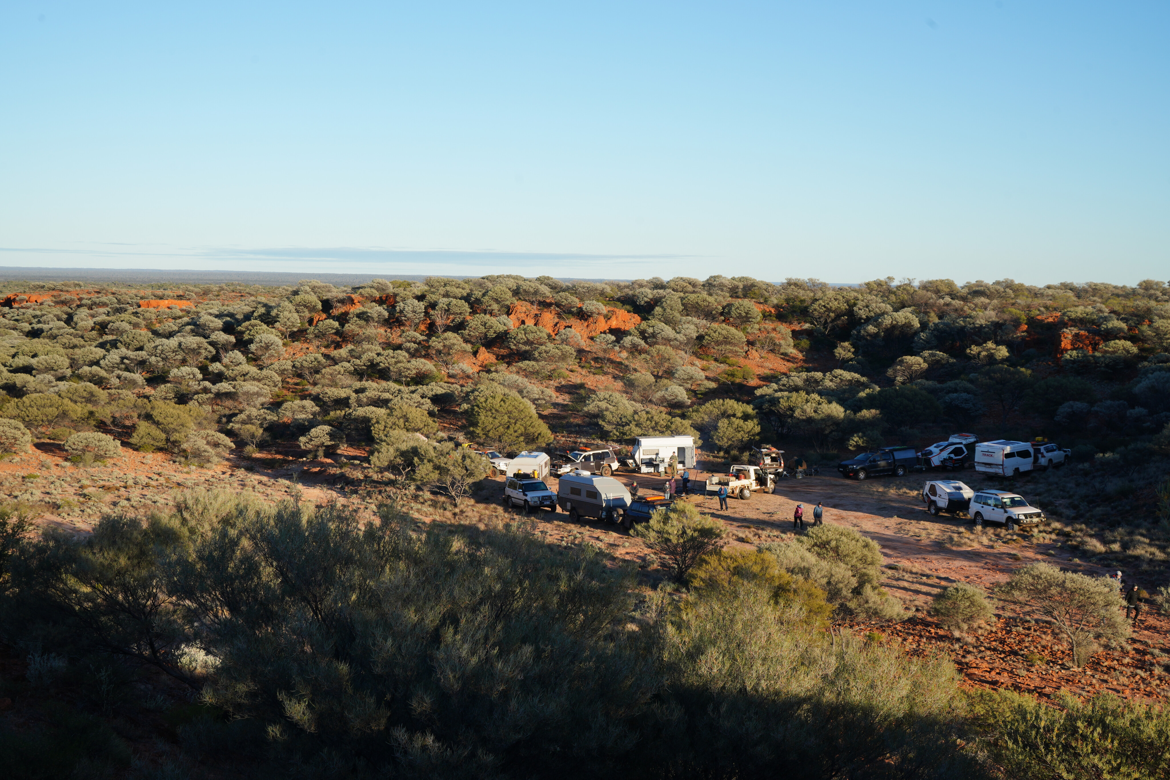
Station tracks crossed the Connie Sue at numerous spots but the ‘highway’, while still not much more than a dozer blade swipe across the ground, was distinctive enough that there was no danger of taking the wrong turn. After an easy run, considering the late start, we pulled up for the night’s camp about 90km north of Rawlinna.
After we got away the next morning, the track condition remained reasonable and arrow straight, heading almost true north. About 15km from our camp, and 105km from Rawlinna, an Aboriginal Business Road (no access) joins the CSH and immediately the road condition improves, becoming wider and more recently graded. A shelter shed and water tank nearby make for a popular campsite but having just started out for the day we pushed on, just stopping to see if the tank had water, which it did.
44
Nearly 70km north from where the business road joins the CSH, it spears off to the north east and the small remote Aboriginal community of Tjuntjuntjarra. Here again, at this second major junction, there is another shelter and water tank.
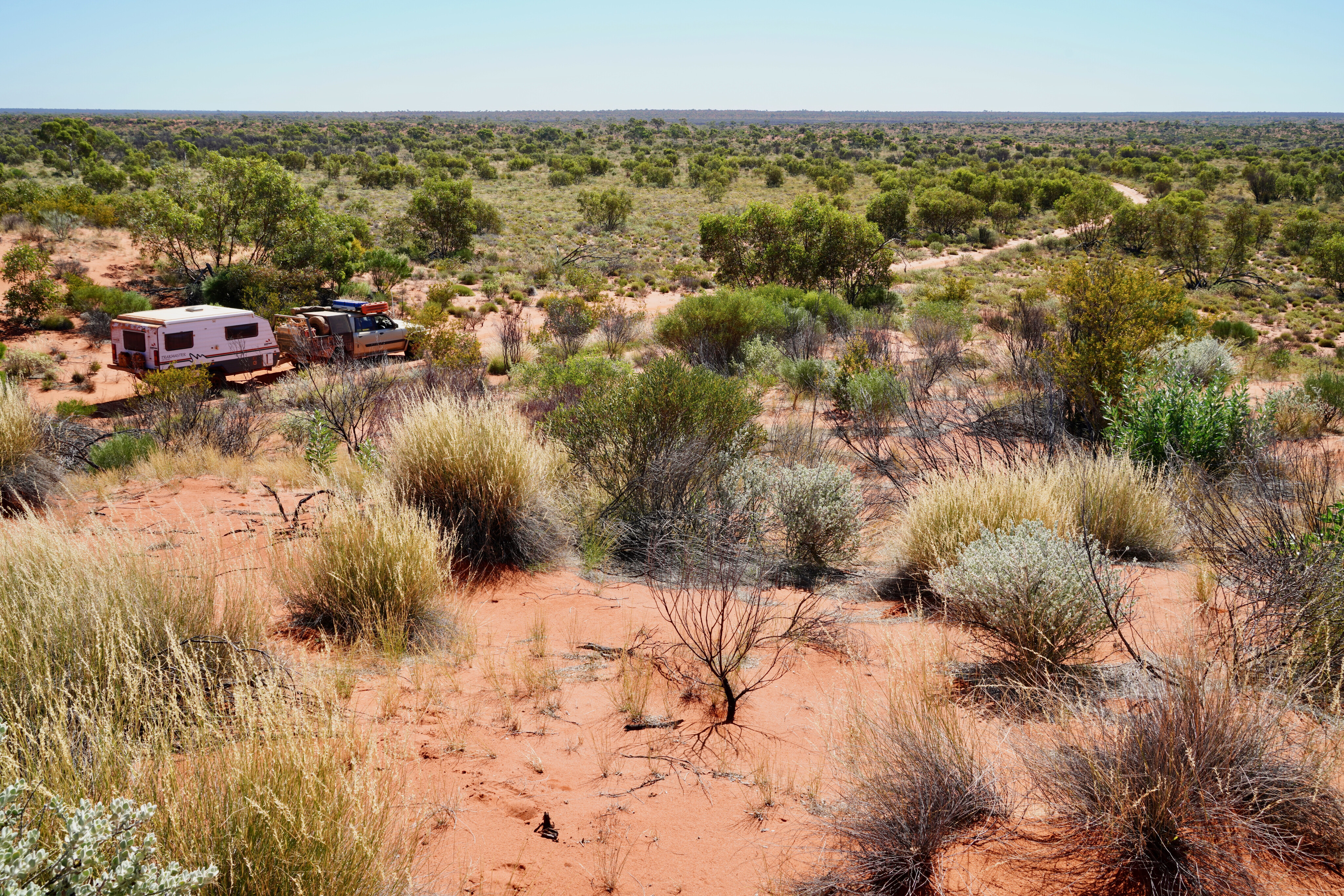
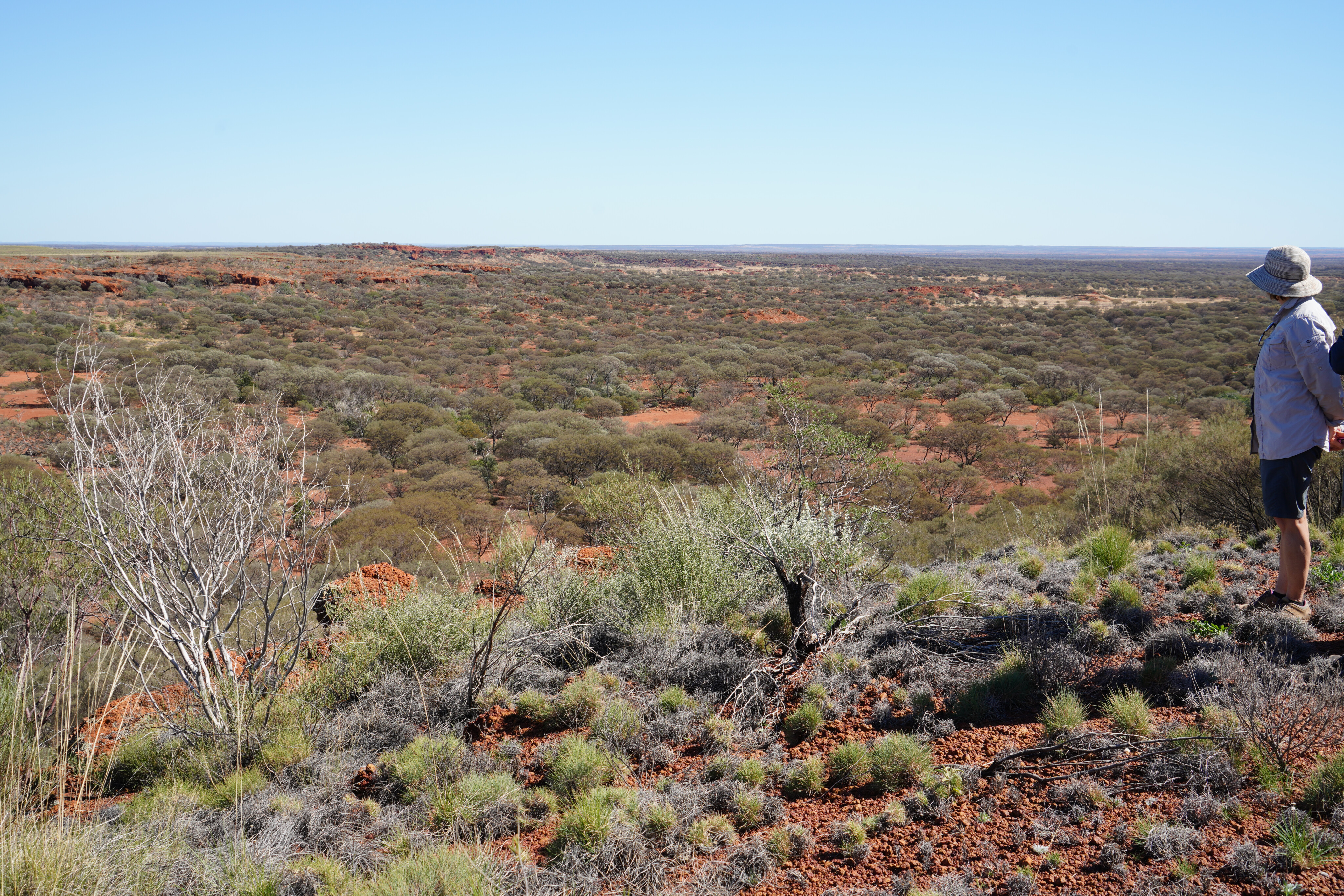
The country and vegetation changed quite a bit as we cruised north on the CSH – first across bluebush plains with some large stands of trees here and there, into mulga scrub, and then mallee scrub, with a thick covering of spinifex and hardly any bluebush anywhere.
We were soon passing through more treed areas with native pine and white gums along with small stands of desert poplars – the latter having been given a hard time by the feral camels. Then we crossed the first of a few widely spaced red dunes, making us feel like we were really in desert country at last.
44
We continued on the CSH which was, at that moment, a well-formed double-track through the scrub in a near straight line, with the road surface as smooth as you could want. Only occasionally were there any corrugations or a few low rocky limestone outcrops to mar the smooth running, and we made good time cruising at around 75km/h.
As we crossed the southern boundary of the Neale Junction Nature Reserve, we were deep within the 349,000sq km Great Victoria Desert, the largest desert in Australia. Much of this desert country is open woodland with spinifex understory, but the stately marble gum is one endemic species while black oak trees are more widespread but equally spectacular.
The desert supports more than 100 species of reptiles and more than 200 bird species, along with 20 or so different mammals, but apart from the birds, the most common animals you’ll see are the bloody camels and the occasional wily dingo.
44
Ernest Giles had crossed through this vast desert near here in September 1875 and he and his party were in a dire situation before they discovered life-giving water at what Giles called Queen Victoria Springs, some 220km further west. David Lindsay, in charge of the Elder Scientific Expedition of 1891-92, crossed a little further to the north, while inveterate explorer Frank Hann explored much of this area during the early 1900s.
That evening, after travelling a lot easier and a lot quicker than those early explorers, we stopped at Neale Junction where the Anne Beadell Highway (another of Len Beadell’s roads) crosses the CSH. Here you’ll find a small campground complete with shelter shed, water tank and a few fireplaces, making it a good spot to stop.
The next morning we pushed on, our route winding through dunes before exiting the nature reserve and then heading over vast slightly undulating sand plains, much of them thickly speckled by ironstone pebbles. With less maintenance, the track was decidedly more demanding and included washouts and long stretches of teeth-chattering corrugations, while thick patches of mulga slowed our group to a crawl.
44
We turned off the main track and wound our way through thick vegetation which got even thicker as white gums heralded a section of flood-out country, the ground covered in a mat of thick grass. Suddenly we broke out of the foliage and had an escarpment of red rock beside us as we made our way across a bluebush dotted plain to a small camping spot tucked in amongst the low carmine-coloured bluffs of Point Lillian.
Frank Hann was the first European to reach this spot in June 1903 and on subsequent trips he visited here a total of eight times, the last in September 1908 when he was attacked by a small party of Aboriginal men and was lucky to escape with his life.
The following morning we found our way to the top of the plateau to the east of our camp and then wandered south where a sharp-edged east-west running gorge halted our progress. Finding our way down into the canyon via a smaller less-steep chasm we scrambled over rocks and around and through the branches of pine trees and mulga to eventually find a large cave, its walls adorned with ancient Aboriginal painted rock art.
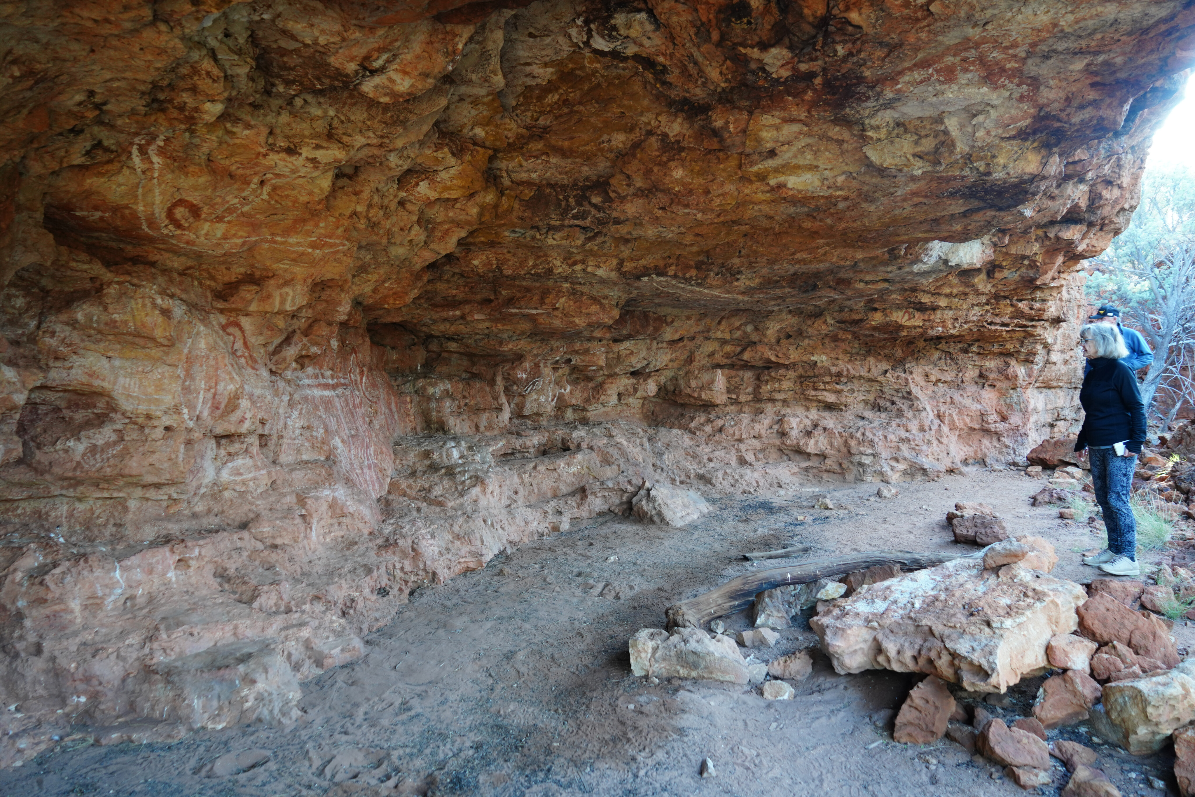
44
The cave floor showed signs of long-ago human habitation, but the only recent signs were of wallabies and kangaroos. We didn’t find any water in the gullies but if any did flow through, it would stay here longer than elsewhere given the protection from the sun and wind offered by the rock walls and thick scrub.
Pleased with our exertions and explorations we headed back to camp and had a brew before heading out to the main track and continuing north on the CSH. We passed the track to Point Sandercock, another bluff named by Hann, and continued along the CSH running north-east for 15km before tracking north-west for a short distance around the almost imperceptible undulations of the Cooper Hills.
These rocky hills give rise to the ephemeral Cooper Creek which crosses the CSH about 5km further north, where a short side track leads to the Cooper Hills Bore. We stopped to check out this solar-powered bore and after a bit of fiddling with the wiring got the pump working, and we were rewarded with a flow of beautiful water.
4x4 Project Vehicles

44
Back on the Connie we soon passed the turn-off to Sykes Bluff and then Ryans Bluff before taking the track out to Woods Pass and Woods Gnamma Hole, all spots named by Hann in his exploration in 1903. While stopped at Woods Pass for a bite to eat, we found one of the campers had a broken camber adjustment bolt on the trailing arm, so we spent a bit of time replacing that.
Turning onto the CSH we soon passed Hanns Tabletop Hill, named in honour of the wide wandering explorer by geologist H. Talbot in 1916. Further north a track leads out to Sydney Yeo Chasm and then a short distance later to Waterfall Gorge but sadly both of these places have been declared out-of-bounds by the Traditional Owners as they are of great importance to the local Aboriginal people. We pushed on, pulling up to camp just off the Connie and on the edge of Mackenzie Gorge, which was an enjoyable spot to watch the sun set far to the west.
Track conditions the following morning alternated between easy going and corrugated, then 50km from camp we veered right at a junction and the route became easier as we left the dunes and ironstone hills behind. The country improved too, with introduced buffel grass replacing the spinifex, and an indication that this area was once cattle grazing country, while white-barked snappy gums dotted the line of the briefly flowing Elder Creek just off to our east.
44
Suddenly we came onto the wide graded Great Central Road and turned east for the 4km or so of smooth road to the large Aboriginal community of Warburton.
Our journey along the Connie Sue Highway was nearly over but with a few things needing repair or replacement we took the opportunity for a shower and to wash clothes at the well-established roadhouse and caravan park.
It had certainly been a memorable trip.
Top five things to see and do
- Go to Rawlinna’s Nullarbor Muster.
- Camp at Neale Junction.
- Check out Point Lillian Aboriginal art.
- Visit MacKenzie Gorge.
- Don’t miss Woods Pass and Woods Gnamma Hole.
Travel planner
Ngaanyatjarra Council: WA
To obtain a permit to traverse the Connie Sue Highway you can apply online or email: reception@ngaanyatjarra.org.au
It’s a 635km drive from Rawlinna to Warburton. There is no fuel at Rawlinna nor any services. Rawlinna is 145km north of Cocklebiddy on the Eyre Highway (the closest fuel).
- Warburton Roadhouse: (08) 8956 7656.
- Western Desert Mechanical, Warburton: Basic repairs and recovery.
- Outback Recovery, Laverton: 0428 196 306
- Best maps are Hema’s Great Desert Tracks guide or Westprint’s The Beadell Roads.
Please enable JavaScript to view the comments powered by Disqus.
COMMENTS