Explore NSW
Gallery21
WE ALL love to get away for a few days along the great eastern seaboard, but campsites along the coast are filled to the brim during peak holiday times.
So it’s a good thing that on the mid-north coast of New South Wales, travellers can instead shoot up to the hills for a quick getaway.
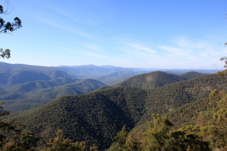
Ebor, 110km inland from Coffs Harbour, is where the Aberfoyle Tableland Track begins, a 100km drive along the top of the Guy Fawkes Plateau that’s filled with a huge diversity of flora, fauna, stunning views and a bit of history thrown in for good measure.
 Ebor, on the New England Plateau, is the home of the stunning Ebor Falls, where crystal-clear water plummets deep into the gorges below. Ebor is also the last place to stop for fuel before tackling the Aberfoyle Tableland Track.
Just 38km west of Ebor is the location of Aberfoyle. On the way, watch out for a small sign indicating a right-hand turn up Aberfoyle Road, before swinging right onto Nowlands Road.
These roads cut through working stations, so beware of cattle and sheep that wander freely out here. But that’s part of the beauty of the area, as there’s no phone service, little traffic, properties that have their own airstrip, and the only radio station you can receive is ABC.
Ward’s Mistake cattle station appears a further 10km down the road. The property was named after Frederick Ward (aka Captain Thunderbolt), who lived and performed many illegal activities in this area. There are several stories on what happened when Fred Ward was shot dead.
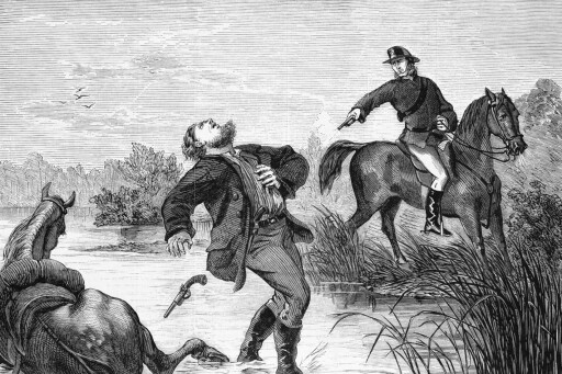 One story suggests Fred and his brothers were bailed up at a nearby swamp, and one of the Ward boys was shot dead by a local policeman. A body mix-up happened, hence the name Ward’s Mistake.
Kookabookra isn’t much these days, but it was once a town with several streets, stores and a warden’s office, where miners cashed in the gold they found. Recently, gems such as topaz, quartz crystals and sapphires have been found here, and a great spot to dig for gems is at the Sara River Bridge, just two kilometres down the road. Here on the right, you can pull up next to some old tennis courts and stretch the legs.
The roads here are fairly easy, so a great alternative for a 4WD is the London Bridge Firetrail, 6km up the road on the right. Tracks aren’t maintained, but they’re signposted along the way and, being a designated state forest, there are plenty of suitable camping areas.
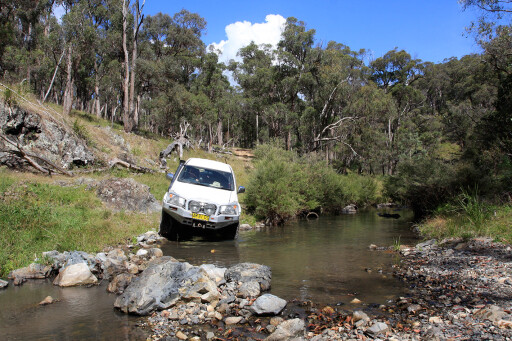
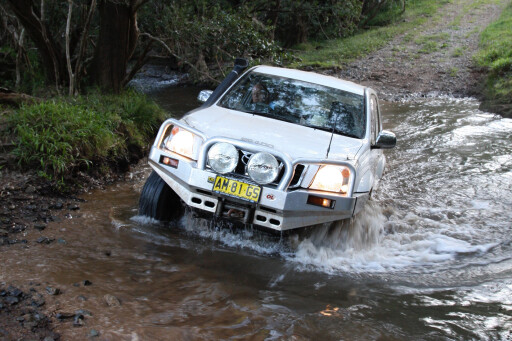
 The London Bridge Firetrail meanders through old logging areas and crosses many creeks that, with a little ground clearance, should be passable with most decent 4WDs.
After 15km, the London Bridge Firetrail soon hits Oakwood Firetrail. An option here is to turn right and head to the end of London Bridge Firetrail and marvel at the stunning views from several lookouts along the way.
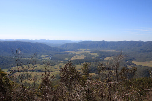
These lookouts are 1250m above the floor below, providing uninterrupted views across the valleys. The London Bridge, Henry Valley and Starlite lookouts provide evidence that volcanic activity took place some 30 million years ago.
The views also give glimpses of the Old Glen Innes Road that used to link the coast to the tablelands at the turn of the century.
It may be a 30km drive to retrace your steps, but camping out here and exploring the lookouts is definitely worth the drive. Once back onto the 20km-long Oakwood Firetrail, the going gets a little tougher as most of this track doesn’t see much traffic.
 Deep creek crossings, rocky outcrops and sections where grass is taller than the bonnet, make for a great drive. While it mightn’t have the exhilarating views of the previous lookouts, we saw wallabies, a host of birdlife, pigs and deer along the way.
Upon reaching Pretty Valley Road, everything changes back to established farms and fertile grazing lands. Unfortunately, the dreaded tar begins and the Celtic town of Glen Innes is only 20km away.
MOREDestinations
On this entire drive, you’re 1000 metres above sea level yet so close to the coastal strip of northern NSW. If you do this trip in winter, rest assured there will be frost or, if you’re lucky, some snow – this is granite country, and it gets bitterly cold here in the cooler months.
If you’re thinking about a few days away, why not explore the Glen Innes region? You never know what you will find!
CONTACTS
Glen Innes Visitor Information Centre: (02) 6730 2400
Glen Innes State Forest Office: (02) 6732 2922
Please enable JavaScript to view the comments powered by Disqus.
COMMENTS