Explore NSW
Gallery2
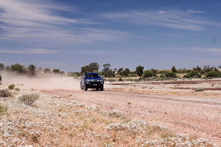
I JAMMED on the brakes of the Hilux, the ABS taking me past the poorly marked intersection which I had belatedly seen as we were cruising north on the Wilcannia-Wanaaring Road.
Backing up I swung the wheel and headed down the narrow but still good dirt track to what is rather optimistically called Peery Lake, where a day-use picnic area has been established in the large and disjointed Paroo-Darling National Park. The vegetation was lush, or at least lush for this part of outback Australia, and was virtually verdant compared to just a few months previously when the drought in this part of Australia finally ended.
The lake, one of the many that make up the Paroo River in this flat landscape, was greener again, thick with a range of herbaceous growth. The trees that fringed the lake bed were dense with a luxuriant sprouting of new leaves. A couple of emus had rushed away as we drove in and a few kangaroos had been spied languishing under the shade of a tree nearby. The water, which we had expected to be filling or at least covering most of the lake, was just a shimmer in the distance, already retreating back under the onslaught of the sun.
The Paroo River may sound grand, but it’s more a string of ephemeral water holes joined by a braided set of shallow channels that combined make up a minor tributary of the much bigger Darling River. The river, for want of a better term, starts its often impermanent, transitory flow in the rocky hills west of Charleville, becoming a more defined stream by the time it reaches Eulo and then Hungerford, 250km north of the NSW/Queensland border. It joins the Darling River just north of Wilcannia, but what little impression the Paroo can make out here is generally hidden from view on private land, well away from the Wilcannia-Wanaaring Road.
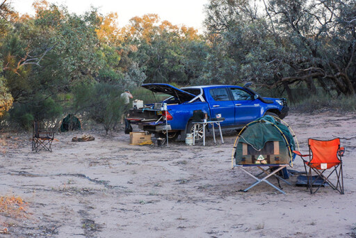
We had started our trip a couple of days earlier in one of my favourite towns in the outback, Broken Hill, before we headed out to Mutawintji National Park for the first night’s camp. The Homestead Creek camping ground is well set-up along the shady creek that gives the area its name. There are even hot showers – if you’re lucky enough to be one of the first to use them – and free gas barbecues, along with fireplaces and tables.
As the sun was setting we took the drive along the Old Coach Road past the ruins of the Rockholes Hotel, spying all three species of kangaroos that inhabit the area: scraggy, bulky euros; slimmer western greys; and red kangaroos. Female red kangaroos are a gun-metal grey-blue colour, often called a ‘blue flier’ for their colour and fleet of foot. Sadly there were also a heap of goats, even though the park often carries out round-ups of these hungry and devastating herbivores – they obviously need to do another muster soon.
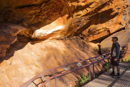
The next morning we took a short walk to Wright’s Cave, where among the more ancient Aboriginal rock art and engravings are a couple of markings made by William Wright. In the late 1850s Wright was the manager of the vast Kinchega Station and acted as a guide for the Burke and Wills Expedition. He visited Mutawintji in 1859 and 1862.
Sadly, because we failed to find a ranger, we couldn’t explore the fenced and gated Mutawintji Historic Site. The best bet to tour this important Aboriginal area and European site is to do so with Tri State Safaris based in Broken Hill, who often do tours of this area and can meet you at the campground.
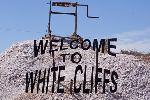
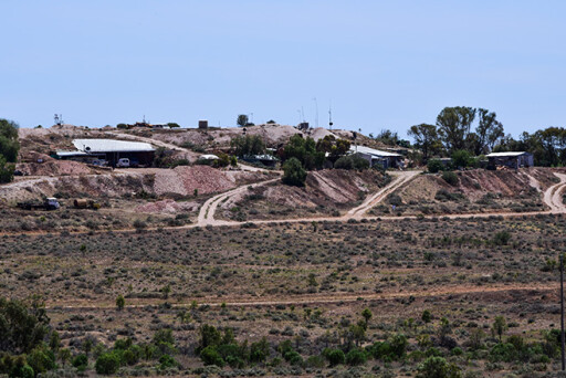
From here we headed to White Cliffs, the small opal mining community that first developed when opal was found here in the early 1890s. With a population of around 200 – a few go missing on census night – most live underground to escape the blistering summer heat, so there’s not much to see above ground. For the passing traveller the local store, pub and national park information centre are the major attractions, although the underground motel does grab a few passing travellers due to its uniqueness.
The most obvious thing visible is the old solar power plant, first built in 1981. It consists of 14 three-metre parabolic dishes covered in mirrors, which are now tarnished by the sun. The station, the first of its type in Australia, was in operation until 2004. The old cemetery on the other side of town, which dates back to the first days of the settlement, houses some poignant headstones, many of young kids and babies who died here in the very remote and harsh region.

We headed east on good dirt roads, meeting with the Wilcannia-Wanaaring Road and entering into the northern section of the Paroo-Darling NP. This park, in five disjointed sections, stretches across hundreds of kilometres of western NSW on both sides of the distant Darling River and takes in what were seven distinct sheep and cattle properties. The northern section is based around the Peery Lake, which is a flood-out lake of the Paroo River. However, a lot of other lakes – albeit smaller ones – need to fill before the bigger Peery Lake gets any life-giving water. Still, when it does, the birdlife can be amazing, with 60,000 birds being recorded there in one recent survey. It was a lot quieter when we were there, but the birdlife was still enjoyable and we were lucky enough to witness the gliding ability of wedge-tailed eagles and the slightly smaller, but much scarcer, black-breasted buzzard, one of Australia’s rarest raptors.
Sadly Peery Lake is only a day-use area, which cheesed me off. In all of this vast park, spread over hundreds of kilometres of outback NSW, there is only one designated campsite, and it’s east of the Darling about 150km away from where we were. The day-use area at Peery Lake is a pretty darn good facility, with a carpark, shelter shed, tables, toilets and free gas barbecues. You have to ask why camping is prohibited?
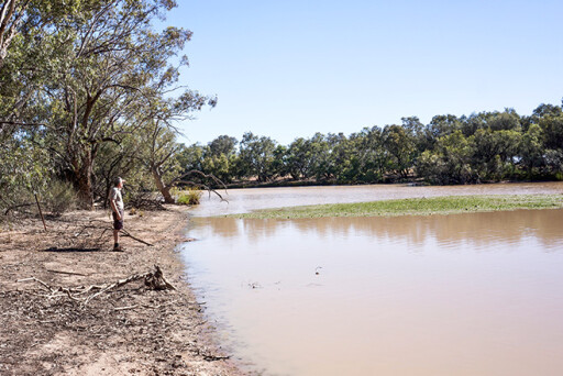
Back on the main road further north we took the Tilpa Road as it crosses the Paroo River, but the river, or at least the bed of it when the water flows, was so indistinct here that we couldn’t tell where the main channel began or ended. We found a track north that led to a shallow lake fed by the river, but a gate with a ‘No Entry’ sign stopped any access.
The Nocoleche Nature Reserve, some 20km south of Wanaaring, covers 740km² and straddles the Paroo River, but again only has one spot available for public access. However, King Charlie Waterhole is probably one of the best spots to gain access to the river and is less than two kilometres off the main road and a short walk from the parking area. A shelter shed has a table and gas barbecue and is a pleasant spot to stop to take in the often rich birdlife the waterhole gathers around it. Mulga and white wood dominate the area, but popular box and black box trees are found closer to the river. The rich, flowering Yapunyah Tree (restricted in range to the floodplains of the Channel Country) has its largest stands here in all of NSW.
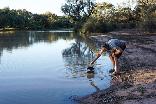
We continued our crossing of Paroo just out of Wanaaring, where we did a circuit of town in what seemed like only a minute or so and then went to the local pub for a cold beer to celebrate our little sojourn up the river. That evening we camped for the night on the edge of the Paroo, where the river looked like a flowing stream hemmed in by low banks. It was a magic spot and worthy of more than just an overnight stay, but our time was up and sadly we had to return south.
For those with a bit more time it’s an easy run further north, paralleling the river to the Queensland border hamlet of Hungerford and then passing through a gate in the Dingo Fence. From here you then pass through Currawinya National Park and follow the river north to Eulo. Put it on the bucket list.
2
TRAVEL PLANNER
Tri State Safaris: www.tristate.com.au
Mutawintji NP: www.nationalparks.nsw.gov.au/visit-a-park/parks/mutawintji-national-park
Goodwood Station: www.goodwoodstationstay.com; ph: (08) 8091 6728
Paroo-Darling NP: www.nationalparks.nsw.gov.au/visit-a-park/parks/paroodarling-national-park
Nocoleche Nature Reserve: www.nationalparks.nsw.gov.au/visit-a-park/parks/nocoleche-nature-reserve
Kilcowera Station: www.kilcowera.com.au
Dowling Track: www.outbackbeds.com.au/the-dowling-track.html
Currawinya NP: www.nprsr.qld.gov.au/parks/currawinya
Please enable JavaScript to view the comments powered by Disqus.
COMMENTS