Explore NT
Gallery21
How good it is when an outback track starts at one of the most remote pubs in the country? Even getting to Mount Dare can be a challenge for many, so enjoy the hospitality offered, top up your fuel tanks and then begin a journey that’ll blow your mind.
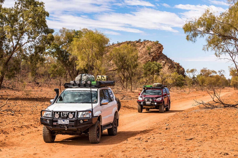
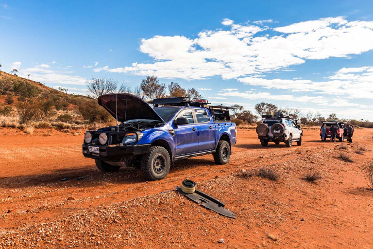
Bulldust! Superfine, super deep and in stretches that can’t compare. It’s nasty stuff and there is no way of keeping it out of your vehicle, especially when you hit a patch so deep the dust sweeps up over your bonnet and straight into the cabin air intake.
21
From Mount Dare, Binns Track leads you across the border into the Northern Territory, towards Old Andando Station and for the first 45km, 80 per cent of the drive is bulldust, but once past Mayfield Bore, it settles a little and the corrugations take over.
Tyre pressures play an important role in making this type of terrain easier to tolerate. (N.B. This section of Binns Track is now closed indefinitely and a detour via New Crown Station is in place.)
Old Andando was home to Molly and Mac Clarke from early in the 1950s and the homestead has been left as it was when Molly reluctantly had to leave. She watches over her beloved property from her nearby grave.
The rustic campground at Old Andando is a great spot to roll out the swag, with flushing toilets and donkey showers included in the $10 camping fee (per person). Wind protected fire pits are spread around the site, but you’ll need to supply your own wood. If the caretaker Cobby Bob is around, invite him down to share your fire and be entertained with bush poetry and yarns that’ll make your night.
21
A little way up the track, a signposted detour leads you to the Mac Clarke Reserve where you’ll find one of only three remaining Acacia peuce collectives. This is an important conservation reserve, so leave only footprints and take only photos; camping and fires are not allowed.
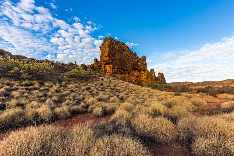
Binns Track continues north towards the Santa Teresa community. This is cattle country and it’s incredible how they survive in this barren landscape devoid of grass, but healthy they look, feasting upon patches of wild things. You’ll pass through areas covered in gibber and burnt orange sand dunes with massive expanses of nothingness, but how beautiful it is.
Then sand country with spinifex, mulga and corrugations. Passing through the gap between the colourful Arookara and Rodinga Ranges, the sandstone looks like bauxite in the afternoon sun, and the waterways are lined by eucalypts.
From Santa Teresa, the road alternates between bitumen and gravel until you reach the airport on the outskirts of Alice Springs. For us, it was a chance to stop and prop for a couple of days to restock and refresh before the next push up Binns Track.
21
It was also a chance to get some repairs done on a pair of eyeglasses that’d been dropped and stepped on, on day one of the adventure. They would be needed as the East MacDonnell Ranges are best viewed with 20-20 vision to soak in their beauty.
From Alice Springs, take the Ross Highway and the first gorge in the stunning range is Anthwerrke (Emily Gap). Emily Creek has flowed through here for thousands of years, carving out the rock to form the Gap that’s very significant to the Arrernte people.
It plays an important part in the Dreamtime story about Three Caterpillars – Yeperenye, Ntyarlke and Utnerrengatye – whom the Arrernte consider themselves direct descendants. It is an easy Grade 2 walk into the Gap, and you’re asked not to photograph the artwork found within.
Continue another 7km down the Ross Highway to the second gorge, Jessie Gap, which is also associated with the Three Caterpillars Dreamtime story. This site is also important in an Emu storyline, with the white sand against the gorge face representing emu fat.
21
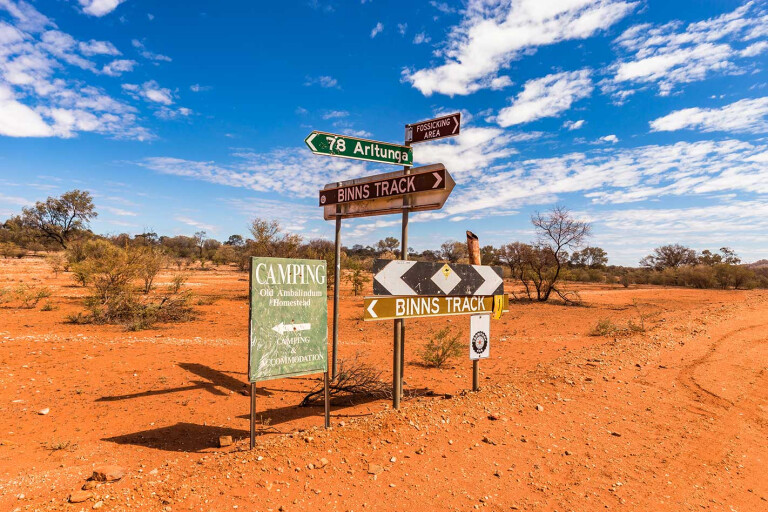
Back on the road you will soon reach the turnoff, following the ‘Binns Track’ sign east. Here is a good opportunity to drop some air out of your tyres as you will encounter bulldust, deep river sand, corrugations and gravel roads for the next 70km or so.
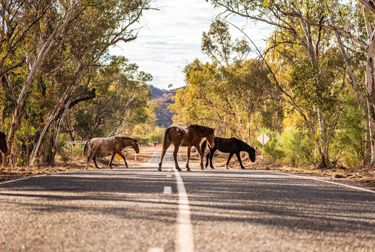
The first section of road is maintained so you will be able to keep a reasonable speed. Watch for horses around dawn and dusk as they can appear from nowhere between the desert oaks, mulga and gum trees that enjoy the underground moisture on the Todd River flood plain.
The willy-willies show where the bulldust holes are with the fine dust easily picked up in the twisters. Having travelled 42km and crossed the Ross River, turn left and follow the signs towards N’Dhala Gorge.
Take it easy around Shannon Bore as the cattle like to hang around the waterpoint and yards. The escarpments of the Fergusson Range are stunning, matched against the ghost gums that line the Ross River. Crossing the dry riverbeds can be a challenge at times as the deep sand can catch you out if you’re not careful.
21
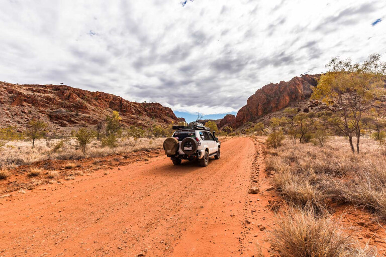
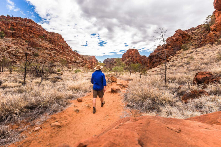
Before long you’ll reach the turn off to N’Dhala Gorge (Irlwentye) carpark and camping area, and you’ll be reaching for the camera as you enter. This is one of the most visually stunning Red Centre gorges. It’s also home to several ancient petroglyphs that are important to the Eastern Arrernte people.
The 1.5km return walk into the gorge is graded as easy and interpretive signs are placed along the trail to explain some of the rock carvings and plant life. If camping, there is a box to self-register and pay the camp fee. You’ll need to be self-reliant as the only facilities are pit toilets, fire pits and tables. Firewood must be collected outside of the park and please, take any rubbish with you.
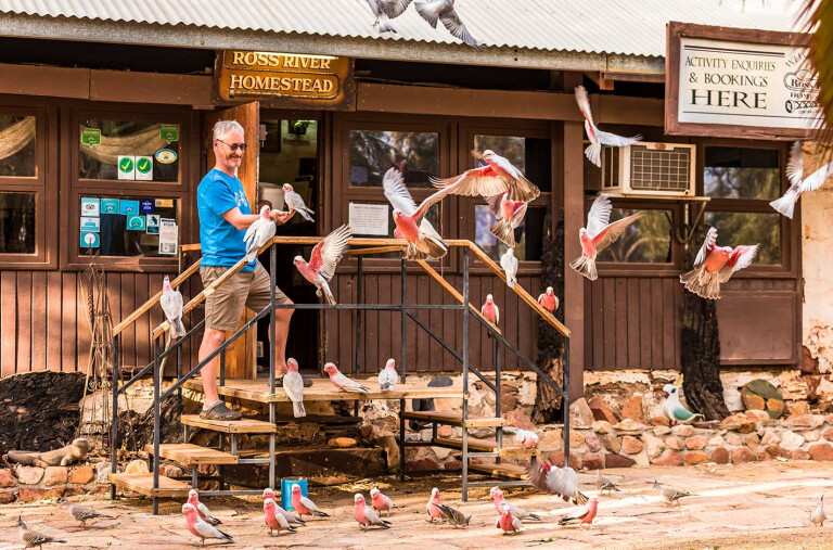
Another option if you want to camp for a couple of days while exploring the Eastern Macs a bit more is at Ross River Resort. There a several options from powered or unpowered sites, cabins or maybe even the rustic Starlight Camp. The swimming pool is a perfect way to cool down and the bar offers meals and cold beverages as well. Make sure you explore the old homestead, especially the massive fireplace.
21
It’s only 12km to the Trephina Gorge turnoff via a bitumen road from the resort, and the 8km drive into the gorge is via a gravel road. Another striking gorge, Trephina offers a couple of great walking options that offer stunning scenic views of the landscape and tree-lined sandy riverbed.
There are also numerous camping sites at the Panorama campground or the Trephina Bluff campground. Access to the remote John Hayes Rockhole is via a challenging 4WD track however it was dry during our visit.
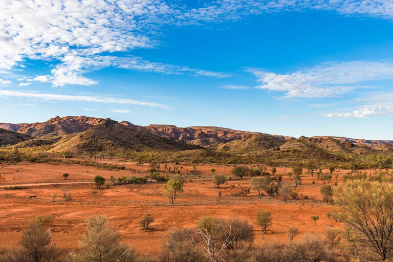
The next section of Binns Track leads to the historic mining town of Arltunga. As you twist and wind your way through the range, crossing many floodways, the views are to die for. Better than the Flinders Ranges with the spinifex, desert oaks, ghost gums and gidgee. It is easy going in a 4WD, but it must have been harsh for those carrying their lives on their backs as they headed to Arltunga in search of a fortune.
21
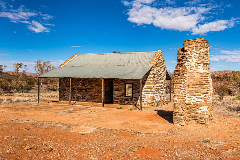
The landscape eventually opens to treeless plains before entering the Cavanagh Range and soon the Arltunga Historical Reserve. Now a deserted gold town, this was the first town in Central Australia thanks to the 1887 gold rush, and it once had a population around 3000 people.
There is an unmanned visitor centre that provides plenty of information on the history of the area and the old police station has been rebuilt. There are more ruins spread about the precinct and a handful of self-guided walks help to show you what life was all about back then.
21
Just over the range is Hale River Homestead at Old Ambalindum that offers a fantastic farm stay with great camping and several accommodation options, meals and beverages, and one of the best pool decks you’ll ever find that’s perfectly placed to watch the sunset behind the windmill. From here it’s only a short drive to Arltunga, or there are plenty of bushwalking/mountain bike riding trails throughout the property. Fredrick’s Lookout is a challenging drive and is another top spot for sunrise or sunset views.
From the homestead, Binns Track follows the Arltunga Tourist Drive for approximately 60km before taking the Pinnacles Track. This is another spectacular drive with magnificent views of the Georgina Range on your left and Mount Johnstone on your right. The Pinnacle Track is slow going at the start and leads you through a gate that takes in Aboriginal Land, so you must stick to the track.
21
The northern section opens onto grassed plains before reaching the old bore at the junction with the Plenty Highway. Turning left and travelling a short 8km will bring you to Gemtree, which is a great place to settle and enjoy some outback hospitality.
If gems take your fancy, especially fossicking for your own, Gemtree is a great place to base yourself and join a tour or you can just pay for a bucket of garnet-bearing gravel if time is limited. You can’t go past a delicious camp oven roast dinner from Kate’s Kitchen, and the Billabong Bar will quench your thirst. The caravan park offers powered or unpowered sites, or choice of cabins or rooms if you want to enjoy some extra comforts.
So how did Binns Track get its name? Named after Bill Binns, who was a ranger with Northern Territory Parks and Wildlife before rising to the position as Executive Director of Parks NT. It was his dream to create a track that enabled travellers to enjoy some of the spectacular national parks that the Territory has on offer. This epic journey covers more than 2000km through some of the most remote, colourful and diverse country and is a 4WD adventure you will never forget.
21
Travel Planner
WHERE: Binns Track from Mount Dare to Gem Tree via Alice Springs is around 700km so allow two or three days to really soak in the landscape.
PERMITS: A Simpson Desert Parks Pass is required to access Mount Dare and can be purchased onsite.
FUEL: Mount Dare, Santa Teresa, Alice Springs, Ross River and Gemtree all provide unleaded and diesel fuel. Gemtree was limiting diesel fuel to 25 litres as the fuel truck was delayed, and this can happen anywhere that is remote, so take this into consideration when planning. Expect to pay top dollar for fuel at the remote places too, with $2/litre and above for diesel common.
BEST TIME TO VISIT: From June to September as the weather is generally cooler and the wet season waters should have receded.
MORE INFO:
- The Hema Maps range of paper maps provide excellent coverage. A device such as a Hema HX-1 Navigator will also come in very handy. www.hemamaps.com
- Mount Dare can sort you out with a desert pass and the latest track conditions. www.mtdare.com.au
Please enable JavaScript to view the comments powered by Disqus.
COMMENTS