Explore NT
Gallery21
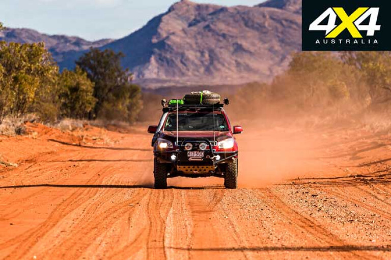
The change is immense – the blacktop where savage corrugations once reigned supreme is now part of the Plenty Highway and will never be the same again. That was the feeling as we drove the section from Gemtree to Harts Range on the ‘Outback Highway’. Fuel was needed, and needed badly, as Gemtree had imposed restrictions due to the fuel truck being late.
Our timing couldn’t have been worse as the bell had rung and all the school kids from the community were packed into the store, stocking up on snacks. With fuel tanks finally filled, we continued along the Plenty for only a short stint before turning north and back onto the dirt.
21
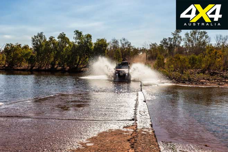
The sandy track is as wide as they come out here, and a grader must have been run over it recently, it was so smooth. As you cross the expanse of the Plenty River, check out Harts Range filling your rear-view mirrors. This is stunning country.
A nice detour is to check out Boxhole Meteorite Crater, a short drive off Binns Track via a station track. The sign for the turnoff is small and easily missed but the rewards are well worth it. An old fella and his faithful companion were relaxing in the shade and it didn’t feel right to disturb them, but the crater beckoned for a quick viewing.
Another fantastic detour is to Tower Rock. Having misread the map, we didn’t turn off to pass the station-stay property at MacDonald Downs but instead followed a little-used track. Driving directly into the sun made it hard to see the gates and we arrived at Tower Rock just as the sun sank below the horizon, quickly setting up camp between some rocks to escape the wind.
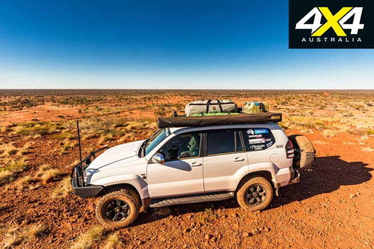
The next morning we retraced our steps along New McDonald Downs Road to the Arapunya Road. From here, turn north and head towards Derry Downs and watch the country change again; spinifex, desert oaks, ghost gums, desert pines and wattles. The road surface also changes from sand and bulldust to stones and clay; it all makes for a great drive and you almost forget the remoteness.
21
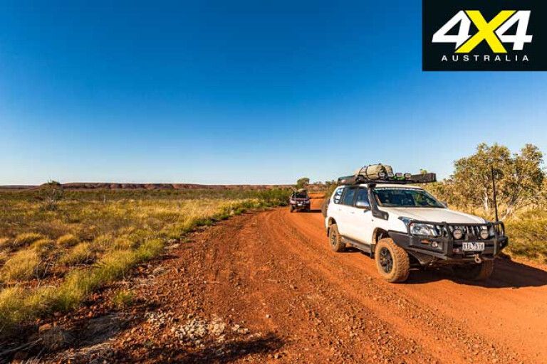
Just prior to Derry Downs, you’ll find a sign directing you along a bypass track. Having crossed the expansive Bundey River, the track then closes in and it’s slow-going as you climb a small rocky range.
Throw in some bush pinstriping and this is what remote desert travel is all about. Once you reach the cattle grid, the track becomes sandy and the country opens up again as you drive through spindly eucalypts, spinifex and gidgee. Upon reaching the Welere Road the sandy track continues and the going is good, but take care on the corners as we nearly had a head-on collision with a Pajero full of locals who were in a rush to get somewhere.
Once you reach the T-junction and turn right, the 19km of corrugations to the Sandover Highway are bone-jarring, but once on the wide-open desert highway the 27km to the Elkedra Road is fast-going. If with Telstra, your phone will start pinging as you pass Ampilatwatja and coverage will last until you’re on the Sandover-Murray Downs Road.
21
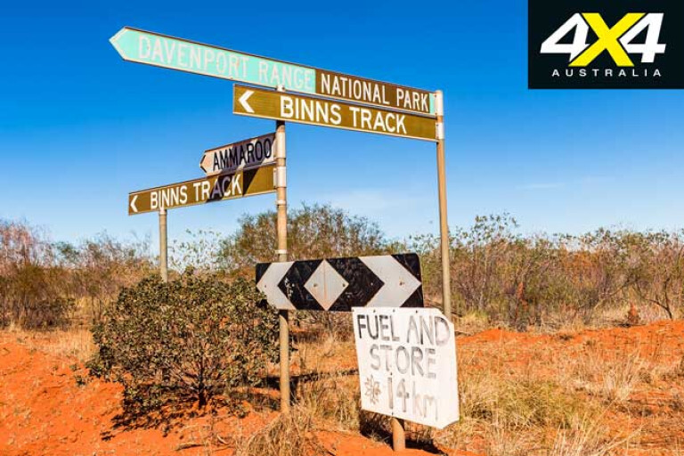
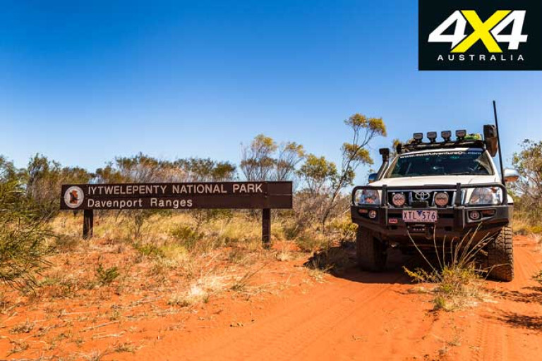
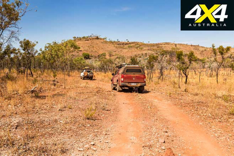
The next 75km is generally good going, and recent rain meant the grader had been out and the landscape was green and colourful. At most other times, though, expect corrugations and bulldust. The turnoff to continue along Binns Track towards Iytwelepenty/Davenport Range National Park is well-signposted. Once through the gate (leave it as you find it), the track narrows and speeds are reduced.
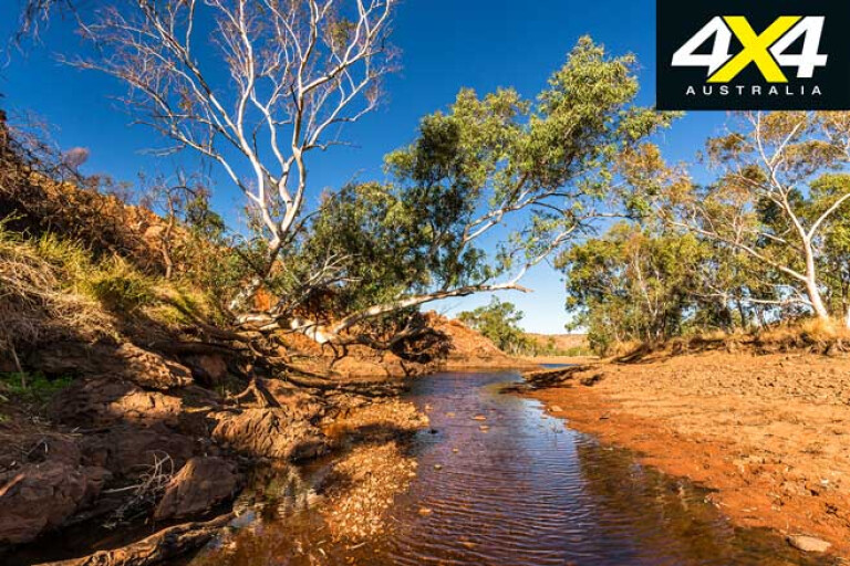
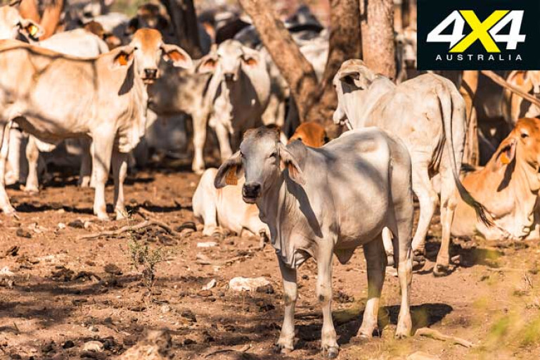
Closing in on the Davenport Range, the scenery is spectacular and a highlight of Binns Track. Spinifex and ghost gums dominate the rocky hills, the stony water crossings are dry and the colours are green, orange and blue. Coulter Waterhole will surprise you, while offering some shade and a place to dip your toes. A gap in the range forms a large valley and a drove of donkeys passed as we neared Hatches Creek. Once past the turnoff to the Frew River 4WD Track, wide-open plains take over and it’s cattle country out here.
21
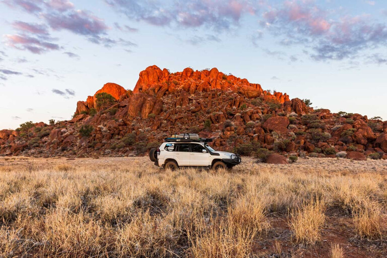
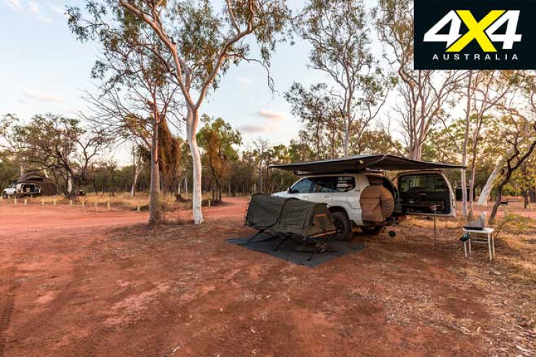
The 9km track to Old Police Station Waterhole offers some amazing landscapes, especially when golden hour kicks in. The campground along the permanent waterhole is well-spaced-out with fireplaces nicely dispersed and the perfect place to roll out a swag for a few days. With the sun gone, you’ll enjoy some relief from the bush flies –attracted by the cattle and the water, they can be frustrating.
When it comes to a remote 4x4 track full of pure awesomeness, the 17km Frew River 4WD Track is hard to beat. There are a couple of tricky climbs where wheel placement and right boot control is important, a few tight sections, and it’s overgrown in places, but the vistas are stunning. As you drive up and down the escarpments you’ll pass spinifex, ghost gums, wildflowers and termite mounds. Allow a good three hours; you’d hate to break something out here.
21
There’s camping at Whistleduck Creek, and the road leading from Old Police Station Waterhole to the north-western section of the Davenport Range handles more like a highway in most parts. The scenic 24km trek through pastoral land into Whistleduck Creek camping area was in good condition, but beware of cattle.
There are two distinct camping areas, with several sites in each one. A couple of walks are also available; one along the creek from the day visitor area to Irrmweng Rockhole, the other, for more experienced hikers, an unmarked trail north along the creek to Injaridan Rockhole.
Retracing your steps back to Kurundi Road, Binns Track continues another 68km before reaching the bitumen of the Stuart Highway. The road conditions along this stretch will vary, with corrugations aplenty in some sections. You’ll reach a small stretch of blacktop with a 60km/h speed limit as you pass Kurundi Station, a cattle property popular with fossickers. The road winds through the range before straightening out as you close in on the Stuart Highway.
21
If you turn left, Boney Well Rest Area is a good spot to put some air back into your tyres, as there’s a lot of highway driving before you reach the next off-road section of Binns Track. The Karlu Karlu/Devils Marbles Conservation Reserve is only 15km south of here and well worth the slight detour. There’s cheap camping available here, and if you have the time it is well worth watching a sunset or sunrise over these gigantic boulders.
It’s a fair hike to Katherine from the Devils Marbles via Tennant Creek and Daly Waters, but an overnight stop at the Mataranka Homestead is a must. Here you have the opportunity to soak away the dust in the extremely popular thermal springs, before quenching your thirst watching the nightly entertainment.
You can top up, stock up and get any mechanical work done at Katherine. From here, jump on the Victoria Highway and head west. It’s 289km to Timber Creek and on the way you’ll get an introduction to the northern section of the Gregory National Park around Victoria River, where massive escarpments dominate the skyline. There’s a free campsite at Sullivan Creek and the old Victoria River crossing can be found down a signposted, dusty then rocky track. Be croc aware, as the salties could be about.
21
Timber Creek is the northern jump-off point for Gregory Range National Park. There’s a caravan park attached to the Timber Creek Hotel that’s a good place for an overnighter, and fuel is available, the last until Top Springs.
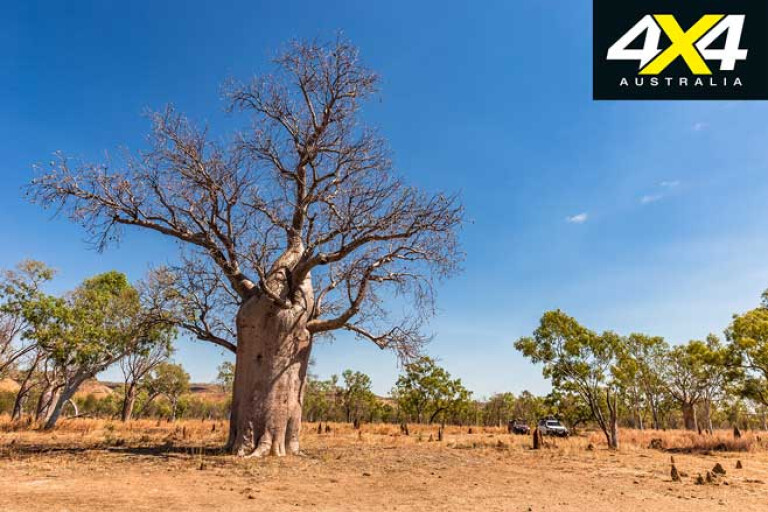
Not far from Timber Creek, on the Kununurra side, is a track that leads down to an old boab, blazed by the expedition artist who was with explorer Augustus Gregory when he visited the region in 1855-56.
The tree is also a sacred site for the local indigenous people, a place they loved to camp at but also for the ‘young man’ ceremony that was performed here. On the way back into Timber Creek is a turnoff on the right that will take you up to a couple of lookouts providing fantastic views of the Victoria River and Timber Creek.
21
From here it’s time to tackle the last stage of Binns Track and spend a couple of days exploring Judbarra\Gregory National Park. The Bullita Access Road leads to a great campsite near the old homestead and stockyards. It’s only 47km on a gravel road, but it’s worth reducing tyre pressures to ease the ride over the corrugations. Unfortunately for us, Limestone Gorge and the campground were closed for maintenance works, so we missed out on some stunning scenery.
The campground is near the old homestead that is a reminder of the pastoral past of the Victoria River District. There are some information boards inside the homestead that tell the history of Bullita, and you can enjoy a cup of coffee or tea with the ranger in the shade of the rear veranda. The nearby Lancewood and Bloodwood stockyards are still maintained and used when rounding up feral cattle that stray into the National Park.
21
A great challenge is the 4WD-only Bullita Stock Route, a one-way loop track once used by packhorses and donkey teams bringing supplies to the isolated cattle stations. It was also a stock route to Wyndham used by Bullita and Humbert River Stations. The 92.6km track crosses the East Baines River a couple of times, and it’s usually dry during the cooler months. The first 10km of the track is rugged in places, with some nice wheel placement and low-range gearing needed at times. It then flattens and driving is easier as boabs, termite mounds, cane grass and bulldust dominates.
There is remote camping available at Spring Creek Yard, East Baines Crossing and Drovers Rest, with beautiful waterholes at the first and last camping spot. Beware the possibility of resident crocs, though, with swimming not recommended anywhere within the National Park. Allow at least six hours to complete the loop track; there is so much to see and trying to do it quickly may create mechanical issues.
21
Binns Track follows the Humbert Track that was used as a stock route between the Bullita Outstation and Humbert River Homestead. This is another beautiful drive that is relatively easy with only the occasional rugged section. Once out of the Park, the roads open up as you pass through private property before reaching the Buchanan Highway.
Passing the expansive Victoria River Downs Station, you soon ford the Victoria River, with a nice, little free camp on the eastern bank. If you’re rolling out a swag, publican Pauline won’t charge you if you enjoy the pub’s facilities. The grub is great and the showers the best you’ll find.
It’s only 180km until you reach the Stuart Highway and complete Binns Track. The best place to sit and reflect on the experiences, sites and scenery of this epic adventure is at the nearby historic Daly Waters Hotel, and that is exactly what we did.
Travel Planner
21
WHERE: Binns Track from Gemtree to Daly Waters Hotel via Davenport Range and Gregory National Parks is more than 2300km, with the longest distance between fuel stops around 800km (Atitjere to Tennant Creek).
PERMITS: No permits required.
FUEL: Gemtree, Atitjere, Tennant Creek, Daly Waters, Mataranka, Katherine and Timber Creek provide unleaded and diesel fuel. Expect to pay top dollar for fuel at the remote places, too, with $2/litre and above for diesel.
BEST TIME TO VISIT: From June to September as the weather is generally cooler and the wet-season waters should have receded.
MORE INFO: Paper maps, with the Hema Maps range providing excellent coverage. Some form of electronic navigation/mapping hardware/software such as the Hema HX-1 Navigator is also recommended.
Please enable JavaScript to view the comments powered by Disqus.
COMMENTS