Explore QLD
Gallery8
IT’S not often I get excited by ‘just’ a road, but after spending a week checking out so much history in a stunning location, I’m sold on the area. While in Cape York we thought we would just shoot over to the much talked about Chilli Beach to see what all the commotion is about.
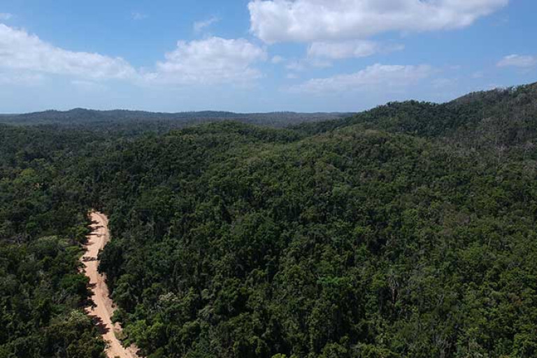
The Portland Road turnoff is 30km north of Laura Roadhouse and 100km south of Coen, along the Peninsula Developmental Road (PDR to the locals). Like nearly all other roads around here, it’s dirt pretty much all the way across to the coast, and well signposted to Lockhart River and Portland Roads.
The majority of the Cape has Traditional Owners protecting the land, and at the start of Portland are a couple of very informative boards explaining their history, ownership and other valuable insights. There are pretty strict rules in the area, so by studying and obeying the boards here you’ll keep on the right track.
8
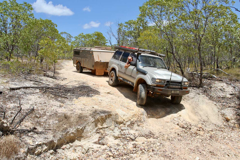
The bone-jarring corrugations start straight away, and bulldust holes are everywhere along the first part of Portland Road. Some of the holes are that deep and wide there are bypass tracks around the original bypass tracks. However, saying that, we did this trip at the end of the dry season, so hopefully graders will fix up the start of the road seeing as there are a few communities along the way.
The first 20km passes through dry scrub bushland not unlike most of the Cape. Tall anthills and patches of grass trees break up the scenery between the gums, and all are covered in dust – either red, white or grey – from the long dry season they’ve had.
VIDEO: FJ40 in Cape York, 1975
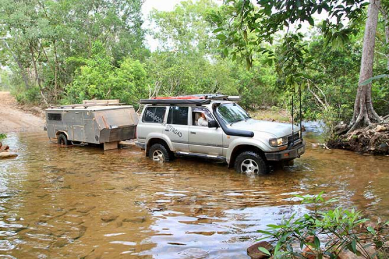
At the Cape during the wet season (generally late spring through summer) everything is bigger, especially the storms, the wind and the water flow. The first mind-blowing indication of this is when you approach the infamous Wenlock River crossing.
It’s not until you reach the top of either side of the crossing that you realise how steep it actually is, to allow the massive amounts of water to flow through during the wet. These days the actual water crossing has a concrete base for better traction.
CAPE GOLD
ANYONE doing research for a trip to the Cape will learn there is plenty of history in the north, including from the war, the goldfields and right down to pastoral. One very significant area that I wanted to explore was the Batavia or Wenlock Goldfields. The shiny stuff was found in the Cape as early as 1876, but the Batavia area was proclaimed later on in 1892. There was that much gold found here that it was declared the most productive goldfield in the Cape during the depression, around 1930.
After crossing the Wenlock heading towards the coast, there are two miners’ tracks to the left, and either one leads to the fields and can loop out on the other. The first road in follows the Wenlock, and we soon found one of the camps with a series of mango trees – the ground had also been levelled, where veggies were grown in long rows beside the river to feed up to 130 men and families working in the field.
8
There are several small concrete slabs around and a bottle dump. An interesting find was the lone grave of Thomas Power, who apparently died in a gunfight back in 1930. The road in doesn’t see much traffic these days, so we found there were plenty of trees and washaways to avoid; but that’s all part of the adventure. Farther around on the loop road (about 3km) the main mining work area can’t be missed ... literally.
TOP TRACKS: Cape York's best 4x4 tracks
There’s a staggering amount of relics trackside and the more we looked, the more we found. Away from constant rainfall and the salt air, most of the equipment still looks pretty good, including steam boilers, water tanks with handmade pop rivets, old trucks, trolley lines, and even a rare Huntington roller stamper.
Normal stampers have tall rods and a heavy head where they’ll crush the rock in the bottom; this one has a series of weights that go around a huge round tank, crushing the rock and then feeding it out. I’ve seen many stampers in my time, but never one as impressive as this. One of the early stampers here was a three-head stamper that ran 24 hours a day – imagine trying to sleep with the constant thud all night.
8
It’s mind-boggling how they managed to transport the gear here, especially when a lot of this gear was made and shipped from London before 1900.
Originally there was only one field, but in 1915 an Aboriginal women, Kitty Pluto, was pushing a barrow and found a large nugget in the wash. It was then that the lower fields were discovered and named Pluto. Kitty also found gold in several other areas, becoming one of the most successful Aboriginal prospectors in Cape York and the only woman recorded as discovering a goldfield in Queensland.
Strangely, in 1942 the Australian Army dismantled some of the mining gear and mines, thinking that if there was an invasion from the north, the Japanese could not utilise this area. Some five years later the mines kicked off again and the Portland Road was properly constructed all the way to the coast and the new settlement of Portland Roads.
Right up until the late 1940s the mining was producing some pretty impressive gold figures, but in the massive storms of 1950 the whole area flooded and mines filled up with water. This was the demise of the Batavia goldfields, and work soon started to wind down.
8
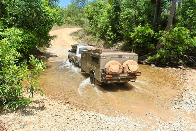
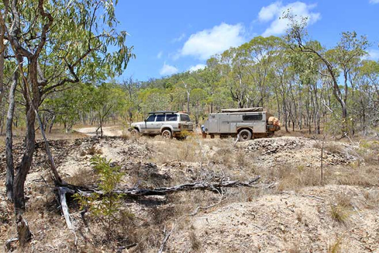
The road out is 4WD only (depending on which way you come from), with several dry creek crossings where the going can be a bit tough. Portland Road continues towards the coast, crossing creeks and winding its way up, over and around several small ranges; sometimes getting down to single-lane tracks but other sections as wide as a freeway. Keep an eye out when crossing Garraway Creek for the massive central pier, used for the bridge construction in 1946 when a proper road was built to the coast.
TO THE NORTH: Northern Cape York
Continuing on and a huge mountain range looms, feeling like it was peering down around every corner. Midway along there’s a pull-off area with a short, signposted walk highlighting flora, fauna and local aboriginal history. It leads to a viewing deck looking towards the Tozer Range. Age-old granite volcanoes spewed out red-hot pumice millions of years ago, leaving layers of ash across the landscape; over time it fused together to form welded tuffs, just like a hard volcanic rock.
The most prominent landmark is Mount Tozer, standing 545m high. Other bands of rock can be seen in the ranges where the heath grass won’t grow in the poor soil; it’s part of the Kutini-Payamu National Park, or the Iron Range NP.
8
For another 15km Portland Rd is sealed, with views in both directions toward the range and to the wind-shaped trees and low heath. There are only a couple of designated camping areas in this part of the world, and if you haven’t booked online you’ll need to detour towards Lockhart and stop at the QNPWS office. There’s no reception along the way, so we had to call in to book – with a self-registration computer system, the process works ... very slowly.
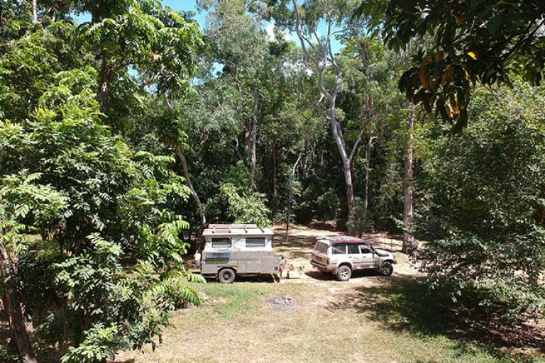
Our camp for the night was back along Portland Road at the Rainforest Number 1 area. Surrounded by thick, almost impenetrable forest it’s a stunning area with plenty of shade and a small walk to the toilets. At night we were greeted by the elusive cuscus, which looked like a large, yellow possum scurrying around and eating the mangoes. From camp there’s a stunning 5km walk through the rainforest to discover more of the area and its unique animals and plant life found only in this part of Cape York.
CHILLI BEACH
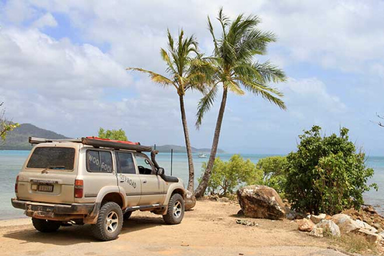
THIRTY minutes along Portland Road is the amazing Chilli Beach, known for its windswept and bent coconut trees, 7km of stunning white and desolated beaches, and views across to Restoration Island where Cook explored back in 1789. Before we headed here people told us the east coast trade winds were making things uncomfortable and there weren’t too many campsites out of the wind. Don’t get me wrong, it’s a ripper of a spot jammed in between the reef and rainforest, but it frequents a lot of rubbish from the ocean currents.
To the north of Chilli Beach and some 10km away is the community of Portland Roads. On a good day there are about 10 people living here around the bay and you can walk the streets in about 10 minutes, but it’s the underlying history that makes this place pretty special.
Prior to WWII a jetty extended from the shore and was a base for local fishing boats trading along the coast, but during the war effort there was a need for a berthing point for large navy ships serving the nearby Iron Range Air Force Base. Today only timber stumps protrude at low tide from the ocean sands, and steel beams lay rusting on the nearby shores. To protect this valuable jetty, naval fort structures were built in the headland overlooking the north, but, thankfully, this area was never targeted.
8
Portland Roads played a key role in keeping supplies to the bomber groups that operated nearby delivering strikes on Japanese installations. This was a turning point in WWII and pushed the front north. Overgrown and lost in the thick scrub, the only remnants left are concrete bases, an observation post and where the gun placements were.
TO THE SOUTH: Southern Cape York
Heading back towards camp, some 30km, a turnoff to the Lockhart River township caught my eye, but not before noticing huge cleared areas in the middle of the rainforest. It’s here, back in 1963, that Australia’s only ‘nuclear’ blast was set off. Named Operation Blowdown, the government at the time wondered what such a blast would have on a tropical rainforest during the Cold War.
Some 17,000 trees surrounding the central blast area were tagged and recorded to see what effect the blast would have. Huge steel platforms were erected and finally a 50-tonne bomb was placed 140 feet in the tower. Thankfully only TNT was used, but it destroyed the area and, even today, only grasses grow where the jungle once stood.
8
Closer towards Lockhart, the historical Iron Range Airport is a must-see. Relics, memorials and a plethora of information are on hand to inform how significant this area was in the protection of our country during war times.
Lockhart itself has a checkered history which dates back to 1789, when William Bligh made contact nearby, and later when explorer Edmund Kennedy passed by in 1848 on his ill-fated attempt to reach the Gulf. From early pearl divers through to sandalwood trading and war expositions, it all happened nearby. Aboriginal culture is strong and alive at Lockhart, where the entire community has a strong identity as one.
What started off as a ‘quick’ detour, turned out to be a huge adventure exploring masses of history, finding relics and whetting my appetite for another exploration along Portland Road in Cape York.
Please enable JavaScript to view the comments powered by Disqus.
COMMENTS