Explore QLD
Gallery9
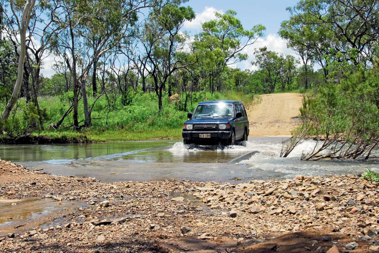
CAPE York Peninsula may be the popular choice, but there are a few amazing side tracks en route before you step into the Cape’s wilderness.
Many mining operations were active in the Great Dividing Range between Charters Towers and Palmer River to the north. While mining is ongoing, the vast majority of mines that opened from the 1870s are now closed; with mining being what it is, though, there is always something happening in one form or another.
.jpg )
9
Tracks leading to nowhere are a feature of this area; some are new and in use and others that end at abandoned mining shafts and forgotten ruins are now long-forgotten. Most are on private land and permission must be sought from local land owners before entering.
Bad things happen in this part of the country, like the vanishing of a prospector a few years ago on the lower Palmer River Goldfields. His body has not been found, but the former Palmerville station owners are doing time for murder.
There is also a saying in this country not to follow the PVC pipeline because some ‘farming’ practices are questionable… But don’t let this stop you from enjoying some of the finest wilderness tracks in North Queensland, though.
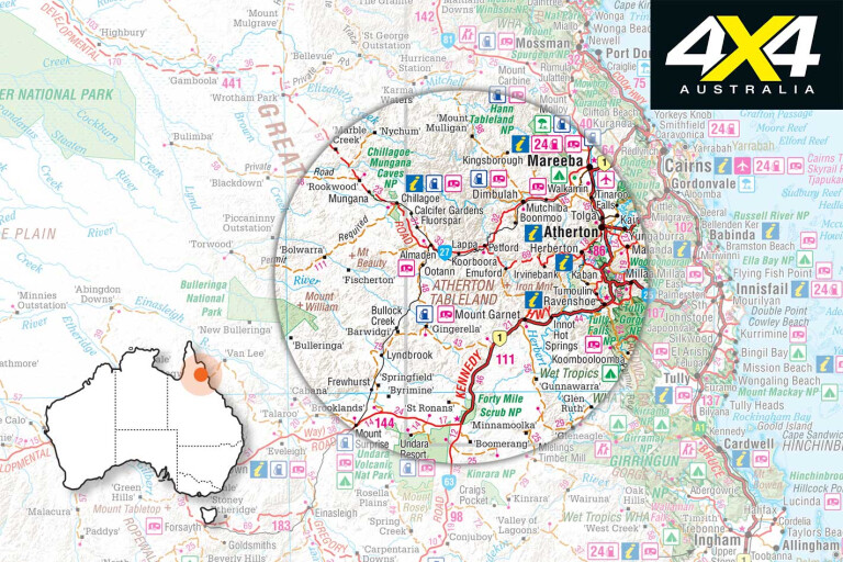
For example, Mount Surprise on the Savannah Way is noted for the amazing Undara National Park and its lava tubes. It’s not to be missed, as there is nothing else like it on the continent. It’s only a 40-minute detour to Undara via the Savannah Way from the Kennedy Developmental Road, just before entering Forty Mile Scrub NP.
9
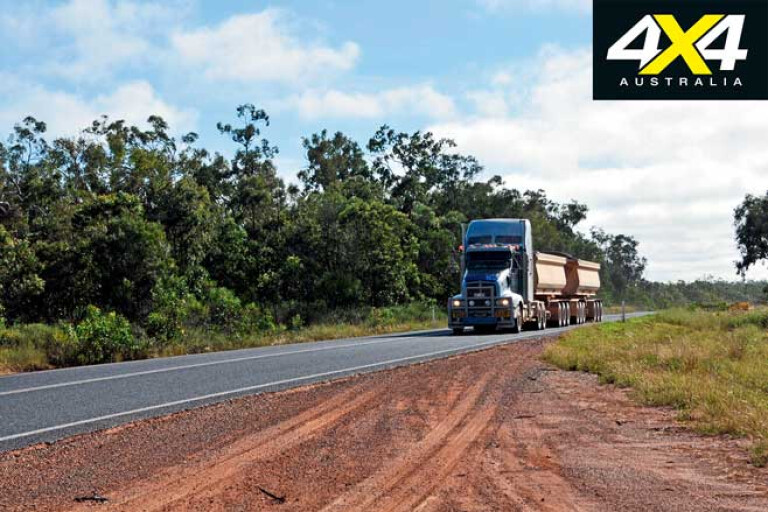
From Mount Surprise it’s a 160km trip to Almaden, located between Mareeba and Chillagoe on the Burke Development Road. The Mount Surprise link is an all-dirt road often used by 50m-long trucks north of the Tate River crossing, which haul ore or cattle from Chillagoe. It’s a true adventure drive that passes termite cities, rugged hills, stream crossings and open woodlands, via Lyndbrook Station.
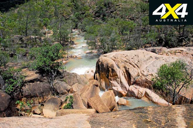
A similar route from Mount Garnett to the Wheelbarrow Way is also popular with weekend explorers. Mount Garnett is noted for its hot springs, towering waterfalls – including Australia’s widest – and for being the gateway to Blencoe Falls on the stunning 4WD-only track to North Kennedy on the Bruce Highway, north of Cardwell.
A couple of interesting routes deviate north from the Kennedy Road at Mount Garnett, and from Innot Hot Springs to Irvinebank and Herberton. Both tracks cut through cattle stations, and all gates must be left as found. There are several abandoned mines and an old town cemetery on the Mount Garnett-Irvinebank track. This is high country, with spectacular views, rugged landscapes, wonderful mountain vistas, and unique upland flora and fauna.
9
Another track leads from Innot Hot Springs, via Wild River Station and the Silver Valley Road to Herberton. Have a mud bath at the spring before enjoying a hearty lunch at the local pub. There are some interesting side tracks on this route; if it’s not posted you are not trespassing, unless you refuse to leave when asked to do so. In this region, with mining exploration ongoing, most tracks lead to mines and the volume of traffic on it will tell you whether it’s active.
In winter take plenty of warm bedding and clothing as heavy frosts and -0°C temperatures occur here, despite being in the tropics. Also, keep an eye open for high-voltage power lines as you near Herberton. A track follows the line and is used by local 4x4, quad and bike enthusiasts. It has some incredibly steep inclines and declines that are challenging.
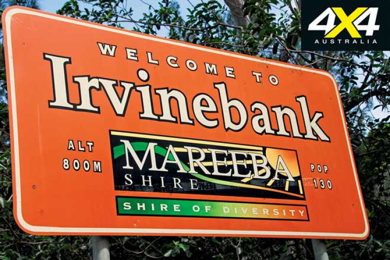
Irvinebank
9
HERBERTON, situated at a 900m elevation, was the first settlement on the Atherton Tablelands. It’s an old town with many fine period buildings, historic walks and scenic views. It gets bitterly cold in winter and has a rich mining and farming history, as well as many attractions worth seeing.
Some 20km to the west is Irvinebank, a small and unique historic mining township … just don’t crash into the windmill in the middle of the road at Watsonville. If you’re looking for a nice place to relax for a drink and some comforts, check in at the Watsonville Rural Firefighters depot located eight kilometres north of the community. It has great campsites, weekend entertainment and hot showers. Plus, there’s a chance to hear tales of the wild old days from the locals.
Hard to believe when you see the village today, but in its heyday it was located on some of the richest copper and tin deposits in the country. It was first established as Gibbs Camp in 1882, but the name was changed by mining magnate John Moffat who owned the town, smelters, treatment plant and everyone else.
9
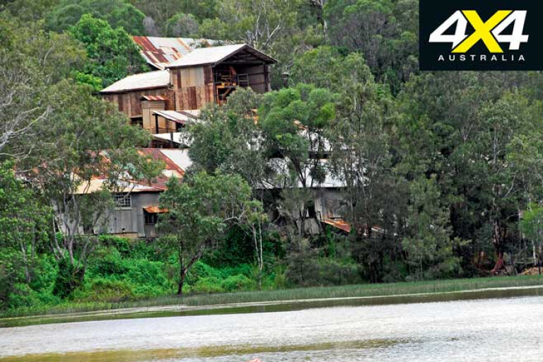
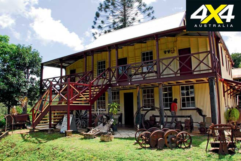
The remnants of the period still remain, with Moffat’s former home now being the Loudoun House Museum and Information Centre. It’s open every day in the dry season and well worth the effort. At the mill’s foot is a lovely lily-clad impoundment, while the retaining wall is made from timber.
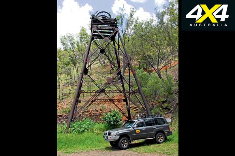
The old Tramway Station is worth a look. Five trains carrying passengers, cargo and ore departed here daily for the Stannary Hills mine. Another nearby attraction is the Vulcan Hill Mine shaft frame, once the deepest mine (440m) in Australia. The Irvinebank Tavern has free camping and great meals.
Irvinebank’s sights include fine period-galvanised iron cottages, School of Arts Hall, Queensland National Bank, Tramway Station, Vulcan Mine, and the 1886 police station and courthouse. In fact, the whole village is a living museum of times past when men laboured in the mines or slaved at the Loudoun Mill treatment plant.
9
After work, most drank their hard-earned or gambled it away at the pubs. Fights and brawls were common, as many unionists were stand-over men who intimidated other workers for failing to join their cause.
Some of the smallest houses in the world are in Irvinebank, and people still live in them. It’s odd to see a humble, galvanised and iron-clad abode complete with a smoking wood-fired chimney having a Toyota Land Cruiser 200 parked in a garage that’s bigger than the house alongside it.
There are number of 4x4-only ring roads in the area that take you to abandoned mines and other places of interest. The area is ideal just after the wet season when all the rivers and creeks run, as they offer safe crocodile-free swimming and relaxing bush escapes.
9
Irvinebank was linked via the tram rail to Petford on the Wheelbarrow Way. It transported ore to the Chillagoe Smelters and coal from Mount Mulligan. The rail line is gone, but a good gravel scenic road links the village to Petford.
About 26km north is Emuford, a tin battery that remains intact. The owner has accrued an amazing collection of old mining engines, plants, memorabilia and more, but the problem is the owner is often absent. Phone John Fitzgerald on (07) 4094 8304 to see if he can show you one of the most intact tin batteries in Australia.
There’s a prospecting area not far past Emu Creek Bridge, with a lovely waterfall that runs for a few weeks after the Wet. It’s a nice spot to camp on the way, north or south. Petford, on the Wheelbarrow Way, is only “just up the road”.
If you want another excuse to do the Cape and want to see more of its unique wilderness, you can start by detouring from the highways well before you get there. A new adventure is waiting.
Know of any side tracks worth exploring in the Cape York area? Let us know in the comments section below.
9
Please enable JavaScript to view the comments powered by Disqus.
COMMENTS