Explore QLD
Gallery16
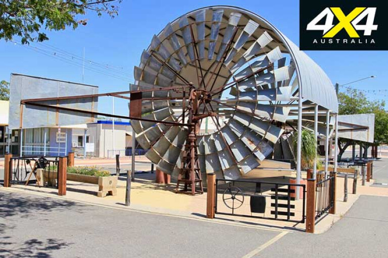
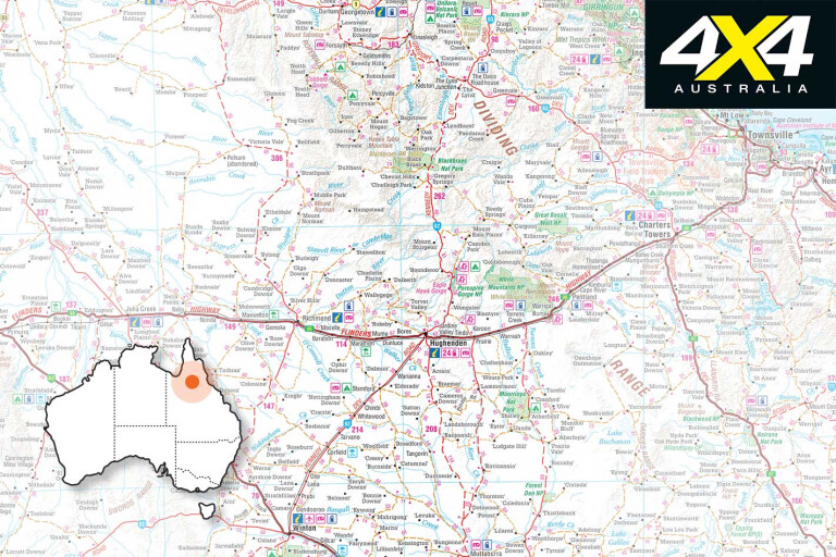
Heading out from Winton it’s a solid 220km run on the blacktop until the historical and colourful town of Hughenden.
Wind the clock back to 1861 and it was Fred Walker who camped near the river heading north searching for the lost Burke and Wills party. Just opposite the Flinders River a huge coolabah tree was blazed by Walker in 1861, and the following year by explorer Landsborough, as they searched in vain.
16
Hughenden, or Mokana as it was named by the local Yirandhali people, was soon to become pastoral land, with huge sheep stations covering the area. The town has had a chequered past where pre-1900 barracks were set up for Aboriginal police, so they could track down runaways in the harsh and often inhospitable outback.
Over the next few years the town grew through land sales, shops were established, and a school, a courthouse and churches were built. On one occasion Americans had stored ammo underground just out of town, and during a ‘controlled burn-off’ the fire got out of hand causing explosions, which left huge craters, blew windows out of buildings and burnt shops down.
Grand plans were passed in 1945 to build a two-storey courthouse, but after it was discovered that the foundations would not support the building, and there was a shortage of cement, it was eventually erected as a single-level building.
These days the town survives on agriculture and the tourist trade, the latter either passing through or stopping by to visit the dinosaur centre. Back in 1963 huge bones were discovered, which turned out to be an eight-metre Muttaburrasaurus that roamed the area some 100 million years ago. Hughenden is part of Queensland’s dinosaur trail and the town has embraced this by setting up a fossil centre with all types of rocks, bones and interactive displays.
16
Along the Kennedy Developmental Road (KDR) you’ll find Point Of Interest (POI) signs alerting you to some pretty cool spots. Just before the Porcupine NP turnoff, keep an eye out for Bottle Tree Hill; although, there are no bottle trees for miles either side of it. A track to the top offers unimpeded views across the plains and ranges in the distance. At the base of the hill is an information sign beside a pile of rocks that suggests a mailman was attacked at this site in 1886 by a group of hostile locals who speared him to death.
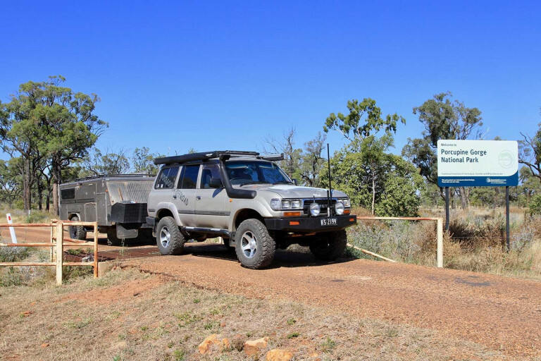
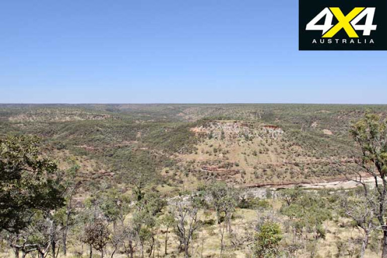
Surrounding Hughenden are four national parks, and the most spectacular of these is Porcupine Gorge an hour north along the KDR. It’s 70km of blacktop along the way and a scenic drive that passes hills covered with sandalwood trees along the base of Mount Beckford, with an under-covering of Mitchell grass. Porcupine Gorge is accessible to any vehicle and there are ample camping areas and facilities, with the main attraction being the stunning Porcupine Gorge in which visitors can hike into the valley below.
16
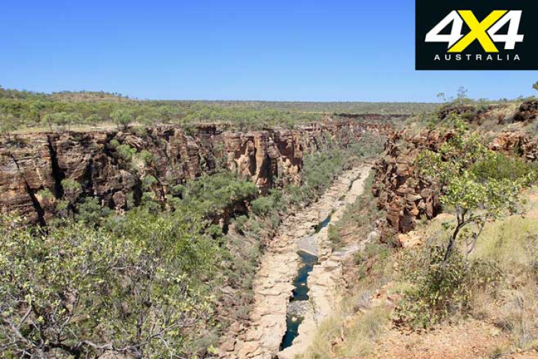
You need to book online to snare your spot at the one and only campground and, as there’s limited reception and the area gets extremely busy during the cooler months, you should do this in advance. The area had volcanic activity millions of years ago, leaving hard basalt layers over the soft sandstone, and with weathering from rain, fast-flowing floods and severe winds it has left what we see today: deep-cut gorges with a multitude of coloured layering rock. This place is a haven for birds (and birdwatchers) who flock here for the cool water deep in the gorge. It’s also popular with hikers who are prepared to spend hours following the trails into the gorge.
While Porcupine Gorge is a great stopover, heading farther north along the KDR sees the tar give way to harsh unsealed outback roads not far from the park’s entrance. Another information sign states that in 1888 a chap called Bill Crossley was bitten on the hand by a scorpion while trying to un-bog his wagon from the creek. It’s said the nearest town doctor would not come out and help Bill until a deposit was made, but by the time his offsider had raised enough cash Bill had passed away by the creek. Today a rock cairn marks this unfortunate occurrence.
16
Farther along you’ll find a sign highlighting Whistling Bore, which was sunk to 500 feet with no water found, but on some days a noise can be heard rising from the capped-off bore. We think we heard the hum but, true or not, it’s not a bad place to stretch the legs.
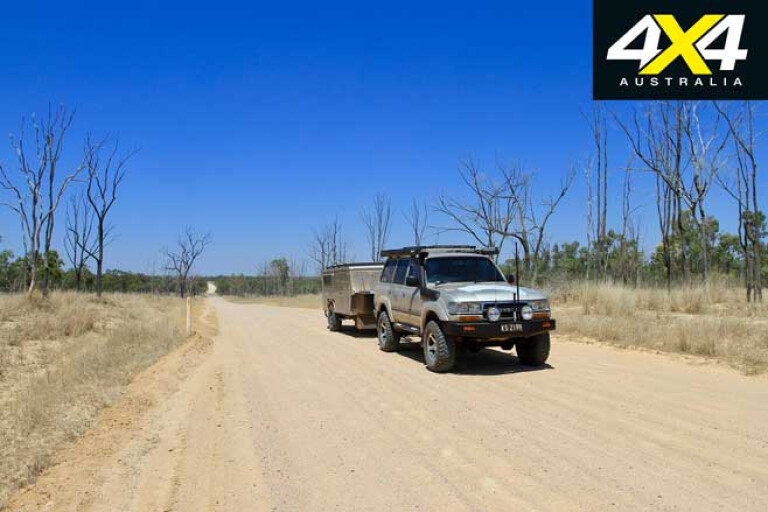
The KDR is narrow in some places, while some of the way it’s as wide as a four-lane freeway. We encountered a few travellers going too fast in the opposite direction, and when they flew past at speed we had to look out for dust and rocks.
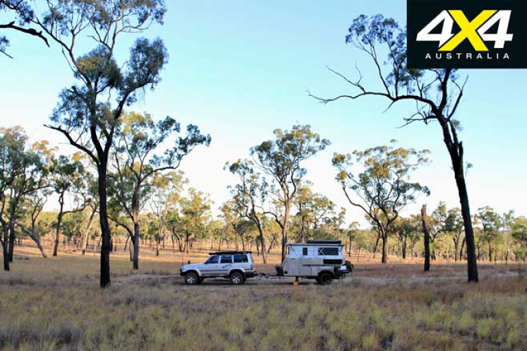
Some 100km along the route you’ll find a couple of free camping sites near Moonstone Hill, and if you have a fossicking permit it’s okay to look for a few gems. The gems found here are weird-looking clear pieces of rock not dissimilar to the broken shards of windscreen glass, and they’re as small as a nail head up to a spoon size. These are only found on this side of the Montgomery Range. The 360-degree views from the top are stunning and often you’ll be able to spot the dust trails of other travellers and cattle trucks rising above the trees.
16
Just up the road is Blackbraes National Park, where you can camp and explore.
With a 21km road in and out, it’s a good base to set-up for a few days to explore Emu Swamp Dam that, when full of water, is alive with birdlife. The dam is an ancient volcanic crater and the surrounding area is typical Gulf lowlands, with black soil plains covered with silver-leafed ironbark trees. The Gilbert Range heads north from here, providing runoff into the lake and surrounding areas.
After leaving this area the KDR follows Einasleigh Creek for many kilometres, and considering how much of the surrounding area was dry it was surprising to see water flowing in some of the creeks, and with it a few bustard birds prancing beside the road.
16
The local shire council was upgrading the road from Lyndhurst Station for around 20km and listening to them on the UHF we heard they were frantically trying to finish the job before the onset of the wet season.
Along the way we found they had completed sealed sections up to 5km long. There are some large properties out this way and with that there are some large trucks hauling cattle around, and despite most only hauling a couple of trailers they demand respect and need the whole road.
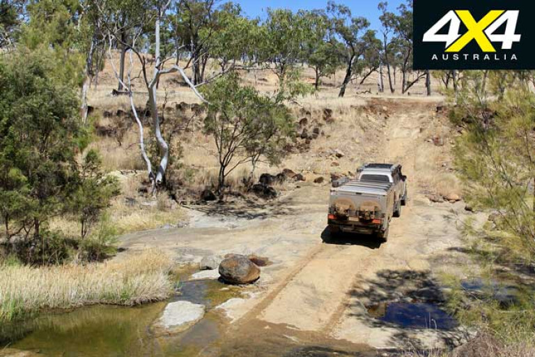
The last 50km from Lyndhurst to The Lynd Roadhouse is in pretty good condition, but don’t expect to be doing any breakneck speeds; generally our speedo was sitting around the 40 to 60km/h mark most of the way due to the rocky and sandy base and our lowered tyre pressures.
16
After two days on the KDR it was a pleasure to hit the tar near the Lynd Roadhouse (where basic supplies can be topped up) and the last 95km up to Minnamoolka is a dream drive. If you have time it’s possible to explore the Undara lava tubes for a price, but that’s at the end of the Kennedy Developmental Road.
While the 350km KDR is not a hard or technical drive, it’s an interesting one for the seasoned traveller; however, bear in mind there’s no phone reception along its length, even up on the ranges. At its end you are presented with several options; keep heading north towards the Atherton Tablelands or farther west towards Normanton along the Gulf Development Road.
Please enable JavaScript to view the comments powered by Disqus.
COMMENTS