Explore QLD
Gallery11
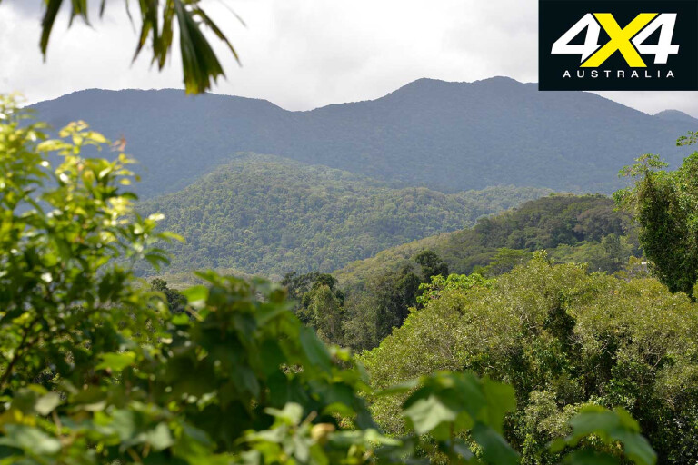
THE WET Tropics World Heritage Region commences at Paluma National Park (NP), north of Townsville, and terminates at Black Mountain NP, south of Cooktown, an unbroken chain of national parks and reserves totalling more than 9000km² of tropical mountains and lowland rainforest.
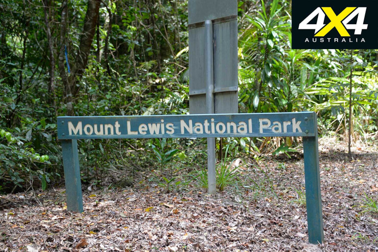
There are many rare jewels in the Wet Tropics including the Daintree Rainforest and Paluma Range NP, but nothing equals the hidden Mount Lewis National Park on the Julatten Tableland, west of Mossman.
11
It’s unique; unlike other parts of the ‘rainforests in the clouds’, which includes the third highest mountain range in Australia, the 28km-long Mount Lewis Track is accessible for most of the year.
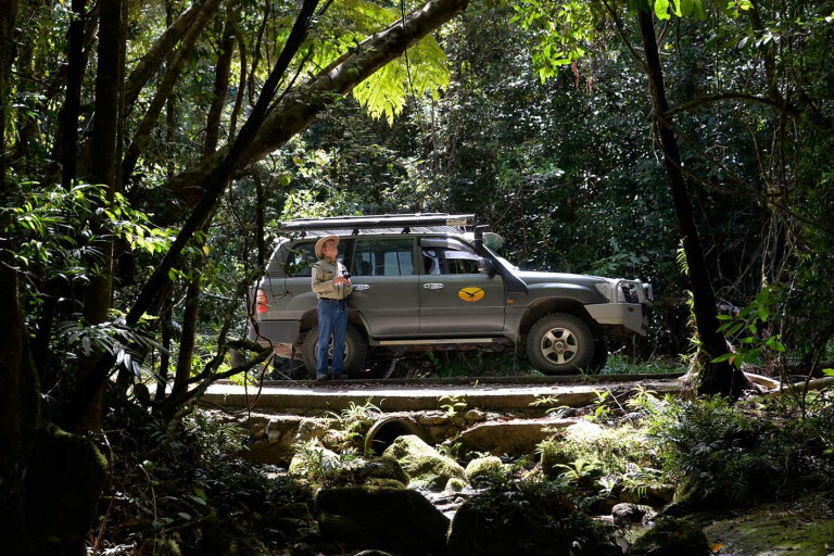
Including Round Mountain and Lyons Lookout the park is 273.55km² in size, all of it pure wilderness, where only a couple of tracks provide access. One is Mount Lewis Track which ascends some 1200m above sea level, making it the highest vehicle access track in Queensland.
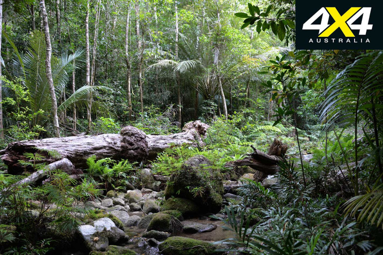
Not that you will see panoramic scenery, because it mostly runs under the canopy of verdant rainforest. The Mount Lewis Track follows the contours of the watershed that gives birth to the Mossman and Daintree rivers to the east and the Mitchell and McLeod rivers to the west. They form about a kilometre from each other, all spring-fed from perennial creeks.
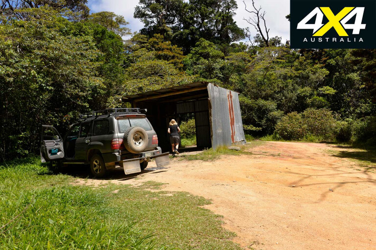
The Mount Lewis Track is only 28km in length and it ends at an old galvanised logging hut, where it continues down the mountain as an overgrown walking track. There used to be a tin mine on the end of it, and years ago the track was well used, but for some reason it appears that few bother to walk it these days.
11
The Mount Lewis Track commences at the Highland Tavern on the Mossman-Mount Molly Road – the sealed road junctions about a kilometre past the tavern. The right turn ends at a lovely swimming spot in Bushy Creek, while the left turn swings up the mountain after crossing the creek. Pull over and see if there are any platypuses swimming below the bridge.
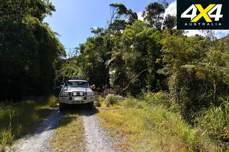
Keep right after crossing the bridge and head straight up the mountain for about 7km before it levels out. The track commences about 500m above sea level through a dense upland forest that drops down into deep valleys and gorges.
The track is recommended 4WD only, but in recent years a lot of work – culverts, bridges and gravel – has made it more user-friendly. The track is closed during the wet season, when up to four metres of rain may fall on the mountains.
11
There is no through access and you must return the way you came in, and expect about a three- to five-hour drive; although it’s easy to spend a full day on the mountain, especially during the build-up season when the low country swelters and the high country is cool.
The first 8km of the ever-climbing track traverses parts of Brooklyn Station, owned by the Australian Wildlife Conservancy, which promptly shut the gates to keep us out. The park boundary commences at the national park entrance gate, which is sited at a grassy clearing, 8km from the start.
It was once a logging and tin-mining camp. A walking track heads west from here to a small dam and a Telstra communication tower. Ensure you wear sturdy walking boots, while knee-high gaiters are recommended against snakes, prickly wait-a-while vines and stinging trees.

11
The track is narrow along its entire route and commonsense is needed when passing other vehicles, and beware of trail bikes and bird watchers who will hit the brakes without warning when they see a bird.
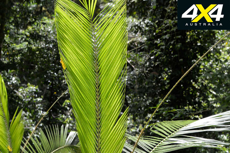
The first 8km of the track’s flora consist of tall trees and vast impregnable tickets of wait-a-while vines, a climbing palm used in the production of cane furnishing. Avoid its prickly thorns. The most poisonous plant in the world, the stinging tree, is also common along this section.
Tiny hair-like harpoons sited on the leaves, filled with poison, are injected into the skin, and the pain is akin to being scolded with hot sticky liquid. Contact its leaves and you will endure extreme pain for several days – it will last for six weeks before waning, but pangs of it will reoccur during cool weather for up to two years.
11
If you get stung spray some self-sealing spray bandage on the area to prevent air from contacting it. Another common “cure” is to wax the injured area and pull all the hair off, which is supposed to also pull the “harpoons” off, but I only did that once and it gave me more pain than I had ever experienced before.
As you pass the gate and enter the park proper, the track glides precariously along steep slopes. The vegetation changes the higher you climb, with Atherton Mist, purple-crowned Alexandra palms and fern trees common.
Huge trees rising from deep gorges are festooned with ferns and orchids, while mosses and colourful fungi dominate. In sections, rays of sunlight shine through gaps in the trees overhead, creating mini-environments where rare plants grow. These tiny hotspots are favoured by reptiles.
11
The farther the track ascends, the cooler it becomes. The cloud forest proper begins at about 900m, where it is often shrouded in mist and scudding clouds, especially in the early morning. These forests are unique, harvesting water directly from the clouds, like a sponge sucks up water. Thus, the forest captures the water that is released throughout the year and keeps the springs bubbling.
Near the end of the track is a highland lake covered with reeds. You may encounter a tree kangaroo here, while huge basalt boulders are a feature when you reach the track’s summit.
MORE4x4 Explore
Travel Planner

11
WHEN
During winter temps can drop to -10°C on the mountain and -5°C on the Julatten and Atherton Tablelands. Warm clothing is recommended, as is a raincoat at times.
TRACK CONDITION
The Mount Lewis Track is unsealed and has many bends and steep grades. Keep left to avoid oncoming vehicles and trail bikes. The track is closed at the gate in the wet season.
WHAT TO BRING
Take drinking water or boil it. If hiking into the forest tell someone what you are doing, or at least leave a note in your vehicle, and carry a PLB. Mobile phone coverage is unreliable.
No dogs or other domestic animals are permitted in any Qld NP, nor are firearms and chainsaws; although, you can clear fallen trees from tracks in an emergency. Take all rubbish out!
CAMPING
There are no dedicated day-use areas and no camping is allowed. Many of the creek crossings, the clearing, and the hut at the end of the track are great spots to pull up and boil the billy.
Travel notes: Wandering wildlife

11
The region is a treasure trove of endemic wildlife. The Mount Lewis upland rain and cloud forests date back to the evolution of flowering plants on earth, when Australia was part of Gondwana.
The road fringes and grassy areas are favoured by red-bellied black snakes and seed-eating birds. Carpet and scrub pythons may also be seen. Also keep an eye out for rainforest dragons, eastern water dragons, wild pigs, many species of frogs, and spiny crayfish.
There is a large bubbling stream past the gate that feeds Mary Creek, some 1000m below in the Mount Carbine valley. It’s deep enough to wade in and a great spot for a splash, though the water is icy cold, and to see crayfish.

11
After heavy SE trade-wind rains, common in the high cloud forests of the Wet Tropics during the dry season, crayfish can be seen “walking” up table drains. Sometimes, if you are lucky, you may also see one of the largest earth worms in the world, the blue worm, which can grow to two metres. It’s generally seen after rains flush it out of its burrow.
The clearing before the park entrance is home to one of the rarest and most regionally restricted birds in Australia, the blue-faced finch. It and red-nape finches are seen only when the grass is seeding, between November and April.
Fruit-eating doves, parrots and lorikeets are common, as are wrens, honey and insect-eaters, along with ground-dwelling scrub fowl, chowchillas, whip and bower birds. You may also spot a masked white-tailed rat, a kangaroo rat, tree kangaroo, a Daintree River possum, or even a cassowary.
Travel notes: History
11
THE TRACK was first pushed in by miners and loggers, with tin and wolfram mining common in these parts. Most was alluvial and collected directly from the many perennial streams, though some rock-mining took place. Pack horses were used to transport goods in and ore out.
The grassy clearing near the park entrance was once a mini-village of galvanised iron huts and bush timber. Tin-mining evidence is in the forest up and downstream from the small creek, just before the clearing.
Logging Kauri pine and red cedar trees was another industry that made the track an important source of income for the Mount Molloy Mill. The track as we now know it was pushed in with a dozer during the late 1940s and closely follows the historic pack-horse trail.
It was extended to the upper slopes in the 1970s, but all mining activity and logging came to a sudden end when the area became part of the Wet Tropics World Heritage Region in 1988.
Travel notes: Plane crash mystery
IN JULY 1967 a plane crashed on Mount Lewis. The area was searched for weeks with no results and the mystery of its disappearance was long forgotten until 12 months later when bushwalkers stumbled across the wreck close to near the upper track. The impact had left a one-metre-deep crater yet there was no damage to the forest.
Please enable JavaScript to view the comments powered by Disqus.
COMMENTS