Explore SA
Gallery8
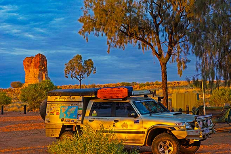
THE track had turned into a badly eroded two-track as it crossed the gibber-strewn tableland country and the invisible line marking the Northern Territory-South Australian border, north-west of a lowly Mt Herne.
Somewhere to our east a lonely concrete obelisk on a flat pebble-covered claypan marks the border proper and is the most easterly border post along that line before coming to a distant Poeppel Corner on the far side of the Simpson Desert.
The Patrol thumped through a nasty washout that marked a runoff channel for a tributary of Coglin Creek. Just a few minutes later the road to Mt Dare Hotel was on our right and then the low scattered ruins of the once proud and important Charlotte Waters repeater station, close to the banks of Coglin Creek, appeared.
8
Established as a repeater station for the Darwin-Adelaide Overland Telegraph Line (OTL) in 1872, a store soon followed along with a police station. The OTL had basically followed the tracks of John McDouall Stuart, who blazed his way north from the settled districts of South Australia to the north coast of the Northern Territory during six incredible and tough expeditions between 1859 and 1861.
The Ghan had followed. In 1878 the first sod of the Great Northern Railway, which was to become ‘The Ghan’, was turned at Port Augusta with the railway routed through Pichi Richi Pass, Quorn, and onto Government Gums (today’s Farina), where the rails eventually arrived in 1882.
Two years later the steel ribbon had made its way to Marree, then known as Hergott Springs for the small permanent pool of water that today can still be found just out of town. By 1891 the railway, following the line of springs which fed the steam locos with much needed aqua, had reached Oodnadatta, which remained the railhead till 1926. In August 1929 the line was finally extended to Alice Springs and there it remained until 2001 when it was finally pushed through to Darwin.
8
With the railway line through to Alice and with ongoing improvements to transmission technology, the Charlotte Waters station was abandoned in July 1930, although the police post remained until that was transferred to Finke in 1938. By 1950 most of the buildings had collapsed after the roofing iron and timbers had been scavenged to build Andado homestead and later, New Crown homestead.
We stopped and wandered around this lonely site which is pretty easy to miss given the thoroughness of those scavengers back in the 1940s, and if it wasn’t for a couple of info signs you’d be flat out making any sense of the scatterings of rubble, posts, old tanks and fence lines.
CROSSROADS OF AUSTRALIA
OUR trip, following the route of the Old Ghan Railway and the OTL, had started a few days earlier in Port Augusta, the self-professed ‘crossroads of Australia’, at the head of Spencer Gulf. We had wandered east through picturesque Pichi Richi Pass, before stopping at Quorn to savour a cold beer at one of the four hotels that had once serviced thirsty train travellers.
Cruising along the blacktop we crossed the flat Willochra Plain to stop at Hawker before wandering up what they now call ‘The Outback highway’ that skirts the western edge of the Flinders Ranges to tiny Parachilna and its famous ‘feral food’ hotel, the historic ghost town of Beltana and small, almost forgotten, Copley. It would be hard to travel this road and not make a detour into the nearby ranges to such delights as Wilpena, Brachina Gorge and Arkaroola but our sights, this trip, were set farther north so we pushed on.
8
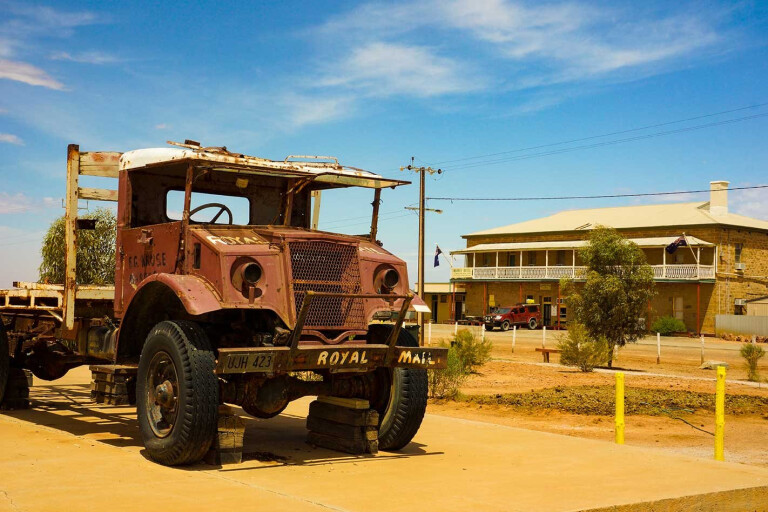
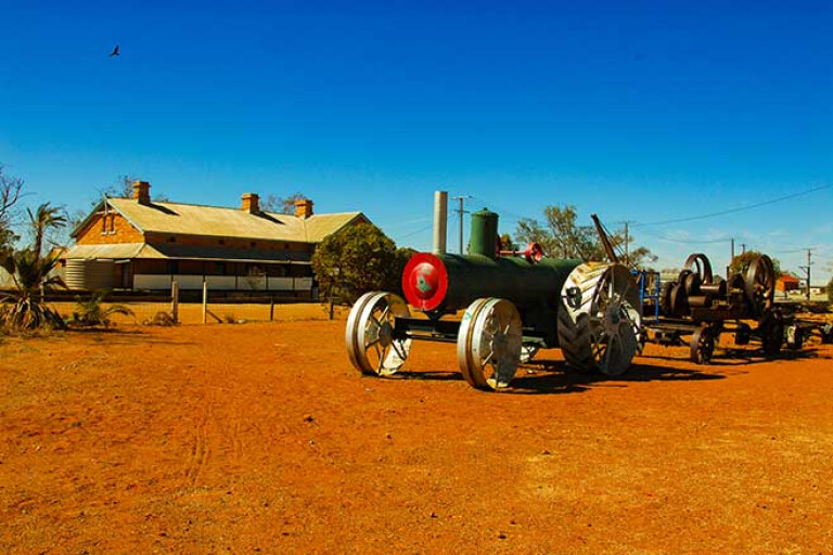
After refuelling at the self-serve opposite the Lyndhurst pub we stopped in at delightful Farina for an overnight camp, tucked in close to the trees that had given this spot its original name, Government Gums. Next day we cruised effortlessly north to Marree (the road is now all blacktop) and checked out the railway precinct with its old diesel engines, the Birdsville mailman’s truck, the town’s original mud-wall mosque, the Lake Eyre Yacht Club (it has a great collection of photos), the nearby Hergott Springs, which was the original reason for Marree to be located where it is and the pub, which has got a great display on the area and particularly on Tom Kruse and his legendary status as the Birdsville mailman.
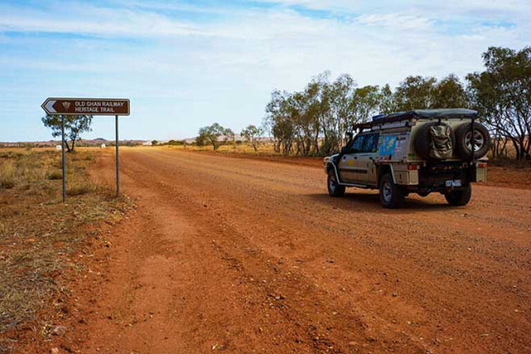
Bitumen gave way to a well-formed graded road as we headed west and then north along the Oodnadatta Track, nowadays a track in name only, although at times after rain the track does take on a semblance of a more minor road. For those wanting to explore the heritage of the Old Ghan there’s a lot to see and places to stop at along the way.
Coward Springs – once an important railway stop with a pub – and now with its pleasant campground and warm pool attracts many travellers to stay for the night and is an ideal spot to explore the surrounding Wabma Kadarbu Mound Springs Conservation Park. The two most visited spots in the park are the springs known as ‘The Bubbler’ and ‘Blanches Cup’, their flowing waters forming a small wetland which attracts a variety of waterbirds.
8
Farther north the Oodnadatta Track passes the quite extensive ruins of the Beresford railway siding and then Strangways, where to the west of the main road the old Overland Telegraph Line (OTL) repeater station can be found. These are well worth exploring and a series of walks from the carpark will take you through the old settlement, which includes not only the telegraph station but also a blacksmith and police station to a woolshed and wool-scouring plant as well as the local cemetery and a number of flowing springs. The telegraph station was closed in 1896 when its operation was taken over by a more modern facility at William Creek.
We stopped for a beer at the great pub at William Creek, which has been a watering hole ever since the railway came by. We were tempted to stay for more but decided to push on, passing through Warrina railway siding with its monument to the 1891 Elder Scientific Expedition before coming to the Neales River and the famous railway bridge across its normally shallow waters. Nearby, the Algebuckina Waterhole just east of the main road is a favoured camping spot, while those with a canoe will enjoy a delightful paddle on this permanent stretch of water.
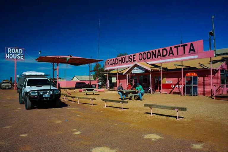
PINK ROADHOUSE
OODNADATTA is the biggest town you’ll drive into between Marree and Alice Springs but don’t expect too much from this small community. For travellers the Pink Roadhouse supplies most requirements, while the pub and general store just up the road will quench one’s thirst and supply other essentials. The Railway Museum is worth a look and the old historic cemetery is just out of town.
Just a few kays north of the town you’ll come to the Angle Pole Memorial which commemorates the OTL and its sudden change of direction here, while just to the west the Angle Pole Waterhole in the Neales River can be found. A few kilometres farther on the real adventure of following the Ghan Line begins as the main road swings westward to Marla and the Stuart Highway while our route following The Ghan points northwards, the old railway line easement now off to our east.
8
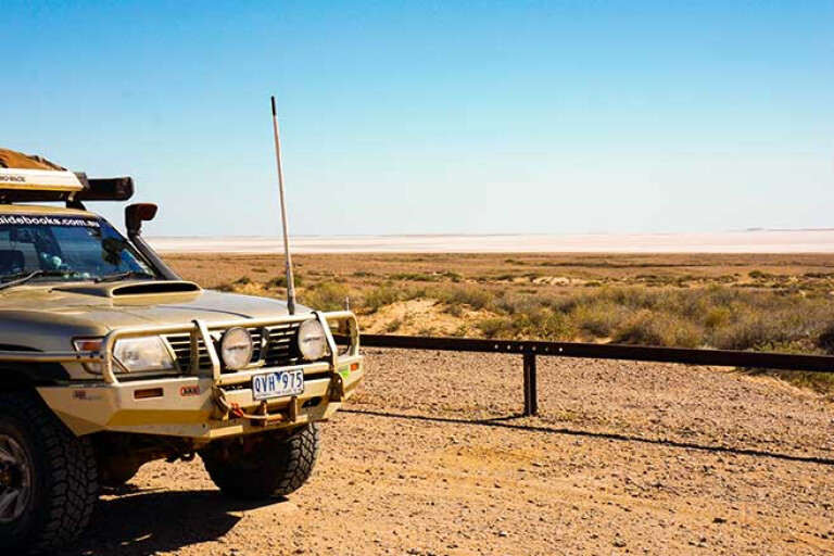
You cross Hamilton Creek near Hamilton Station – the camping area here is now closed – and come to a track junction where the more major one swings east to Pedirka railway siding and is the main route to Dalhousie Springs and a crossing of the Simpson Desert.
From this junction the route north deteriorates a little as it dodges between Mount Ross and Mount Hornet and crosses Stevenson Creek before coming to Lindsay Creek where Eringa Waterhole makes a shady spot to grab a bite to eat. On the south side of the creek are the ruins of the old homestead, the property once being owned by Sidney Kidman, the cattle king. Sadly, as part of Hamilton Station, camping is no longer allowed here.
You meet the old railway line at the ruins of Abminga where quite a bit of infrastructure can still be seen, although the roof of the fettlers’ hut was blown away a few years back by some strong winds. Crossing the railway line here, the track heads to Charlotte Waters and our meeting with these historic but sadly depleted ruins along with a better track north that leads to the Aboriginal community of Finke, now more correctly known by its Aboriginal name as, Aputula. The town, which can supply travellers with fuel and basic supplies is more well-known for being the halfway point of the annual, Finke Desert Race.
FINKE RIVER
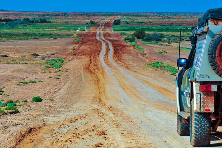
ONCE across the sandy bed of the wide Finke River the route north sticks closely to the old Ghan railway easement and in places runs along directly on the top of it, the large corrugations from old railway sleepers making the travel unforgettable but, luckily for man and machine, relatively short lived.
The route wanders across some tableland country to Rumbalara siding where the low peak of Colson Pinnacle off to the east can be seen by observant travellers. Farther north again the more obvious ruins of Mundooma Siding are reached and here the more major track swings away from the railway line, first to Alice Well on the Hugh River, the track then paralleling the sandy bed of the stream to Maryvale homestead and the turnoff to Chambers Pillar.
The track out to this impressive column of rock is often sandy but it’s well worth the detour and the small camping area close to the pillar is a beauty. We pulled in for the night and set up camp, enjoying the play of light on the nearby hills, buttes and rock outcrops, both at sunset and the following morning.
8
Back on the old railway line easement, north of Maryvale Homestead, the track improves and passes through the low hills of the James Range near Deep Well Tank. Making a beeline for Alice Springs, now not so far away, the route passes the western end of the Ooraminna Range, where Mount Ooraminna at 630 metres is the highest point for a long way around. Through here too, in the low sand-ridge country, the first of the desert oaks make an appearance along the track, their drooping needle-like leaves sighing in the slightest of breezes making any camp amongst them a delight.
MOREClose to Darwin
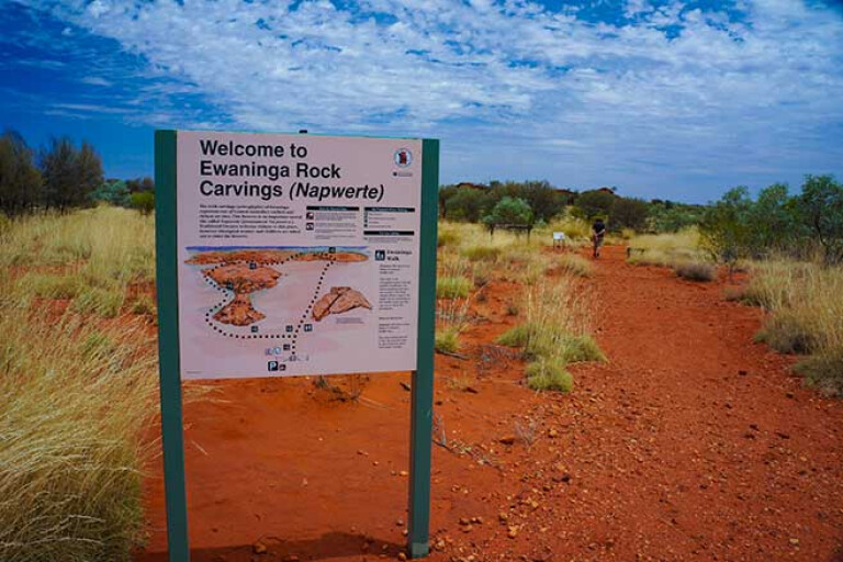
The small reserve of the Ewaninga or, ‘Napwerte’ rock engravings, surrounds a small claypan that holds water after rain and was once a favoured site for wandering bands of the Arrernte Aboriginal people. Here they would stop and camp, trap animals and carve symbols and motives into the rock surfaces. These petroglyphs are best viewed in the late afternoon or early morning and it is important (and against the law) to touch or deface these ancient engravings that would have to be many thousands of years old.
8
Just a short distance north, the old railway siding of Ewaninga is off to the west of the road and a short time later the track north crosses Roe Creek and comes to the bitumen, just 12km south of the centre of Alice Springs.
After you pass the ‘Welcome to Alice’ sign, which is a photo stop for many, and south of the impressive Heavitree Gap where the Todd River flows through a break in the MacDonnell Range, a road on the left leads to the national Transport Hall of Fame (well worth a visit), the Old Ghan Railway Museum and a nearby camping ground. The displays here at MacDonnell Siding include a 1930s-style railway station built from the plans originally intended for Stuart (the original name of Alice Springs) along with a number of old diesel locomotives, sleeping carriages and the like. It makes a fitting place to end your trip along the historic old Ghan railway which helped open up Central Australia.
Please enable JavaScript to view the comments powered by Disqus.
COMMENTS