Explore

Gallery17
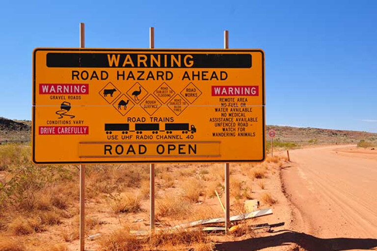
With hundreds of tracks and routes carving their way through the outback, planning a trip to the desert can be overwhelming.
To help, we’ve narrowed down and compiled a list of eight essential trips and tracks – in no particular order – to add to your bucket lists.
JUMP AHEAD
- Gibson Desert, WA
- Canning Stock Route, WA
- Strzelecki Track, SA
- Anne Beadell Highway, SA/WA
- Flinders Ranges and beyond, SA
- Great Sandy Desert, WA
- Little Desert National Park, Vic
- Simpson Desert, NT/SA/Qld
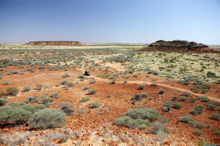
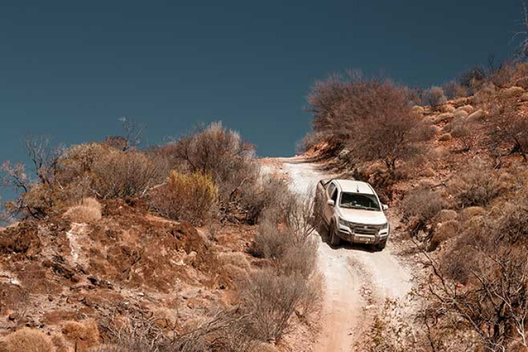
Gibson Desert, WA
Western Australia’s Gibson Desert mightn't be the biggest desert in Australia, but it still measures in at just over 155,000 square kilometres in size – making it the fifth largest behind the Great Victoria, Great Sandy, Tanami and the Simpson.
17
The Gibson is bordered to the north by the Great Sandy Desert and to the south by the Great Victoria Desert, and a 4x4 trip to this arid region requires serious preparation and an equally serious 4x4 vehicle. The area is remote, and isolation is all but guaranteed. However, with those perks comes extra caution, as you'll need to be entirely self-sufficient and prepared for the worst. That means packing competent recovery gear, plenty of water and working communications.
The world-famous Canning Stock Route passes through the Gibson (as well as the Great Sandy and Tanami deserts) and you can read all about the revered CSR in this feature. However, while the CSR may steal the headlines, the Gibson contains other compelling 4x4 tracks.
17
A lesser-known yet equally difficult route within the Gibson is the Talawana Track, which itself intersects with the Canning Stock Route. The 596km-long Talawana Track – the majority of it built by Len Beadell and co. – leaves the Gary Highway at Windy Corner and runs west to Marble Bar Road. The track is extremely remote and you’ll have plenty of time to spend getting to know the many spinifex that dot the horizon.
For a more ‘straightforward’ drive, take the corrugated Gunbarrel Highway, a track of more than 1300km of vertebrae-destroying bumps. A Gunbarrel run can be paired with trips to the Tanami, the CSR, or a trip to the West MacDonnells. The Highway, built between 1955-58, runs from Carnegie in WA to Victory Downs just over the border in the NT.
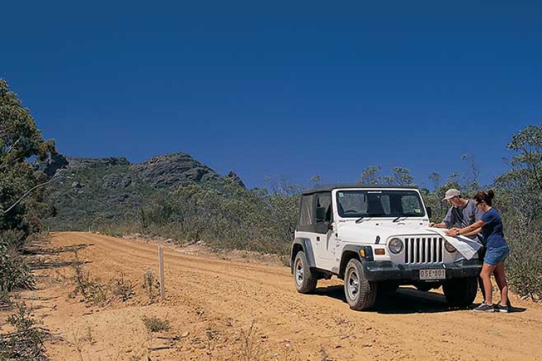
As with all tracks and destinations on this list, low range and high clearance are required.
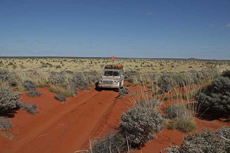
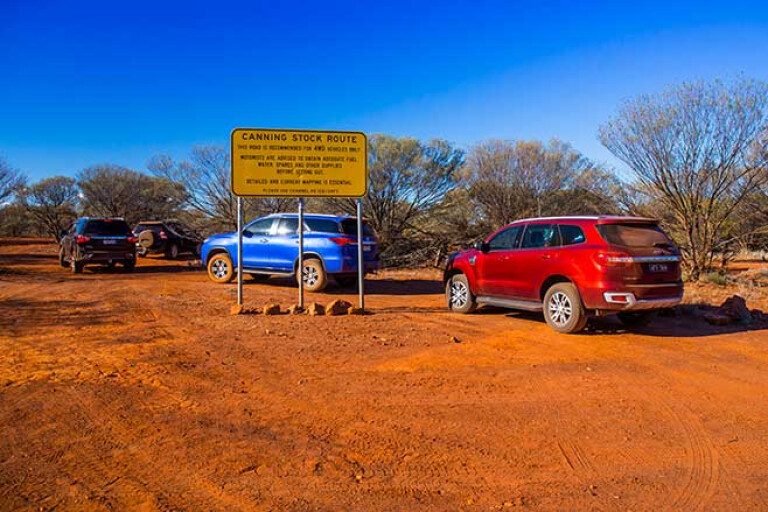
Canning Stock Route, WA
We simply couldn’t have a list of essential desert expeditions without shining the spotlight on the Canning Stock Route (CSR).
The CSR is an essential desert trip, with the route crossing three deserts – the Gibson, Great Sandy and Tanami – in its entirety. Anyone who has travelled this route will tell you it’s not for the fainthearted, and it constantly comes up in campfire conversations when discussing Australia’s toughest tracks.
17
The brutal, almost-1800km slog, comprises of treacherous ruts and hundreds of sand dunes, making the CSR one of Australia’s – if not the world’s – most demanding tracks. The route strikes through the heart of WA’s huge outback, running from Wiluna in the south all the way up to Halls Creek in the north, and we’d put aside a few weeks for this adventure.
A calling card of the CSR is to follow the wells that connect the track and once watered the stock travelling the route back in the day – its origins dating back to 1910. The track can be reached via Tanami Road from the Bililuna turnoff.
17
With tracks of this magnitude and difficulty we’d recommend travelling with a convoy – one other buddy at a minimum – or joining up with one of the many tour parties that cater for this area. Yes, it’s difficult, but the well-earned beers upon completing the CSR will taste even better.
A CSR permit is required to travel between Wells 5 to 51 and can be acquired online. Remember, though, proceed with caution: the rugged, unyielding track has a reputation for killing 4WDs. So get your 4x4 checked and ticked off before you leave, ensure your suspension is in tip-top shape, have plenty of spares and supplies, and pack the air compressor.
The CSR is a remote desert experience recommended for experienced travellers only.
Strzelecki Track, SA
The Strzelecki Track strikes right through the heart of South Australia’s Strzelecki Desert, and while it mightn’t be the most challenging or demanding outback track, it leads to a number of intersecting tracks and nearby attractions to explore.
Experienced 4x4 scribes often describe the Strzelecki Track as a great introduction to remote-area touring; for those a bit wet behind the ears when it comes to loading the fourbie for long stints off the blacktop. If a Simpson Desert expedition seems daunting, then the Strzelecki is great preparation to build up one’s confidence. Still, you’ll need to be self-sufficient, have adequate recovery kit, and be packing up-to-date, working equipment and communications.
17
A recommended starting point to tackle the Strzelecki is at Leigh Creek in the south, a former mining town with a dwindling population. From Leigh Creek, the route will pass through the Vulkathunha-Gammon National Park and parts of the Flinders Ranges (Arkaroola, as mentioned in ‘Flinders Ranges and Beyond’, is also nearby and well-signposted), before joining the Strzelecki Track near Mount Hopeless.
The Strzelecki Track itself, pioneered back in 1871 by a cattle thief named Harry Redford, is quite well-maintained and mostly unsealed, with the 475km outback track linking Innamincka to Lyndhurst. The surrounding desert views for the majority of the track remain largely unchanged, with hardy vegetation stretching to the horizon.
Worthwhile detours include a stopover for a pint at Cameron Corner, via the Merty Merty Track; a sticky beak at the Moomba processing plant; the outskirts of the Lake Eyre basin; and the Montecollina Bore (and the nearby Strzelecki Crossing). Before too long you’ll arrive at Innamincka, well-known for the historically significant Burke and Wills Dig Tree.
17
Put aside a couple of days for a Strzelecki adventure, but remember it gets very hot during summer and it can be impassable after heavy rain. Rain also makes the tracks slippery and closed with flash flooding known to occur in the area.
Fuel can be picked up at Lyndhurst, Leigh Creek, Innamincka, Arkaroola and Cameron Corner. However, as with any desert trip, be prepared and self-reliant, with spare fuel, spare water, recovery gear and working comms.
Special-access permits are required to travel in the area, and a Desert Parks Pass is required to camp in the Innamincka Reserve.
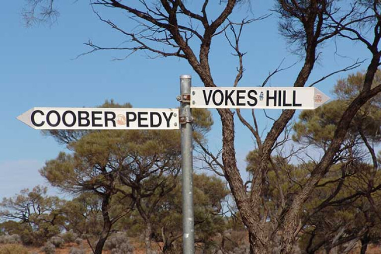
Anne Beadell Highway, SA/WA
A route that lives somewhat in the shadow of the famous CSR is the Anne Beadell Highway, which is notably shorter but considerably less popular for 4x4 tourers – a reason why it’s arguably even more remote than the revered CSR.
Dominated by claypans and salt lakes to corrugations and sand dunes, Anne Beadell remains largely untouched, in turn increasing the track’s degree of difficulty.
17
Like other tracks on this list, the Anne Beadell Highway was surveyed and built by Len Beadell, and the track was named after Len’s wife Anne. The Highway, listed at some 1324km in length, strikes through WA’s massive Great Victoria Desert, from Laverton in WA to Coober Pedy in SA.
If undertaking an Anne Beadell expedition, expect remoteness, with tourers often returning from their trips without encountering a single soul. You’ll need to be entirely self-sufficient. In fact, there are very long distances between fuel stops so you’ll need to pack extra fuel, water and supplies.
17
The extreme remoteness of the track means it should be left to steerers adept at desert travel, in low-range vehicles with uprated suspension and a couple of spares. The area is also sparingly signposted, so a good GPS system and even paper maps will prove invaluable.
Permits are required to travel through aboriginal and government-restricted areas, and they can be acquired by visiting www.ilkurlka.org.au
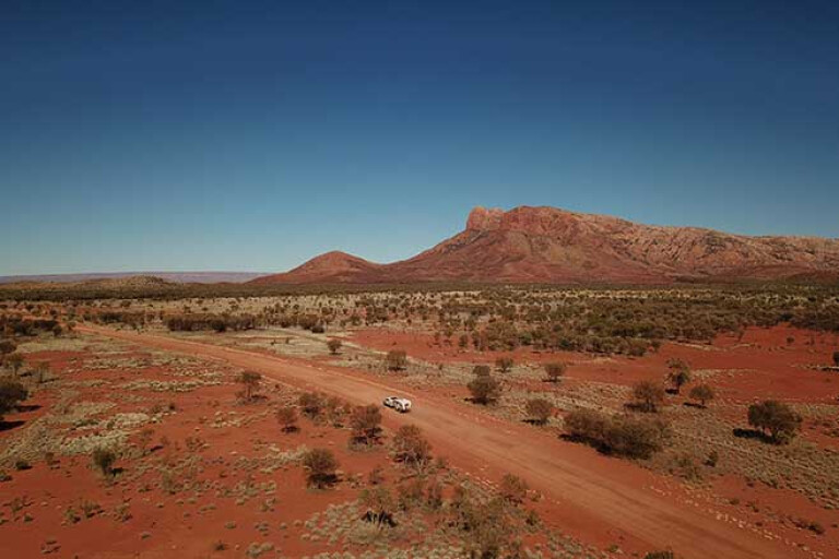
Flinders Ranges and beyond, SA
The Flinders Ranges officially begin about 500km north of Adelaide, making it a five-hour jaunt on bitumen or an hour in the air.
Those familiar with the region will know that the Flinders isn’t solely known for desert country, with the area’s mountains also lush with forests, vegetation and wildlife. However, going north into the Ranges – and farther north again – you’ll enter real desert territory, with soft sand tracks and a barren, remote landscape leading to the horizon in every direction.
17
In 2019, our 4X4 Adventure Series team tackled the Flinders Ranges from south to north, beginning near the southern edge at Mount Remarkable and heading north via the Bendleby Ranges, Quorn (and its famous Pichi Richi Railway), the Willochra Plains, the Skytrek Track at Willow Springs, Brachina Gorges, Wilpena Pound, Beltana, Moro Gorge, Gammon Ranges and Chambers Gorge. If you can follow that route, you’ll be well-rewarded.
The semi-arid Wilpena Pound, in particular, is a must-visit outback spot that’s very popular with international tourists who long for a taste of outback Australiana.
17
Arkaroola is another recommended spot in this northern Flinders Ranges region, with the dry outback location luring many pundits each year. A bucket-list destination within the Flinders Ranges is to climb the Ridgetop Track in the Arkaroola Wilderness Sanctuary to Sillers Lookout. The dry track leads to some of the best outback views in the country. You’ll need to join a tour for the opportunity, though.
From the Flinders Ranges, tourers can continue their journeys north to the Simpson Desert, with roads leading to Maree, Coober Pedy or past Arkaroola to the Strzelecki Track.
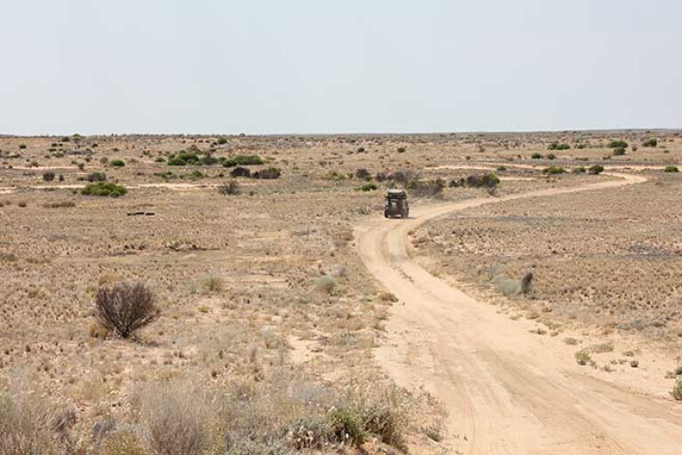
Great Sandy Desert, WA
For a truly epic desert experience, a trip down the Gary Junction Road through Western Australia’s Great Sandy Desert is unmissable. And, like many other desert tracks in the region, this too was built by Len Beadell and his crew, back in 1960.
Heading in an easterly direction from Marble Bar, an old mining town with prominence as “the hottest town in Australia”, following the Gary Junction Road is around a 1400km journey to Alice Springs. The trip from Marble Bar to Alice Springs strikes through the heart of the Great Sandy.
17
Fuel and limited supplies can be picked up from various spots along the way including at Punmu; Kunawarritji; Kiwirrkurra; Kintore; and Papunya. The latter open 24 hours a day, while the longest fuel stop between drinks – 400km – is between Marble Bar and Punmu.
Gary Junction Road is unlike many other remote tracks in the region in that it is – for the most part – a well-formed dirt road, despite corrugations and soft sand in sections. For that, a low-range 4x4 is essential.
Haasts Bluff and Mt Liebig are but two highlights of the track, with the communities of Papunya, Kintore and Kiwirrkurra all serviced by the road.
17
Another route in the Great Sandy is to follow the Nyangumarta Highway (formerly known as the Kidson Track) to 80 Mile Beach, located north of Port Hedland. The route was once blazed in the pursuit of oil, but has since been abandoned. It’s remote and hard work, but you’ll be well-rewarded upon completion.
To travel the full length of the Gary Junction Road you’ll need a permit from the Central Lands Council in the NT and the Dept of Aboriginal Affairs in WA. Both are available online and are easily applied for and generally quickly issued.
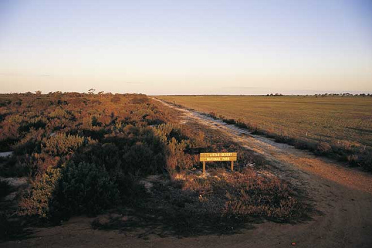
Little Desert National Park, Vic
There's an ‘outback’ in Victoria and it’s only a four-hour drive from Melbourne. Yep, the 1326 square-kilometre Little Desert National Park is Victoria’s own slice of outback Australia!
The park is located not far from the township of Dimboola, and is bordered by the Wimmera River and the SA/Vic border to the west. The tracks consist of a heady mixture of sandy desert terrain, lined with a mix of mallee country vegetation and river red gums.
17
Of the 600km of 4x4 tracks within the park, some of the point-of-interests include Dahlenburgs Mill, Jungkum, Salt Lake, Mallee, McCabes Hut, Broughtons-Sambells, Lawloit (for views of and from Sister Hills), Jacobs and Mt Moffat. There are six campgrounds within the park to unwind for a night or two, including the Kiata, Ackle Bend and Horseshoe Bend campgrounds. Fees vary, so be sure to check before you go.
The tracks aren’t regarded as overly difficult, so they should pose no issues for experienced four-wheel drivers – however, the tracks in the park’s western section are considered to be rated as more difficult. The park also provides access to a great deal of bushwalking tracks, and a vast collection of flora and fauna. The tracks are subject to seasonal closures, and can also be closed due to the weather.
17
While it mightn’t be as epic as a Simpson trip, it’s a great way to dip the toes in if it’s your first foray into desert expeditions. A great recommendation before tackling the more serious tracks in the wild west, whether it be for one night or many.
Simpson Desert, NT/SA/QLD
Australia's most popular desert for 4x4ers looking to escape civilisation for a quintessential outback experience, the Simpson Desert is riddled with famous tracks.
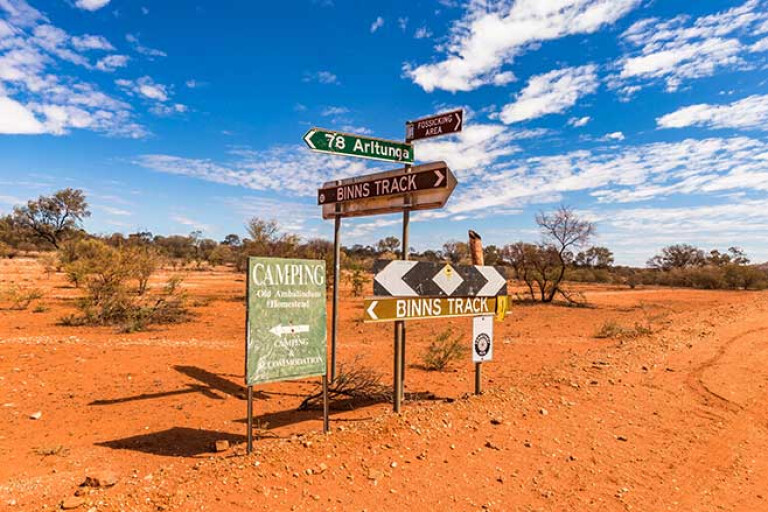
Binns Track (starting at Mount Dare in SA), the Madigan Line, the QAA Line, the Old Andado Track, and the Hay River Track all lie within the Simpson’s boundaries.
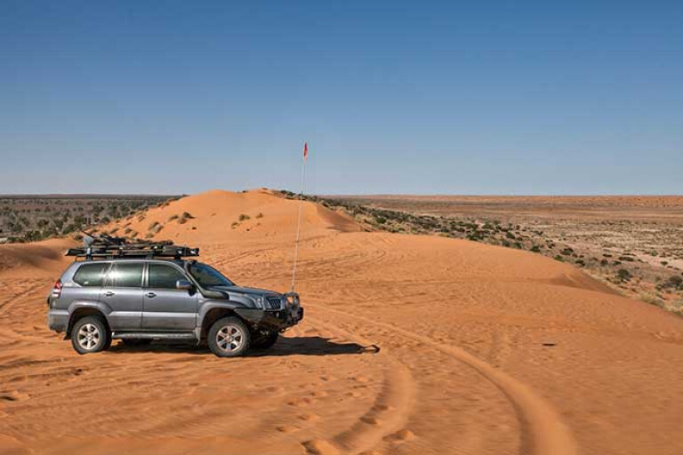
The Simpson Desert is the fourth largest desert in Australia and one of its claims to fame is that it features the longest parallel dunes in the world, with some dunes said to be an incredible 200km in length. The most famous dune in the Simpson is Big Red, on the outskirts of Birdsville in outback Queensland, which stands 40 metres tall.
17
The southern end of the Simpson Desert begins in northern South Australia, near Lake Eyre and north of the Flinders Ranges. In its entirety, the desert measures a whopping 170,000 square kilometres and spans across the NT, South Australia and Queensland.
There are a number of popular routes to take for a quintessential Simpson adventure. One such track is Binns, which begins at Mount Dare in South Australia and then runs north into the NT where Old Andado Road leads to Alice Springs.
The Madigan Line begins north of Old Andado Station, striking east into Queensland before meeting up with the QAA Line. The QAA Line then leads from the junction of the K1 Line near Poeppel Corner, all the way to Big Red near Birdsville.
17
Both the Oodnadatta and Birdsville Tracks begin at the small outback town of Marree in SA, with the Birdsville Tracks heading northeast to Birdsville, and the 405km-long Oodnadatta track following the Old Ghan Railway.
There are also numerous National Parks and iconic landmarks within the Simpson Desert, with the Parks subject to seasonal closures during the summer months. A Desert Parks Pass permit is required to travel via a number of tracks through the Simpson Desert.
Due to the Simpson’s popularity, most of the tracks aren’t as isolated as some others on this list (CSR, Anne Beadell etc.), but it’s still remote, difficult touring; so a well-prepped vehicle is essential.


Please enable JavaScript to view the comments powered by Disqus.
COMMENTS