Explore VIC
Gallery25
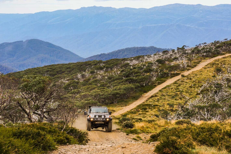
The vehicle was scrambling as I flicked the locker switch on the Cruiser’s dash, the tyres biting more positively as the V8 responded precisely to my measured response to the rocky, shaly step we had encountered halfway up the steep-sided hill along the Limestone Creek Track.
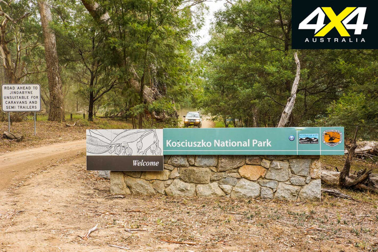
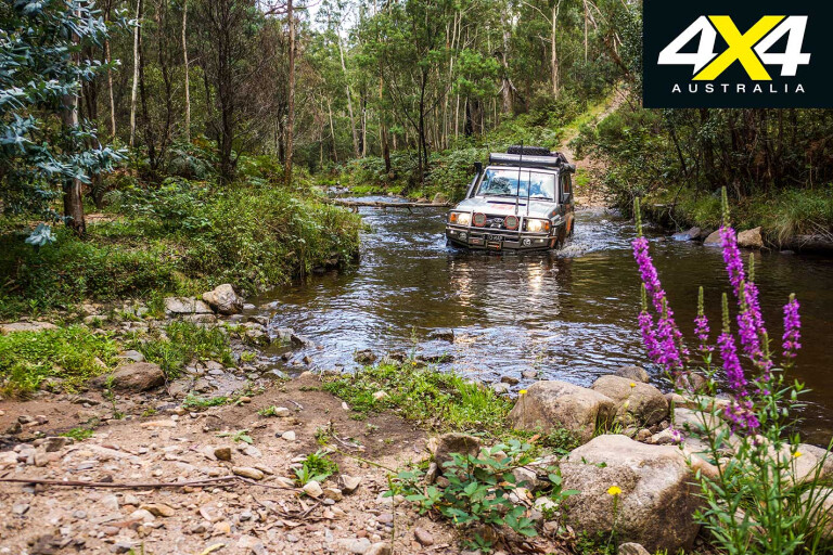
Our trip had started a few days earlier when we had driven up the Snowy River Road (officially Barry Way) and found a campsite just north of the Vic/NSW border. This was beside the Pinch River in the very southern section of Kosciuszko NP and a stone’s throw from the slow-flowing waters of the once mighty Snowy River.
 Scrub crowds the flat, sandy banks close to the river where once they had been regularly swept clear of any debris, alive or dead.
Dammed in the 1970s as part of the great Snowy River Hydro Scheme, the river was deprived of its annual floods and the scrubs and trees have reclaimed the soil along the river’s edge. Recently, annual flows have increased, or so they say, with water being released down the river in spring in an effort to replicate nature, but the pulse of water is just a shadow of its former self.
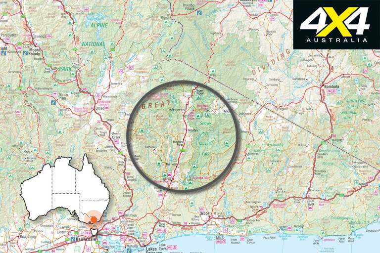
This is vastly different terrain to the rest of the Australian Alps, with the area in a ‘rain shadow’ and receiving far less moisture than those hills and mountain tops a relatively short distance to either the west or east. The resultant dry but still steep mountains are clad with white Cyprus pine and white box woodlands, which immediately bring to mind Banjo Patterson’s famous words…
"And down by Kosciuszko, where the pine clad ridges raise
Their torn and rugged battlements on high
Where the air is clear as crystal, and the white stars fairly blaze
At midnight in the cold and frosty sky."
Before the road was completed in 1961, cattle had been driven south from the Monaro district of NSW, first to settle the country around Wulgulmerang and Omeo in the 1830s before a stock route was established, which saw up to a thousand head of cattle at a time, driven south to the markets at Bairnsdale.
25
It was an arduous and dangerous undertaking, with the cattle and wagons being jostled across the rugged country and down the notorious ‘Pinch’ into the Snowy River valley before climbing the ridge to a low pass and onto the Gelantipy Plains.
The country was so steep that the wagons, forced to traverse long sections of the valley edges, removed their wheels from the high side of the wagon to keep them in some form of level attitude.
For us it was a lot easier and, after a brief but close encounter with a few wild horses, we crossed into Victoria at Willis, which the straight-line section of the border – known as the Black-Allan Line, after the two surveyors who marked it – passes through. The cairn they built here, or what remains of it, can be seen beside the boulder that marks the completion of the road being built.
25
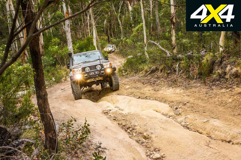
A few kilometres south we turned onto the Ingeegoodbee Track, dropped tyre pressures and slipped all the rigs into low ratio for the climb that begins immediately when one leaves the main Snowy River Road.
Like most travellers on this challenging, longish route, the first stop was at the crest and helipad of Mount Menaak, which normally offers fine views of the surrounding precipitous country, but drifting fog and bracing mist limited the view and cooled our ardour for anything outside the vehicles.
Dropping down to cross the Ingeegoodbee River we again climbed through dry forest into snow gums before coming to the heart of McFarlane Flat. The main track passes to the south of the larger snow plains where James McFarlane built his hut in the early 1830s.
25
Some say this was the first European residence in what was to become Victoria, predating even the illegal Henty’s camp at Portland. The debate is open to conjecture, but little remains of that first hut; a small pile of stones mark the site a few metres from the burnt-out remains (from the 2003 fires) of Buff Rodgers Hut, the last hut built here in the early 1980s.
Wild horses are commonly seen through here; in fact, in the last three visits in the two years previously we have seen horses on each occasion. They are skittish, though, unlike the ones we had seen on the Snowy which have grown used to campers and travellers; these ones making for the cover of the scrub in double quick time.
From here the track west and south to the main road dips down to cross the Berrima Creek before climbing again to once more plunge into the Suggan Buggan River valley.
25
The climb from here to the edge of the Ramshead Range, and then dipping to the Free Stone Creek under the broody bulk of Mt Cobberas, is challenging to say the least. And that’s in the dry – if the track is wet, be prepared for some heavy-duty, long winches.
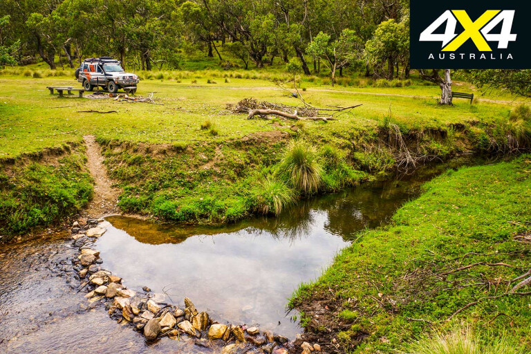
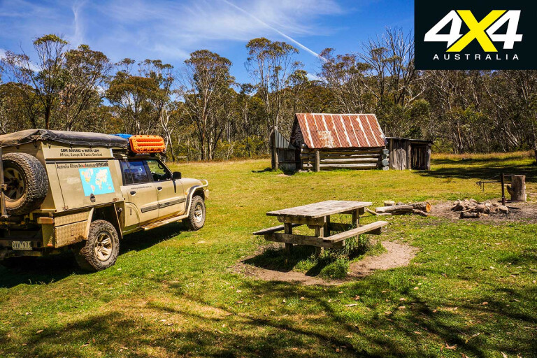
That evening we camped at the pleasant and popular Native Dog campground, and the next day we climbed the hills on the Limestone Creek track.
25
The first part of this track is pretty easy and skirts the edge of Limestone Creek where, away from the small block of private land, there are some pleasant grassy campsites to enjoy. Again, we saw wild horses – one a good-looking white stallion – but like most of the horses running wild they need a good feed and worming.
A short detour under the bulk of Round Mountain brings you to ‘The Poplars’ or McCarthys, the track ending on the banks of an incipient Murray River.
The poplar trees themselves and the pleasant small camp spot on the NSW side of the stream have long gone. They were cleaned up by overzealous NSW park officials who declared that the area was a wilderness zone and vehicle access and the trees would not be tolerated on that side of the waterway.
What you are left with on the Victorian side of the border is a pretty poor excuse for a camp, but NSW is still pushing for the access road to be gated farther back from the border.
25
Climbing the steep hill from McCarthys, the track is soon on the ridgeline that is dominated by the grey skeletons of dead trees towering over the new growth that is like an impenetrable wall of green.
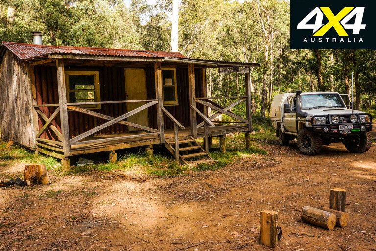
From here the route is pretty easy, first crossing Charlie Creek with its pleasant camping and old hut site (the hut long gone), followed by a few short scrambles to the crest of snow-gum covered hills before coming to Davies Plain Hut.
The small snow plain here lies on the edge of the Indi Wilderness Area, while the gentle trickle of water known as Davies Plain Creek is a couple of hundred metres north from the hut. It’s a top spot to camp and is one of my all-time favourite places in the Victorian High Country.
25
Back in 2002, we were with the managers and some friends who took what was to be the last mob of cattle up onto their grazing lease on the Davies Plains. It was a memorable experience made even more poignant by the huge, devastating fires the year afterwards and the government’s subsequent banning of cattle from the High Country.
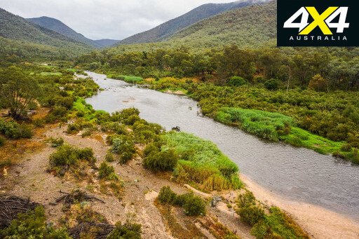
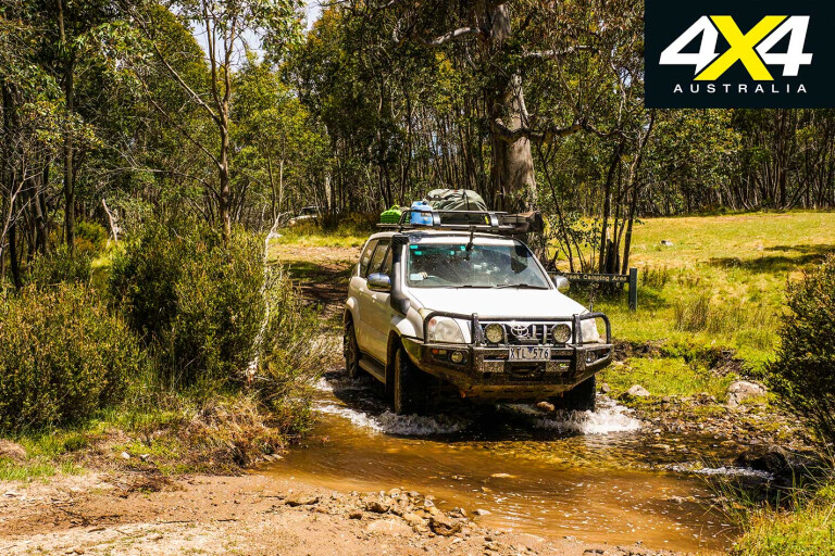
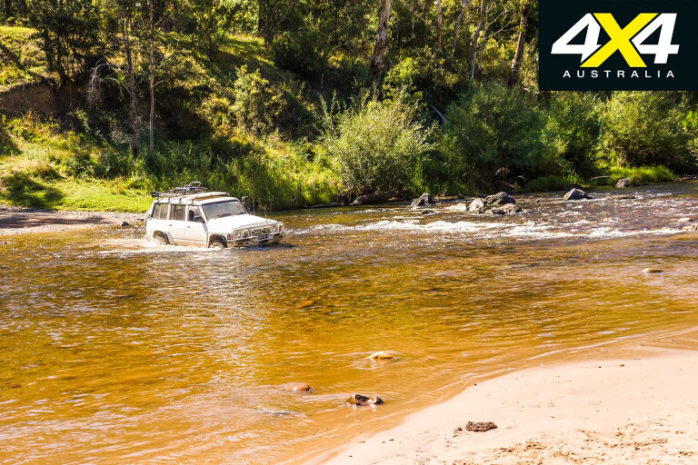
Next day, we dropped down the hill to Buckwong Creek and onto the Murray River crossing, where the river has grown a little since seeing it at Poplars.
While the NSW side is within the Kosciuszko NP and has a large, popular campground nearby, on the Victorian side is Dogmans Hut and its small camping area which is nestled up to the fast-flowing stream. These are top places to enjoy, act as a base to explore the mountains, fly fish in the clear waters of the rivers, or float down the stream for a kilometre or two.

25
Tom Groggin Station, which takes up a chunk of cleared land on the south side of the river, was once one of the biggest grazing properties in Victoria, its lands stretching up to the high peaks of the Australian Alps on the NSW side, as well as on the Victorian side of the border. Today, it is less than 1000ha, but it is still delightfully picturesque.
Established as a grazing property in 1855 the property was visited by Banjo Patterson in 1890 and the then manager, Jack Riley, has been widely credited with the inspiration behind the famous poem, The Man from Snowy River.
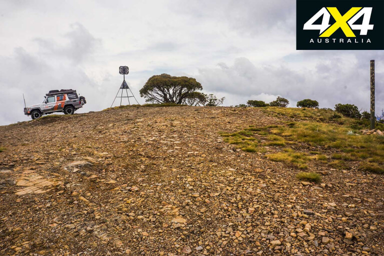
Tearing ourselves away from this exceptional stretch of pristine water, which is so different to its more normal appearance farther downstream, we headed to the crest of Mt Pinnibar, which is a long, challenging clamber to the top.
25
At nearly 1800 metres the peak gives outstanding 360-degree views, while dominating the eastern horizon is the high peaks and ridgeline of the Australian Alps with Mt Kosciuszko, our nation’s highest peak, almost lost in the menagerie of lofty summits.
Wandering through delightful alpine ash forest we found our way to Gibson Hut (sometimes known as Mt Pinnibar Hut) on the low banks of Shady Creek before pushing on to Wheelers Creek Hut on the stream of the same name. Both spots offer pleasant camping for wandering four-wheelers and are popular with fisherman and deer hunters.
From here, we climbed and wound our way through the hills on the Wheelers Creek Logging Road to the more major Benambra-Corryong Road, which is a good dirt thoroughfare where we climbed up to Sassafras Gap, the watershed of the Great Dividing Range, and dropped down the other side to follow the Gibbo River for a short time where there are some pleasant camping areas close to the road.
25
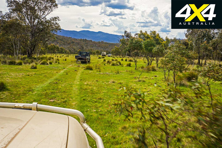
With the road south turning to bitumen it was time to get off it, and we dodged onto the gravel of the Tablelands Road and cruised effortlessly through open grazing land to the ford across the Mitta Mitta River at Taylors Crossing. This is an enjoyable spot to camp and, with river access up and down stream, it is a good spot to throw a canoe in and go for a paddle. Otherwise, you can cast a line and catch some trout, laze around doing bugger all, or head off on more bush tracks to hidden huts and old goldfields.
MOREExplore
25
Nearby is Kennedy Hut on the edge of the Mitta, just a kilometre or so downstream, while the lesser known and visited Wombat PO hut is a few kilometres off, tucked away almost hidden, amongst the tall timbers of the steep-sided valleys of Four Mile Creek and its tributaries.
Our huts, high plains and mighty rivers sojourn was over, though, and after a day soaking up the sun on the banks of the Mitta we headed south to Benambra and historic Omeo. We’ll be back, of course; once you visit the High Country, you will always return!
Travel Planner
25
Most of the tracks are closed over winter. For more details see: www.4wdvictoria.org.au
Best guide book for the region: The High Country Victoria from www.hemamaps.com
Omeo: www.visitvictoria.com/Regions/Gippsland/Destinations/Omeo
Tom Groggin Station: www.tomgrogginstation.com.au
Please enable JavaScript to view the comments powered by Disqus.
COMMENTS