Explore VIC
Gallery24
We were wandering through the High Country of Victoria about 12 months back and somehow the conversation around the campfire got around to the famous ‘5 Peak Challenge’ in the UK, which has been copied by runners and bike riders the world over. That thought lay dormant in my little brain for a month or so and then, not being enthused by either running or riding up hills, I got around to thinking about a ‘5 peak challenge’ in Victoria for four-wheel drivers.
That took me to the maps of the High Country, helped of course by Google, as I looked for the highest peaks you could drive to in the Victorian mountains. I quickly discounted all the roads you can travel on the blacktop, which included the highest road in all of Australia where the Great Alpine Road crosses over Mt Hotham at 1840m, or 6040ft in the old money.
Then I had to make a couple of other arbitrary decisions. Most peaks demanded you walk a few metres to get to the crest. I discounted those such as Mt Cope (at 1820m a contender early on) that needs a 2km walk to reach the highest point and any similar such mountain. I set a limit for the walk of a couple of hundred metres.
24
So, with that criteria, I established my list of the ‘Big Five’. They are:
1. Mt Pinnibar at 1772m
2. Mt Gibbo at 1757m
3. Blue Rag at 1726m
4. Mt Stirling at 1720m
5. King Billy No1 at 1716m
Most High Country lovers would be familiar with these peaks and some will point out that maybe Mt McKay at 1842m should be on the list; that little conundrum and how I convinced myself of its eligibility, you can read in the accompanying sidebar.
Then I figured out a route that took me to each peak and which by sheer chance leads one through most of the Victorian High Country from Corryong in the east and close to the NSW border to Mansfield at the western end of the mountain chain.
24
How you actually get from one peak to the other is really up to you, but I added another criterion for my trip of visiting Corryong, Omeo, Dargo, Merrijig and Mansfield along the way; you’ll probably need to anyway for fuel, beer or other supplies. And today, after the horrendous bushfires, such mountain towns need all the help they can get from passing travellers.
Finally, we were on our way, the Cruiser enjoying the run along the edge of the mountains to Corryong where we turned south and found our way to Mt Pinnibar Hut tucked in beside a trickling tributary of Shady Creek. I first camped here in the mid-1970s and have always known this timber abode as Gibson’s Hut, after the mountain cattlemen family who built it and ran cattle in the surrounding forest for generations.
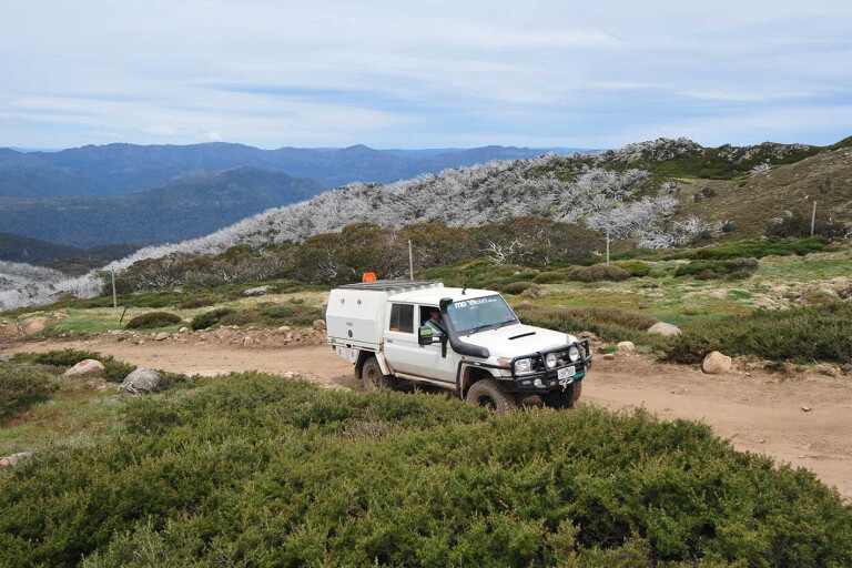
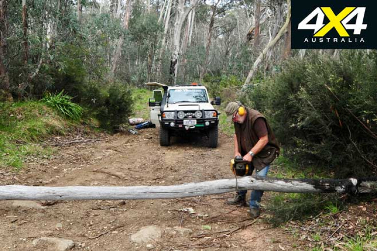
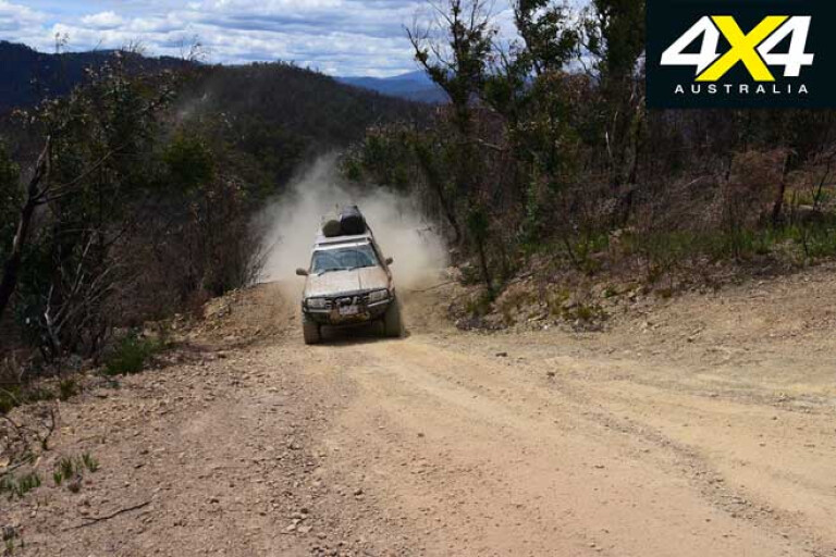
There’s also a lot of track work going on around here with even new culverts and bridges being erected over what was, until recently, some challenging creek crossings. Talking to one of the road workers it’s all due to improved fire-fighting access, which I guess is fair enough. Still the drive to the top of Mt Pinnibar, the first peak in our quest to drive to all five of the highest peaks in Victoria, isn’t a doddle, the last few hundred metres sending the Cruiser scrambling for a foothold on the steep, shaly slope.
24
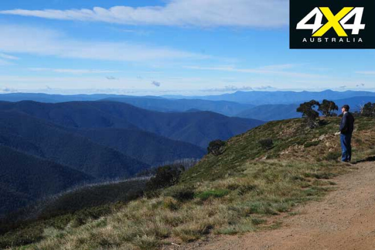
The view once we were at the top was expansive, but misty cloud (or was it smoke from those fires far to the north) obscured the grand vista of the Main Range of the Snowy Mountains, across the border in NSW, where Mt Townsend and Mt Kosciuszko are the highest peaks.
We dropped off the peak and then skirted along the ridge to Mt Anderson before making the difficult climb to Mt Gibbo, at one stage needing to slip in the Cruiser’s rear locker to climb a particularly challenging rocky step. The view from the crest again was superlative and with the sun higher in the sky the intervening mist and cloud had burnt off a little, making the view even grander.
From these two closely related peaks, separated as they are by less than 13km of mountain trails, we dropped off the ridgeline onto better forestry roads and headed to Omeo where we grabbed a few supplies and fuel.
24
Our next peak – No 3 in our quest – was the famous Blue Rag. There are a number of ways to get there from Omeo but we opted for an easy run across the lush, rolling plains of Cobungra Station. The 6486ha (plus 24,000ha of forest lease country) property, is one of the most prestigious cattle-breeding properties in Victoria, and one of the largest, which sold for a mere $35 million earlier last year.
Anyway, I always enjoy the drive through here, the delightful green, grassy hills dotted with cattle reminding me, more than any other place in Australia, of the verdant hills of Montana or Wyoming, which we’ve been lucky enough to visit on more than one occasion.
That evening we set up our swags amongst snow gums, just back from the edge of the cliff-lined Devils Hollow. At 1500m above sea level we were hoping for a calm and mild night, which luckily for us we got, although a small fire helped keep the chill of the night air away.

24
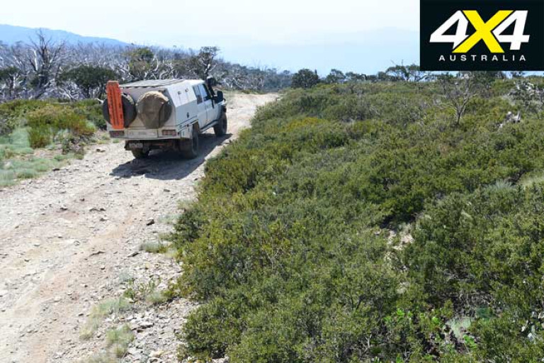
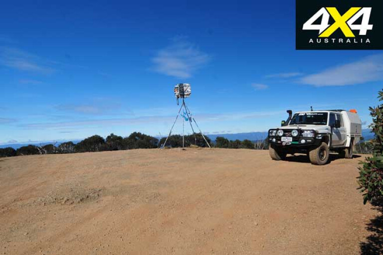
The next morning we were up with the sparrows and heading north along the Dargo High Plains Road before taking the track to Blue Rag. The route climbs quickly from the road junction, although a relatively new culvert makes access a lot easier at the very start. The 7km out to the trig on top of Blue Rag is challenging in parts, steep in others, but nearly always sticks to the top of the ridgeline and offers some fine views along the way.
Once at the top we were joined by a few other adventurers. Such is the popularity of this high peak that you can now rarely visit it without being joined by other like-minded souls. We shot a bit of video, took a few pics and enjoyed the view while having a brew. Then as we headed off we passed a couple of bike riders and a few more four-wheel drive vehicles, all heading to the top.
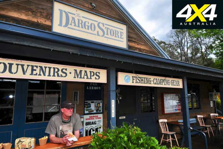
Having lunch in Dargo we enjoyed an egg and bacon roll from the general store, which is now adorned by a large, impressive mural. We took on some fuel, more as a thank you to the store for being open and there, than for any real need to keep the engine running. You’ve got to support these places because if you don’t they could well close their doors and we’d all be the losers if that happened.
24
We took the Wonnangatta River Road to Eaglevale, our wheels throwing up a cloud of dust, and then climbed Mt Cynthia before descending into the ‘Hidden valley of the Australian Alps’, the famous Wonnangatta Valley, via Herne Spur.
This steep track I tend to stay away from when it is wet … damp, even! Still, it was dry as chips and it was a bit of a doddle, even though it still had its legendary steepness. At its base we splashed through a couple of shallow river crossings as we headed along the verdant valley.
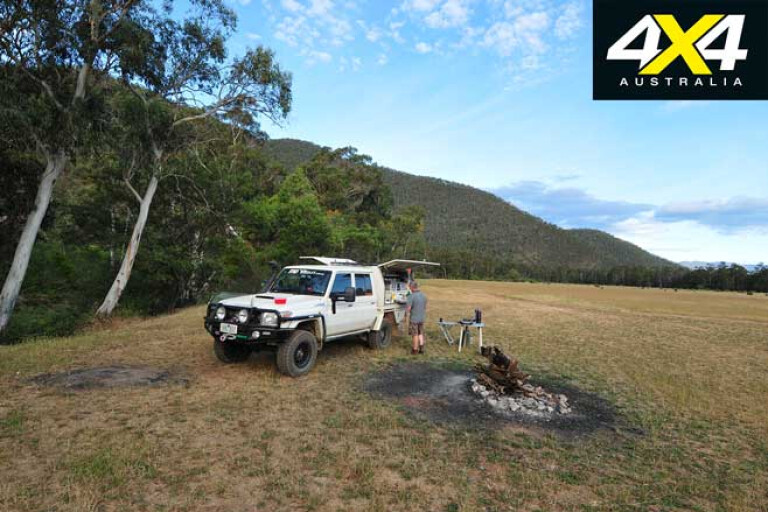
Being a Saturday afternoon and a pretty late one at that, a couple of my favoured campsites north of the old Wonnangatta homestead site were already taken, so we just pulled up above the river on a wide, open grassy flat and called it a night. Still, it was as magical as ever, and like most people, it’s a place I never get sick of.
24
The climb out of the valley the next morning was a long one up Zeka Spur Track, but again the track has been worked on for much of the way since I was last here 12 months or so ago, and it only took us an hour and forty minutes to get to the junction with the Howitt High Plains Road.
Heading north the road quickly gives way to the King Billy Track which drops down through ancient volcanic rock scree slopes to the headwaters of the delightful, but timber choked, Macalister River. A long climb follows which brings you to the top of the range, a major track junction and King Billy No 2, at 1690m just a tad short of our Big 5.
Taking the Bluff Track we passed just below the peak of King Billy No 1, before stopping at the short walking trail to the crest. This was the fourth peak in our quest for the top five peaks and we again unlimbered the cameras to record the event.
24
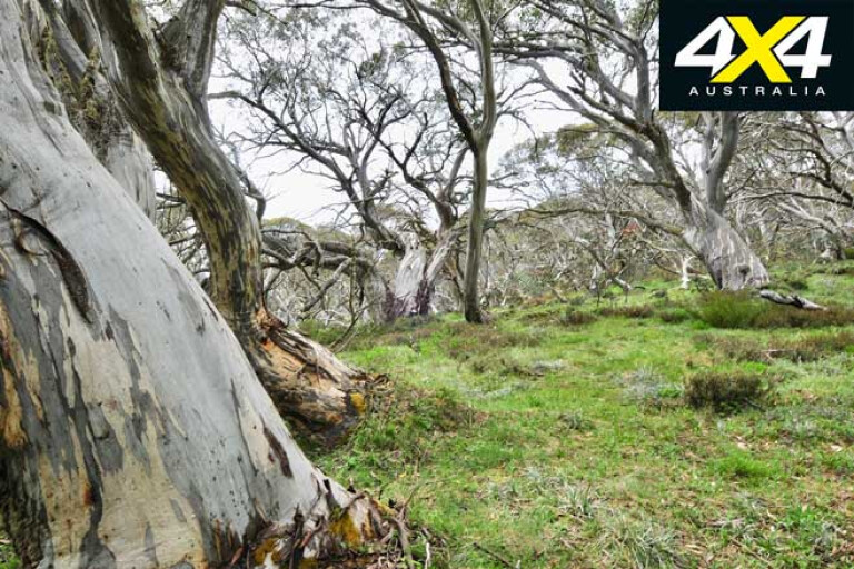
This route also takes you past the heritage-listed King Billy Tree, a gnarled snow gum reputed to be 500 to 600 years old, before getting to Picture Point, a bluff and impressive lookout made famous by the first The Man from Snowy River film.
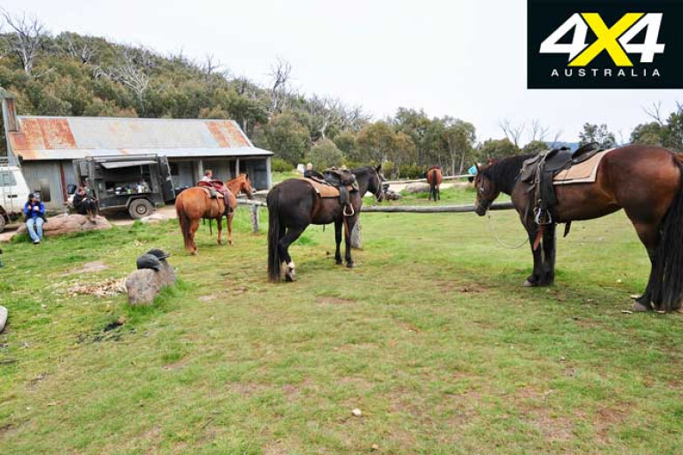
Shortly afterwards the track brings you to Lovick’s Hut, built and named by one of the most renowned mountain cattlemen families. From here the track improves slightly taking you to the famous Bluff Hut, built by another celebrated mountain cattlemen family, the Stoneys.
The hut and surrounds were crowded with a group of horse riders having lunch and as we didn’t receive an invite we headed off down Link Road to cross the Howqua River just upstream from one of my mountain favourites, Bindaree Hut.
24
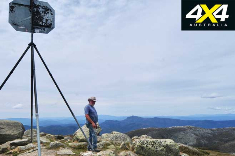
From the Howqua crossing we climbed to Circuit Road, crossing it onto Monument Track. This track was once a pretty difficult one, but recent roadworks have made the route much easier to traverse and we quickly and uneventfully slipped onto the Clear Hills Track for the final climb to our last summit, Mt Stirling.
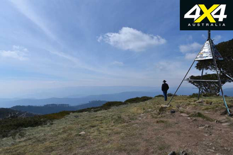
The skies were clear when we got to the carpark and walked the 70m or so to the trig point on top of the peak. And while it was sunny, the wind was strong and cool. We didn’t stay long, just long enough to admire the expansive view and rugged mountains, and to gloat on the success of our trip and crank up the cameras before we headed back to the shelter of the Tojo.
24
The next stop was the Merrijig pub for a celebratory drink for having driven to the ‘Big 5’, the five highest peaks you can drive to in Victoria. The route, whichever way you choose to connect the peaks, takes you through some of the finest mountain country in Australia and some of the most scenic with some of the best campsites in the whole continent. And it’s just another excuse to experience the Victorian High Country!
That bloody Mt McKay
24
The highest peak you can drive to in all of Australia, I was to find out halfway through my quest, is Mt McKay.
We had just come down onto the Dargo High Plains Road from summiting Blue Rag when we met up with a video crew filming the latest Nissan Navara ad. One of the crew, a keen four-wheeler, let me know about Mt McKay.
‘Shiiiit’, I thought, ‘Is there some way I can discount this peak, or will I have to include it?’
Back home after my drive through the mountains I checked the info available on Mt McKay. I had assumed that any peak within cooee of Falls Creek was out of bounds for vehicles; I was wrong.
You can certainly drive to Mt McKay … and it’s via a dirt road – albeit a good dirt road hailed as a tourist drive – from the Falls Creek village.
So, for this story I discounted it. And later when I wanted to go there I couldn’t because of all the fires tearing through the mountains. Bugger!
So, you can include this 1842m peak if you wish – you’re sure to enjoy the drive across the Bogong High Plains and around Rocky Valley, but most of it is on bitumen with only the last few kilometres being a dirt road.
Travel Planner
24
From Corryong to Mansfield via the 5 Peaks is about 700km, depending on your actual route and whether you go to Mt McKay.
Driving time for this challenge will depend on how committed you are and how much you want to enjoy the experience. You could do it in three days (or even shorter) but why hurry?
Supplies and fuel are available at Corryong, Benambra, Omeo, Dargo and Mansfield, so you shouldn’t have any issues in that regard.
You’ll need Hema’s map of the High Country as well as a Hema navigator loaded with the Vic High Country map.
Be well prepared as many of these tracks are rated as ‘double black diamond’ which demands experience and a very well set-up vehicle.
Snow and cold weather can hit at any time in these mountains so have the appropriate clothing and sleeping gear.
You’ll be in the Victorian Alpine National Park for most of the time so check the Parks Victoria website for the latest track closures, fire warnings etc.
Please enable JavaScript to view the comments powered by Disqus.
COMMENTS