Explore NT
Gallery50
The Northern Territory has some amazing and diverse protected areas, ranging from rich wetlands to dry savannah and deserts.
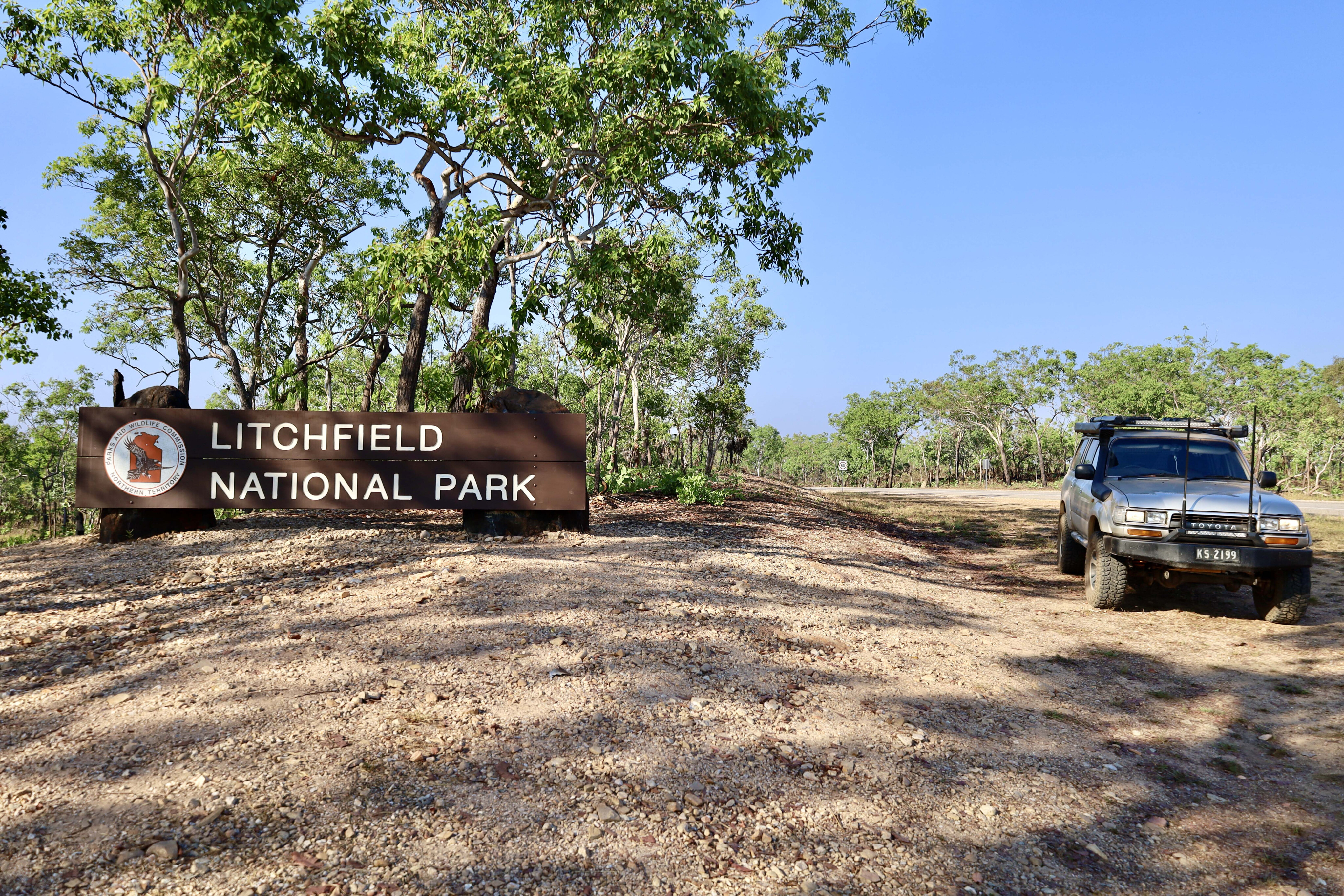
Of course, one of these areas is Australia’s largest national park, Kakadu, but not far from here is the much smaller but equally as significant Litchfield NP.
Just over an hour’s drive from Darwin, Litchfield NP is one of the most popular parks in the NT’s north, attracting more than 260,000 visitors a year, and is an integral part of the Territory’s network of conservation areas. Covering just 1500km², Litchfield contains a diverse range of plants and animals with some only found within its borders.
50
History lesson
Local Aboriginal tribes have lived in the area for thousands of years and unlike other parks, their cultural sites are not open to the general public.
It was in 1864 when explorer Fredrick Litchfield headed an expedition through this area that the park was named after him. On this trip, they found gold in the nearby Finniss River and over the next few years, a mini gold rush boomed in the Top End.
Litchfield is a day visit for many travelling in 2WD cars, with easy access to waterfalls and stunning views from the plateau lookouts, but to see the real hidden gems here you’ll need a 4x4 vehicle. These days there are two sealed roads into Litchfield so most visitors can do a loop around and continue back to Darwin or continue on their journey south.
50
The drive from Darwin heads off the Cox Peninsula Road from the north, and the road in from Batchelor comes off the Stuart Highway to the east.
The road in from the north (Litchfield Park Road) traverses huge tropical floodplains and it is often closed in the wet season. As you near the park, large sandstone plateaus begin to appear, and paperbark and monsoon forests line the road with stunning cycads and pandanas palms scattered through the bush and along creek lines.
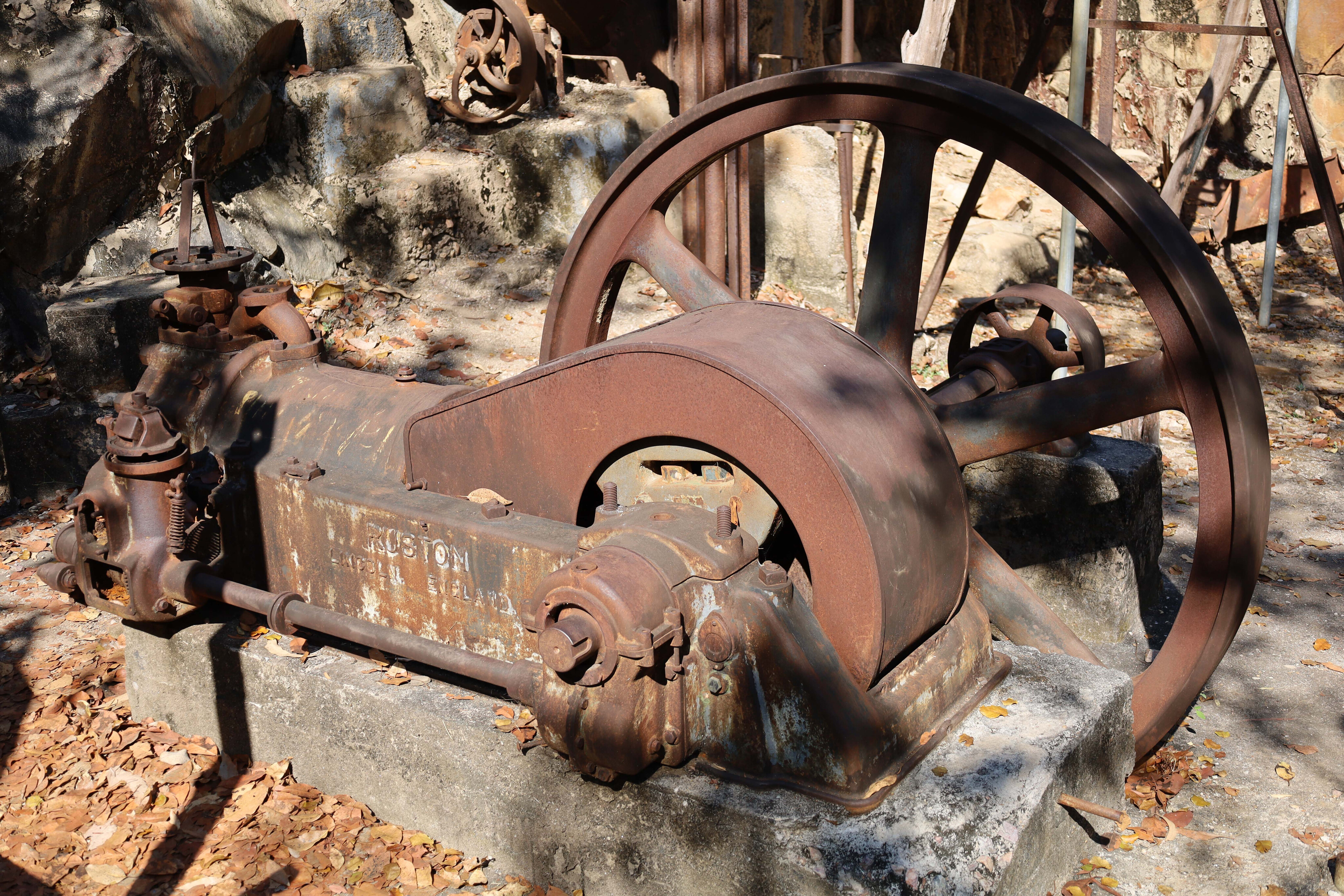
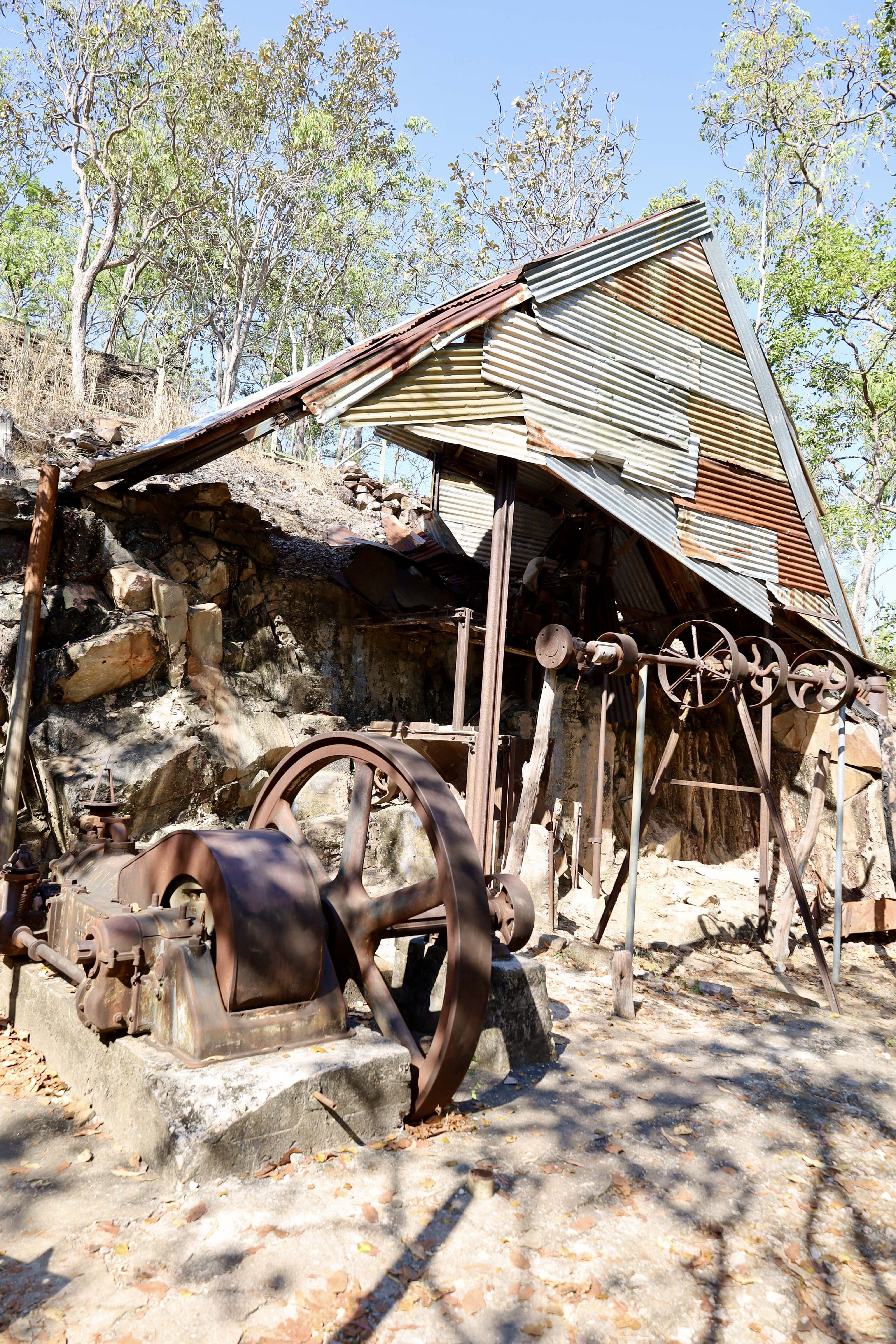
The first port of call from here is the old Bamboo Creek Tin mine just a few kilometres off the main road. Tin was discovered here in 1906 and was worked on and off for the next 50 years. Local Aboriginal people were employed by the mine and some were married to the Europeans.
50
Over the years of operations around 46 tons of tin was extracted manually and another 250kg of tanalite was found. Tantalite was generally used with alloy to increase the hardness of the metal.
The mine was eventually abandoned in 1954 when it was no longer viable to work the tin. Today there’s a short walking loop around the working shed, stamper, past the water tanks and up to the mine itself. Information boards along the way give an insight into the labour-intensive process that went on here.
Apparently, the Bamboo Creek Tin Mine was the first in the area that sustained genuine contact between the Aboriginal people and the Europeans. Prior to this, cultural conflicts and a lack of understanding between the two led to conflict, with retaliation for many wrong doings as both parties had different laws, beliefs and understandings.
50
Walking and swimming
After visiting the mine the next stops are Walker Creek and the Cascades. Both have day areas and swimming is allowed.
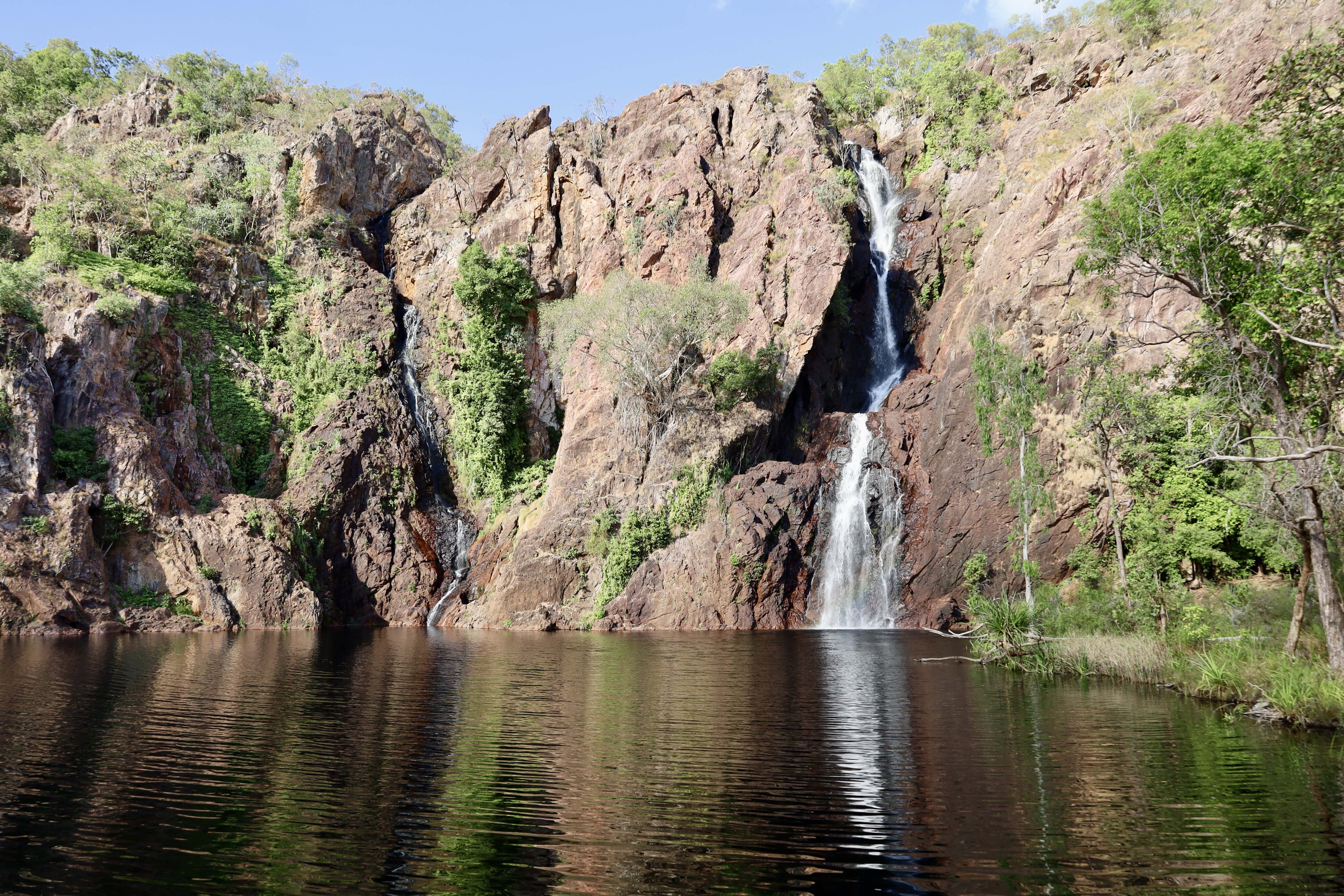
Wangi Falls is like the hub of Litchfield NP, and is where Parks NT has set up a fabulous campground that is the perfect place to set up base to explore the outer reaches of the park. Wangi Falls has two falls that plunge over the rock face into a deep pool, and occasionally it is closed if conditions are considered too dangerous.
Litchfield is known for its many walking tracks; there are nearly 100km of tracks to explore, ranging from short hour-long walks to difficult treks over many days. Some of the walks start at Wangi Falls.
50
The loop road continues around past Tjaetaba Falls where a walking track follows Greenant Creek to the base of waterfalls where you can cool off in the lower pool.
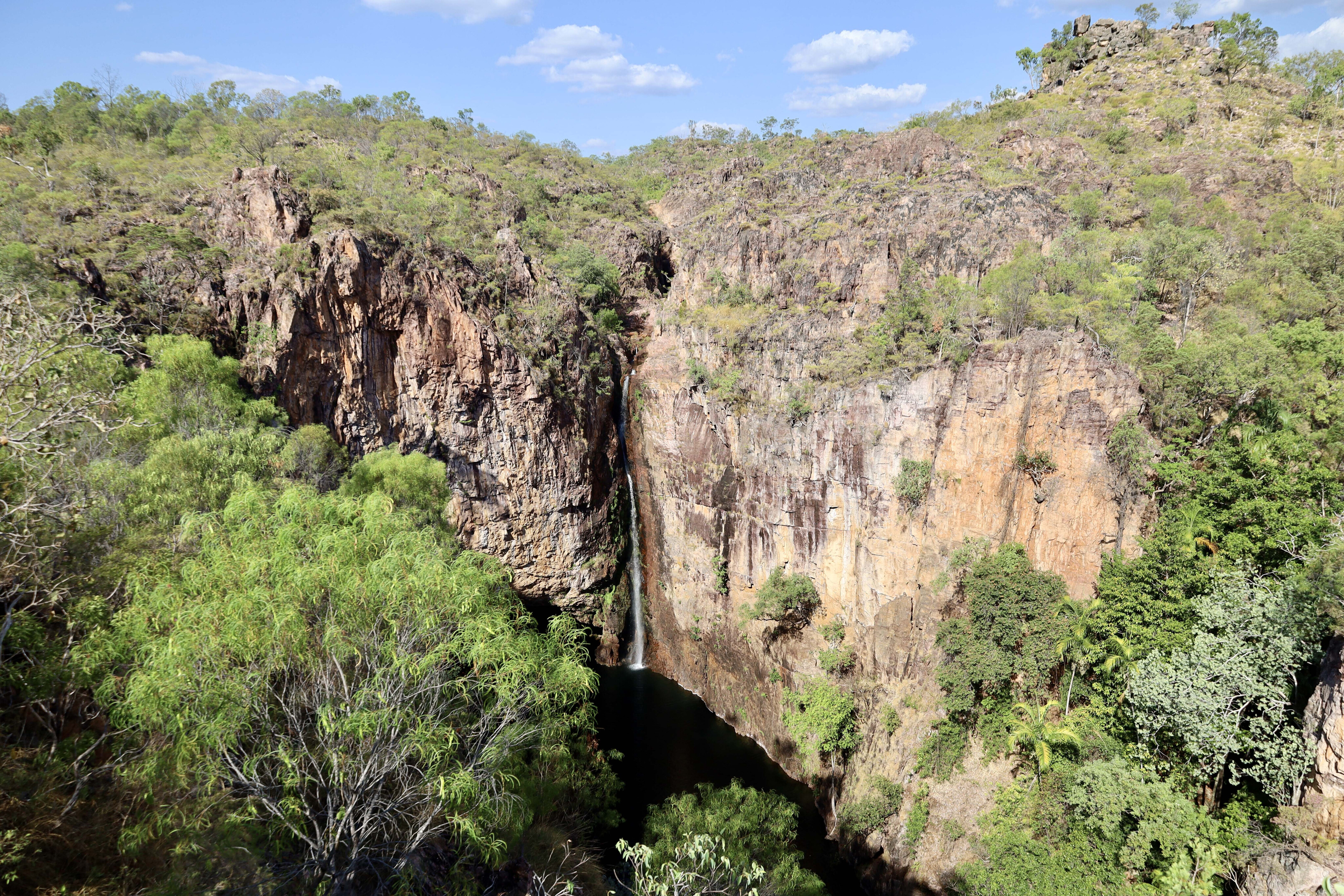
Further on the stunning Tolmer Falls is a must-do, where a short walk to the lookout platforms gives you a full view of the falls and across the vast savannah woodlands of Litchfield. There are caves near the falls in which rare protected orange leaf-nosed bats are found, so swimming in the gorge is not permitted.
The popular Florence Falls are next. The dramatic falls can be accessed via a long, steep walk to the base where you can soak in the water and swim under the falls. The other option is to follow Shady creek to Buley Rockhole for a day in the fresh water. There are campgrounds here but they get busy.

50
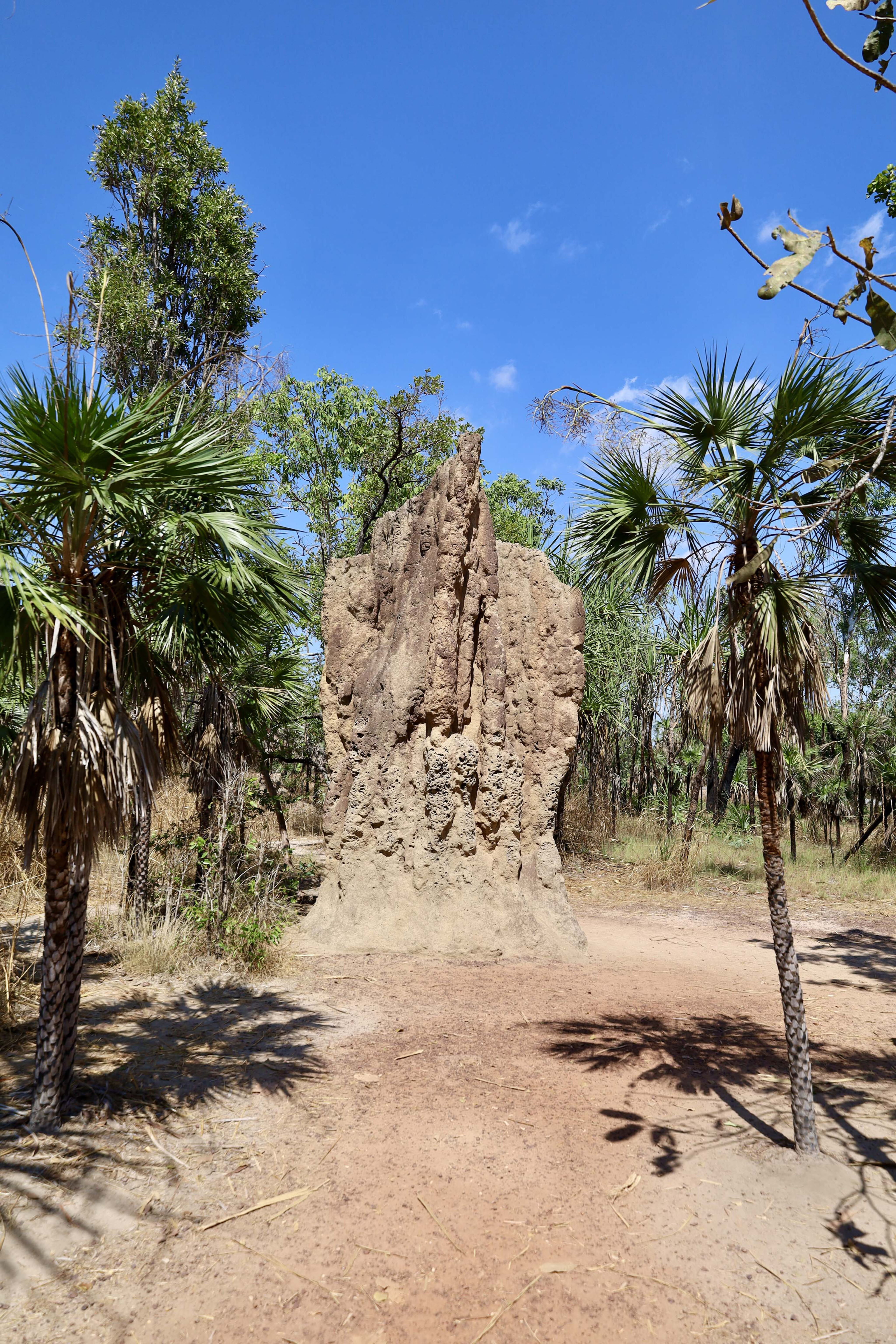
The last port of call along the loop road is the series of termite mounds that rise dramatically out of the floodplain.
These grey wedge-shaped mounds are up to three metres tall with a north-south aspect to repel the heat away in the hot days of the north. There are two boardwalks here; one highlights a 50-year-old cathedral mound with castle-like points on the top, and the other boardwalk leads you out through a shelter where where you can read about these mysterious mounds before you scope the dozens of them along the floodplain that seem to go forever… and all built by a tiny 5mm long termite!
From here the road heads out to Batchelor and over the Tabletop Range where the views across remote parts of the park can be enjoyed.
50
The lost city
Apart from doing the 2WD Litchfield loop, there are a couple of drives where a 4x4 vehicle is a must for those wanting to explore the outer reaches and full beauty of Litchfield NP.
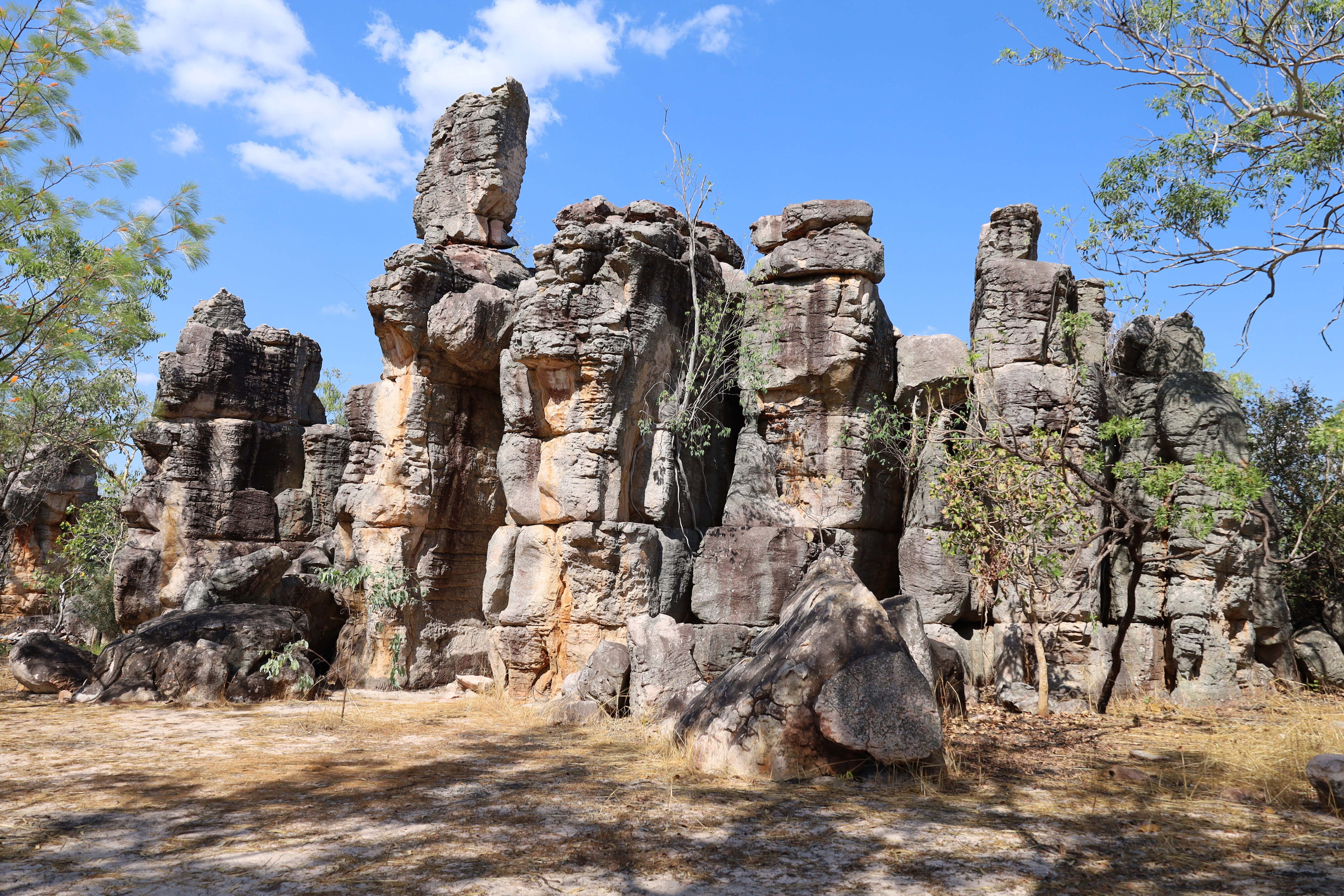
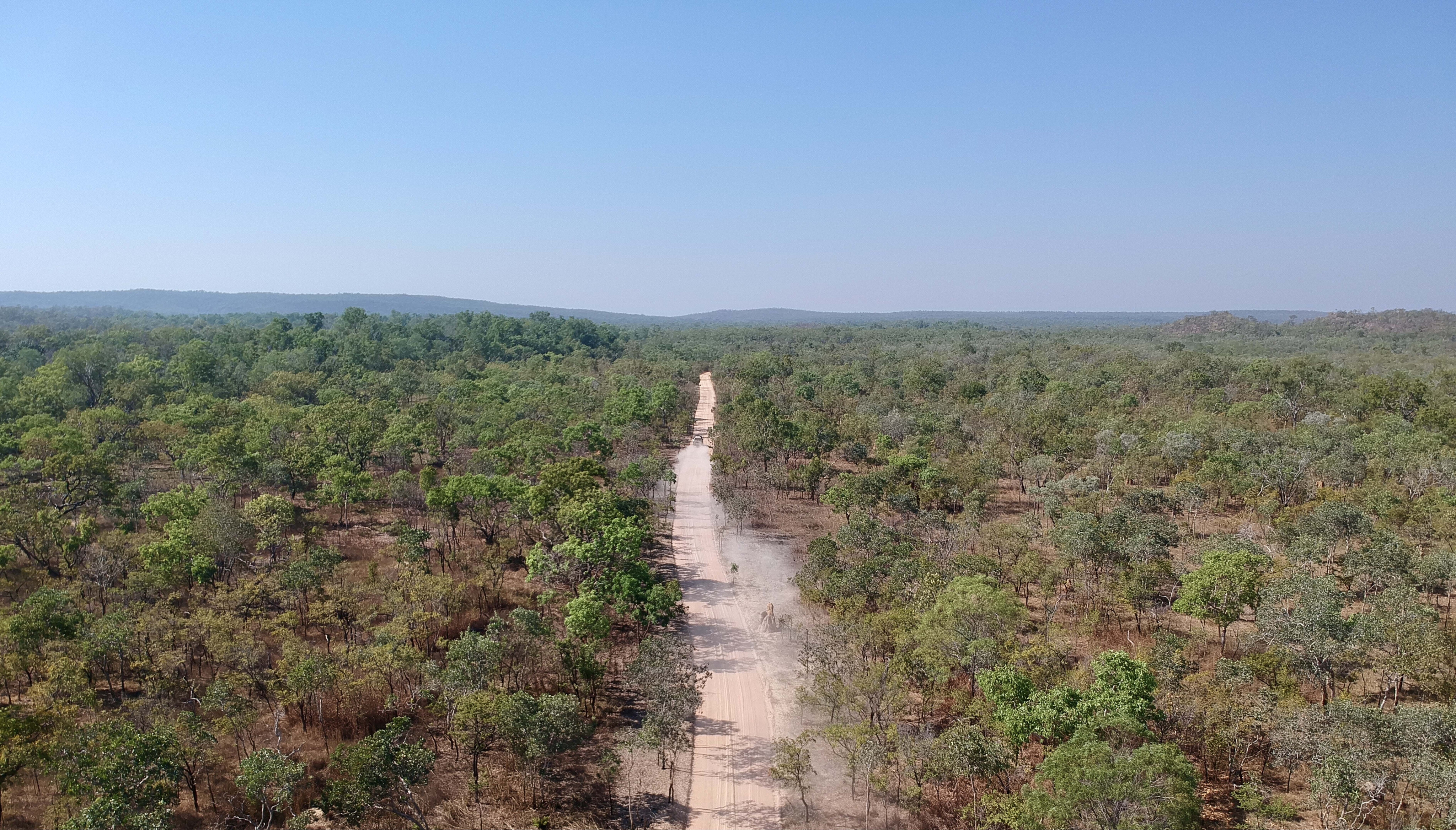
The Lost City Track is one of these; it is not a serious 4x4 track but it is narrow, rough and dusty for most of the 14km drive in.
The Lost City is a natural rock formation where huge pillars of eroded sandstone stand up to 20m tall. Part of the Tabletop Range, these pillars have been weathered over millions of years. The track to the Lost City is on the Batchelor end of the loop road and is well signposted.
50
The Reynolds River Track
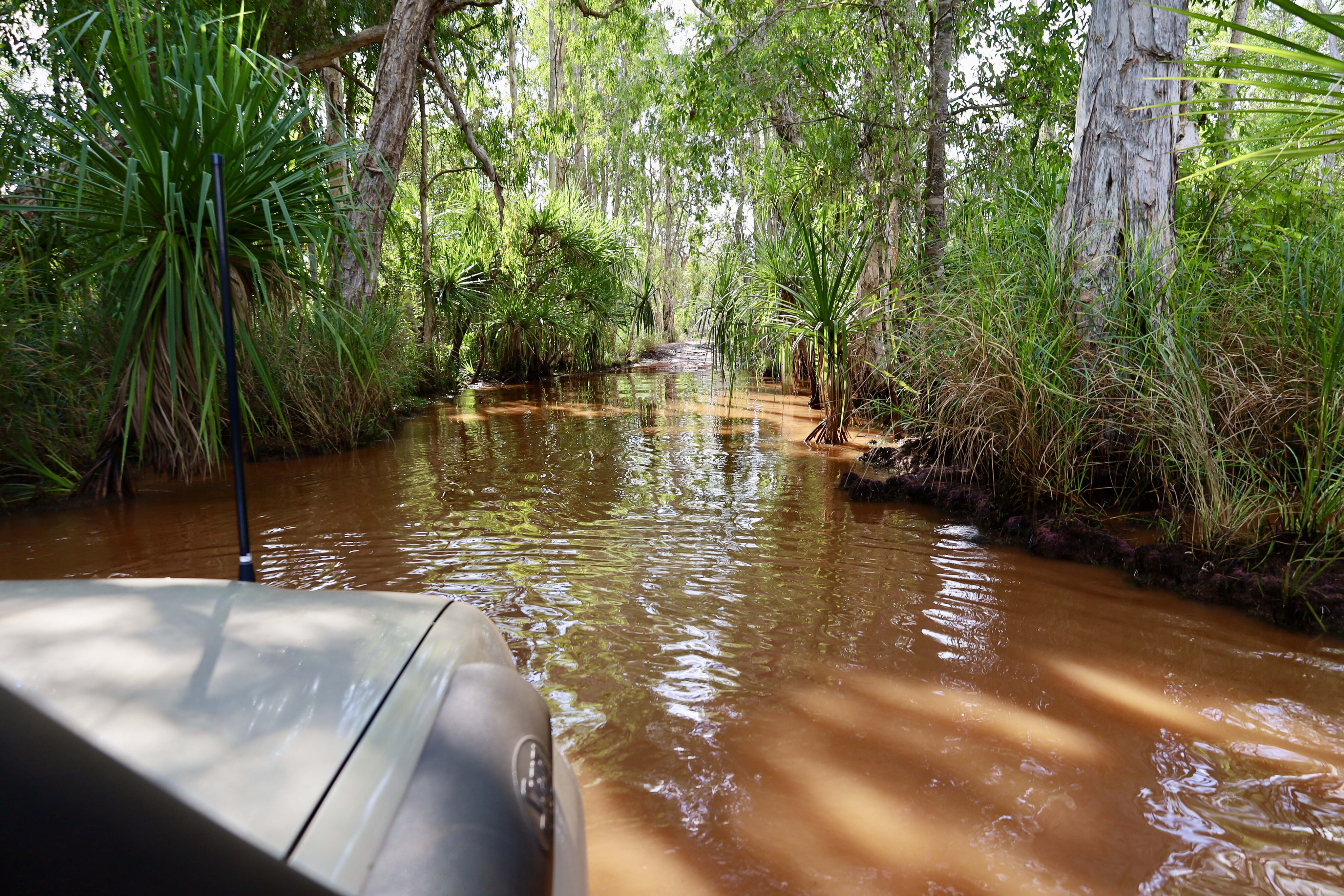
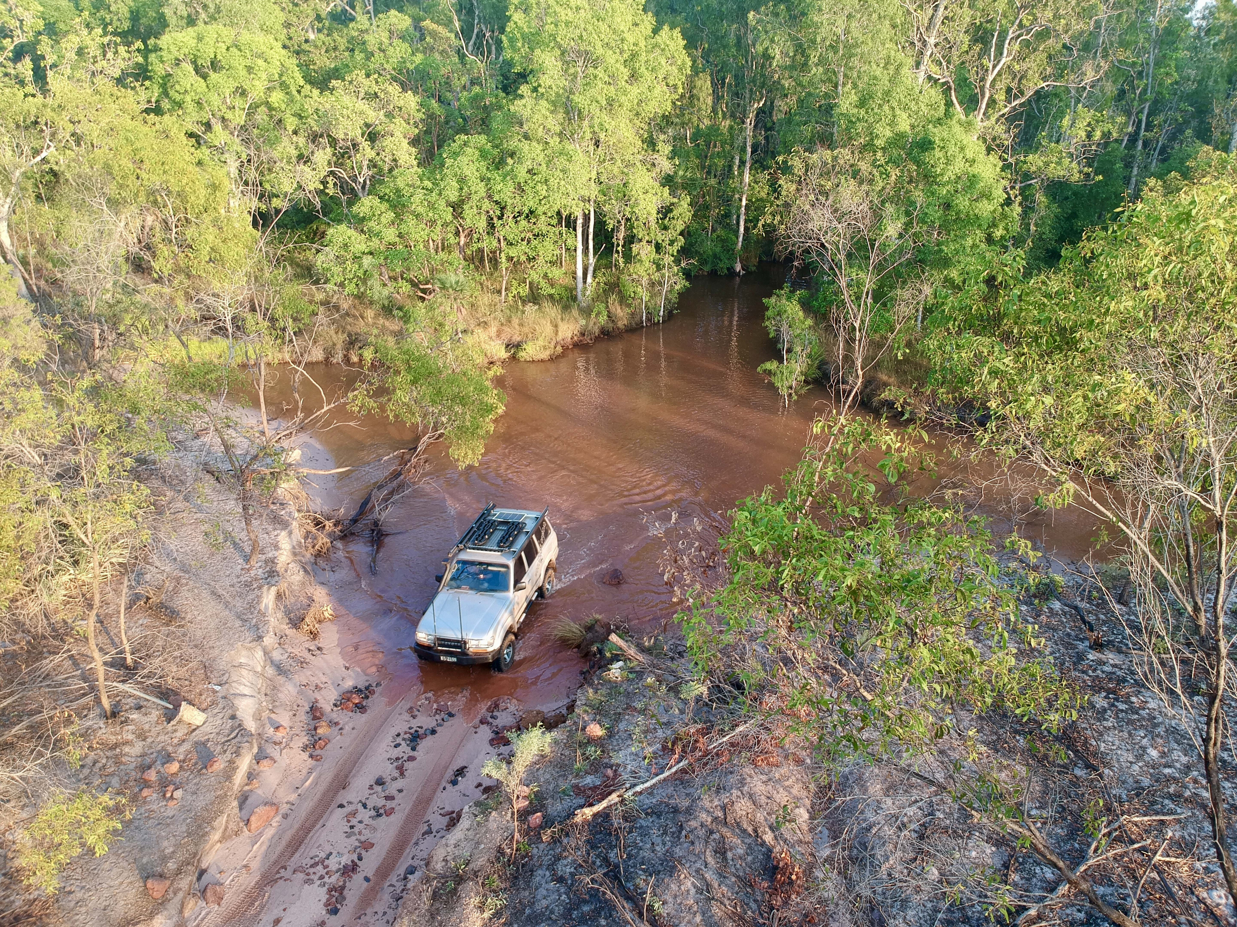
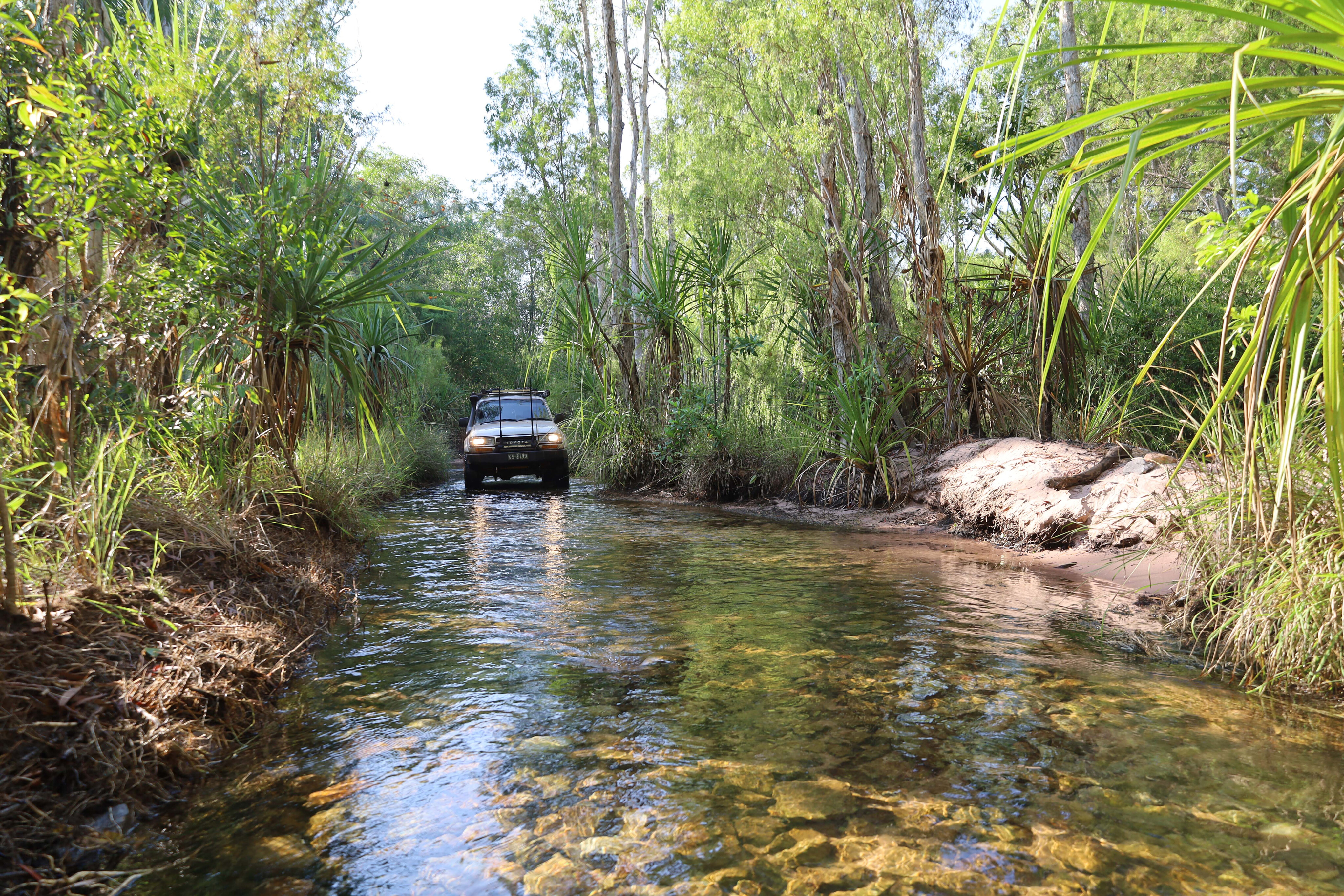
The Reynolds River Track is on the southern end of the park and it provides access to more of what Litchfield NP is all about, plus it gets you away from the hoards of scantily clad backpackers. It’s a 44km-long 4x4-only track and while not difficult, you will need to engage four-wheel drive for the several river crossings.
Open only during the dry season, and only after the river levels drop below 800mm, it’s a fun track with five different river crossings over the Reynolds River system. Rangers occasionally close the track when they feel it necessary, whether due to weather, or for maintenance or pest control.
Highlights along the track include a detour into the old Blyth Homestead and Mount Tolmer Mine. At the old homestead you can see how the Sargent family lived and survived out here in this harsh environment. Originally owned by the Chinese, this pastoral lease was sold to the Sargent family in 1924 and they continued to work the land and mine the mountain for tin.
50
The homestead has plenty of relics from back in the day on display, plus the family has left an amazing book of their history that dates back to 1924. It’s hard to believe that they had nearly 14,000 head of cattle here.
There is a record of when Dick Sargent was repairing the cattle yards and nearly took his heal off near his ankle using an adze (old school axe type). The family rode through the night to help him, crossing croc-infested flooded rivers trying to save him, but he eventually passed away with his father by his side in hospital.
Further on you’ll find Tjaynera Falls, commonly called Sandy Creek, where there’s camping and day-visitor parking. It’s a 1.5km walk to the tiered falls and there’s a low risk of crocs here too. Next along the track is a diversion into Surprise Creek and falls. Again a two-tiered drop into deep pools, and there’s also a small campsite here.
50
The track continues across huge floodplains and savannah lands where some of the best termite mounds can be seen. Most are magnetic mounds but there are also the impressive cathedral mounds mixed in.
The Reynolds River Track starts to run parallel with the Reynolds River at the far south end of the park, where I found that after the last flooding there were plenty of sandy and dusty patches along the way, but they didn’t cause any issues.
The several river crossings along the track have a rocky base, and they are inspected and maintained by the local rangers to ensure access through the park is maintained. A couple of the crossings have steep entry and exit points but nothing too hard.
50
At the end of the track, depending on where your camp is or where you’re heading, it’s about an hour’s drive to the Adelaide River township and a loop drive back to the park.
Even though it’s only 44km long, the Reynolds River Track takes a minimum four hours to explore, swim and enjoy the drive.
Would I do Litchfield again? Absolutely! With its rich and diverse flora and fauna, stunning scenery, good central camping and a little four-wheel driving thrown in, it’s a must-do when in the NT.
More information
Please enable JavaScript to view the comments powered by Disqus.
COMMENTS