Explore VIC
Gallery1
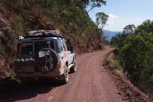
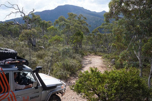
THE descent was steep and scrambly, the Cruiser growling in low-range first as we edged down the track, picking a line to keep us out of the erosion gullies and to maintain all four wheels on the deck as much as possible.
It was relatively simple, really, made even easier by the well-set-up and extremely capable LC76 I was driving. We were mapping and working on the next edition of Hema’s Victorian High Country Atlas & Guide and, while I hadn’t been on this series of tracks for a few years, I knew we had a lot more descents and more difficult climbs to come that would test both me and the vehicle.
We were on the Ingeegoodbee Track having just left the somewhat grandiosely named Barry Way, and almost immediately the track was for 4WDs. A sign at the start gives some indication of its difficulty, with a blunt warning of ‘no trailers’. I guess some rules weren’t meant to be broken.
 This tough track – one of the hardest long-distance routes in the Victorian High Country – begins just seven kilometres north along the Snowy River Road from the historic hamlet of Suggan Buggan, or, if you are coming south from Jindabyne in NSW, it’s just 11km south of Willis on the NSW/Vic border.
The route is one of the most important historical tracks in East Gippsland and was originally an Aboriginal pathway. When James McFarlane, from the Monaro in NSW, crossed the remote and mighty Snowy River in 1833-1834 with a mob of cattle, he followed that route and established himself at what became known as McFarlanes Flat. That marked the beginning of the connection with the High Country in Victoria by the famous mountain cattlemen.
Some believe the ruins of the original hut at McFarlanes Flat was the first European building in Victoria, dating from around 1834 and possibly predating the more well-known Henty brothers’ settlement in Portland by up to 12 months.
 As European colonisation increased, the pathway through here became the major stock route for the movement of cattle from the Monaro district to East Gippsland, and it opened up the remote forests of the region to European occupation. It also provided a means of communication between early European settlements of eastern Victoria and the more established areas of southern NSW.
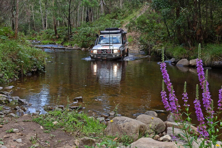
The track today immediately becomes steep, climbing to a great viewpoint near Mount Menaak which is worth a stop. A short time later you need to turn west onto the McFarlane Flat Track, with the route north on the Ingeegoodbee Track being gated six kilometres further on. The route west dips and climbs a few times, to get you into the swing of the difficulty level ahead, before making the aforementioned steep descent to the Ingeegoodbee River, some 11km from the main road.
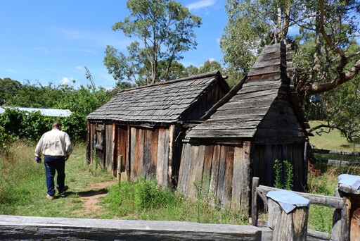
The route continues to be challenging nearly all the way to McFarlanes Flat, which is more a scattering of lightly treed, grassy plains spread through the forest. More substantial grassy plains are north of the main track, and these can be visited by following a faint track that branches off the main route near the remnants of an old fence line. Roughly 500 metres further along the fence the track swings away from the fence line and you will come to the ruins of Buff Rogers Hut (built back in 1981, but destroyed in the 2003 bushfires) one kilometre from the main track. This replaced the much earlier and historic McFarlanes Flat Hut, which is now just an insignificant pile of stones nearby.
 Back on the main route you cross the Berrima River and then come to the junction of the Snow Gum Trail. This leads a short distance to a locked gate and is the closest access point for walkers and mountain-bike riders to access the delightful Cowombat Flat, the source of the mighty Murray River and the historic border cairn on Forest Hill. The latter two are only accessible via a bit of a bush-bashing through the spindly snowgum scrub. In fact, it’s best to go to Cowombat Flat and then follow the river up to the springs and the cairn.
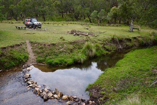
The main track turns south at the aforementioned junction and becomes the Cobberas Trail, which enters rugged and steep country as it drops and crosses first Freestone Creek and, 100 metres later, the Suggan Buggan River. The climb out of the valley is long, difficult and extremely memorable.
There are some good views of the rugged Cobberas to the west, and at one point you pass a fenced and signposted research plot just off the main track. There are a few bush camps dotted through here, and you’ll find the best just four kilometres from the main Limestone Road: Playgrounds Bush Camp. It’s a pleasant spot which acts as the starting point for a 6.5km walking trail to the top of Mt Cobberas No 1 (allow six to seven hours for the return trip). From here it is a short drive to Limestone Road and then an easy run to the delightful and large camping area at Native Dog Flat, which makes a good spot to pull up and camp for the night.
 Continuing west along the good gravel of the Limestone-Black Mountain Road for about nine kilometres you’ll then turn north onto the Limestone Creek Track. This route begins easily enough and there are some pleasant camping spots dotted along the creek.
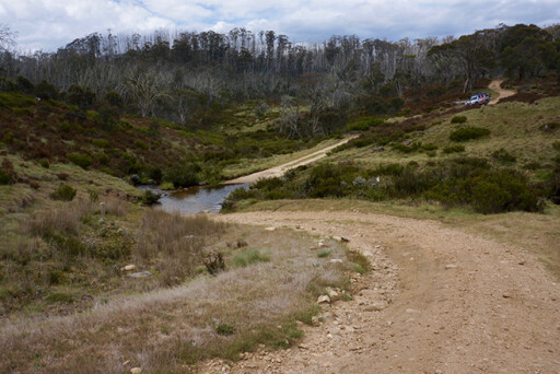
As you get farther along the track the route becomes harder and much more challenging, with some steep descents and very hard climbs where you’ll crawl and claw your way to the top of each and every hill. On a couple of these climbs I had to use the Cruiser’s lockers to get to the top – one of the few trails we’ve done during our surveys that demanded such action. Don’t be surprised if you fail and need to back up and try it all over again.
About 12km from the main road you’ll come to a track junction, turning right takes you a short distance to The Poplars, a small but pleasant camping spot nestling beside the fast-flowing waters of a nascent Murray River. Back at the junction, turning left will take you onto McCarthys Track, which again climbs steeply. Once at the top of the climb you’ll be among snow gums and come to a set of cross tracks where you need to turn right (north) onto the Davies Plain Track.
The route, now flat and a lot easier, crosses the small snow pasture of Charlie Creek Plain, before crossing Charlie Creek and passing by Charlie Hut. There’s some very pleasant camping here, but please remain on the main track. If camping, be careful where you pull over as much of the area is boggy and once churned up will take years to recover. The main track then enters thick scrubby country, much of it regrowth from the 2003 fires that ravaged the region.
 A little farther north the route comes to a sublime snowy and grassy veld and the Davies Plain Hut; first built in 1892, rebuilt after the 1939 bushfires, and then greatly refurbished in about 1995. There is a magical cleared area around the hut perfect for pitching a tent or throwing down a swag. You’ll often see gang-gang cockatoos around here, while wild horses and deer are also a common sight.
Once you’ve torn yourself away from this magical spot, the route drops just a short distance from the hut to a crossing of the babbling Davies Plain Creek. From here the track descends and climbs through forest ravaged by the 2003 fires. The close-knit scrub often scratches and clings to your vehicle.
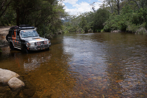
Finally you’ll come to Buckwong Creek, a camping area and creek crossing, and from here it’s an easy drive to a major track junction and info sign just south of the Murray River. Veering left will take you to Dogmans Hut and onwards to a number of 4WD routes that eventually take you to Corryong or Omeo. Straight ahead the junction will dip you into a normally shallow crossing of the Murray River, where you’ll climb the northern bank into the southern section of Kosciuszko National Park, with its fabulous camping along the river, some 20km south-west of the ski resort of Thredbo.
 You’ll probably breathe a sigh of relief once here, even more so if you have come through relatively unscathed. But I can guarantee you’ll never forget the tremendous camping and the incredibly challenging circuit of steep tracks and snow plains in Victoria’s remote High Country.
TRAVEL PLANNER
WARNING
Many of these tracks are rated as Double Black Diamond in difficulty (see www.4wdvictoria.org.au for more information) meaning some are impassable and very dangerous in even slight wet weather.
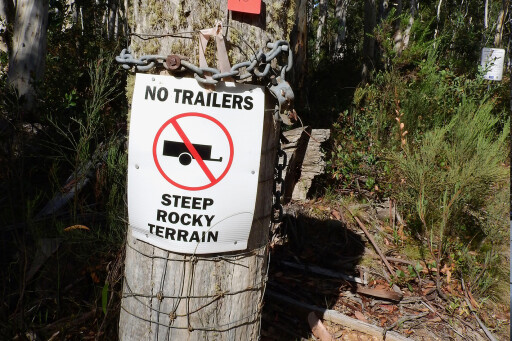 It’s strongly suggested that trailers aren’t to be taken on any of the difficult tracks. Trailers and vans aren’t recommended on the Barry Way; although we have seen some. Native Dog Flat, Suggan Buggan bush camping area and the camping areas on both sides of the Murray River can easily be reached with an off-road camper trailer.
All tracks in the alpine area of Victoria are subject to seasonal road closures. For the latest go to: www.parkweb.vic.gov.au/safety/closures
WEBSITES
Alpine NP
Kosciuszko NP
What's your next off-road destination? Find out and explore.
Please enable JavaScript to view the comments powered by Disqus.
COMMENTS