Explore NSW
Gallery10
A COUPLE of hours’ drive from the Coffs Coast, midway between Sydney and Brisbane, is a wilderness area where you can camp and explore.
This trip begins just out of Dorrigo on the NSW mid-north coast, an area known for rich farmland that grows some of the best potatoes in the world (outside of Ireland, of course). Volcanic activity in the area near Ebor some 30 million years ago pushed and formed high peaks that became part of the Great Diving Range, and it also provided deep-cut gorges that are inaccessible and rugged.
10
After visiting several tourist locations in the quaint village of Dorrigo, where you can still get real meat pies, we headed farther west towards Armidale. The tar road from Dorrigo twists its way over rolling hills, green from recent rainfalls, and it’s not long before we hit Grafton-Armidale Road and headed north to Dorrigo Plateau, where the views here fall into the distance on both sides of the road. After a 10-minute drive we soon approached the locality of Hernani. Population... not a lot.
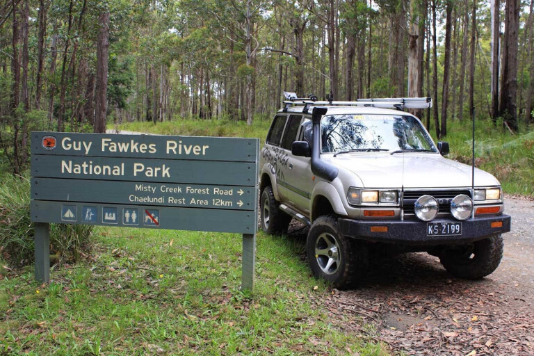
Signposted directions led to Guy Fawkes River National Park and, still on the tar, we swung past sleepy farms and the local district school. It didn’t take long to hit the dirt, and when we did, we passed the last farm and the last sign of civilisation. Phone signal dropped, too, so it’s vital to be self-sufficient with spare tyres, food, water and tools. It was hard to comprehend that just an hour ago we were battling coastal traffic for parking spaces at the local beach.
When you leave the locality of Hernani you’ll hit Hardens Road, a good all-weather road that passes through old timber forests. Keep a look out for several signposted turns – but look closely, as the signs are ageing with moss and other gremlins. Still, you can’t go wrong with a good GPS system at your fingertips.
MORECoffs Coast
10
The vegetation starts to change to a more temperate setting as you climb higher, with vines climbing over ash trees and tree ferns; while down below at ground level, fragile soft maiden hair ferns mind their own business.
Around the 15km mark an old timber sign pointed us towards Mount Hyland picnic area. A 4WD is needed on this narrow track as you’ll need to squeeze past tree ferns, but it’s worth it for the walk to the trig station which provides awesome views of the ridges towards the coast.
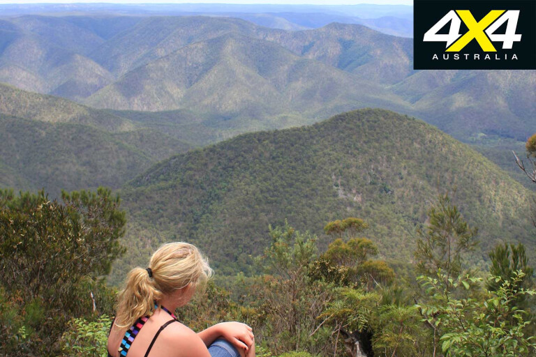
Back on the main road we found ourselves at a T-intersection and spotted ‘Vista Lookout’ to our right, a signposted road where several trailers can easily swing around and park. This spot was great, with a picnic table, information board explaining why this area is so special, and views towards the coast. It’s a top spot for a cuppa and to reflect on life, and all this just 20km into our trip.
10
Backtracking past the T-intersection you’ll soon find the turnoff to Chaelundi Rest camping area. This 12km diversion down into the wilderness camping area is on a steep, winding road where you need to keep an eye out for 4WDs and animals as there isn’t much room to quickly pull over.
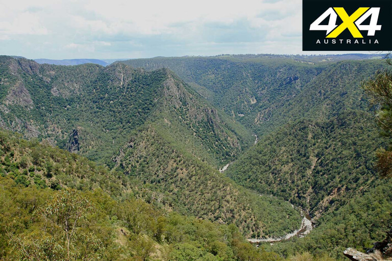
A spot where you can stop is marked as Misty Creek Lookout, about 6km down the road on the left. A 300m return walk to the edge of some of the most breathtaking lookouts you will ever see provides views across the rugged Guy Fawkes Wilderness, from the river below that snakes its way through the valley, to pockets of rainforest tucked in on the southern sides of the gorges.
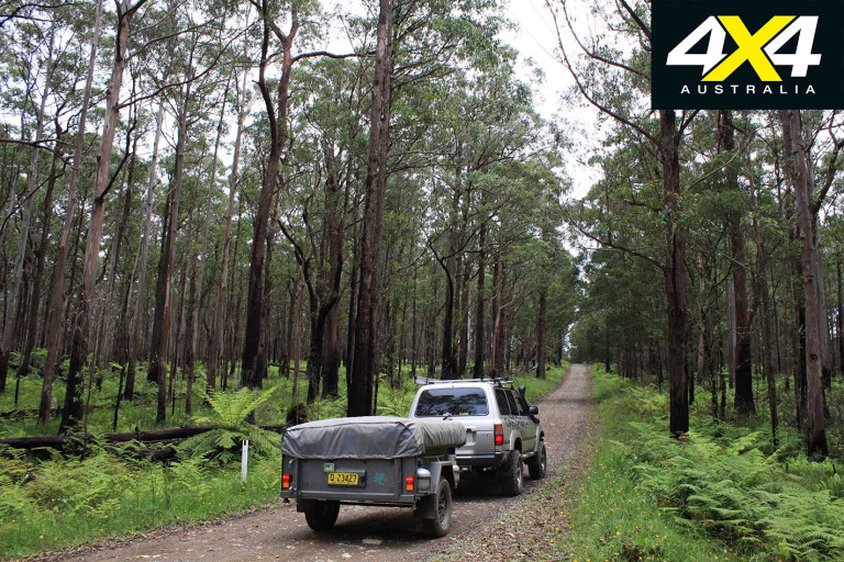
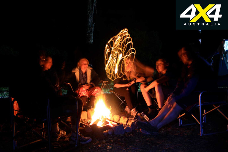
The vegetation farther down the mountain is still thick, with heavily timbered hills and a scattering of tall tree ferns throughout. Some 6km down you will enter the Chaelundi Rest Area, with tent areas, a section for day-trippers and bushwalkers, and a pocket for camper trailers.
10
The well-thought-out camping area has information boards, a fire box with timber offcuts, pit toilets and barbecue plates. The site utilises an honesty pay system and general fees apply for camping and those without an annual vehicle pass.
Once you decide it’s time to leave, wander back to the top of the range. As it’s a steep climb out, 4WD is recommended here; and as you wind your way along the ridgetop, the highest section of Chaelundi Mountain is at an altitude of 1377m above sea level.
Dropping down the northern side of the mountain the vegetation changes again, with the cooler temperate areas changing into areas littered with huge granite boulders hiding amongst huge gums.
10
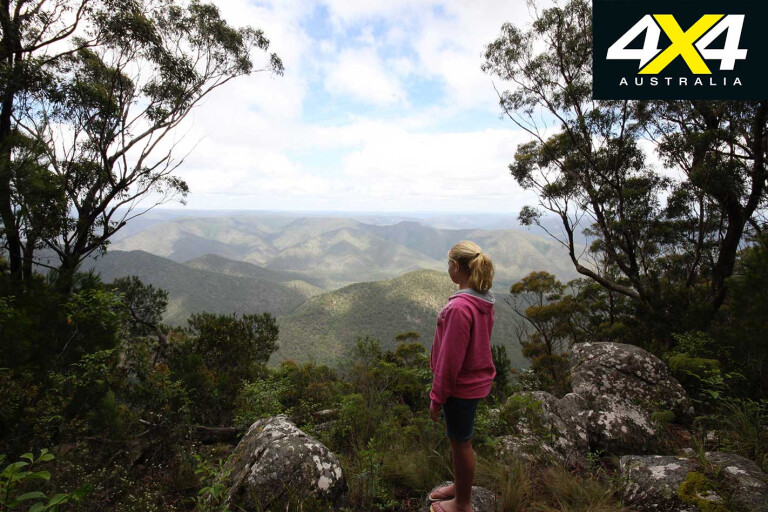
Just when we thought the trip was over, Sundew Lookout appeared some 7km down the road. It’s signposted, but you need to keep an eye out. The view was the same as previous days: awesome, unbelievable and fantastic.
The high elevation means you need to be aware of the weather, as it can change from gully to gully. Several heavy showers in a very short time had turned the road to slop, but being in a 4WD we just flicked a lever for added traction.
Jumping back on the road we lasted only five minutes before another marked lookout was posted on the road. This time there was a twist: the lookout was to the west.
10
A bit farther down the road, keep an eye out for Hamburger Rock – maybe if you squint it may look like a hamburger? The road then meanders downhill through thick timber forests, the soft tree ferns giving way to grass trees and a host of different cycad palms.
It’s evident that there’s less road maintenance out this end of the trail as it was rough, with small ruts and rocks, but nothing a little ground clearance or some good all-terrain tyres wouldn’t fix.
As we approached the 100km mark we realised our trip was nearly over. A last stop beside the Mann River for afternoon tea left us with several decisions: do we turn around and do it again, or do we swing right and head back to the hustle of the coast?
MORE4x4 Explore
Travel Planner
10
LOCATION
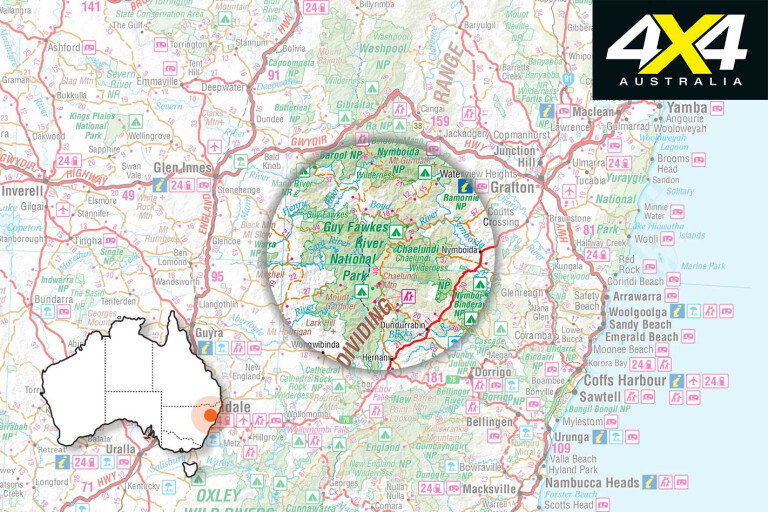
The Guy Fawkes Wilderness area is located in northern NSW, 100km inland from the Coffs Coast. This region has a host of State Forests and National Parks, with lookouts, walking trails and side roads. With a mining history that dates back to the mid-1880s, with several gold and gem fields, it’s always exciting to explore. The plateau was formed some 30 million years ago from a nearby volcanic eruption, thus giving a diverse range of flora and fauna. The summers get hot, but in winter there is often a light snow.
CAMPING
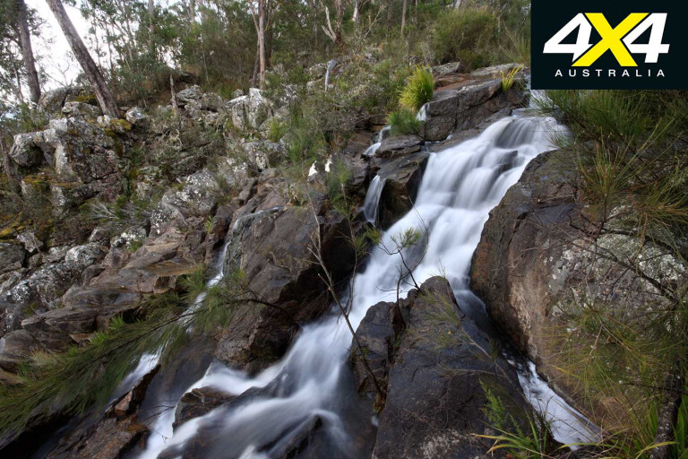
This trip is fairly isolated and you’ll need to be self-sufficient with food, fuel, water and maps. Several campsites are situated along this drive, but the main one, the Chaelundi Rest Camping Area, is located along the middle of the Chaelundi Trail. National Parks has set aside enough room for camper trailers and there’s a huge tent area. Pit toilets have been installed and there’s free firewood supplied by National Parks. A small creek flows past the camping area, with water available from here – boil it first. No bins are provided and fire pits are located throughout. Camping fees are $5 adult per night and $3 child per night. The vehicle pass is payable into an honesty box when you arrive at the campsite.
BEST TIME TO TRAVEL
Spring or autumn. Summer can get stifling hot, which brings out flies and the odd black snake. As you’re 1000m above sea level for the majority of the time, the winters get bitterly cold with a good chance of light snow.
FUEL & SUPPLIES
The nearest major town is Dorrigo, a friendly place with basic facilities including several fuel stops, mechanical services, supermarket and a great country bakery. The local info centre has all the relevant details. Phone service is limited; and while this trip is only 200km-long, you need to be self-sufficient. Once you end the trip at Dalmorton (now abandoned), it is another 80km to fuel.
TRIP STANDARD
Stick to the main trails and this trip is fine for a decent off-road camper trailer. The main forest trails are irregularly maintained. A 4WD is essential, not for the deep ruts or funky trails but for the rise and fall of 1300m over several steep kilometres. All-terrain tyres are recommended. This trip is unsuitable for caravans due to some narrow, winding roads. Camper trailers need to take care.
MAPS & GUIDES
There are several brochures available from the Glen Innes Information Centre, but the best map for this location is the Glen Innes State Forest Map. This scale of 1:125,000 has basic info yet covers the whole area.
CONTACTS
Glen Innes Visitor Information Centre: (02) 6730 2400
Glen Innes State Forest office: (02) 6732 2922
Alternatively, drop into the Dorrigo Visitor Information Centre, or the local National Parks office for information on road conditions and camping fees.
Please enable JavaScript to view the comments powered by Disqus.
COMMENTS