Explore QLD
Gallery22
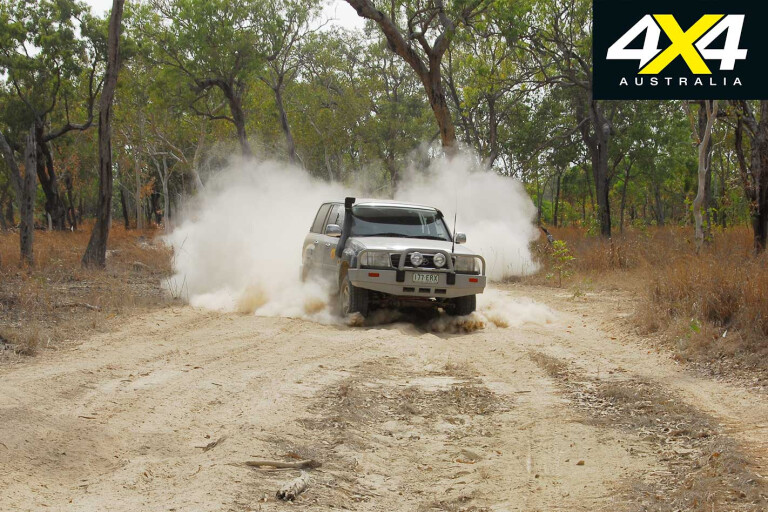
IT STANDS to reason that the vast majority of Cape York Peninsula travellers have one goal in mind: the Tip. There are several routes that will take you there, with routes either skirting or directly accessed via national parks.
THE INLAND ROUTE
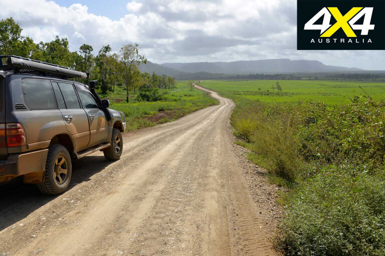
The inland route on the Peninsula Developmental Road (PDR) is the most popular journey to the Tip, as most people are always pressed for time. Unfortunately, by opting for this passage, punters will miss the best parts of what the region has to offer.
 Most Cape York journeys start from Mareeba on the northern Atherton Tablelands. From here, take the Mulligan Highway at Mareeba to Lakelands, before turning onto the PDR to Laura. It’s a sealed road with long stretches of bitumen all the way to Weipa, and with sealing expected to be completed by the end of 2018. Expect delays en route.
The PDR is rated as a boring drive by some, especially by those in a hurry. But pull-up here and there (apart from roadhouses/townships) and discover strange and new flora and fauna. Boil the billy, suck up the fresh air and live the life.
THE COASTAL ROUTE
The Cairns route is the most exciting and scenic journey to the Cape. Take the Cook Highway, visit Hartley’s Crocodile Adventures wildlife park, and have lunch at Port Douglas and stay overnight.
The next day visit the Great Barrier Reef Marine Park on a diving or fishing trip before heading north across the beautiful Daintree River. En route visit Mossman Gorge in Daintree National Park, Daintree Village and take a crocodile-spotting river cruise.
22
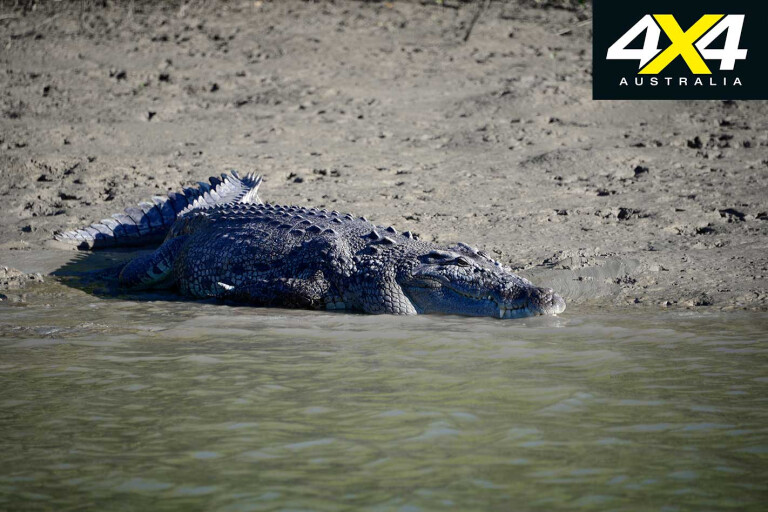
There are also cruises at Noah Creek and Cooktown, but book ahead or you may miss out. Do the crocodile cruise as it will help you to understand the Saurians a little, including the often imaginary danger they pose.
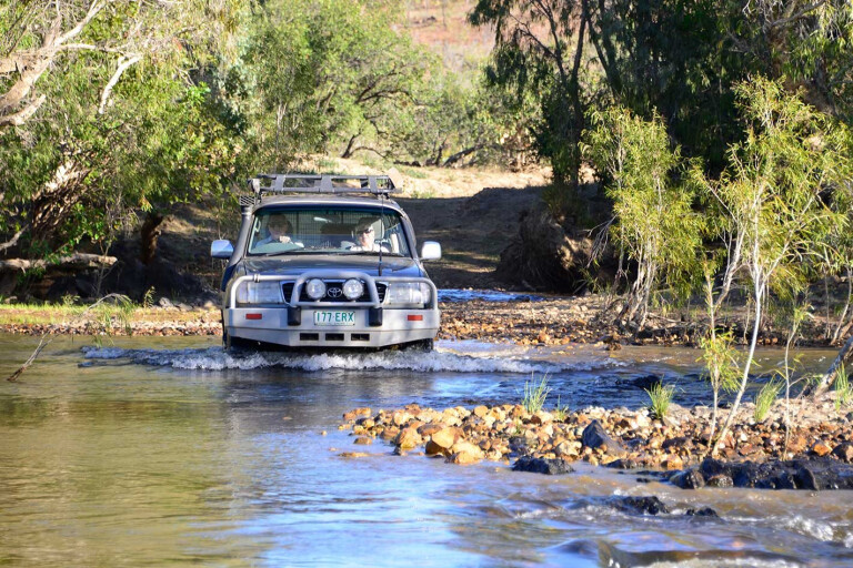
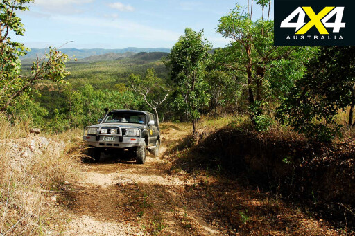
You have a choice of taking the CREB Track from Daintree Village, or the Bloomfield Track via Cape Tribulation. The CREB is challenging and closed when it rains on the mountains, and it often does in the dry season when the southeast tradewinds blast the coast.
After crossing the Daintree River on the ferry, there is much to see and do on the way to Cape Tribulation and beyond. The Daintree rainforest is the oldest continual rainforest in the world, and take a stroll on one of several boardwalks in the area – the Noah Creek walk is my favourite, as it continues into the tidal forest beyond the realm of the jungle.
22
Beyond Cape Tribulation the bitumen runs out when you enter the Bloomfield Track. It’s a great drive, but take it easy on the steep declines and inclines, especially when towing a camper or an off-road van during wet conditions. There are some nice lunch and safe swimming spots on the track, and just after crossing the Bloomfield River bridge take the track upriver to the Bloomfield Falls.
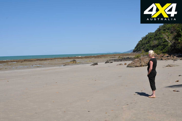
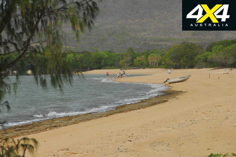
The road bypasses Wujal Wujal, an indigenous community – don’t enter it if you have alcohol on board. Ayton is a small village fronting the river and Weary Bay. There is a store with fuel, basic supplies and a private campground before the beach turnoff. Take time off and see beautiful Weary Bay as Lt. James Cook named it after getting stuck on a reef on its northern perimeter. The beach track ends at the river mouth.
Rossville, followed by the overrated Lions Den, falls behind as you junction with the Mulligan Highway. Black Mountain National Park is on your right, where boulders of all sizes are piled mountain high on top of each other. Only a few fig trees grow in the granite pile, and a lookout is on the highway.
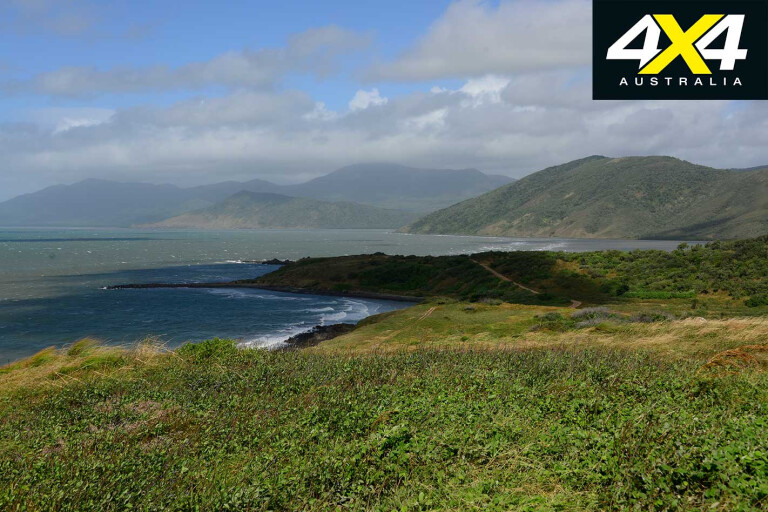
Don’t miss Archer Point, it has an awesome view of the Daintree Coast and Cape Bedford. It can be very windy at the lighthouse, but when it’s calm and the sea is serene the views spread out to the reef 40km away.
22
It amazes me that many visitors avoid Cooktown. It is part of the adventure and is truly a great little historical town with fine eating and much to do. It has several small national parks and conservation areas that are well worth the walks.
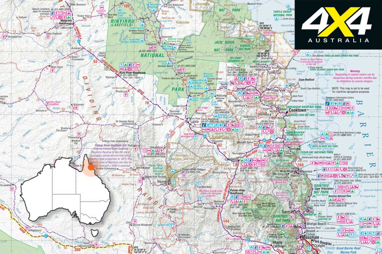
At Cooktown you have a choice of heading south to Lakelands and onto the PDR, north on the Battle Camp Track to Rinyirru (Lakefield) NP and Laura, or take the Starcke Track to Muundhi, Cape Melville and Rinyirru national parks and Bathurst Head. Don’t miss a couple of nights’ camping on Elim Beach, via Hopevale.
Both tracks are maintained, though the Starcke only as far as the Starcke River, where it turns into long stretches of bulldust. The Starcke Track is the most scenic and adventurous route to Rinyirru and the track closely follows the coast. From Mount Webb National Park views unfold of the Cape Flattery dune fields and old Starcke Station.
22
From here there are more than 100 creek and gully crossings before the Starcke River. There is a bush campground and a boat ramp at the river mouth.
The first park encountered is Muundhi NP, which is part of Rinyirru NP and is located on its eastern border. It connects with Cape Melville NP. Combined, they cover a huge area, but access is limited, as are tracks. Check with the park’s office at Cooktown or the Lakefield ranger base for access and camping information.
CAPE MELVILLE
At abandoned Wakooka Station there is the choice to head north to Cape Melville NP and Ninian Bay, or head west to Bathurst Bay and Kalpowar Crossing on the Normanby River. It marks the border of Rinyirru.
22
The Cape Melville route is challenging when towing a trailer as the northern section has lots of deep washouts and sandy sections. It’s a good idea to air down to 16-18psi as you will be driving on the beach to the campsites.
The park is well worth the visit. There is a spring-fed creek between 432m-high Bay Hill, an outlier, and Abbey Hill on the Melville Range. This range, Bay Hill and the distant western Bathurst Range are similar to the Black Mountains, being composed of even larger granite boulders. Huge fruit trees, figs and Burdekin plums alive with birds separate the beach from the range.
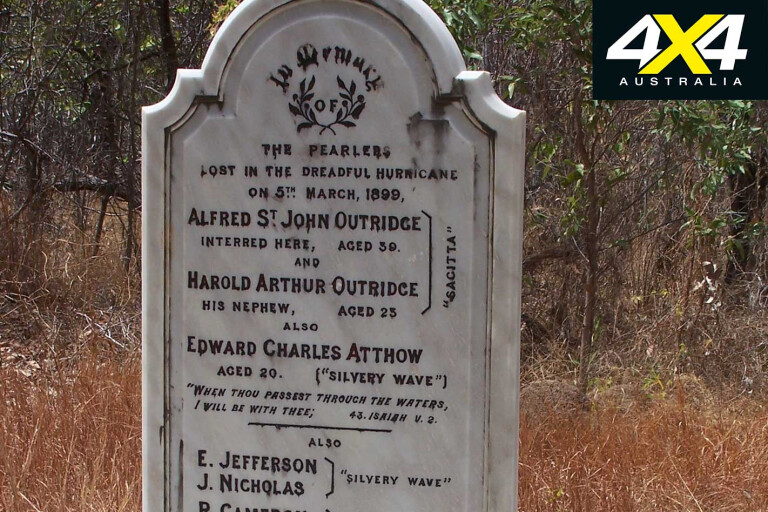
The area has a dark past with the dubious honour of having Australia’s largest loss of lives record. Just before midnight on March 4, 1899, the entire Torres Strait pearling fleet, consisting of 109 luggers, eight schooners and six cutters, plus the Channel Island lighthouse ship, were hit by Cyclone Mahina and wiped out. Only the aptly named schooner Crest of the Wave survived.
In total, more than 300 people died including many Aborigines camped under the trees on the beach. They, along with many ships, were washed ashore and smashed on the rocks when a 15-metre tidal surge swept over them.
22
The evidence of that dark night can still be found along the rock walls, where bits of pearl and trochus shells, timber and rusty iron remains. A monument is sited between Abbey Hill and the Bay Hill outlier.
The park has good beach fishing, while the Muck River to the west also fishes well if you have boat or tinnie. Needless to say, beware of crocodiles, as a land attack in the beach camps happened a few years ago.
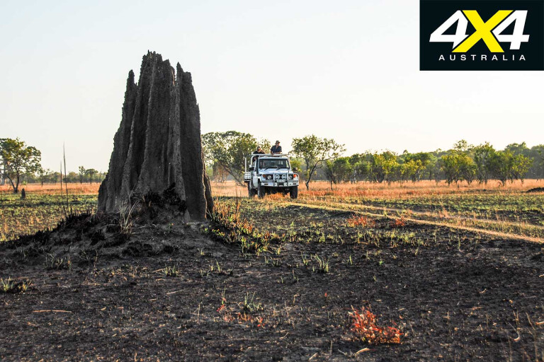
RINYIRRU NATIONAL PARK
It matters little where you enter, from east, south or west. It’s a huge area that drains seven rivers from the Laura Basin, making it an extremely important wetland region. In the 1980s several large cattle stations were forcefully resumed by the Qld Government to form a park that would match Kakadu in the NT.
22
While the area is similar in size there was never enough money to even remotely match Kakadu and it remains similar as before the takeover.
The park is composed of open monsoon woodlands interspersed with vine forests, paperbark wetlands, swamps, billabongs, rivers and open plains like the Nifold Plains region. The park is an important fishing destination for keen anglers.
There are many campsites scattered about the park with bush boat ramps available for easy launching. Nearer to the coast are vast tidal flats and mangrove forests fringing huge tidal inlets. Estuarine boat access is also available.
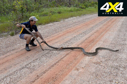
Every waterhole, swamp and billabong holds crocodiles, with both freshwater and estuarine species being present in numbers. Rinyirru has the largest population of saltwater crocodiles in Qld. A canoeist was killed by a crocodile in the Normanby River some years back, so leave the canoe or kayak at home unless you have a death wish.
22
The park is a renowned bird-spotting area and birders armed with field glasses and iPhone apps roam the park in the dry season. The park has important Aboriginal significance and is jointly managed by the Qld Parks & Wildlife Service and the traditional owners – as is every other national park on the Cape under the CYPAL agreement.
The park is closed on November 1 when the east coast barramundi season closure commences. It reopens on June 1.
If you love nature, birds, photography, fishing and hiking, Rinyirru NP is for you. You can spend weeks here and still feel like you have missed most of it when you depart in a cloud of trailing dust.
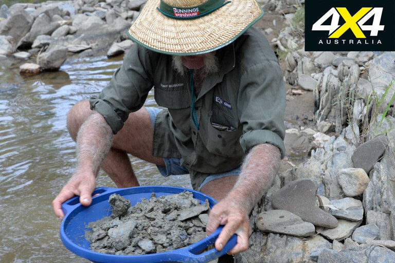
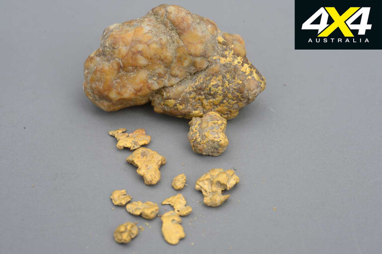
PALMER GOLDFIELD RESOURCES RESERVE
The River of Gold, the Palmer, has a rich mining history that dates back to the 1870s, when explorer Frank Hann first reported gold. The field was later proved by Mulligan, but he took credit for the find.
22
It started a gold rush from Cooktown, via the Battle Camp Track, which was so named after Aborigines attacked a party of diggers on their way to the new field.
The Palmer still has gold and is a popular prospecting destination, while a whole army of small miners still eke out an existence on the field.
MOREExplore
The Palmer reserve is reached via Whites Creek Road, 67km north of Mount Carbine on the Mulligan Highway. There is a free camping area about 12km from the reserve.
22
Other tracks lead in from the Burke Developmental Road and from Laura on the original Old Coach Road, a challenging but not insurmountable 4WD route.
ERRK OYKANGAND NP
Formerly known as the Alice-Mitchell NP, it’s at the bottom of the Cape and arguably the least visited park on the Peninsula. It largely consists of open woodlands interspersed by vine thickets, swamps, billabongs, dry creeks and the boundaries of the Mitchell and Alice rivers. It’s very isolated and managed by the Kowanyama Land and Sea Rangers.
22
Call the Kowanyama Aboriginal Land & Natural Resource Management office on (07) 4060 5187 for details, camping and entry when planning a trip there.
The park is accessed from Kowanyama, via Shelfo Crossing on the Mitchell River, and from the Dixie Station turnoff, 21km south of Musgrave Roadhouse on the PDR, via the Dunbar Station Junction.
MORE PARKS
West from the Hann River Roadhouse are two new national parks, Alwal and Olkola, as well as the Olkola Conservation Park. They are accessed from the Dixie and Fairview Roads and from Hann River Roadhouse. There is currently no access to these parks as grazing cattle continues, while the Government and the traditional owners struggle with an agreement under the CYPAL framework.
22
It’s an attractive area being composed of low escarpments, undulating hills, seasonal wetlands and patches of monsoon vine thickets dominated by monsoon woodlands. The parks are home to the very rare golden-shouldered parrot and some threatened plants. So it’s worth keeping an eye on future developments.
Travel Planner
WHEN TO VISIT
The dry season from late May to September is the most popular time to visit the Cape, though many people put up with the warm, humid nights and hot days into December, depending when the first storms of the wet season reach the Cape.
The cool months of June and July are favoured by southern visitors unaccustomed to tropical climates. Many Cape visitors are on discovery and some on 4WD wrecking missions during this time, which often spoils the true wilderness escape for others.
Most parks are closed from November to April when wet season conditions make bush travel impossible in most areas. Some parks are closed from December until June, and sometimes even later if the Wet ends late.
22
NATIONAL PARK REGULATIONS
You can book online using a credit card or camping credit. Some parks have a self-service facility. Most ranger stations take credit cards when booking in.
Self-service booking facilities are available at the QNPWS offices in Cairns, Cooktown and Coen, and at ranger bases at Rinyirru and Kutini-Payamu National Parks and the Heathlands Resources Reserve. Over-the-counter camping permits are available at the Atherton Visitors Centre, Cooktown’s Lure Shop and Moreton Bay Telegraph Station. Also use a public payphone or mobile phone where coverage is available by calling 13 QGOV (13 74 68).
 VEHICLES
Cape York’s National Parks are 4WD-only country. Travel with another vehicle if possible.
You must be self-sufficient, have insect repellent, navigation and maps, recovery gear, spare parts, drinking water, food, and daily-needed supplies. Take a shovel to bury your personal waste. Take a PLB, a sat-phone or VHF radio for emergencies.
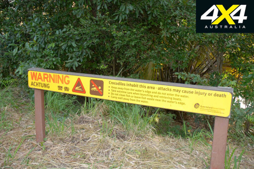 CROC ADVICE
• Keep away from steep banks when fishing and always have an escape route.
• Educate your children about the danger and guard them.
• Camp at least 50 metres away from water.
• Do not dump food waste and fish remains near camps.
• Do not harass crocodiles or attempt to feed them.
• Do not use canoes or kayaks in crocodile waters.
 SURVIVAL CHECK-LIST
• Do not disturb, take away or cut down plants and trees.
• Do not take pets into a national park.
• Drive only on existing tracks.
• Take care with campfires. Use existing fire places in campgrounds.
• Do not use soap or detergents in streams.
•Take your rubbish out with you when you leave.
• Firearms are prohibited.
• Only use generators that operate at less than 65dB(A) and only in generator-approved camping zones.
• Book well ahead for campsites during June to September.
• Quad bikes and chainsaws are forbidden in NPs and on all beaches.
• Use the vehicle wash-down facilities at Lakeland to avoid carrying weeds and seeds in and out of the Cape.
• Don’t dump rubbish in the chemical toilet tanks at campgrounds.
• Camp only in approved campsites.
• Respect the indigenous culture and sites of the Cape York traditional owners.
USEFUL WEBSITES
www.queenslandnationalparks.com.au
www.qld.gov.au/camping for online booking.
www.tourismcapeyork.com/know for alcohol restrictions and general information.
Road conditions: www.131940.qld.gov.au or phone 13 19 40.
Road conditions: www.cook.qld.gov.au/services/roads for current road status.
Waste disposal sites: www.lawmac.org.au
Quarantine: www.daf.qld.gov.au
Emergencies: dial 000 or 112 with a digital or satellite phone.
Fishing: www.fisheries.qld.gov.au
Great Barrier Reef MP: www.gbrmpa.gov.au
Vehicle Recovery: Phone 13 11 11. Contact: www.racq.com.au
Weather: 1-14 day forecast: www.meteovista.com/oceania/australia/capeyork/3769030
Please enable JavaScript to view the comments powered by Disqus.
COMMENTS