Explore QLD
.jpg )
Gallery16
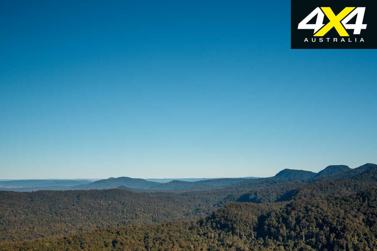
THE DRIVE was an easy one, the dirt road dipping and curling along the very top of the range while expansive views spread to the horizon on both sides of the narrow ridgeline we were traversing.
To the west was the valley of the Clarence River, while to the east of our lofty perch was the Richmond River valley. We stopped at the Cambridge Plateau Lookout to soak in the view and the surrounding rainforest, while 80km to the north-east, as the crow flies, the distinctive peak of Mount Warning jutted its gnarled, volcano-born head above the jungle.
16
Earlier that day we had left the razzmatazz and crowded streets of the Gold Coast heading south and then inland to a pleasant camp at the Mt Warning Rainforest Park on the edge of the Korrumbyn Creek, our camp surrounded by the rich forests of these lush mountains.
Our plan initially was to climb Mt Warning, and while heaps of people do it, even though the local Aboriginal people have asked visitors not to, we weren’t allowed to as we had a video crew along for the ride and filming is now strictly forbidden in Wollumbin NP.
‘Bugger!’, we thought, as we changed plans and headed to Border Ranges NP only to find the gate locked there because of flood damage and the fact that most of the roads in the park were closed. (They should be open by now, but it would pay to check on the national park’s website if planning a visit.)
16
With our initial plans in tatters we headed to the timber town of Kyogle. The town is the service centre of a rich pastoral and logging region and is famous for its 1930s Art Deco architecture that lines the main street. It’s a sight worth seeing.
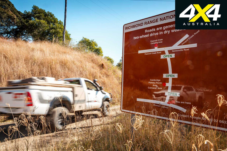
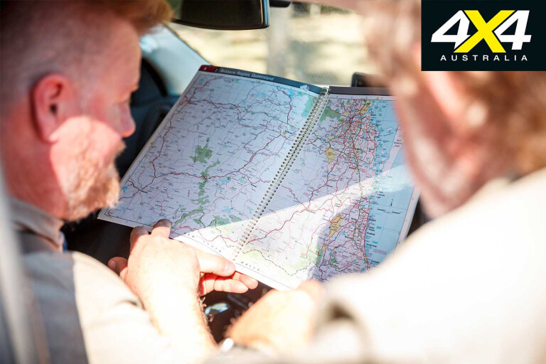
With a new plan in place, we headed on back roads through Ettrick and Dyraaba Central, places I’d never heard of before this trip, meeting the Bruxner Highway at Dyraaba Arm. In our haste to get off the blacktop we took a track shown on the map from Mummulgum (don’t you love the name?) and headed for Richmond Range NP, only to be stopped just short of our goal at a farmer’s gate.
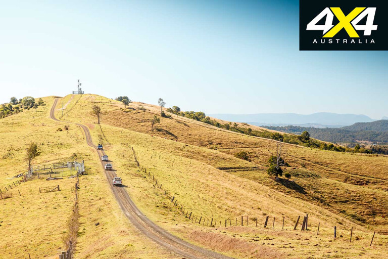
We backtracked yet again and farther along the highway took the dirt road up the hill from Mallanganee Lookout, the route passing through cleared farmland for 6km or so before entering the park proper, the route on top of the range offering great views of the surrounding area.
16
Richmond Range NP covers 15,400ha along the spine of the range of the same name. The park protects a variety of habitats, from dry grass tree landscapes to tall eucalypt forest and open woodland. It covers part of the World Heritage-listed rainforest in the Cambridge Plateau and Bungdoozle areas of the park.
These rainforest areas, protected in 40-odd reserves and parks in northern NSW and SE Qld, are all part of the Gondwana Rainforest World Heritage Area that covers 370,000ha of warm temperate rainforest and nearly all the Antarctic beech, cool temperate rainforest left in Australia.
Even though rainforests cover only about 0.3 per cent of Australia, they contain about half of all Australian plant families and about a third of Australia’s mammal and bird species. More than 200 rare or threatened plant and animal species are found there, with the Border Ranges region of NSW/Qld having the highest concentration of frogs, snakes, birds and marsupial species in Australia.
16
The Richmond Range supports some of our rarer animals and birds, including the beautiful spotted-tail quoll, Parma wallabies, long-nosed potoroos, regent bowerbirds, rose-crowned fruit dove and the wompoo fruitdove, which is almost always heard before it is seen.
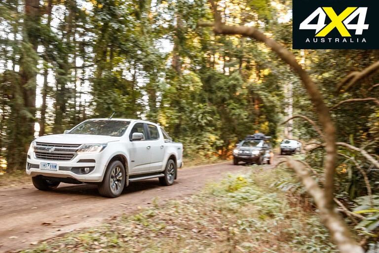
On our 32km drive through the park we saw many wallabies and even had potoroos scuttle away from our feet as we walked through the grass to gain a better view at the lookout. The park has only one camping area, and that is at Peacock Creek in the northern section of the park near Mt Brown.
Our route took us out of the park just south of there on Ironpot Creek Road and down across the front of the Toonumbar Dam wall, before reaching the hamlet of Afterlee and taking Coxs Road north into the Toonumbar NP, which joins with the Richmond Range park along its southern edge. That evening we threw down our swags at the rainforest-enclosed Iron Creek Camping Area.

16
A walking track nearby takes you to the creek proper, part of the upper catchment for the much bigger and easterly flowing Richmond River, the route passing through a mixture of wet sclerophyll and rainforest where the white trunks of flooded gums stand out in the gloom. Red cedar can be found here too, the very timber that was the impetus for the region being opened up in the 1830s. So valued was it, the tree and timber were called ‘red gold’.
This park, established in 1995, protects 14,910ha of rugged country around Iron Pot Creek, the Dome Mountain and includes the Murray Scrub, a rather derogatory sounding name for a large area of World Heritage-listed rainforest.
This region, some 23 million years ago, was a hot bed of volcanic and seismic activity which has resulted in the many abrupt, rugged and sheer-sided peaks dotting the landscape. Mt Warning is one, while Toonumbar’s Dome Mountain, Glassy Mountain and Edinburgh Castle, in the far west of the park, are others.
16
Our route north took us past the Murray Scrub Lookout with its fine views of the rainforest-clad valley across to the crest of Dome Mountain. Sadly, our time in these parks was rather short, but having hada taste of the rich lush region we’ll be coming back with plans to spend a lot more time exploring and savouring this unique area of Australia.
Passing through the pleasant town of Woodenbong we headed west to stop briefly at the small reserve around the 40-metre high Queen Mary Falls. The surrounding forest is, again, part of the Gondwana protected area, while the creek is in the very headwaters of the westward flowing Murray-Darling river system.
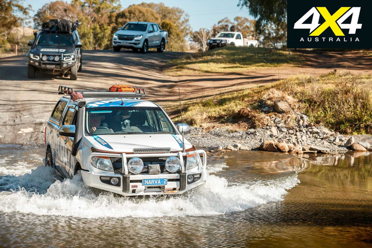
From the falls we took the Condamine River Road that follows the upper reaches of the Condamine River (another western bound stream) from just north of Killarney to meet with the more major Boonah-Rathdowney Road. Along the way the reasonable dirt road crosses the Condamine River in a few places; at times this road can be closed because of these crossings and high flood waters.
16
It’s an enjoyable drive with high red bluffs overlooking the stream in parts, but sadly there are few, if any, places to camp – unless you know one of the land owners, many of whom have put out ‘Trespassers prosecuted’ signs!
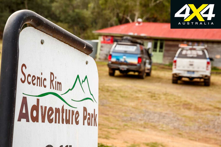
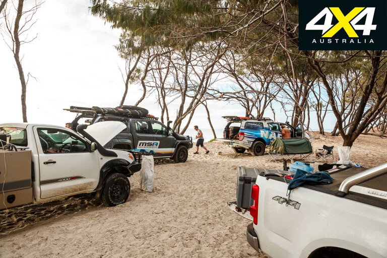
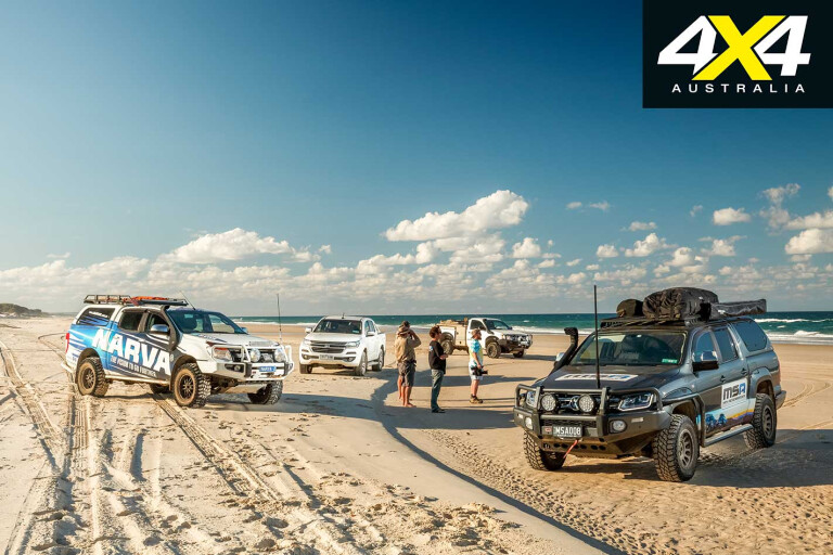
From Rathdowney we found our way to the Scenic Rim Adventure Park, one of the handful 4WD parks that dot the territory around the greater Brisbane area and which offer four-wheel drive tracks and bush camping.
The Scenic Rim Adventure Park contains about 30km of 4WD tracks to test your skill on – some are extreme – and over a dozen camping spots along with a couple of huts if you are looking for some rustic, bush accommodation. We enjoyed the next day here on a few of the trails and a couple of nights camped on the edge of the creek.
16
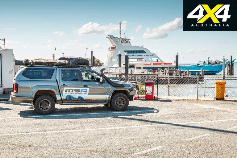
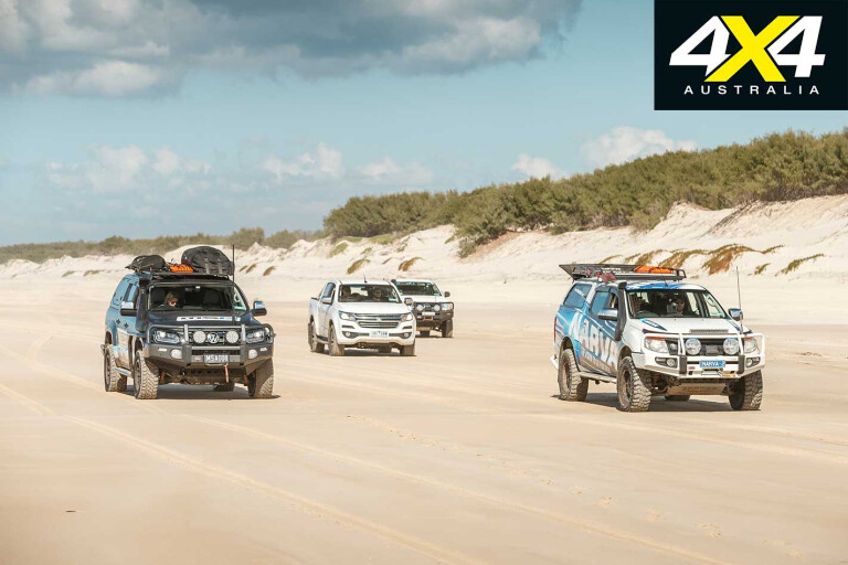
With a change of scene planned we found our way through the suburbs of Brisbane and to Cleveland where we caught the ferry to North Stradbroke Island, or ‘Straddie’, as it is affectionately known by the locals.
Once on the island at the small township of Dunwich and armed with our permits, available from the office near where the ferry lands, we headed over to Main Beach. We hit the white sands and turned south for a really enjoyable run to our chosen campsite near the southern end of the island.
The Quandamooka Aboriginal people have had a long association with the island and Moreton Bay stretching back generations, while European heritage dates back to just 1827 when the first British ship, the Rainbow entered Moreton Bay.
16
Captain Rous promptly named the island after his father, the Earl of Stradbroke, while Dunwich, now the island’s main settlement, was named after his brother. Don’t you just love it how those early British mariners named the places they deemed important enough to have a name?
Next day saw us cruising back up the beach, which was dotted every few kilometres with parked vehicles, their occupants standing close to their fishing rods, waiting and hoping for a tug on the line. Tailor are the most common adversary, but it is surprising what other fish come off the beach or the headland at Point Lookout – snapper, trevally, mulloway and even yellowfin tuna, wahoo and sailfish. No wonder Straddie is such a popular spot for the fishing folk!
We headed inland and took the 5km return walk to Blue Lake, which passes through wallum woodland, stunted eucalypts and flowering heath some of which were already in flower – it would be delightful and spectacular in spring.
16
The walk is a pretty easy one, passing a lookout platform before dropping to the shores of the lake. It is one of the two largest lakes on the island and has long been sacred to the local Aboriginal people where Dreamtime legend has it that it is the home of a giant carpet snake.
Back on the road we headed north to check out the small townships of Amity Point and then Point Lookout, making up the trifecta of towns on the island. Amongst the three you’ll be able to find everything you need to have a fabulous time on this island paradise. It lies so close and is so readily accessible from Brisbane that it makes for the perfect trip.
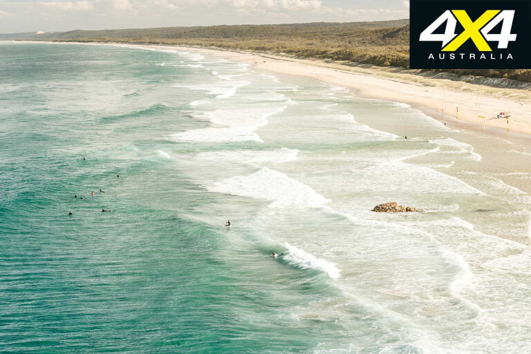
At Point Lookout we took the boardwalk around the headland that gives inspiring views of the coast – to the south is the long sweep of Main Beach while to the east the blue Pacific rises and falls to the beat of the tides and the south-east swells.
16
It is claimed proudly by the locals that within a few kilometres of the rocky headland 98 per cent of the whales that make the journey up the east coast of Australia from their feeding grounds in Antarctica to their breeding haunts in the sheltered waters of the Great Barrier Reef, pass this point.
And so it seemed to us; we saw a couple pass in just the hour or so we were on the headland, one coming within a couple of hundred metres from land, its path underwater easy to see by the oily slick it left behind, before it came to the surface to breathe. Over the course of the few days we were on the beach and taking note looking out to sea, we saw more than a dozen whales passing the island; there would have been many more.
16
Next day we met up with ‘Barefoot Dave’, a guide on the island who has been leading fishing, sand boarding, kayaking and whale watching trips for more than 18 years. As we headed off sand boarding to a spot he has exclusive access to amongst some steep dunes close to Point Lookout, he was indeed a happy man.
The group of young backpackers were mainly from Germany and Denmark, while a couple were from Canada. Us Aussies were outnumbered and I was certainly the oldie in the group, but nonetheless a lot of fun and an entertaining way to kill a few hours.
Instead of running the beach for the whole way south, this time we took a sandy 4WD track that cuts through the centre of the island from near Amity Point to the main road across the island meeting it near the Blue Lake carpark.
.jpg )
16
It’s an easy enough drive that sticks to the high ridge in the centre of the island, while occasionally offering views of Moreton Bay to the west. Although the thick forest of blue and scribbly gums, bloodwood, blackbutt, drooping sheoaks and cypress-pine all interspersed with a lower story of banksia trees, wattles and acacia blocks some of the expansive views.
Next morning, our last beach run took us back to Dunwich and the ferry back to the mainland and reality. I had never been to Straddie before, but it quickly won my heart. The white sand, the rolling surf, the great driving, diving and fishing, along with a host of other activities, ensures it won’t be long before I’ll be heading back again. It is magic!
16
Travel Planner
Mt Warning Rainforest Park: www.mtwarningrainforestpark.com/park-map
For the parks in NSW see: www.nationalparks.nsw.gov.au
For parks in Qld see: www.npsr.qld.gov.au/parks
Gondwana Rainforest World Heritage Area: www.environment.gov.au/heritage/places/world/gondwana
Scenic Rim Adventure Park: www.scenicrimadventurepark.com.au
North Stradbroke info/ferrries: www.stradbrokeferries.com.au
Camping and Vehicle Permits for Straddie: www.minjerribahcamping.com.au/plan-your-stay/4wding/4wd-access
Fishing, sand boarding (& more) tours: www.straddiekingfishertours.com.au
Please enable JavaScript to view the comments powered by Disqus.
COMMENTS