Explore SA
Gallery12
OUR Holden Colorado isn’t quite the DeLorean, but it felt like it was flying as we navigated some of the most extreme tracks that at times left us airborne. “The trick is not to stop” we’d been advised.
We were in the middle of Big Desert National Park, having crossed Wyperfield National Park the day before. It was the Easter long weekend and our trip of highs and lows had seen us traverse sand dunes both in Victoria and South Australia. Now we were on the home stretch and we’d hit the mother of all dunes.
12
We’d tackled numerous sand dunes over the past two days, slow and steady, but this one appeared particularly challenging. With a sheer climb and no clue what was on the other side, we powered up in low range, but, at the very top, the track turned and converged into three directions. Hesitating for just a second in deciding which track to take was our mistake, as we lost momentum on the soft sand and the wheels stopped. The Colorado was stuck.
We’d left our Jayco Outback van at home for this trip and strapped a new deluxe Kings swag on top of the car. “No vans on this trip mate” we’d been adamantly told. Arriving at Green Lake in Ararat the day before, we became vehicle number 13 in the Werribee Four Wheel Drive tagalong convoy heading towards Wyperfield National Park, the Big Desert and ultimately the Border Track. As we were to find out, travelling in a group is the best way to tackle this wilderness area.
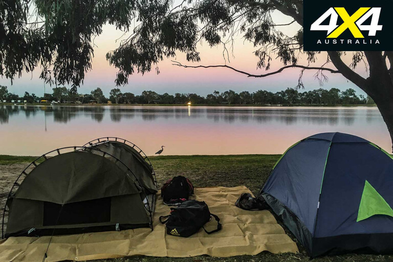
A further two-hour drive saw us at Lake Lascelles, the gateway into the Mallee country, where our swags were rolled out for the first time. With barbecues, toilets, a boat ramp, green lawn and free unpowered sites, it’s a hidden gem in the area. That night our group enjoyed a leisurely dinner at the nearby Hopetoun Pub, a good thing as the following night it wouldn’t be so clean and easy.
12
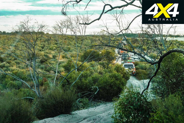
The next morning it was time to set off for two days of playing tagalong, crossing sandhills and marking corners. This is vast territory and, with so many vehicles, it was important to have radio contact so no one got left behind.
Wyperfield National Park has a fascinating geological history. It’s incredible to think that 25 million years ago this area was a shallow sea; today it contains a series of lakes linked by Outlet Creek, which are usually dry and fill up only when the Wimmera River floods.
After heavy rain this arid region is transformed, with tiny desert plants sprouting to cover the ground with clusters of bright native flowers. When we visited it was warm and dry and tyre pressures were promptly reduced in readiness for the sandy terrain.
12
Our first stop was Snowdrift Camping area at the end of Snowdrift Track, a popular spot for day-trippers. Snowdrift is home to one of the largest sand dunes in the area and a natural playground for those who want to climb it. From there we continued into the park, with our goal to reach the Billy Bore Campground before nightfall.
MORE4x4 Explore
Milmed Road Track is graded as ‘medium’ and provided moments of exhilaration tinged with more sedate sections. While many in the group had little difficulty navigating the dunes, some drivers needed repeated attempts. We discovered it was often a matter of reversing and giving it a bit more momentum – the unspoken motto of the weekend was “if at first you don’t succeed try and try again”.
12
The track is 80km long and very remote; in the middle of summer there are few cars travelling the track and the soft sand can be deep, so if you break down out here and you’re on your own, you could be in for a long wait. Alternatively, in winter and after rain, the clay track can be impassable.
We were in low range for much of the Milmed Track, and it was a slow-going but easy pace. It felt a long way from anywhere and that sense of peace and isolation was palpable, as it was at Wonga Campground, our stop for lunch on the second day.
With a few stops during the afternoon it looked as though we wouldn’t reach Billy Bore before nightfall. Driving conditions were slow, and in such a vast wilderness it’s always advisable to pitch camp early, so I was relieved when we reached our changed destination of Round Swamp Campground before dark.
12
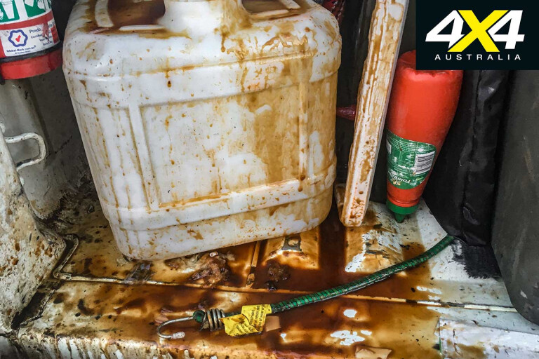
We chose our patch of turf and, despite the presence of bees, all was going well. That was until I opened the fridge in the back of the Colorado and was greeted with the most unappetising mixture of ingredients imaginable. Raspberry jam had slopped in with the sweet potato dip and spread through everything in our fridge. Combined with a rogue upturned bottle of barbecue sauce, the concoction looked like the regurgitated after-effects from a hard night on the booze.
The bees thought the succulent spills was their dinner, and dozens of the buggers buzzed around me. Still, after a clean-up, dinner cooked over the fire and a few well-earned drinks, all was well. It taught us a lesson: thoroughly secure food contents and leave the jam at home.
12
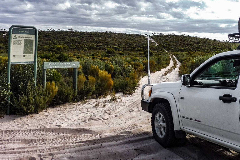
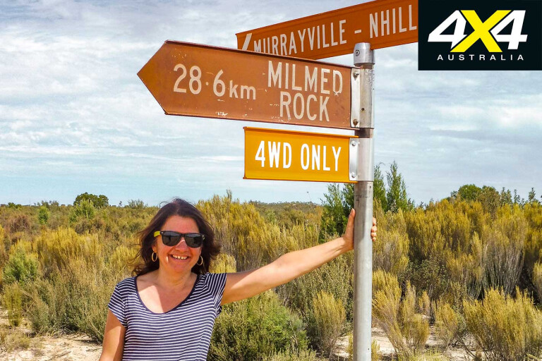
The next day saw us reach the end of Milmed Track, turn onto the Murrayville-Nhill Road and head back into Underbool. Here, we were able to check into civilisation with a spot of service and a refuel before once again hitting the dirt. Finally, we were on the Border Track.
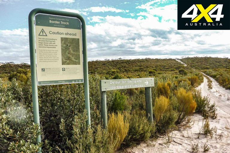
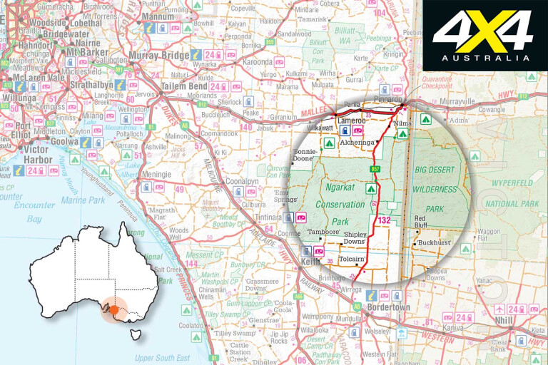
As its name suggests, the Border Track follows more than 50km of the fence line marking the boundary between Victoria and South Australia. While this track is comparatively short compared to other tracks around Australia, it presents a helluva challenge for those who like to test their off-road skills.
We began the track entering the South Australian Ngarkat Conservation Park, which covers 270,000 pristine hectares of flat, sandy landscape, covered with a cloak of olive-green scrub. This track has been described as ‘legendary’ with its beautiful landscape and challenging driving conditions and, as we were to discover, with many dunes still to traverse, it would more than live up to expectations.
12
With a track classification of ‘difficult’, it felt comforting to be part of a convoy. Twenty-nine kilometres of the track from the south to the north is one-way only, partly to protect the sand dunes, track surface and vegetation and, quite likely, to avoid the possibility of collision between oncoming vehicles.
There are sections where the track is narrow, so don’t expect to go much faster than 20km/h, as it twists and turns through sand hills and blind corners. It’s bumpy going and slow, but incredibly peaceful.
Along the way the imposing Hensley Trig, the highest point in the park, provides a challenging hill climb. After a couple of unsuccessful attempts, we ended up taking the “chicken track”. Pride was no longer a factor at this point and, standing at the top after we’d made it up, we were treated to expansive views. There’s even a spot of patchy phone coverage there.

12
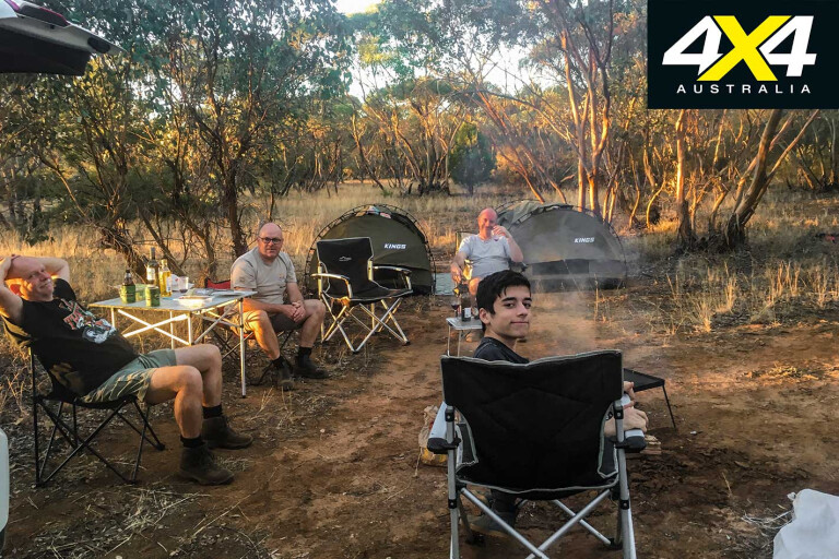
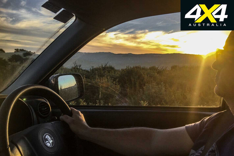
Hours later, right on dusk, we reached Red Bluff Campground; a dusty, dirty and motley crew, relieved to finally pitch camp. Swags and tents were set up amid a spectacular sunset and a backdrop of cliffs that glowed red in the last golden rays of the sun. Drinks and dinner were enjoyed around the fire before a night of music and doing the Nutbush had us falling into our swags with tiredness.
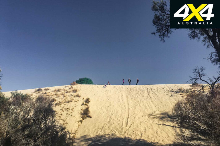
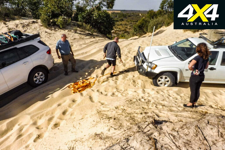
We woke to a crisp morning and the welcome thought of a homecoming shower that night, thinking the most challenging driving was behind us. However, just 20 minutes from Red Bluff campground we came to the mother of all sand dunes. With two tracks to choose from we decided on the right-hand one; however, at the top the track turned and multiple tracks converged.
MOREDriving on Sand
Hesitating, unsure which direction we should take we lost momentum. It was only for a second, but that was all it took. There was no going backwards or forwards. Our rig was stuck. Fortunately, even though most of the convoy had dispersed, we still had two vehicles with us and, finally, after securing the snatch strap correctly, we were hauled out.
12
Getting bogged wasn’t the only heart-stopping moment. The day before I thought I’d lost my husband’s phone deep in the sand dunes – they were the longest five minutes of the trip. Then, through all the turbulent bouncing on the tracks, our mate Greg had the roof rack, complete with two swags, unceremoniously tumble from the top of his MU-X. It was all-hands-on-deck as tools came out and we helped him secure the rack back on top.
Thrills, spills and mishaps are part of any off-road adventure, but being part of a large convoy means there’ll always be someone behind you to help. Going outback and tackling the Border Track will undoubtedly test your driving skills, but it will also leave you with indelible memories.
12
Travel Planner
WHERE
Wyperfield National Park is approximately 450km north-west of Melbourne reached via the Western Highway at Dimboola, via Sunraysia Highway through Patchewollock to Pine Plains. It can be also reached by Hopetoun on the Henty Highway or via Underbool on the Mallee Highway.
12
CAMPING
Lake Lascelles: Hopetoun, Victoria. Free camping, amenities block, barbecue, fixed fireplaces, pet-friendly and water taps.
Wyperfield National Park has free camping at Casuarina, Round Swamp, Milmed Swamp and the Snowdrift, each with pit toilets, tables and fire pits.
There are five campsites located just outside Big Desert Wilderness Area, all accessed along the Murrayville-Nhill Track: Big Billy Camping Area, The Springs Camping Area, Moonlight Tank Camping Area, Broken Bucket Camping Area and Red Bluff Camping area, accessed via Border Track or Bluff Track, 4WD only.
SUPPLIES
It is strongly advised to carry your own recovery gear, rated straps, shackles, long-handled shovel, tyre deflator and compressor. Bring enough food and water to be self-sufficient for the duration of your stay. Campgrounds have long-drop toilets. Firewood can be hard to come by in this region, so it’s advised to bring a bag of wood.
WHEN TO TRAVEL
The best time to visit is the cooler months of April through to October. Summer is not recommended because of sandy tracks, high temperatures and risk of fire.
CONTACTS
SA Department for Environment and Heritage, Lameroo, SA
Phone: (08) 8576 3690
Web: environment.sa.gov.au
Please enable JavaScript to view the comments powered by Disqus.
COMMENTS