Explore VIC
Gallery68
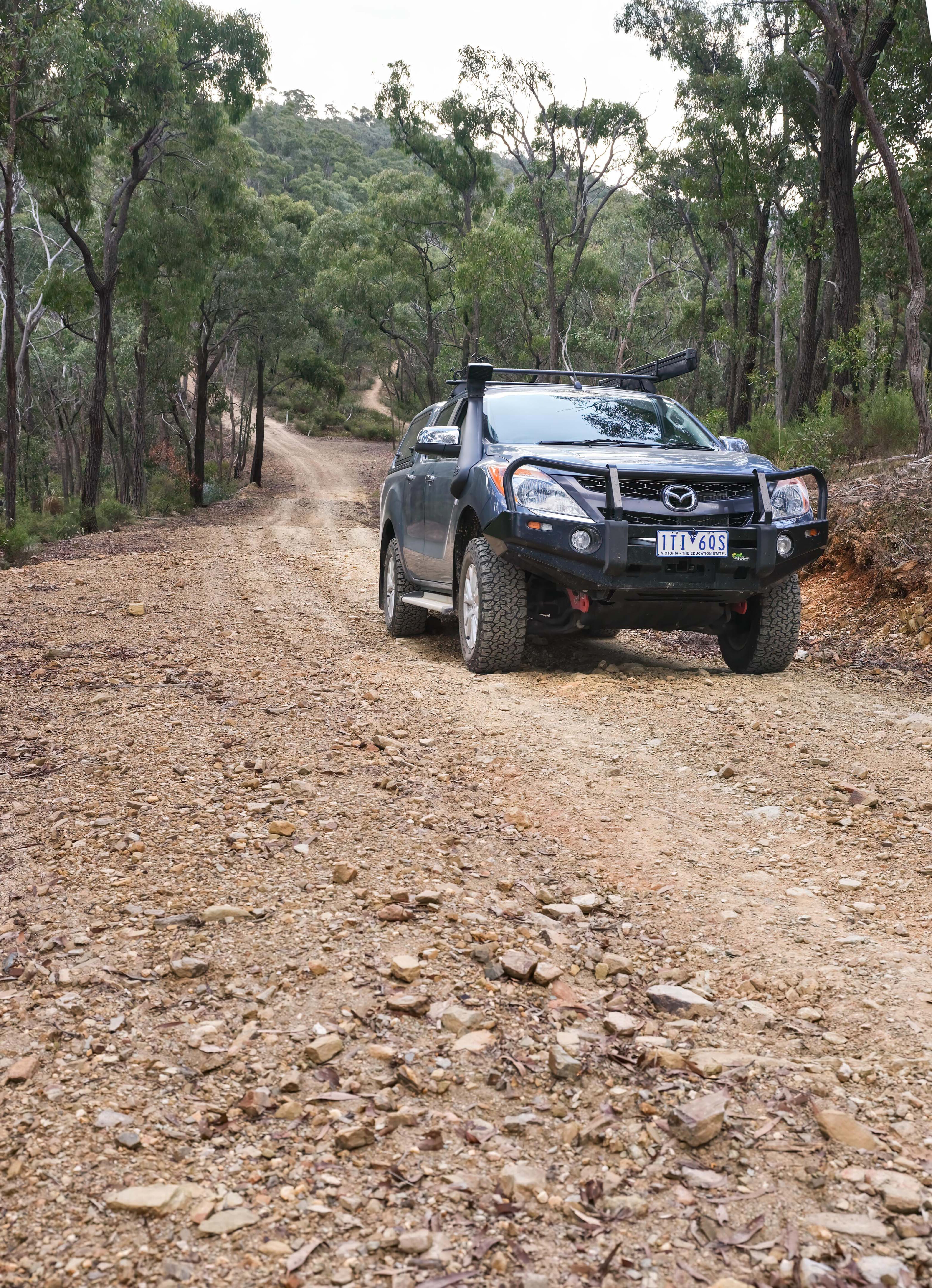
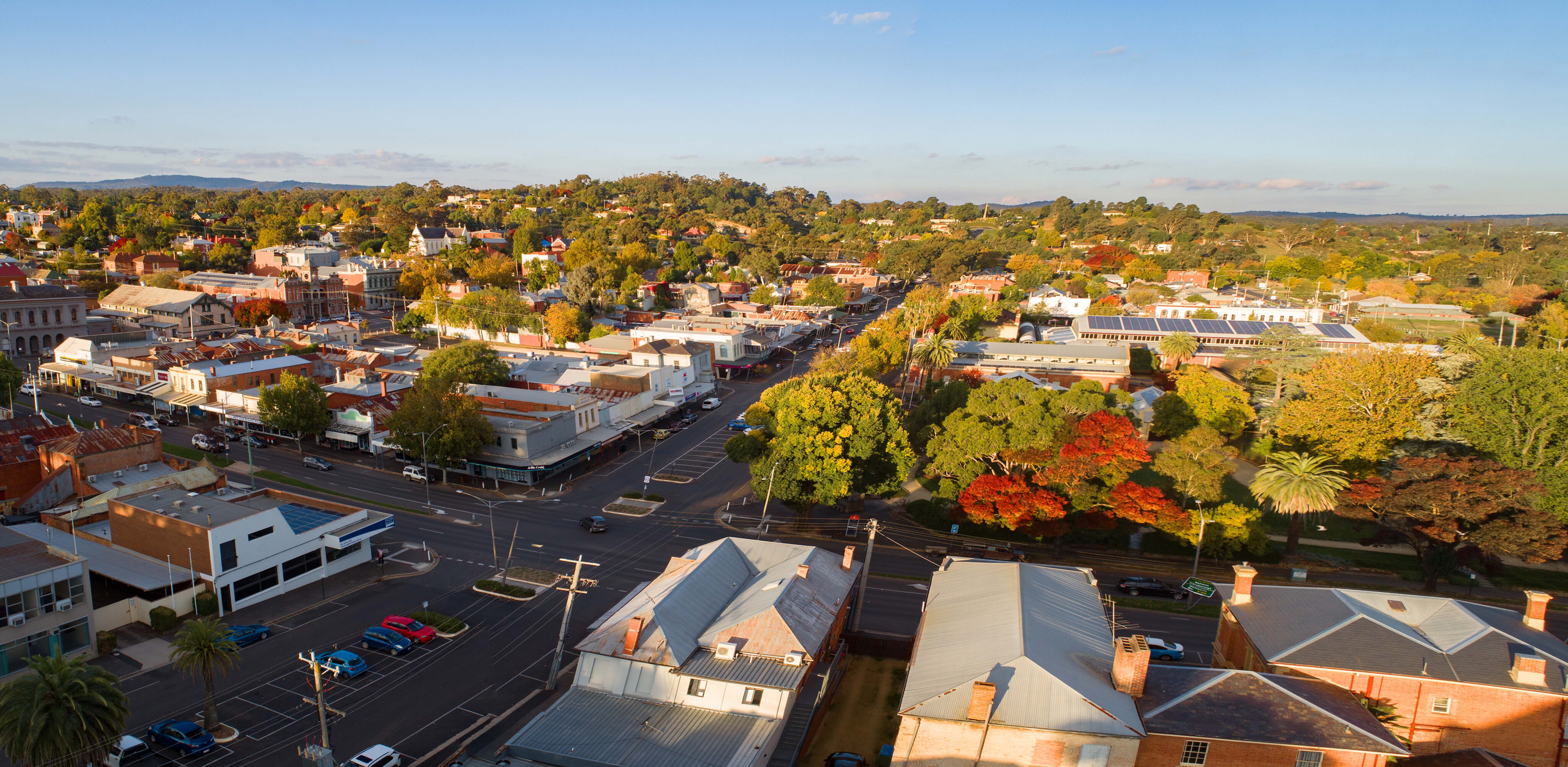
Just 90 minutes from Melbourne, the Central Victorian town of Castlemaine oozes gold rush era history wherever you look. There’s also plenty of fun to be had camping and exploring the many 4x4 tracks that criss-cross the nearby state forests.
In the 1850s, when the wider Castlemaine area was collectively known as Forest Creek, gold discovered here fuelled the start of Victoria’s historic gold rush.
Forest Creek was one of the richest shallow alluvial goldfields in the world and, along with the surrounding area, was responsible for producing some of the largest nuggets ever unearthed, including the world’s largest, the Welcome Stranger, which was found just 30mm beneath the earth at the base of a tree.
68
Since 1851 the area has produced over 1500 tons of gold (about $1.5b in today’s money) although that is likely a gross underestimate given poor record keeping and undisclosed finds.
Geological estimates suggest that only 11 per cent of the available gold has been extracted – which is no doubt why fossickers still comb the old diggings. Early in 2023 one lucky soul turned up a 2.6kg nugget estimated to be worth $240,000.
68
Easy drive
While the major forest roads and tracks in the area don’t strictly require four-wheel drive in dry conditions, there are numerous minor tracks to challenge 4x4 enthusiasts.
Victoria’s Department of Environment, Land Water & Planning (DELWP) promotes a four-hour, 100km 4x4 drive in the Wombat State Forest, starting in the east from near Gisborne and finishing near Daylesford. When we checked out this drive it was largely on good gravel roads that had just been graded, so the emphasis was more on drive than four-wheel drive. That said, the trip passes through some great forest scenery and incorporates the rough, narrow and definitely 4x4 Rat Hole Track that runs past the site of an old mine.
Anyone wanting the full 4x4 experience would need to spend time exploring the myriad forest tracks, but if just looking for a pleasant day drive on your way to explore the attractions of the old gold diggings, the Wombat SF is a good place to start.
68
Near the drive’s western exit onto the Ballan Daylesford Road, the Werribee River picnic area with its tables and firepits offers a quiet rest stop.
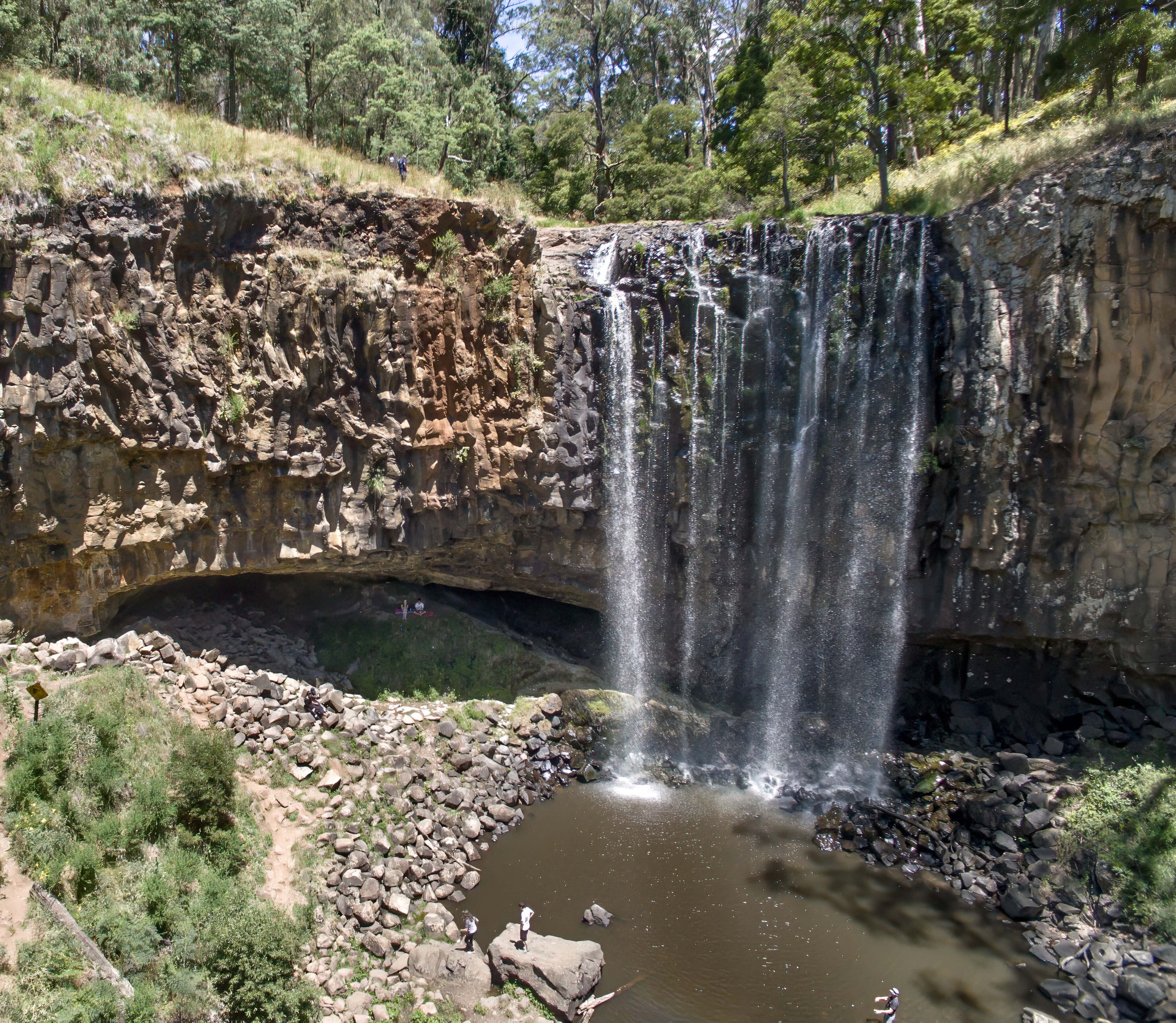
Near Daylesford you can stretch your legs at Sailors Falls. These are best seen after rain as they can be a no-show at dry times of the year, but otherwise make sure to take your camera as the picturesque waterfall plunges 20m into rock pools at the base of a deep fern-lined gully. If there has been rain recently, nearby Trentham Falls and Loddon Falls (where the latter drops dramatically over a wall of basalt columns) are also worth adding to your itinerary.
For the Bear Grylls enthusiasts who like to camp out under the stars and enjoy a burnt snag with a beer or three around the campfire, free camping opportunities in the state forests around Castlemaine are endless. Those who don’t revel in sleeping under canvas after a day touring the tracks might consider swapping the snag (and the swag) for something more upmarket, such as a pub meal and live music in Castlemaine.
68
Once thriving towns
From the Wombat SF, Castlemaine is 30 minutes further north and can be reached by the Midland Highway or via Vaughan Springs, using secondary roads and tracks in and around the 7500ha Castlemaine Diggings National Heritage Park.
Vaughan Springs, spawned in the 1850s gold rush, at one point boasted a population of 40,000. Many were Chinese, working in the mines as well as planting market gardens. While the intervening 170 years has seen the town’s population fall to double digits, and most signs of early settlement erased, the town’s shady picnic area on the banks of the Loddon River remains an attractive place to take a break.
While here, make sure to visit the Chinese cemetery and sample some water from the mineral springs. And, for the more energetic, a footbridge over the river is part of the 210km Goldfields Track that takes walkers and mountain bikers from Ballarat to Bendigo.
68
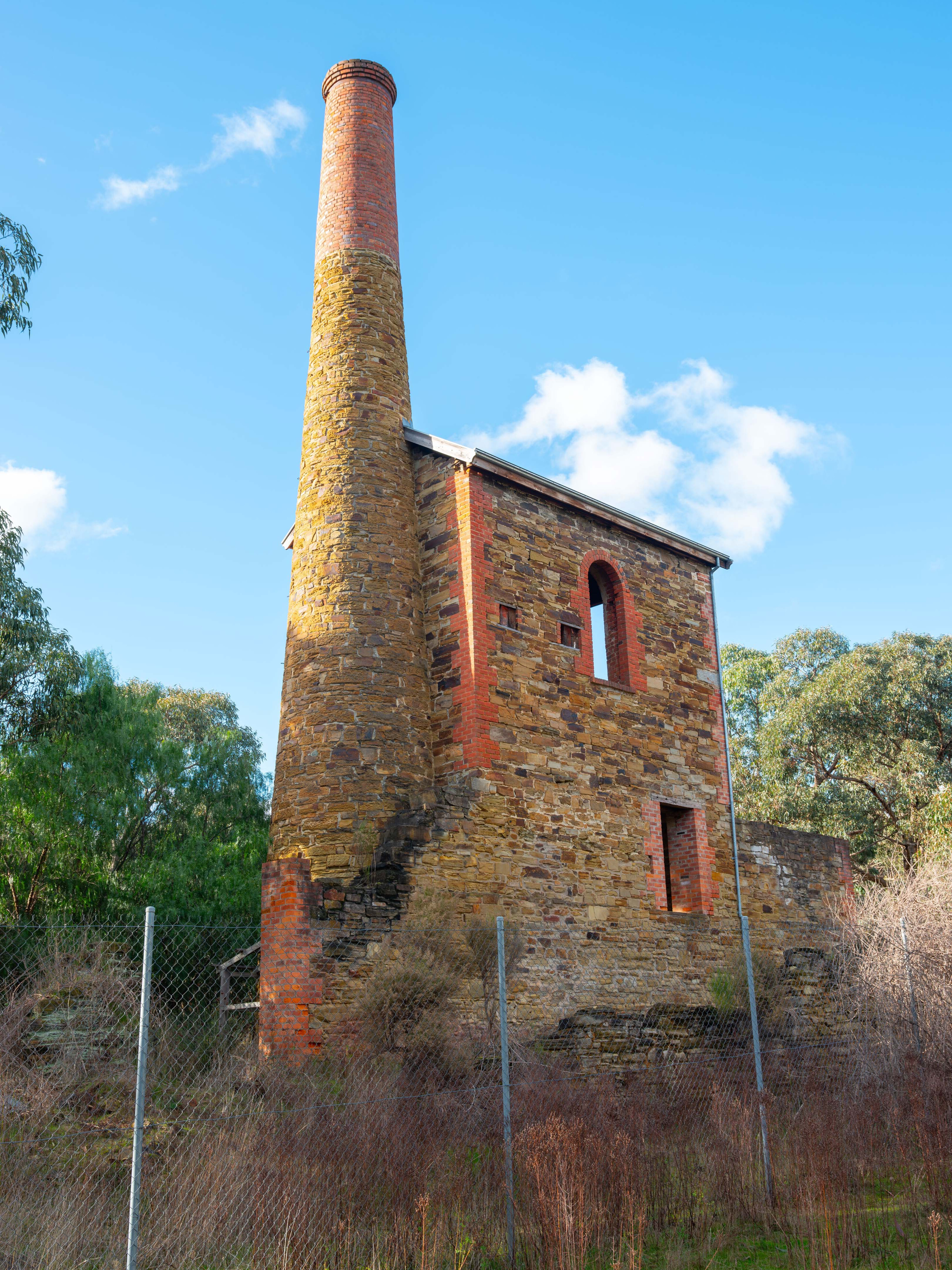
Nearby Fryerstown is another old gold mining settlement where the imposing ruins of the 1865 Duke of Cornwall mine engine house can be seen alongside the main road to Chewton.
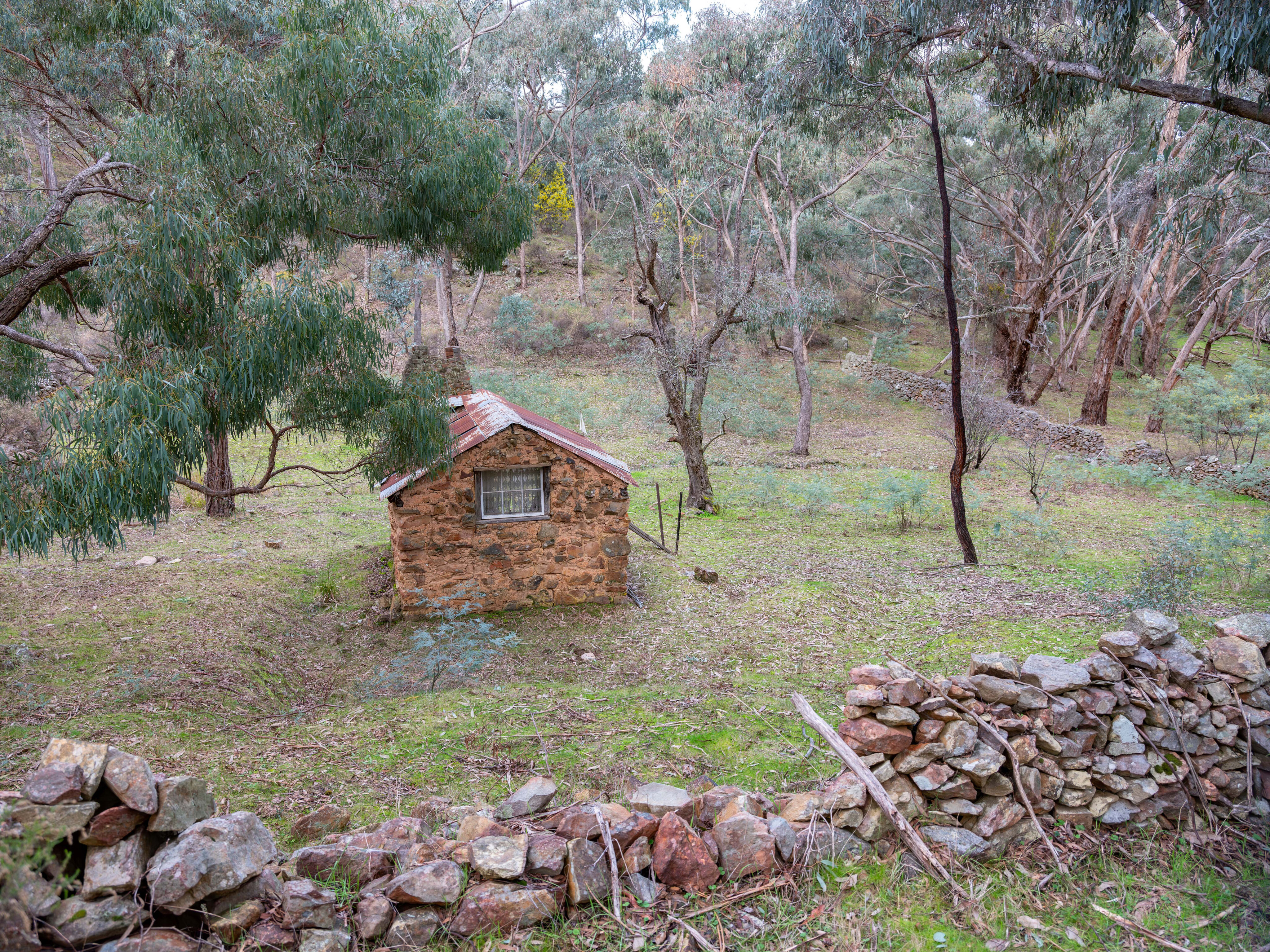
For those into a short walk, turn into Crocodile Reservoir Road and stop at the siding 50m or so from the corner. Follow the (poorly) marked foot track across Golden Gully (yet another rich goldfield) for a few hundred metres to find a small hut sitting in a clearing bounded by a stone wall.
Dating from the mid-1800s this quaint shepherd’s hut, despite showing the ravages of time, is remarkably intact, even down to an old bed frame.
68
The track from the hut continues north through what was Herons Reef for about 2km, passing numerous signs of old mining activity until reaching the Fryerstown Chewton Road.
You might want to keep your eyes on the ground as you walk – you never know your luck. Herons Reef produced the largest nugget (28kg) ever found on the Forest Creek diggings.
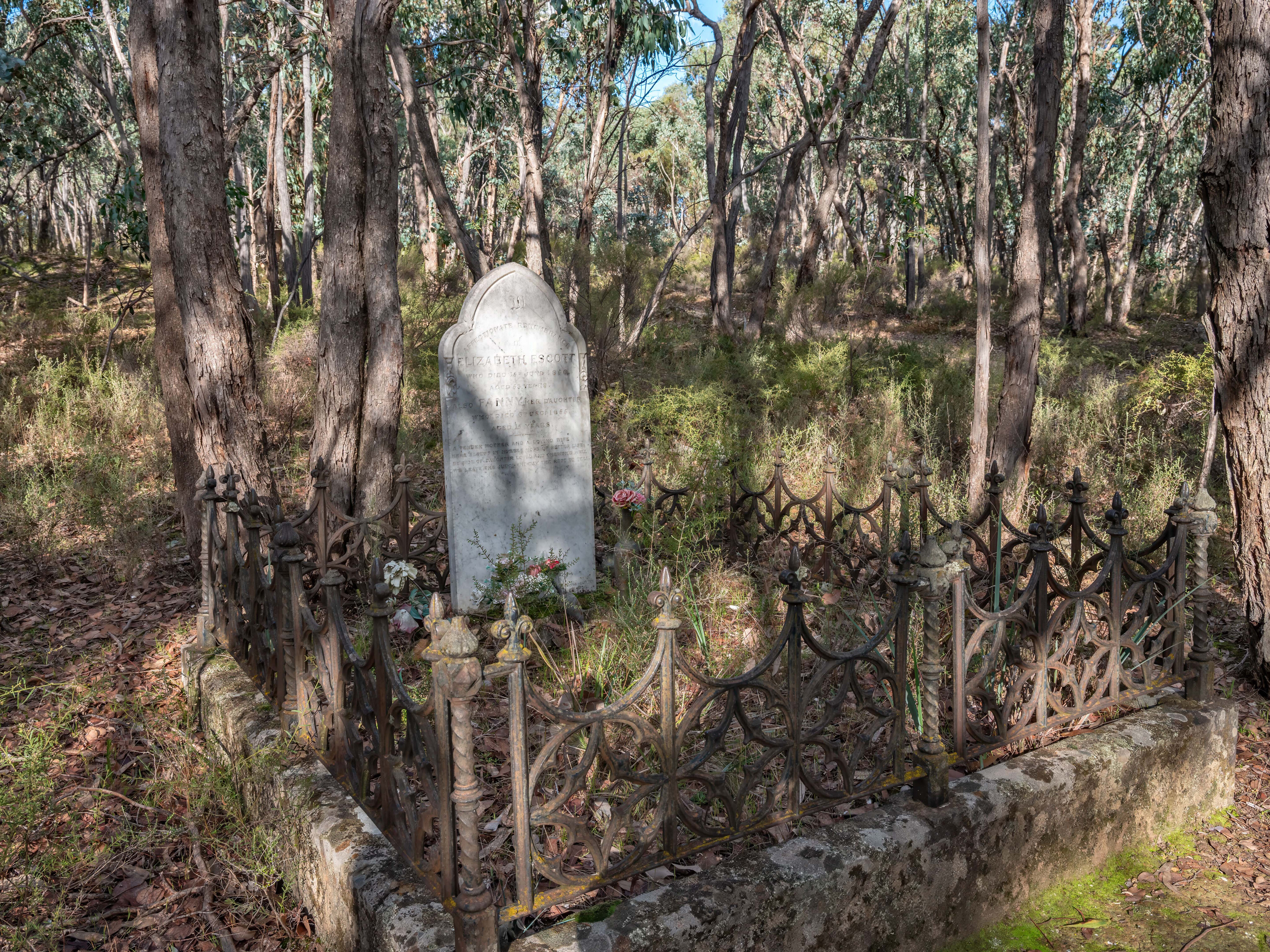
A little further along the Chewton road a short detour up Evenmore Track brings you to a remote grave site. The goldfields attracted some female diggers, including Elizabeth Escott who left England with her 11 children after her husband died. Life on the diggings was hard and Elizabeth and two of her daughters are buried in this lonely grave after passing away in 1855.
68
A changed landscape
It is difficult to visualise how this now densely forested area was once a potholed, treeless landscape where almost every square metre of ground had been turned over in search of the precious metal.
The strange names borne by many of the tracks and gullies were often based on people who lived and worked there, like Dirty Dick, or notable events, like Murdering Flats, Deadman’s Gully etc. Many were named for their success or otherwise, such as Poverty Hill or Nuggety Flat. In some cases, such as Poverty Gully, a rich strike might be given a name that would hopefully deter other prospectors.
Off Jacobs Track, just north of the Escott Grave, is Eureka Reef. Originally a huge outcrop of white quartz some 20m wide and as high as the treetops, the reef produced 175kg of gold over seven years from 1855. As the early miners followed the reef they left behind the long narrow gully that snakes over the hillside.
68
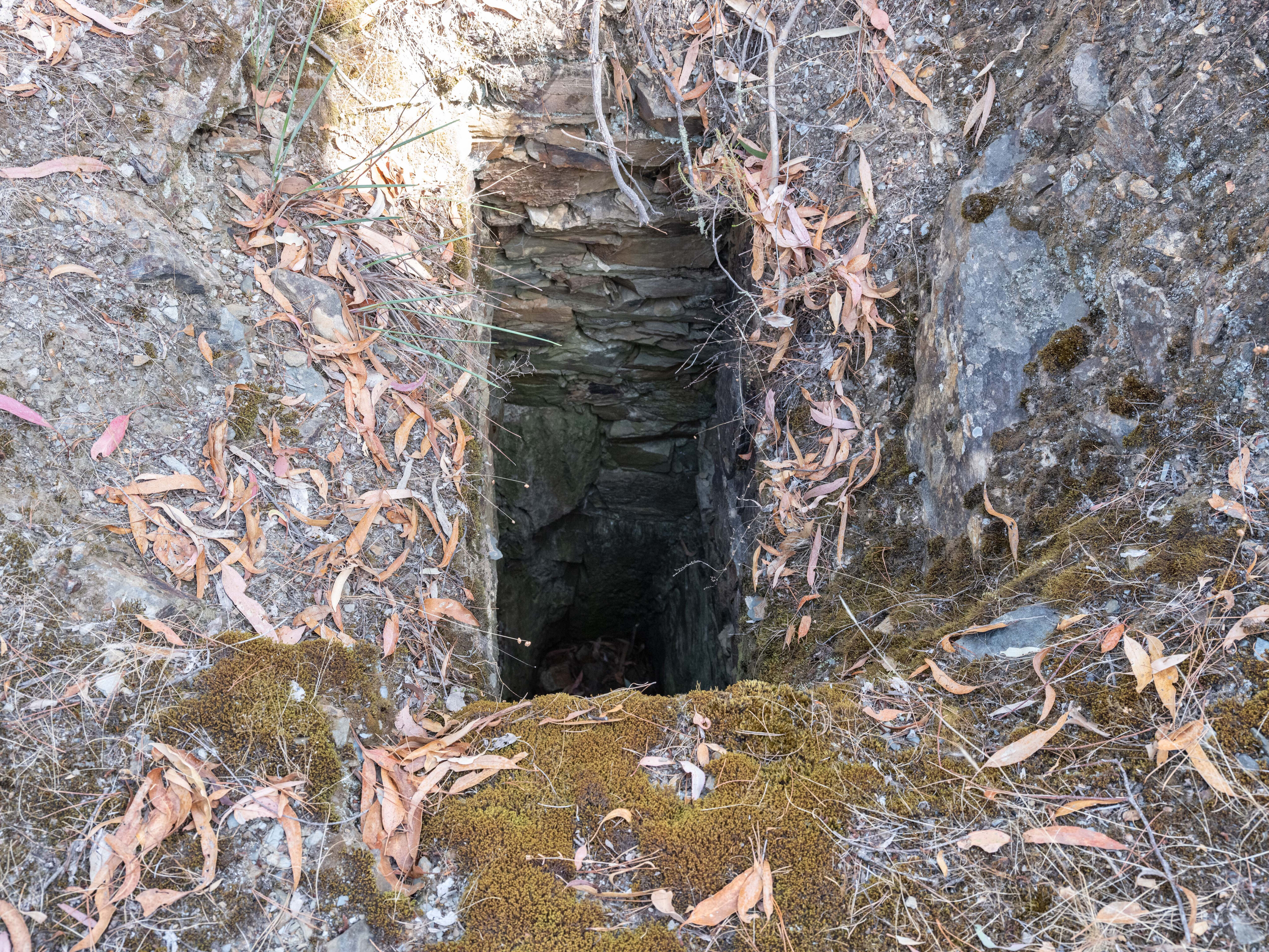
A 150m deep mine subsequently operated here until the 1950s. Its main shaft near the carpark is capped by a concrete slab with a small central hole; you can drop a stone down and listen for it to hit bottom.
It can be a bit unsettling to realise the (relatively) thin layer of concrete is the only thing between you and eternity.
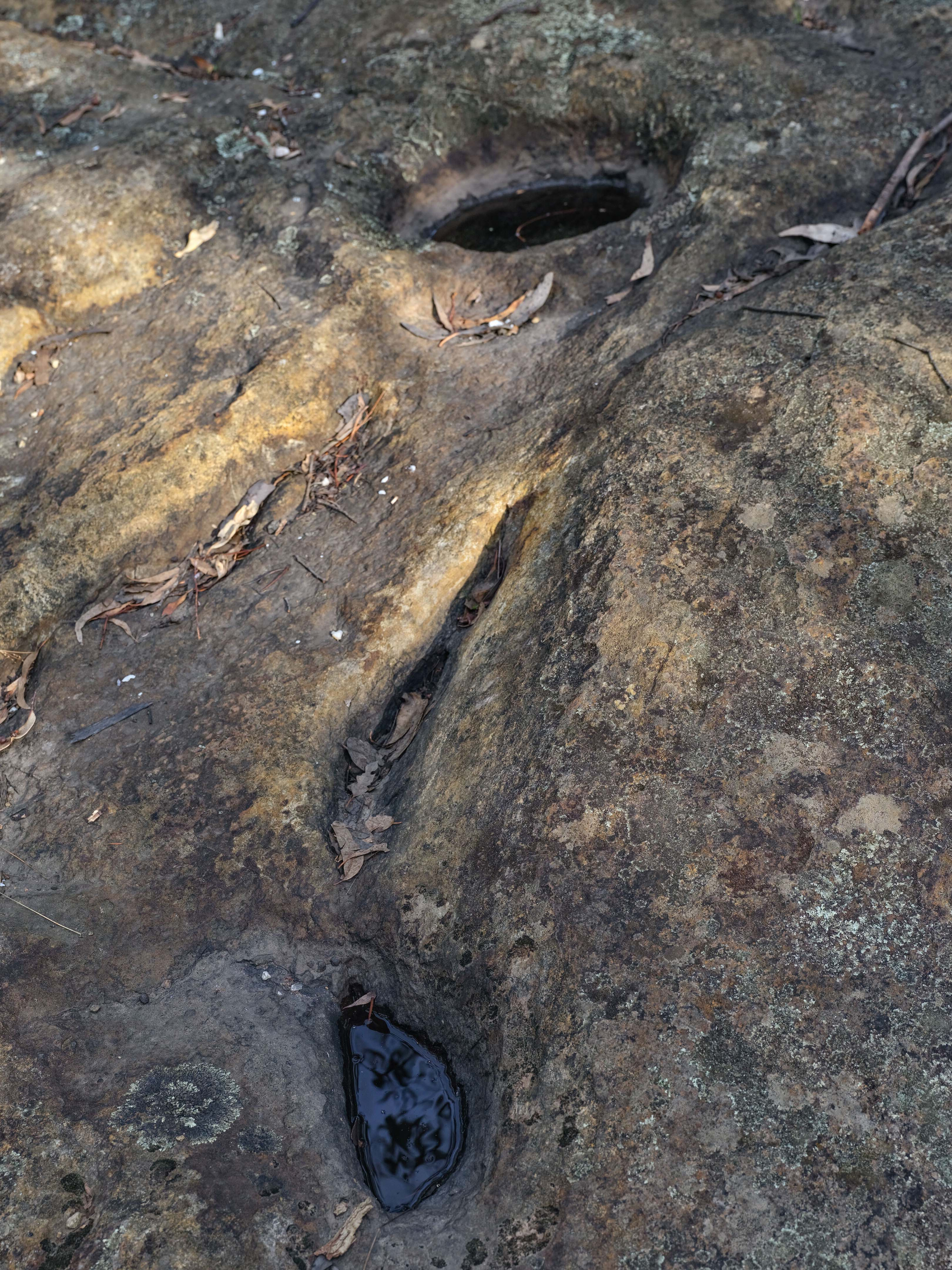
The reef has a 2km walking track with a guide that can be downloaded from the internet. Along the walk, as well as remnants of mining activities there is a reminder of earlier aboriginal connections to this land in the form of rock pools made to trap and hold rainwater.
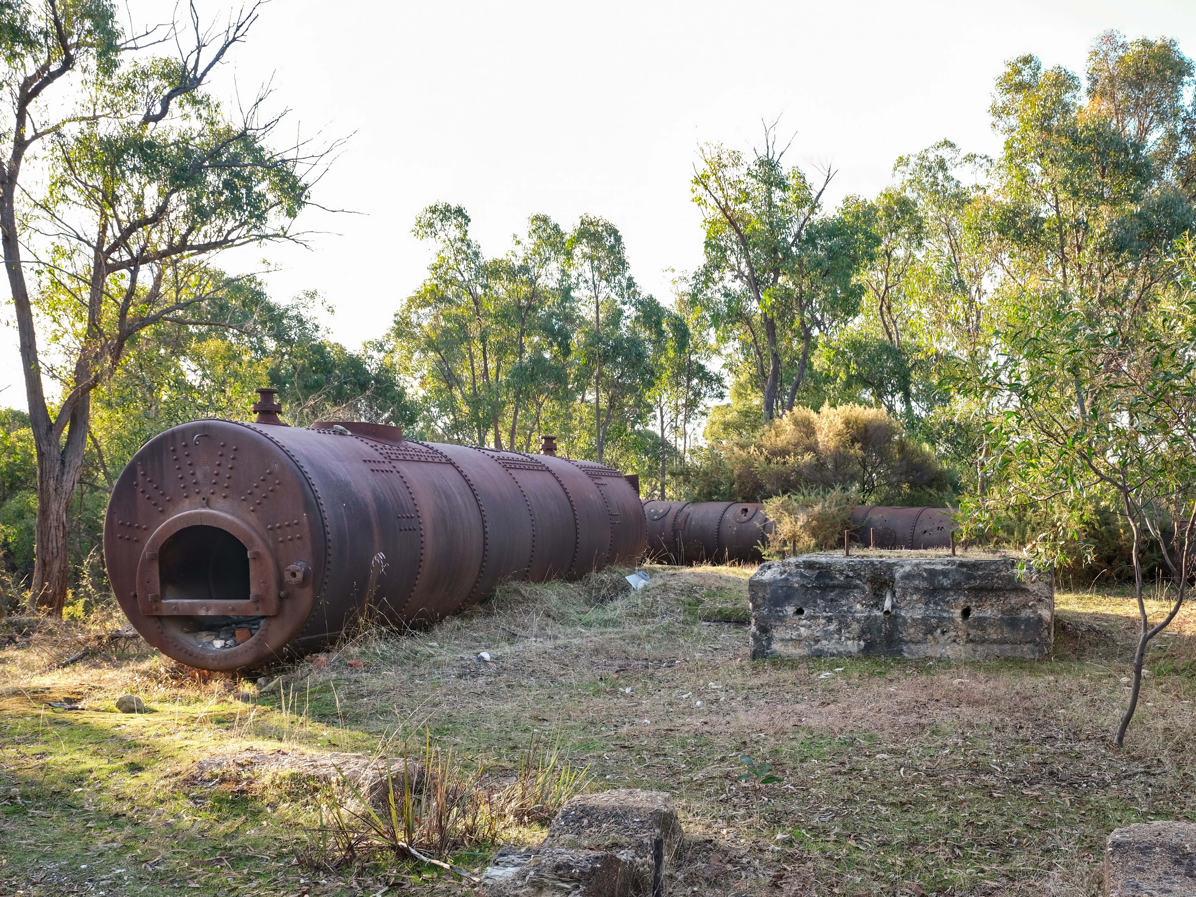
A scenic route from Eureka Reef to Castlemaine is via the 4x4 Poverty Gully Track, which passes numerous signs of old mining activity including an old boiler hidden amongst the bushes on a hilltop.
68
Resting Place
Accidents and a lack of clean water were a common source of death on the goldfields with many victims being young children. The children’s cemetery at Pennyweight Flat near Chewton is the resting place of some 200 children who died in just six years between 1851 and 1857.
It earned its name because it was said you would need to work the ground all day to find just a pennyweight (1.5g) of gold. Being one of the few places not mined for this reason, the site was chosen as a cemetery because the graves were less likely to be desecrated.
Given the close proximity to the diggings and the rocky ground preventing graves being much more than a mound of rocks, the stench from the cemetery led to its closure. Despite its macabre history, a walk around the cemetery today is a poignant experience.
68
Few could afford headstones and many graves had nothing more than a child’s name roughly chiselled into a flat rock set upright in the ground.
The Wattle Gully mine at Chewton operated from 1853 to around 2010 and produced 1300kg of gold (about $130m in today’s money). In the 1930s drilling below the shallow mines of the prior century indicated a large gold deposit, but when a shaft was sunk nothing was found.
Investigations showed the shaft was in the wrong location because the drill had been deflected off course by a hard layer of rock, and when they dug to the correct location, there was the gold. Had the drill not been accidentally deflected it is likely the deposit would never have been found.
68
A colourful town
Castlemaine is anecdotally considered God’s Waiting Room for many retired Melbournians who have cashed in their city homes for a more relaxed country lifestyle – an argument supported by a sea of greying hair that predominates in the town’s streets.
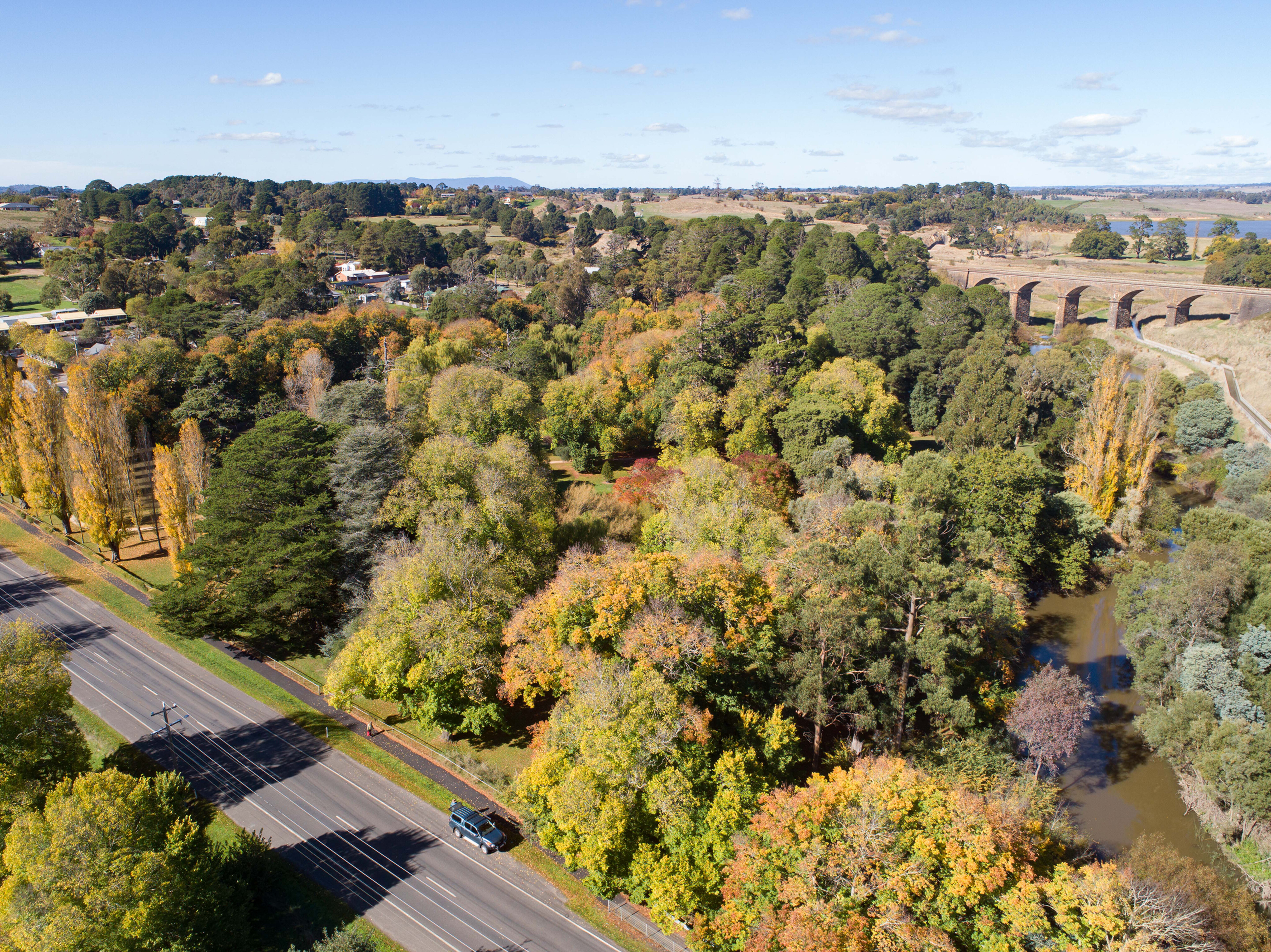
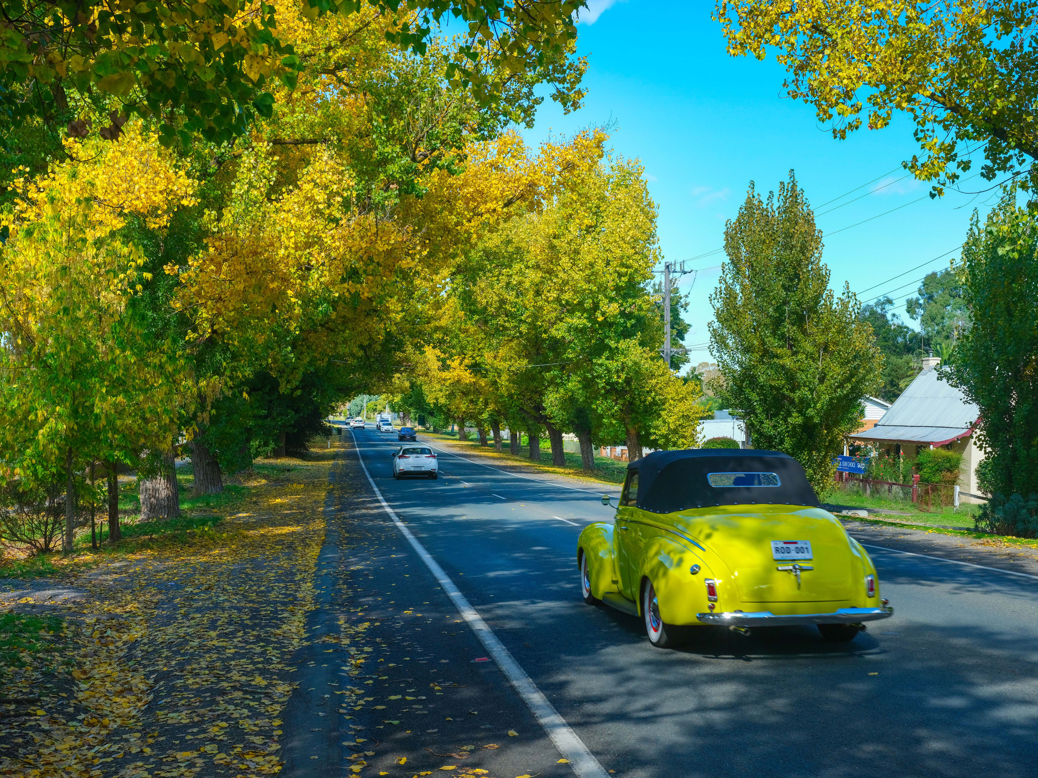
Wherever you look there are charming historic buildings dating from the gold rush era and as the early settlers planted many European trees to remind them of home, the town is a kaleidoscope of colour in Autumn.
There is an active art scene with a number of venues offering live music from a range of genres. At the local theatre, which dates from the 1850s, you can watch the big screen from comfy settees.
68
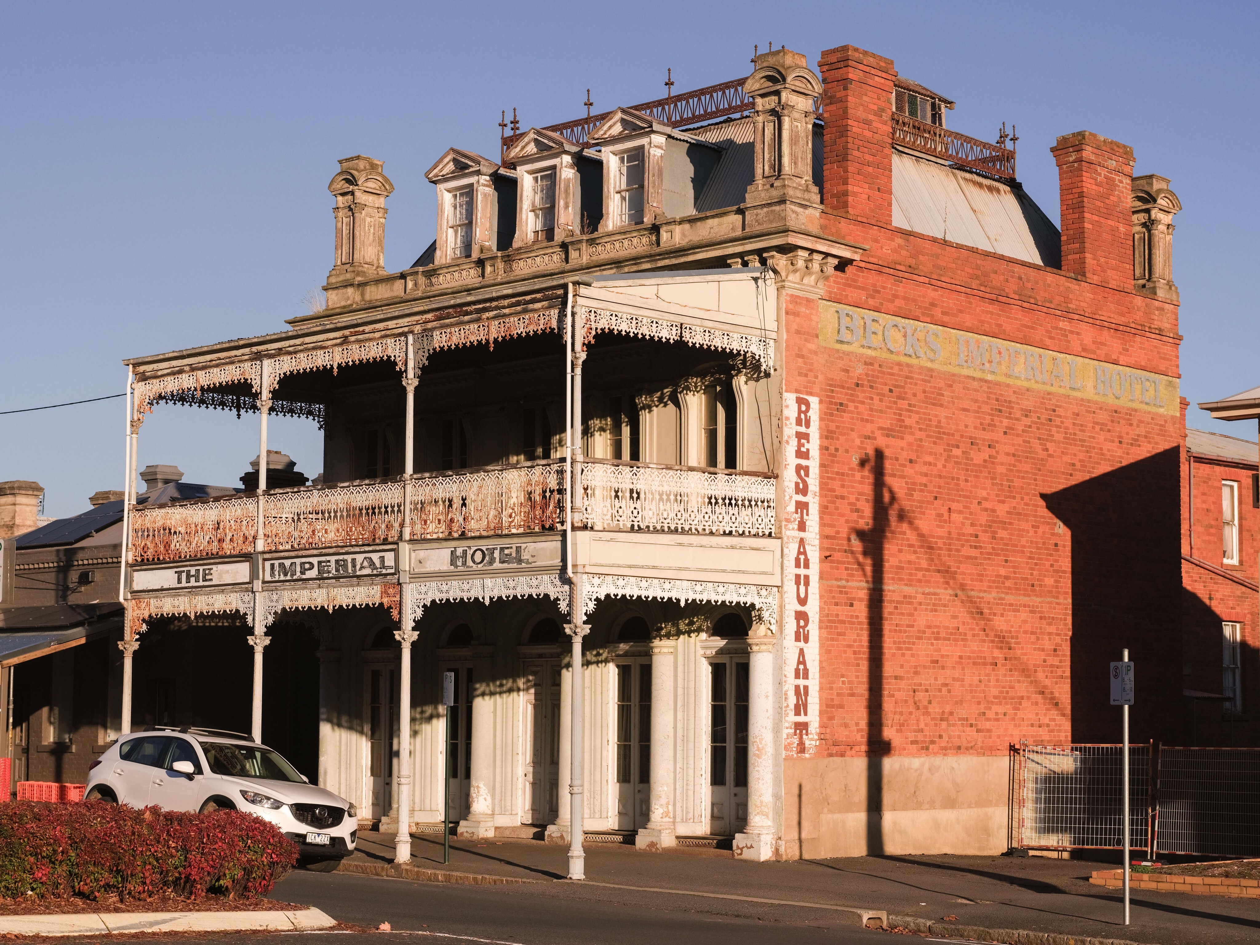
Finding a meal isn’t a problem given a good range of hotels, cafes and takeaways, or for something more upmarket try Wild or the Bar Midland restaurants.
The Railway Hotel and Bridge Hotel are popular watering holes, as is the Red Hill Hotel in Chewton. The latter’s cellar has been used as a lockup, morgue and for gold storage at various times.
If you do drop into the Red Hill Hotel for an ale, be sure to wander down the road to see the transportable police lockup used during the goldrush.
68
Gold diggers
Men from all walks of life came from Melbourne and Adelaide to try their luck – so many in fact that the cities became short of labour and the government feared economic collapse.
It has been said that most of the male population of Adelaide set out for the goldfields when their discovery was announced, and by 1852 (when Melbourne only had a population of 77,000) some 50,000 people were seeking their fortunes at Forest Creek.
Some of the stories from the gold rush seem too good to be true. In a short 10 years the goldfields around Castlemaine yielded roughly 100 tons of bullion worth a staggering $10b today. One short gully at Golden Point yielded a ton of gold. In nearby Chewton an 8.5kg nugget was found while another prospector dug a hole a few feet deep to find 17kg of gold ($1.6m today).
68
Then there is the story of two young men without any experience who came to the area to start digging in an abandoned claim and almost immediately find a 30kg nugget.
Showing just how fickle the luck of the diggers was, the nugget showed score marks where the mine’s previous occupant had hit it with his pick but missed uncovering it.
4x4 tracks run north from Chewton past the foundations of the Garfield waterwheel, originally a huge wooden wheel 22m in diameter and 2m wide with 220 buckets that ran a 15 head crushing battery. Working 24 hours a day, six days a week, the noise from the battery could be heard as far away as Castlemaine.
68
Water to power the wheel was brought by many kilometres of open channels from the Explorer Reservoir on the Coliban River.
Follow the maze of tracks north from the waterwheel and you will pass Quartz Hill where sheets of pure gold were famously peeled from the rock, rolled up and sold by the square foot.
A deep cutting across the hill marks where the miners followed the reef. Walk around and you will see signs of more recent fossicking and narrow tunnels driven into the side of the old cutting.
68
Back on the blacktop
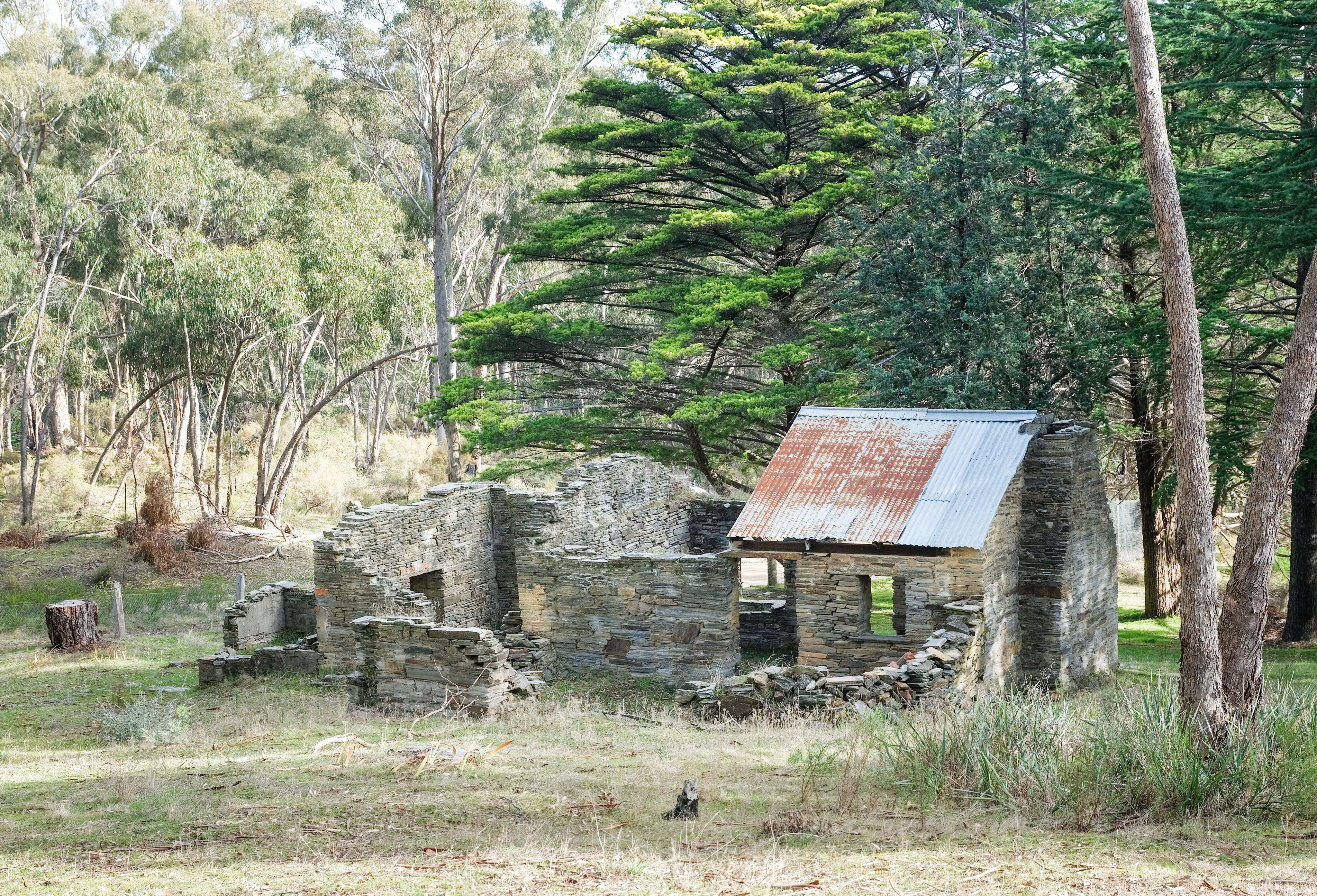
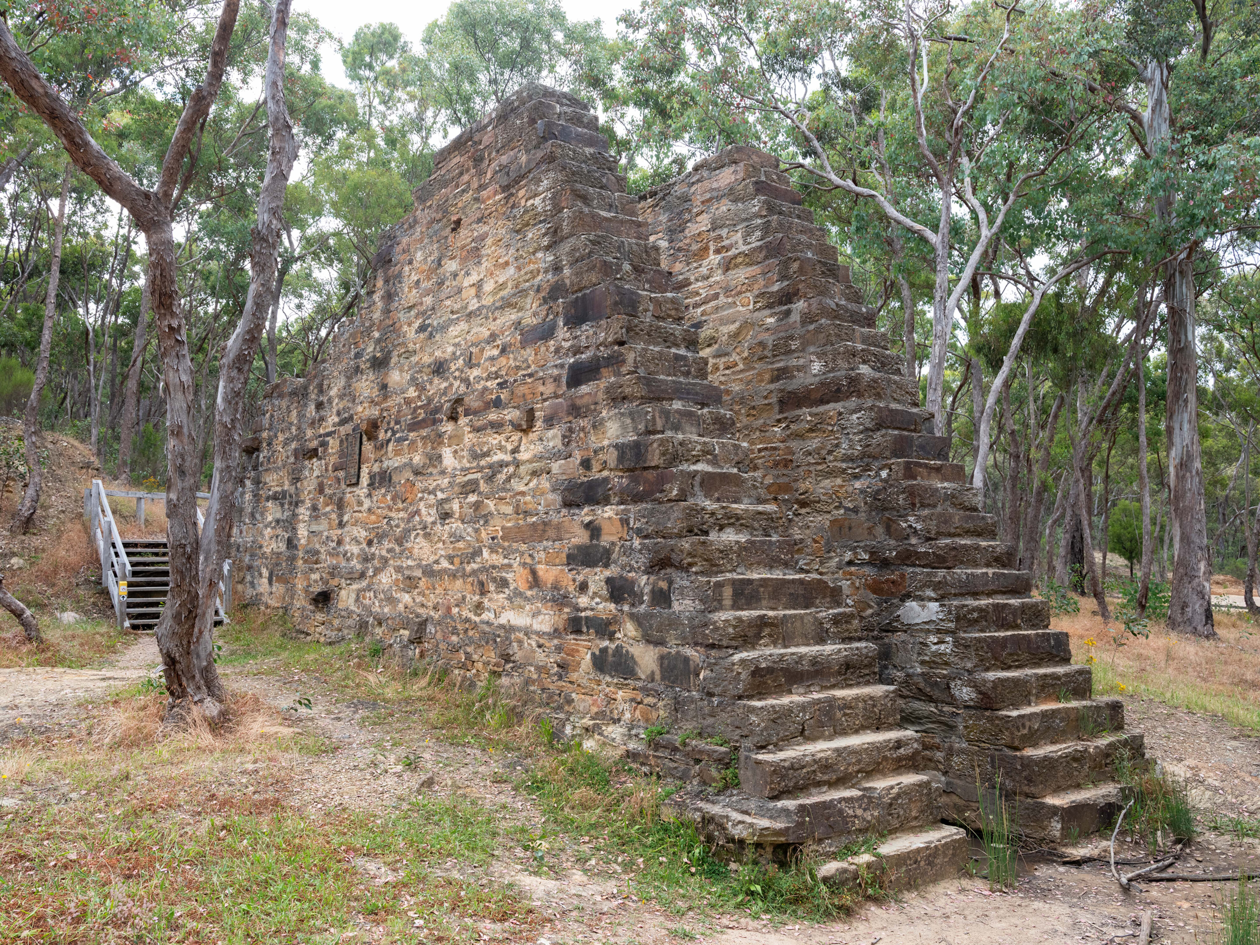
The tracks eventually exit onto the bitumen near Explorers Dam and the ruins of the Welsh Village. The latter requires a modest uphill walk from the carpark and it is worth reading the early history which explains the purpose of the numerous ruins of stone buildings.
Given these ruins are 170 years old it is remarkable that a fruit tree and a large rosemary bush still survive today – although they may very well be the progeny of earlier plants. As the name suggests, the miners were largely Welsh and brought with them their drywall stonemason skills, an example of which can be seen in a large retaining wall next to the walking track.
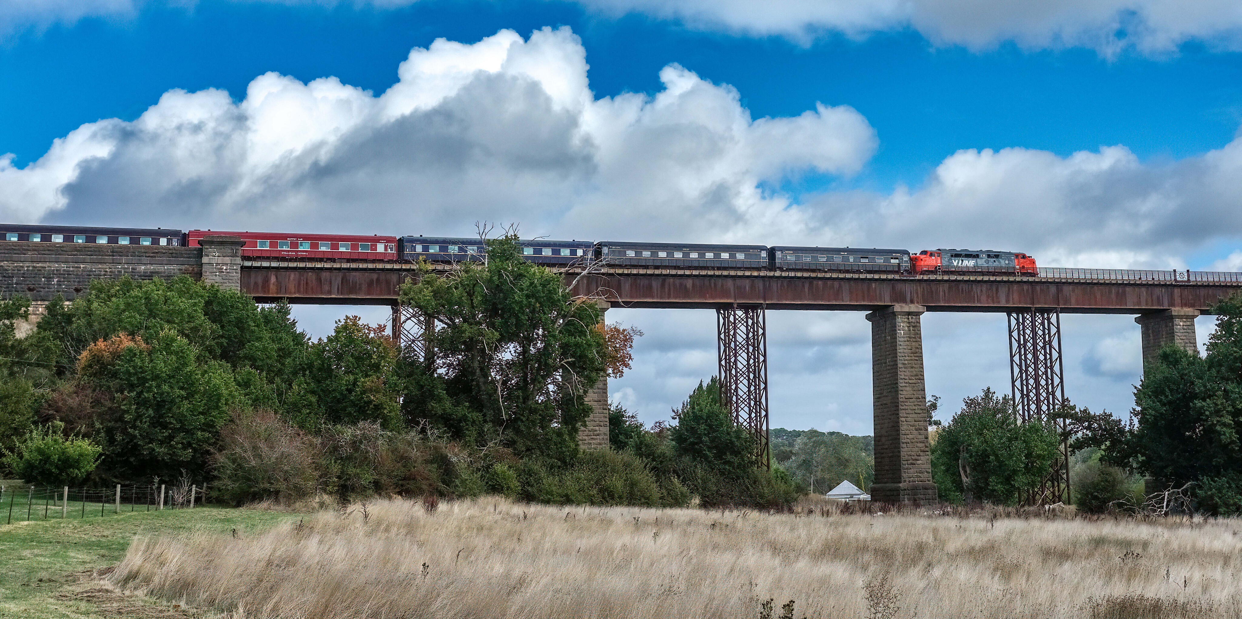
There are other interesting things to see and do in Castlemaine, such as take a trip on the twice weekly historic steam train trip to and from Maldon, or check out The Mill complex which hosts stalls of bric-a-brac as well as a restaurant and bar with live music.
68
Farmer and artist markets run regularly in the centre of town and the historic market building displays the work of local artists.
The old gaol overlooking the town is also another piece of history not to miss. Pay a visit to the village of Malmsbury with its botanic gardens and rail viaduct over the Coliban River. Still the largest masonry bridge in Victoria, it was also Australia’s longest when constructed. While there be sure to see the impressive 250m long and 36m high 1860s viaduct at nearby Taradale.
For the petrol heads, Castlemaine claims to be the street rod capital of Australia and wonderfully restored vehicles dating from the early 1900s to more recent muscle cars are a regular sight tooling the town’s streets.
While the Castlemaine Gold Digging’s 4x4 tracks might not rank up there with those of the High Country, they will introduce you to some amazing relics of Australia’s gold rush era, and when not behind the wheel, the area has many other attractions to interest the whole family.
Fact file
Where:
Castlemaine and the nearby Diggings National Heritage Park are approximately 120km north-west of Melbourne.
What to do and see:
The options are endless: test yourself against the many 4x4 tracks that criss-cross the forest; camp out and enjoy the natural beauty of the area; visit the old mining ruins that dot the area; catch the historical Castlemaine to Maldon steam train; sample the offerings of the pubs and cafes in Castlemaine, including live music; and if all else fails, hire a gold detector and try your luck.
Contacts
For current information contact the Castlemaine Visitor Information Centre – Ph 1800 171 888.
Please enable JavaScript to view the comments powered by Disqus.
COMMENTS