Explore
Gallery8
Kempsey, on the mid-north coast of NSW, lies at the base of some of the most spectacular 4WDing, camping and viewing points that you might ever come across.
When earth had a mighty volcanic upheaval 35 million years ago, it left a host of mountains, peaks and plateaus standing. Weathered down, they point to the sky over 1200m high – and the best part is, most of it is still accessible for us to admire and enjoy.
On the banks of the Macleay River, Kempsey is halfway between Sydney and Brisbane and perfect for an overnight stay – or before heading to the hills for a culture lesson, exploring more of the area that timber-cutters and miners once called home.
There are several combined National Parks in this area that include Carrai, Willi Willi, Oxley Wild Rivers and Cottan-Bimbang, whose geology is from the Carboniferous period – some 400 million years ago – and composed of mudstones, sandstones and conglomerates, allowing for the rich growth that occurs here.
With a maze of nearly 200,000 hectares of valleys, cliffs and rivers, this place is home to the Thunggutti Aboriginal People who, in years gone by, used the rivers and ridges like roads, linking the coast to the higher plateaus towards the New England region.
MACLEAY RIVER
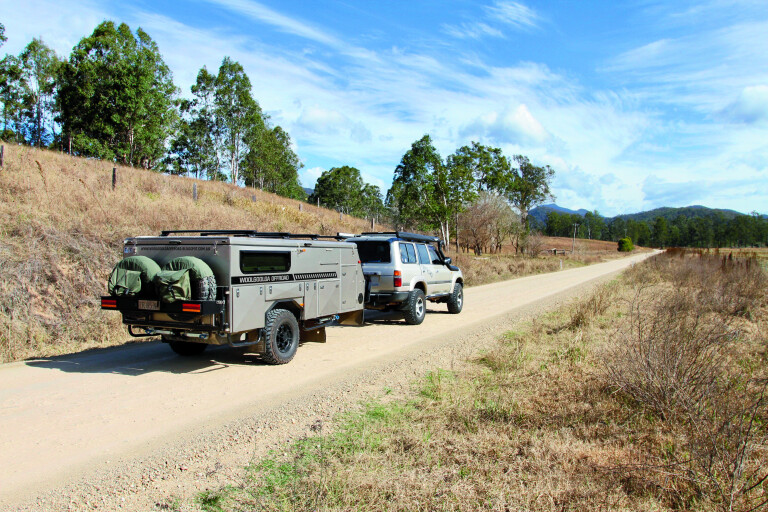
The Macleay River is at the heart of the Kempsey Shire, carving its way from the mountains of the New England Plateau to the sea at South West Rocks. It starts as the Guyra River and merges with a number of tributaries including the Apsley, Chandler and Styx Rivers 100km to the west. These days, Kempsey is a major hub for supplies and fuel, and you need to be self-sufficient on trips into the wilderness.
8
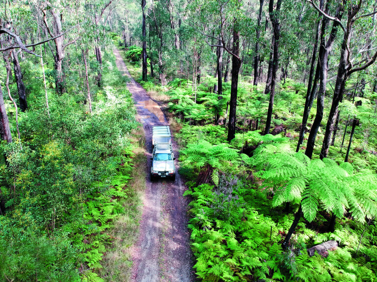
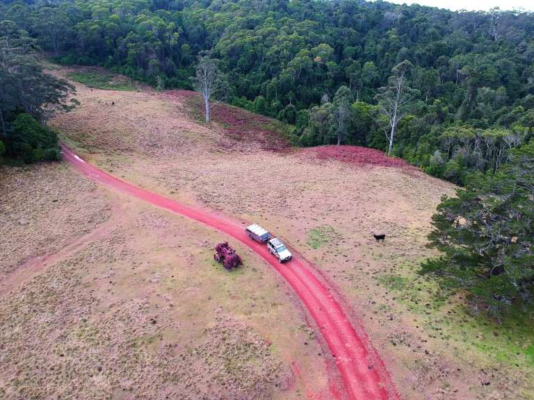
The going is easy along this track amid towering timber and tree ferns
Heading out of town westward for 20km, turn left to Temagog, which is signposted with a locals’ info board at the corner where you can pick up local chit chat on current conditions in the area – bit like the bushman’s telegraph.
When crossing the Macleay River on a fairly new bridge – remnants of the old one can still be seen poking up out of the water – one thing you may notice is just how low this new bridge is; the reason being is to let most debris flow over the top of it to avoid causing structural damage.
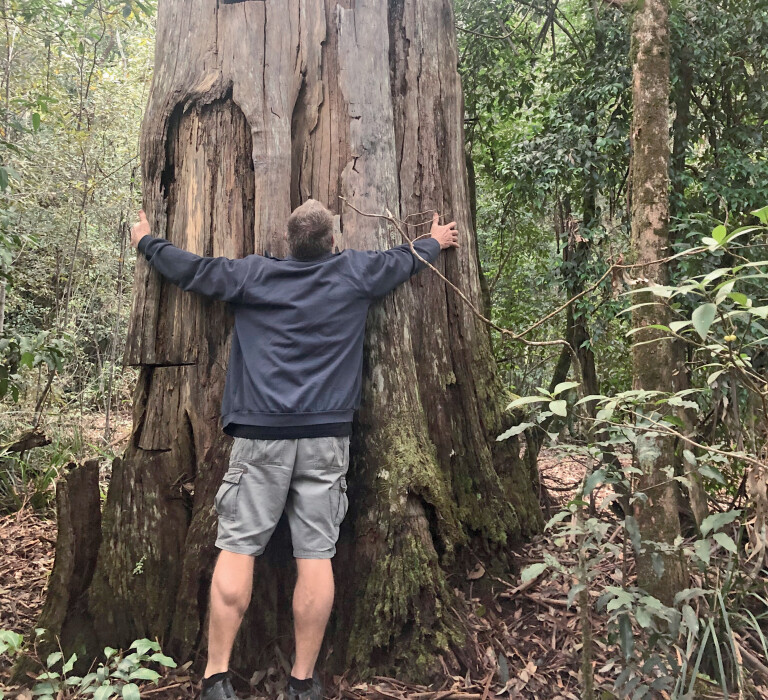
A little side note for around here is that you’re only at 67m above sea level and it’s hard to imagine that you will soon be around the 1200m mark. It’s a good drive heading to the hills here, as it’s well signposted all the way. The roads that twist and wind their way around this steep country were put in at the turn of the century, when hardy men sought huge red cedar trees from the Macleay’s valleys and plateaus – it’s reported that some of these trees had a circumference of around 30 feet.
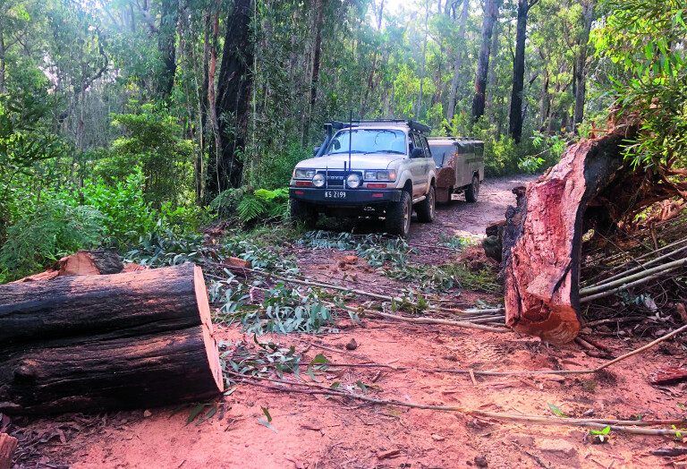
8
The trees here are BIG, so take care driving forest tracks
There are reports that if the men couldn’t get down into the valley to snig the logs out after being cut, they would winch them over cliffs. Some of the old dozers from the 1950s and ’60s had nearly two miles of steel cable on them for these jobs – try doing that now battling with OH&S.
One of the bonuses of travelling on a track that rises so high and so fast are the views, and there are several stops along the way to pull over to admire them. A notable stop is Willi Willi Lookout, where you get a clear view of the rich farmlands below, towards the coast along the Macleay River. In all fairness, this trip does sound like another drive into the hills, but around every corner there is always the chance to see something new, from the shy eastern spotted quoll, Frypan Corner, and even lyre birds darting across the road ahead. Even the quality of the eco systems up here are something to be seen, from thick pockets of rainforest and cool-climate stands of coachwood trees, right down to fragile ferns that cover the ground under the last remaining tall gums.
8
Following Carrai Road for several kilometres, you come across the intersection with Coachwood Road – this is the old town of Kookaburra. Once an active sawmill, it was a tough life here as the men had to endure snow (we are 1000m above sea level), stifling hot summers and then the remoteness of the camp.
Kookaburra was established in 1946 for harvesting red cedar, rosewood and coachwood from the nearby forests. The mill closed in 1967 and the 30 men employed moved on along with their families. The old school house has been restored and free camping is allowed around the grounds.
‘HIGH COUNTRY’ HUTS
Heading back along Carrai Road, the forests change to thick timbered country with an undergrowth of cool-climate tree ferns. Another 20km along, look out for the old hut which resembles something from the Victorian High Country. This hut has some of the best views you will ever see across the deep gorges, remote peaks and valleys. Owned by the McMillian family for many generations, this area once had orchards and market gardens supplying locals and themselves.
8
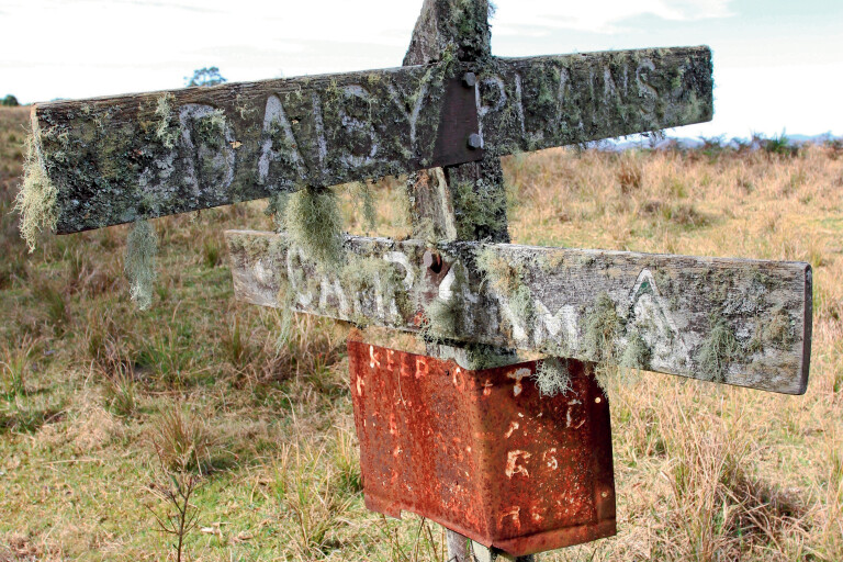
Little remains of the old timber and mining town of Daisy Plains
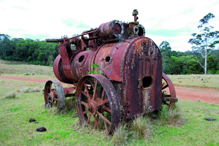
Farther down the road is the site of the Daisy Plains township where the only thing left is the moss-covered sign and a few mining relics. Daisy Plains was once a town where more than 200 residents called home, including miners, timber cutters and families looking for fortunes. A great reminder of the area’s past is the old Ruston Proctor steam engine that sits idle beside the track, as well as other relics including boilers, building foundations and old cattle yards – if it wasn’t for these last remaining pieces, no one would believe there was once a town here where tin and gold was mined.
8
Blink and you’ll miss Daisy Plains, the town sign the only indication it was once here
By now, if you’re after a top camping spot, just 5km along you will encounter what is commonly known as the Daisy Plains Huts. These huts are owned and maintained by National Parks and surprisingly are available to the public to stay at free of charge for as long as a three-week stint. Several huts include a kitchen, sleeping quarters and even a bathroom hut. Access for travellers is on a first-in first-served basis, so don’t be disappointed if there are other groups here. A flushing toilet is a bonus.
The huts have been put in place for the NP workers that frequent the area for park maintenance, to save on the three-hour travel time back to town each day.
8
A few relics from a bygone era are left scattered about at Daisy Plains
The huts have huge grassy areas where camper trailers or tents can be set up and left when exploring the nearby tracks.
MARY’S LOOKOUT
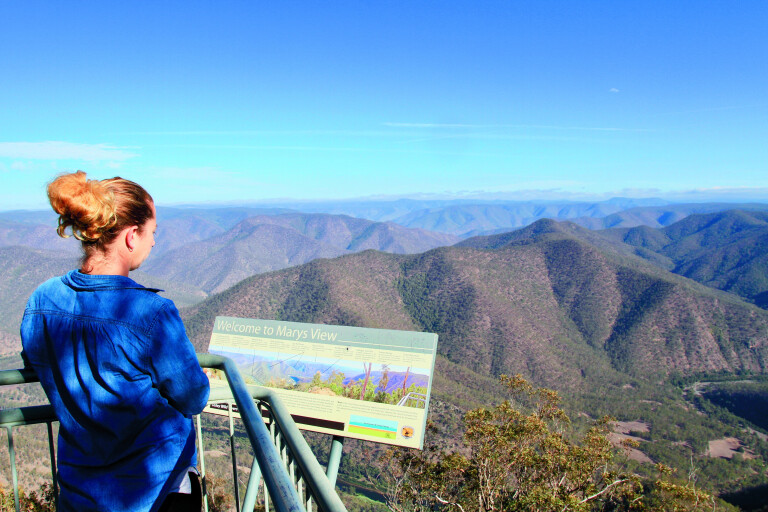
Farther along Carrai Road, a turn to the left will point you down Cochrane Road, where for 35km the trail follows remote farmlands and scrubby timber country towards Mary’s Lookout. At the ‘car park’ it’s a 100m walk to the spectacular viewing area. National Parks has done a great job here installing safety barriers away from the 1000m drop.
8
It’s certainly a top-of-the-world experience at Mary’s Lookout
Looking into the wilderness below and the plateaus west, it’s hard to comprehend how the early settlers explored these areas with as little as a bellyful of determination and a handful of pack horses. Way back in 1818, explorer John Oxley passed through the New England Tablelands, opening it up for graziers and timber cutters. Mary’s View was named after Mary Cochrane, the wife of an early settler and logger on the Carrai Plateau.
While not a hard drive or extreme area to explore, the Kempsey tablelands are rich in diversity, history and beauty. National Parks has opened up many of the area’s sections so we can explore them to our hearts’ content.
FIVE KEY PLACES:
1. PARKS UNITED
A string of five National Parks – Carrai, Willi Willi, Oxley Wild Rivers, Kumbertine and Cottan-Bimbang – are grouped together, draping a massive area of the mountains, ranges and valleys just to the west of Kempsey.
2. KEMPSEY
Kempsey is the major town of the Macleay River Valley and worth a stay in its own right. Stock up here on supplies and fuel for the trip into the wilderness.
3. WORKERS HUTS
Reminiscent of the Vic High Country are the huts found in a couple of the parks, especially at Daisy Plains. Here, National Parks maintain several workers huts and, when not required, are available free-of-charge to the public on a first-in first-served basis.
4. THE VIEWS
For breathtaking mountain views, check out Willi Willi Lookout for a view of the farmlands heading to the coast along the Macleay River. Also, Mary’s Lookout for the wilderness and views to the ranges and plateaus west.
5. KOOKABURRA
The old timber town of Kookaburra is 1000m above sea level, and a place that’s stifling hot in summer and has snow in winter. Camping is free.
Please enable JavaScript to view the comments powered by Disqus.
COMMENTS