Explore NSW
Gallery8
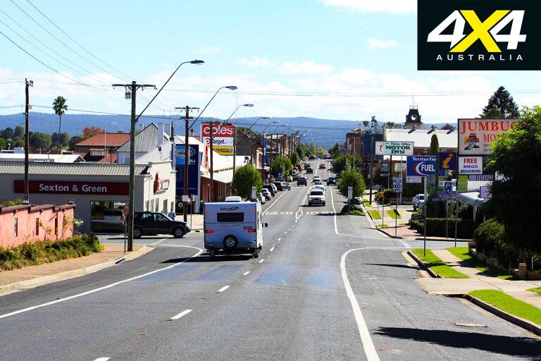
TENTERFIELD, located 20km south of the New South Wales/Queensland border in the New England region, is well-known for its history, the surrounding stunning national parks, and the songs sung about it by Peter Allen. A great way to explore this area is to ‘get a feel’ for its local history with a walk around town, locating the old stone buildings that have stood for more than 100 years.
The first known European to pass through the Tenterfield area was Allan Cunningham during his 1827 investigation of the Darling Downs, and white settlers began to arrive in the late 1830s to begin grazing operations on the fertile land. However, the fortunes of the town were boosted when gold was discovered in the district in 1858, in areas that included the Rocky River, Morgans Gully, Ropers Gully and the Timbarra Plateau.
8
In the ensuing years Tenterfield developed with a bank, an Anglican church, a flour mill, school, blacksmith and other significant buildings. By 1879, 1500 people called Tenterfield home, and in these years a police station, gaol and courthouse were erected.
Then the bushrangers came. In 1868, Captain Thunderbolt (aka Frederick Ward) made an appearance around Tenterfield and called the surrounding hills his home; you can still explore the caves where he supposedly hid. Tenterfield is located in an area now primarily devoted to sheep and cattle grazing; although, timber, mixed farming and tourism provide other local industries, and the town is home to more than 4000 people.
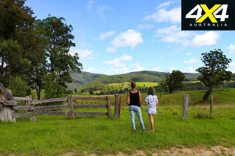
The trip to Rocky River starts just south of the heart of town, by wandering down the aptly named Scrub Road and onto Billirimba Road. Keep an eye out for abandoned farm and transport machinery which sit quietly in the paddocks, and, with long, straight, tree-lined sections of dirt, you can gaze across the paddocks with views to die for in every direction.
8
With Quilgeran Pinnacle to your right and Black Mountain to your left, the road snakes through – and soon passes by – the locality of Steinbrook, which is basically home to an old hall and not much else.
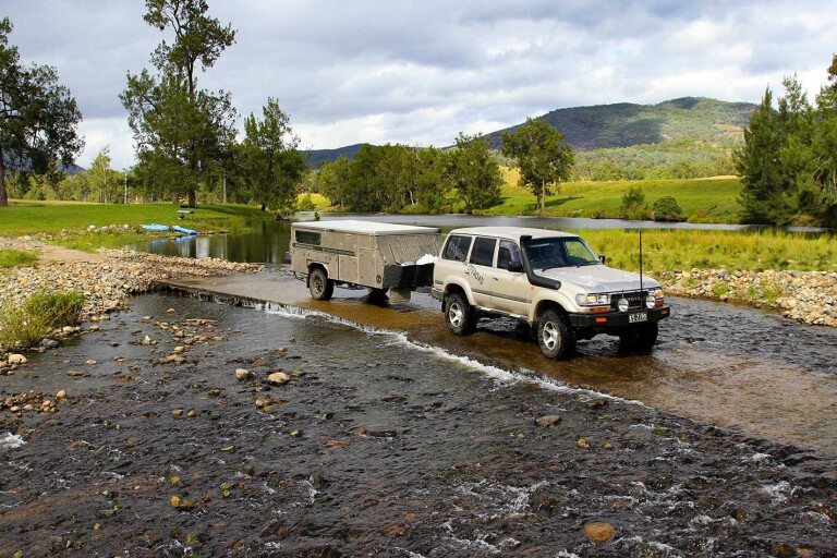
The road then passes through private cattle-breeding stations in the valleys, old sheds and massive trees. After travelling a further 35km Billirimba Road winds its way down to the Timbarra River and the intersection of Upper Rocky River Road.
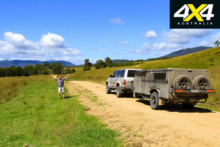
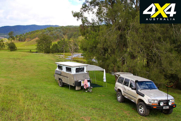
It may only take an hour to get this far, but, if you’re looking for one of the best camping options, head another 3km to Wunglebung Station. Camping at Wunglebung is by appointment only and campsites are limited along the Timbarra to keep the place private, clean and manageable.
8
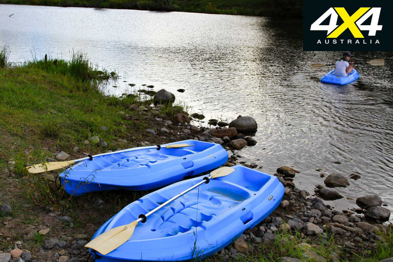
After you’re shown to your exclusive camp by owners Katrina and Stu you can relax, kayak on the supplied units, or explore the hills. Kat is happy to give you a rundown on the history of the station, advice on the drive up the valley, or a heads-up on the 4X4 tracks in the hills. The 8.1km² working cattle station has a serene feel to it and that’s the way they want it kept; there’s no hooning, mad off-road scrabbling, shooting, motorbikes or quads.
It’s hard to relax though, when you can swim, kayak, go platypus stalking and explore the old yards, relics and remains of the original homestead.
8
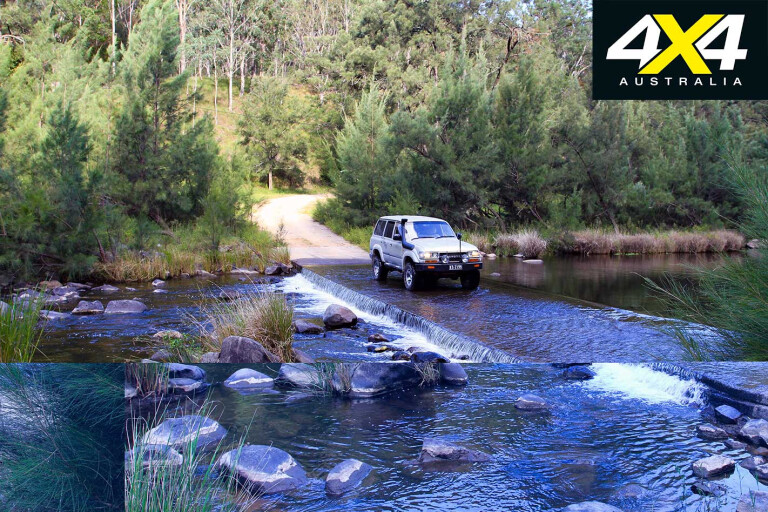
Four-wheel driving is possible up the valley towards Washpool NP, where easy station roads lead into gorge country and cross the upper reaches of the Timbarra River into more timbered areas and eventually to a gate where the Bicentennial Trail continues south.
If you’re keen on a more serious challenge, Kat and Stu can point you into the hills toward the Billirimba Trail in the nearby NP. Billirimba is suited to high-clearance 4X4s as it twists and winds its way up nearly 700 metres – midway along there are a handful of mines and some mining gear from the past, and the views from here are to die for.
8
Once you’re done ogling the views, retreat to Rocky River Road and swing right towards Drake (53km away). One hundred years ago this route was the main thoroughfare between Tenterfield, Drake and Grafton, and the road workers at the time couldn’t move these granite boulders so they simply built the road around them.
As the road follows the Timbarra River the drop-offs become steep and you’ll pass pockets of dry rainforest, old sheds in the hills, and acres of tree-felled paddocks where cattle freely roam along the road. Farmhouses will soon appear roadside, so slow up to keep dust down and keep a look out for dogs that may shoot out onto the road.
There are areas beside the river where camping isn’t permitted, but at the 25km mark there’s a huge grassed area with tracks leading down to the Timbarra, and all are welcome. Stopping under the old casuarina trees is pretty special as the water flows past, and don’t forget to throw a rod in for a chance to snag a freshwater yabby or a fork-tail catfish.
8
If the weather is right swimming in the Timbarra River is pure bliss, as the fresh water, which has been filtered through granite particles, leaves you feeling relaxed and clean. Whether staying for an hour or a night, remember to take any rubbish with you to keep the area pristine and the land owners happy.
Once you’ve left camp and veered away from the river and into the hills, the country farmlands turn into a thick scrub and the road soon changes from dirt to tar. The road steepens as it enters Girard State Forest, and the terrain gets more serious as you climb to almost 1000 metres above sea level in just a few kilometres.
On the southern side of the range the stunning rainforest is generally a bit cooler than the flats below. With tall cool-climate ferns and long-trunked bangalow palms and coachwood trees, it’s a totally different eco system to what you have just left behind. Even the wildlife changes to the sounds of whipbirds, pademelon wallabies and lyrebirds.
Reaching the summit is obvious, as large stands of scrubby timber – ironbark, blackbutt, scribbly gum and grass trees – seem to dance in the wind as you zoom past. Girard State Forest soon gives way to farms and dodgy looking houses and eventually leads to the Bruxner Highway, which runs between the coast and back up to the tablelands past Tenterfield.
Travel Planner
8
WHERE
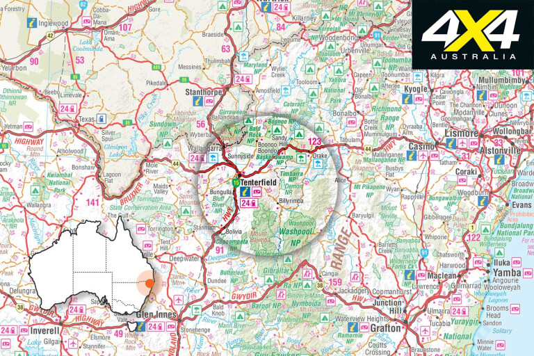
TENTERFIELD is the gateway to both the New England and Northern Rivers regions, and is surrounded by 10 national parks. The Rocky River drive begins a few kilometres out of Tenterfield, and the whole trip is around 100km – depending on any 4WDing – eventually ending at the small town of Drake.
CAMPING, FACILITIES & AMENITIES
Wunglebung has 8.1km² to explore, with camping along the Timbarra River. Sites are grassy and private, and all have river views and access. There are clean drop toilets and hot showers nearby, but no phone service – there is an emergency phone on the property.
BEST TIME TO TRAVEL
Being in granite country, the summers are stifling hot yet the winters are bitterly cold. The ideal time to travel is either mid-spring or autumn, when the nights start to cool yet the days are great for swimming.
FUEL & SUPPLIES
Tenterfield is a fairly large town with fuel depots, a large shopping centre and plenty of mechanical service centres. This whole trip is around 100km, so filling up in town will definitely get you to Drake.
THINGS TO SEE ON THE WAY
One of the great things about this trip is passing by working cattle stations. From farmers herding cattle on horseback to cattle taking over the road, the kids can get nice and close. This area holds eight different types of wallabies and kangaroos, several types of eagles, and skinks basking on the warm granite. The waters here are alive with eels, cod, yabbies and platypus.
CONTACTS
Tenterfield Tourism: (02) 6736 1082
Tenterfield Council (for current road conditions): (02) 6736 6000
Wunglebung Station: 0427 002 732
MAPS
Several topo maps can be used – Malara, Bulldog Rock and Drake – but a great overall map is the Hema North East NSW.
Please enable JavaScript to view the comments powered by Disqus.
COMMENTS