Explore NSW
Gallery2
AUSTRALIA is home to some of the best coastal drives on the planet and, just a couple of hours’ drive north of Sydney, one of these drives will lead you to a spectacular campsite in the Hat Head National Park.
This beach-hugging adventure starts just north of Port Macquarie and incorporates beach and unsealed roads. The amazing diversity of the coastal track north of Port Macquarie is definitely a well-kept secret, with the track beginning once you dismount the ferry at Settlement Point Ferry North.
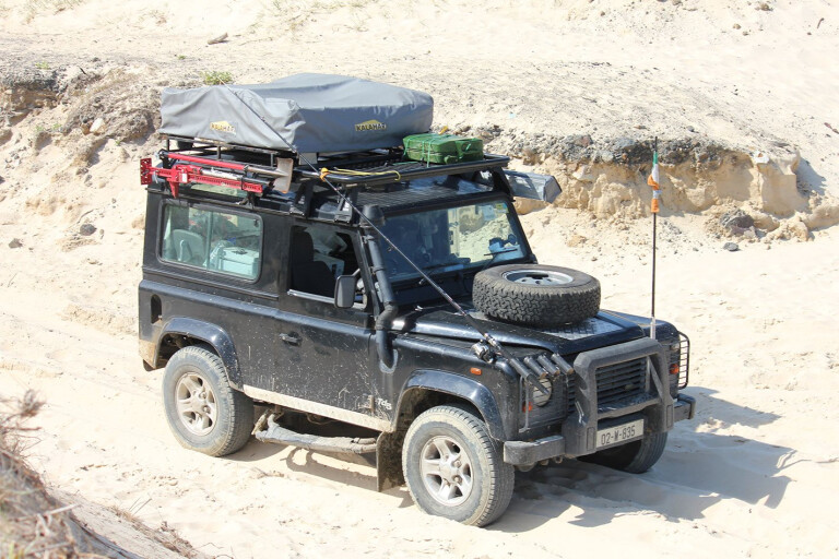
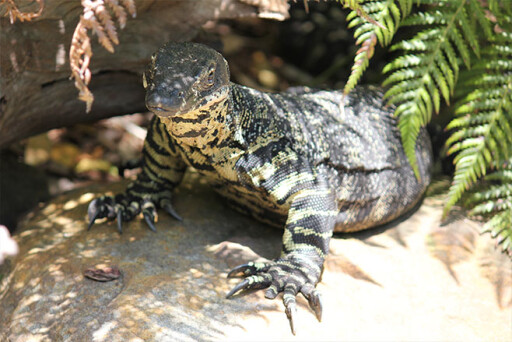
This trip introduces travellers to a number of stunning natural attractions, as well as some low-range action, before arriving at the perfect coastal campsite known as Hat Head National Park. Have your camera at the ready as this route is home to dingoes, koalas, kangaroos, wallabies, reptiles and a variety of bird species.
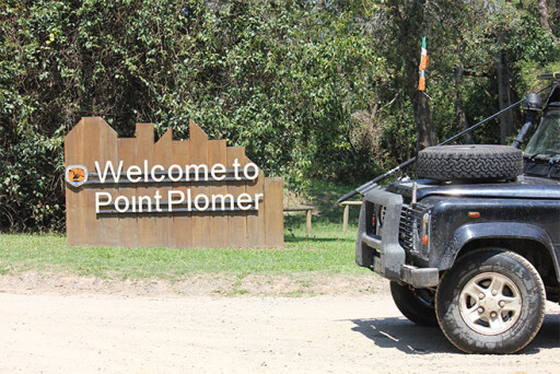
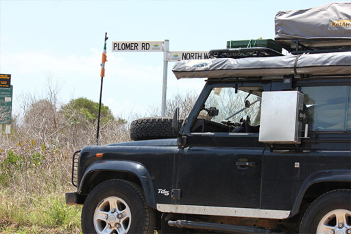
The journey begins by catching a ferry from Settlement Point across the Hasting River to the North Shore. After the ferry ride that lasts only a couple of minutes follow the signposts to Plomer Road, which leads to Point Plomer. You have two choices here: you can either take the beach drive or the track that runs parallel to the beach behind the dunes. We decided to take the Point Plomer Track behind the beach, as we had planned to tackle some of the Killick Beach further up the coast.
The Point Plomer Track is a narrow, soft sand track with a few large potholes thrown into the mix. As you drive along you’ll notice some opportunities to veer off to the right to access the beach, and if you have the time on your side you should definitely check out some of the spectacular beaches along this route – so have an air compressor at the ready.
Keep an eye on low-flung branches that overhang the track, as they’ll scrape the side of your vehicle if you get too close. There are also some deep depressions along the track with not much room to skim around them; these are fine when dry, but in wet conditions these depressions can quickly fill with water and cover the full width of the track. Take your time in wet conditions and you shouldn’t have any dramas in a standard 4WD. The Point Plomer Track runs for 12km before finally arriving at the beach and campsite at Point Plomer; the camping ground here is located right beside the beach.
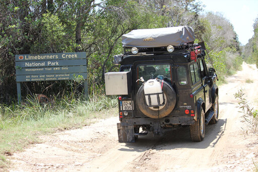
After Point Plomer continue hugging the coastline until you reach the Limeburners Creek Nature Reserve, and if you have time check out Saltwater Lake and the nearby rainforest. There are also plenty of interesting sites along this track to pull over for a cuppa and admire the beautiful coastline – one of these spots is just to the right of the Limeburners Reserve information sign.
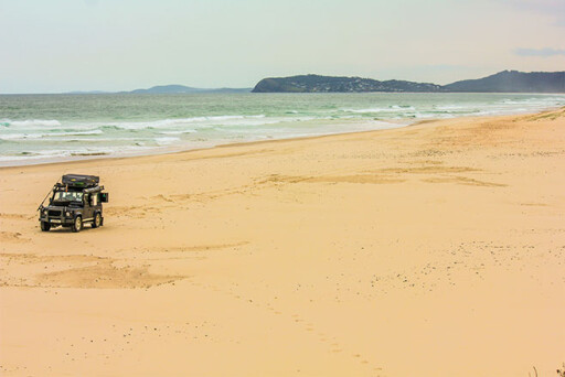
Point Plomer Track continues to run through the scrub behind the long, narrow Goolawah Lagoon, and after a few kilometres it arrives at the Goolawah Beach which looks out at the Tasman Sea – part of the South Pacific Ocean. In the distance you will see the huge water tank overlooking the 5km-long beach at Crescent Head. Along this beach you’re also likely to see plenty of fishermen chancing their luck as they cast their rods from the comfort of the shore.
The town of Crescent Head has a real chilled-out feel about it, with a tidy population of 1200. If you have time, drive up to the large water tower in the town, which provides great views of the Goolawah National Park, Killick Beach and Hat Head National Park in the distance.
A couple of kilometres out of town we took the signposted right-hand turn for Richardson’s Crossing, the entry point to the impressive Killick Beach, an 11km low-range beach run that will take you all the way to the Hungry Gate Campground.
You’ll need to get a permit to access Killick Beach from the Crescent Head campground/information office. If you happen to have a surfboard attached to your 4WD then you’re in the right place, as this area is also an international hotspot for surfing.
It is advisable to check out tidal times before tackling Killick Beach, as you don’t want to be rushing late in the evening on a quiet beach as the tide is making its way in. Remember, you have 11km of beach driving ahead, so keep that in mind before going onto the beach late in the evening. We learned this from experience, as we had left it a bit late before reaching Killick Beach and it was a bit of a rush trying to make sure we made it to our camp ahead of the incoming tide. We didn’t get the chance to enjoy the beach run as we were too busy wiping the sweat from our brows in an attempt to reach the end of the beach. With that said, Killick Beach is a striking white-sand beach backed by large sand dunes, and it’s important to maintain momentum even if you aren’t in a rush as it can be pretty soft in parts.
After plodding along we were very relieved to see the exit point to reach our campsite. It’s a good idea to put down the foot as you approach the exit, as it can be a bit tricky with soft sand and a bit of an incline. Upon exiting the beach you’ll now be close to the Hungry Gate Campground in the Hat Head National Park – our final destination on this short coastal trip.
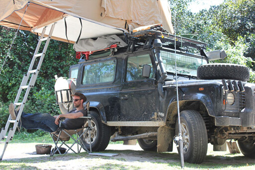
Within a couple of minutes of leaving the beach we reached the campsite, an open area with a spacious feel that’s protected from the ocean by large sand dunes and thick vegetation. There are also some hidden corners where you can hide away from the main camping area, and we parked the Land Rover in a sheltered area behind the dunes under a large gum tree. You are never far from civilisation on this track, but you can feel isolated and very much away from it all and that makes this place even more special.
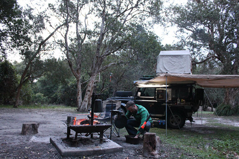
The Hungry Gate Campsite is a bit of a gem; it’s quiet, secluded and offers fire pits and plenty of space. After setting up camp it was on with the fire and out with the rotisserie for a well-deserved dinner of roast chicken washed down with a couple of cold beers. We pitched up here for two nights and enjoyed some chill-out time, a spot of fishing and some tasty camp cooking.
If you decide to tackle this route in the near future don’t forget recovery gear and a shovel – you don’t want to get stuck when the tide is coming in. Also, allow for extra fuel as you will burn more fuel than normal while driving on the beach.
Many of the campsites along this coastal route rely on honesty boxes, so bring change. Insect repellent is a must as the mozzies can be a bit of a pain in the ass around some of the campsites, particularly in summer.
Other than that, simply enjoy what this little part of the world has to offer. Fish along Limeburners Nature Reserve, stroll through the rainforest canopy at Sea Acres Nature Reserve, and stop and take some time out to enjoy the many beautiful beaches and headlands you’ll pass along Point Plomber Track.
With a number of options for great fishing, beach driving and bush-type camping, this adventure has all of the ingredients for a cracking weekend away in your 4WD.
2
TRAVEL PLANNER
STAYING THERE
WE camped at the Hungry Gate Campground which is located right beside the beach and is protected by the park’s unspoiled sand dunes. The area is surrounded by thick heath and woodland vegetation. Bring drinking water as there are only basic amenities. GPS: Latitude 31° 4’ 47.172”S Longitude 153° 2’ 31.452”E
TRACK CONDITIONS
POINT Plomber Track: Conditions vary significantly depending on the weather. The sand can get soft in places, though you should have no issues with a standard 4WD. The real fun on this trip is the beach driving, and like all beach driving you should be prepared.
KILLICK Beach: The northern entry point on Killick Beach to the Hat Head campsite can be a challenge, particularly at low tide, so make sure you adjust tyre pressures. Maintain momentum as you drive along this beach as it is soft in parts; it is advisable to keep the momentum going in order to avoid any chance of stalling. Also check the tidal times.
FUEL & SUPPLIES
FUEL is available at Port Macquarie, Crescent Head, Hat Head and South West Rocks. Port Macquarie has a major town centre and all necessary supplies can be obtained here. Crescent Head also has facilities, while Hat Head has limited services including a pub and a service station.
TRAVEL DISTANCES
PORT Macquarie is 388km from Sydney and 550km from Brisbane.
MAPS
THE Port Macquarie Tourist Centre provides a detailed beach map of the area.
RESTRICTIONS AND PERMITS
BEACH permits for the financial year (July 1 to June 30) are available for a fee and cover the Kempsey, Hastings and Nambucca Shires. A current registration number is required when requesting a Beach Permit. They can be purchased from the council’s customer service centre.
They may also be purchased from Crescent Head Caravan Park, Grassy Head Caravan Park, Hat Head Caravan Park, Hat Head General Store, South West Rocks General Store, South West Rocks Service Station, South West Rocks Bait Marine and Tackle, and Stuarts Point Caravan Park. Note: if you intend to purchase from these outlets, it may be worthwhile confirming they have them in stock first.
Please enable JavaScript to view the comments powered by Disqus.
COMMENTS