Explore
Gallery39
The Top End of Australia is so unique, with animals and plants that can only be found here, a wet season that can leave hundreds of billabongs and rivers full, while seasonal cyclones can destroy huge amounts of land, yet the balance in all this has to be seen to be believed.
One of these delicate and often under-rated sections is the Mary River NP just 150km out of Darwin and very much shadowed by nearby Kakadu. Mary River consists of a handful of small reserve areas which protect part of the huge Mary River catchment area covering a staggering 8000km² and is one of eight rivers in the Top End with huge water systems.
39
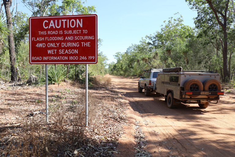
In the dry season from May to September, most areas are accessible to all vehicles, however many roads are unsealed. During the wet season from October to April, flooding can cause seasonal road closures. It has huge areas where monsoon forests, floodplains, savannah grasslands, paperbark and bamboo forests meet, and the best thing is it’s open to exploring − fishing, driving the 4WD tracks, getting back to nature and some of the best camping around.
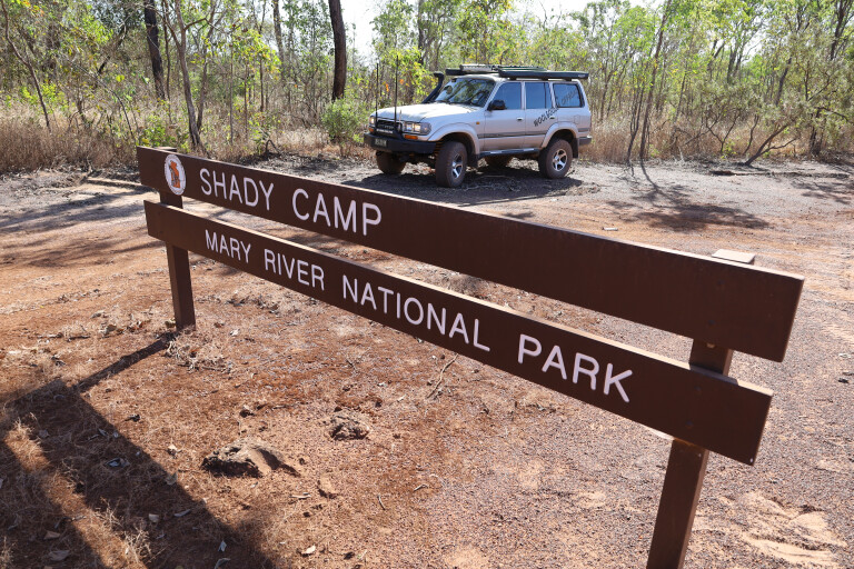
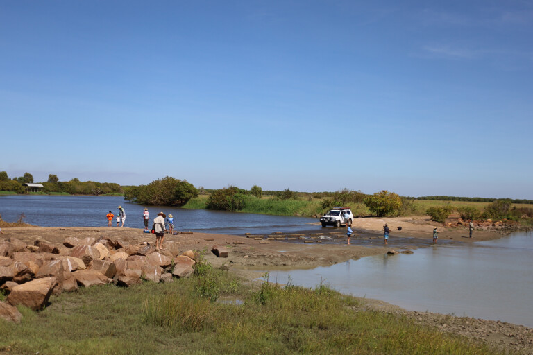
SHADY CAMP
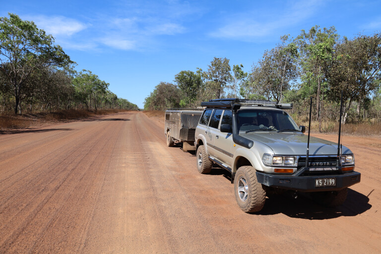
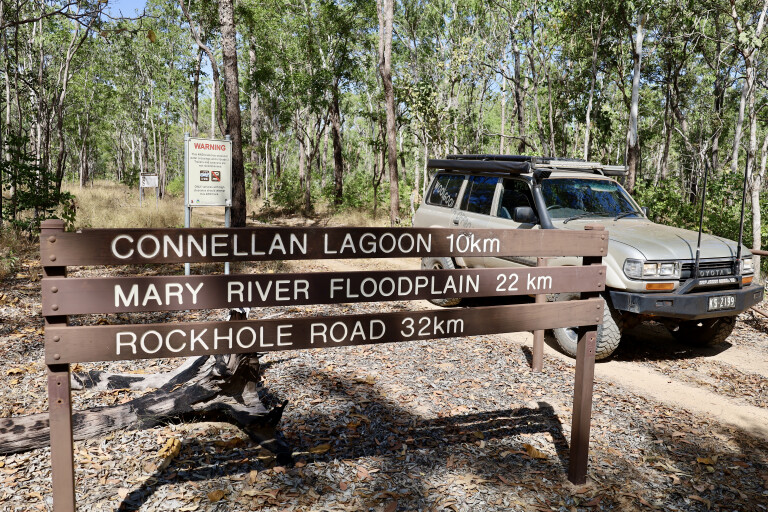
Getting to Mary River is pretty simple along the Arnhem Highway towards Kakadu for 135km, then turning north towards Mary River NP for another 55km. The road to the park is sealed for nearly 30km then turns in to a good, solid dirt road.
During the wet season, the road may be closed due to flooding, but huge signs at the start will say whether open or closed. My first target point was the well-known Shady Camp area that’s an iconic spot for fishos chasing big barra.
Unfortunately, my effort was pretty dismal, but there’s always next time.
39
Take heed of seasonal road conditions
Camping out here is pretty good where the NP’s only charge is $3.30 per person for unpowered sites, but there are bins and compost toilets. At the boat launching ramps, a barrage has been installed to protect the wetlands.
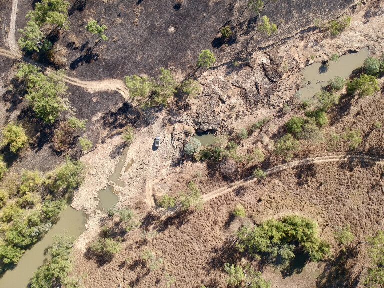
Much of the Mary River catchment is below sea level and up until the 1940s, this area was totally landlocked. For the past 80 years, huge sea levels, cyclones and wildlife have carved an opening out to sea allowing for the area to drain and allowing saltwater to destroy parts of the area. Due to this, a barrage (or low-level wall) was built to hold back the freshwater so it can regenerate through the estimated 250km² that has been destroyed.
The Shady Camp barrage is nearly 30km from the ocean to the north and at low tide, the saltwater drains away to nothing leaving just thick mud until the next tide. Yet at high tide, the water often flows over the barrage into the fresh side. If the barrage wasn’t built, huge amounts of saltwater would penetrate the upstream area causing devastation to the fragile environment.
If fishing isn’t your thing and you need a day away from camp, go back out to Point Stuart Road and head north to the Point Stuart Coastal Reserve. The road soon turns to a single-lane track where the NP is only a thin sliver of land with private stations on either side.
Honestly, there’s nothing hard about this long dirt road but it does follow the trek that explorer John Stuart took on his last epic trip to the north of Australia back in 1862 looking for pastoral land and to be the first person to reach the Gulf. Back in the day, the government offered £2000 to the first person to do so and with this, Stuart and his party made the successful trip there and back.
39
I was hoping to reach the rock monument right at the tip of the coastal reserve but was met with a locked gate, just a few kilometres short of the coast due to a seasonal closure – yet on the park’s website it was marked as open. Stuart’s mapping skills and records were so great that when others followed his trail, they found everything to be spot on.
Another significant area to explore relating to explorer Stuart is Mistake Billabong just south of Shady Camp. It is believed that his party camped here on his way north and the return journey for its water and possibly fresh food. A bird hide has been built overlooking the lagoon so visitors can view the birdlife, colourful lillies and crocs.
39
The barrage at Shady Camp − be croc-safe here, this is saltwater croc country
COUZENS LOOKOUT
Within the centre of the Mary River NP is another popular spot, Couzens Lookout campground that overlooks the stunning and huge river system of the Mary River.
It’s located off the tar section of the Point Stuart Road, with a 19km dirt section that again may be closed in the wet season. The camping fees here are cheap too, but you’ll need to be self-sufficient.
A popular activity is to stroll up to the lookout at sunset to see the light change as the sun sets, plus with the high viewpoint you can see big crocs often cruise past stalking their next meal. Masses of lotus lily line the banks and in the distance, vast wetlands cover the area. During the night, the bellows of wild buffalo can be heard as well as wild dogs howling in the distance.

39
Evening light on the Mary River floodplain
Nearby at the Rockhole, river cruises operate from here and it’s also great to fish for barra in the deep holes safely from the shore. It’s said that the Mary River system has the highest number of crocs per km than anywhere else in Australia, and here at the Rockhole I counted dozens with a mix between salties and freshwater crocs.
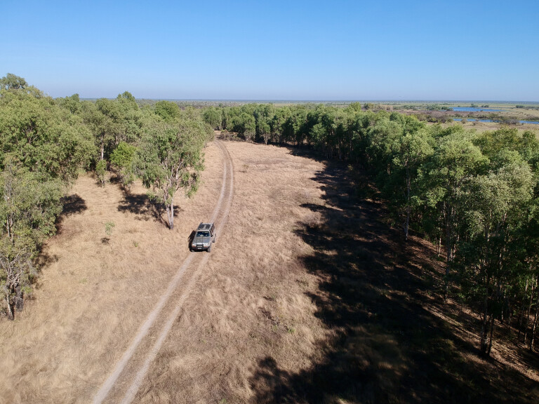
WILDMAN TRACK
Starting at the Rockhole, the Wildman 4WD Track takes you from here 32km north to Wildman Road. Again it has seasonal closures, recommended for high-clearance 4WDs and definitely no trailers. The track meanders past huge billabongs full of birds, fish and crocs, plus you’ll see an array of different vegetation including massive native bamboo stands, stunning pandanus forests and tea tree-lined waterways.
The nearby Wildman River was named in 1866 and today is a protected waterway. Across the floodplains, don’t be surprised to see jabiru, magpie geese, masses of white herons right down to herds of feral buffalo who have made a mess of the swampy areas on the edge of the waterholes.
39
Exploring on the Wildman 4WD Track
While not a hard track, allow several hours to enjoy the serenity and what the area offers. The Wildman Track joins back to the Wildman Road to the north, where it’s only a short drive back to the main road.
HARDIES 4WD TRACK
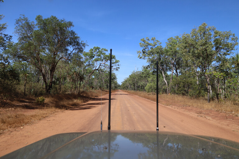
If you’re after something a little more diverse and even a little harder, Hardies 4WD Track is a must-do. An entry point is to the south near the Corroboree Tavern and Bark Hut Inn, and the track is around a 100km loop. It dives deep into the fertile and harsh area that Mary has to offer.
Only open during the dry season, the track sees extensive flooding across the plains with several deep river crossings that often close the track for months at a time when it’s been wet. Prior to the loop, the track used to cross at Clarkes Crossing before heading north through Annaburroo Station to nearby Couzens Lookout, but access is now blocked through the station.
39
The gravel roads are good in the dry season and relatively smooth
At the start of the track, Bird Billabong is a pleasant walk to see large numbers of birds, even in the dry ground where water used to be. From the moment you pass through the gate, the track narrows and winds its way through stands of tea tree towards a viewing point of the Mary River.
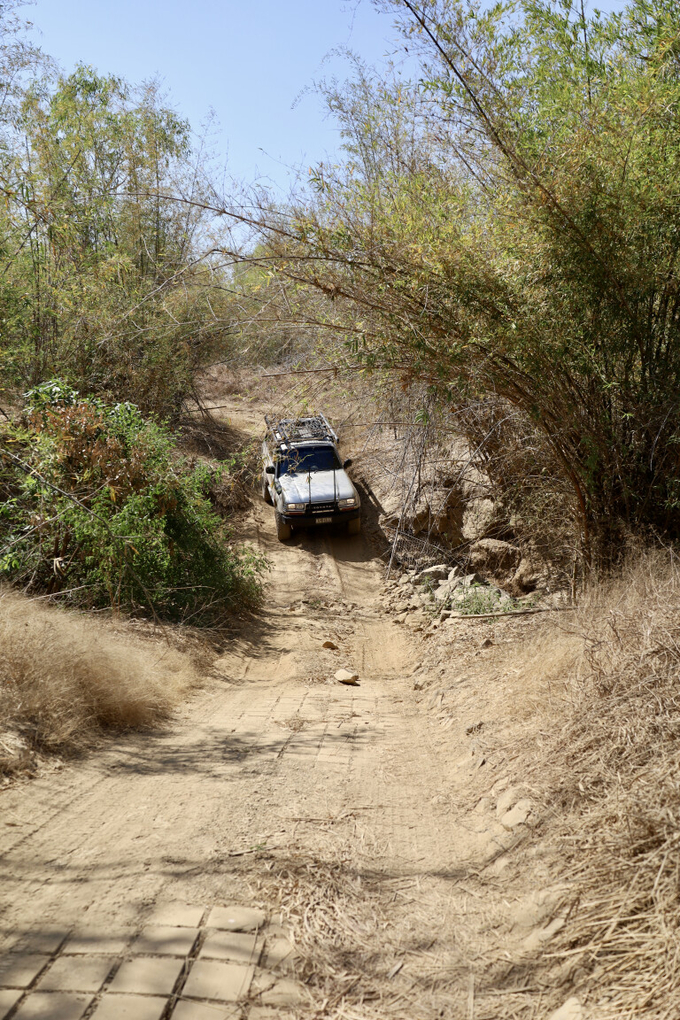
Along the way, keep an eye out across the other side for the massive Bambusa arnhemica stands, one of three bamboo species endemic to Australia. It lives for about 30 years, flowers, then dies.
Soon the track heads westward towards the hills of Mount Bundey, these rock formations and lumps were important to the Limilngan-Wulna people of this land. The track follows the hills for some way before branching off through savannah grass which, before it’s burnt, can be as high as a 4WD’s bonnet.
There are a couple of river crossings to negotiate, but dependent on the water level and the time of the year. The water at Hardies Crossing flows for most of the year and it’s a narrow, rocky track through the water at the flowing end of the lagoon. Even though the water is flowing, be croc wise, as it’s a permanent waterhole and they are there … as I found out, lying in the pools of water on the track.
39
The loop follows the wet plains and heads to its farthest point at Corroboree Billabong where there’s a boat ramp but also a high point up the bank to have a break and croc spotting. Parts of the road were extremely rough, not from lack of maintenance but from the feral pigs and buffalo who use the road as their highway going from waterhole to waterhole.
At times, with tyres right down, driving it was only at a slow walking pace. Following the track was pretty easy though, with a stack of blue and red arrows along the way but really, there is only one main track. To fully enjoy and discover the Hardie loop track, allow a full day out with the many spots to enjoy and discover, you never know what you’ll see. My other advice is to get on to the track early in the morning as sections of it were that dusty, it was hard to see out the window.
The Mary River NP is a must-do if you’re in the area, as it combines some good 4WDing, has a hint of the gulf country plus the attractions of nearby Kakadu.
39
FIVE PLACES TO VISIT
1. SHADY CAMP
A popular barra-fishing departure point and campsite, with boat ramps either side of the barrage for fishing saltwater downstream or freshwater upriver.
2. COUZENS LOOKOUT
Enjoy secluded camping beside the Mary River, with only a short walk to the lookout for magic sunset views.
3. WILDMAN 4WD TRACK
This 32km track is limited to trailer-less and high-clearance 4WDs for exploring the wetlands, monsoonal forests and the wildlife within.
4. HARDIES 4WD TRACK
This dry-season only route is just off the Arnhem Highway and is one of a limited number of tracks with access to the floodplains.
5. POINT STUART COASTAL RESERVE
Only accessible during the dry, the drive to the reserve takes you through a variety of environments to Finke Bay. The track also takes you past Stuart’s Memorial Cairn.
Please enable JavaScript to view the comments powered by Disqus.
COMMENTS