Explore NSW
Gallery29
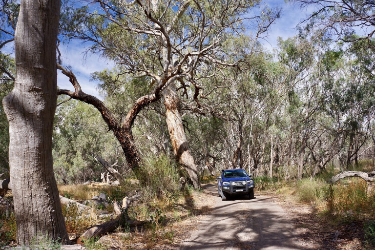
THE walking trail winds over a low rock rise and then down the edge of a boulder-strewn gully through an open forest of native pine and gum trees.
While much of the grass had dried to a golden sand colour along the creek when we visited – in contrast to the red and black rocks that dominated the scene – a thin strip of green indicated water was still trickling down the brook amongst the surrounding rocks.
The Mulareenya Creek Art Site can be found at the track’s end, on the far side of the creek under an impressive and large rock overhang. A viewing platform gives you easy access and keeps reaching hands away from the delicate ancient art, which not only depicts animal figures, but dancers, hand stencils and hunting tools.

First seen and noted by Charles Sturt during his 1828 to 1829 expedition, the Gundabooka Range wasn’t taken up by pastoralists until the late 1800s, when it was included in some of the large surrounding pastoral properties.
After WWI, these extensive land holdings were subdivided, and three stations – Ben Lomond, Belah and Mulgowan – were established. In 1996, these sheep properties were taken over by the state government and united to form the Gundabooka National Park.
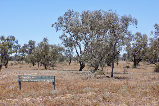 In 2005, the adjoining Gundabooka State Conservation Area was founded and now links Gundabooka NP with the even newer Toorale NP on the west side of the Darling River. In all, the three parks protect more than 1200km² of outback country watered infrequently by the Darling River and its ephemeral floodplain.
A small camping area is located in the heart of the park at Dry Tank, where among the basic facilities is a five kilometre return walking trail to the top of Little Mountain. The nearby Bennetts Gorge picnic area is a pleasant spot for a barbecue and a wonderful spot for birdwatching.
The Valley of the Eagles walk, which starts here, is a fairly difficult 5.7km return walk exploring the imposing Mount Gundabooka, which rises about 500m above the surrounding area. Our latest journey down the Darling River had started the day before at the historic township of Bourke. This area of western NSW was first seen by Sturt in 1828, but little happened here until Thomas Mitchell saw it in 1835.
 By the 1870s, the town was a trade hub for the region and places further north and west, with paddle steamers thrashing their way north along the muddy, often shallow waters of the Darling. The railway arrived in 1885, and in 1892 a young Henry Lawson arrived to get a taste of outback life.
Later bush poets, Harry ‘Breaker’ Morantand William Ogilvie, arrived for the same reason. The town grew its reputation as being on the edge of the outback, and being out ‘the back of Bourke’ was seen as very remote and pretty darn close to the black stump.
Plagued by crime and Aboriginal youth issues, there has been a concentrated effort by many people on both sides of the cultural divide to improve the town of Bourke, and I have to say we enjoyed our latest foray there. The Back O’ Bourke Exhibition Centre is worth a visit, while a trip on the local paddle steamer is always enjoyable.
 Just south of the town and accessed via the River Road is Fort Bourke, built by Mitchell back in 1835 when he and his men feared an attack by local Aboriginals. You can visit this site today, but it is accessed via a private track and you need a key to the gate, which is available from the local tourist office.
Louth, a little further south along the River Road from the camping areas in Gundabooka, is a small community of less than 100 people, and that’s including the nearby properties. The town traces its beginnings back to 1859, when a pub was built here to service the passing paddle steamer trade. Today, the pub is still the heart and soul of the place.
The town is famous for its outback races held each year in August, as well as the unique cross-shaped headstone, which reflects the evening sunlight and is now a declared national monument. We threw down our swags on the verdant grass behind the pub, close to the river. Not wanting to stretch ourselves too much, we opted for a few cold beers and a meal in the cool confines of Shindy’s Inn, as the pub is called these days.
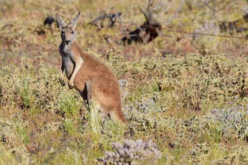 The next morning we checked out the free camping on the west side of the river (Louth has one of two bridges across the river between Bourke and Wilcannia), before cruising south where quite a number of red kangaroos watched us from the side of the road, while emus ran around like chickens with their heads cut off.
How one or more of them didn’t end up spread across our bullbar, I’m not sure. We stopped in at the even smaller settlement of Tilpa, where the second bridge across the river gives access to the tin shed of a friendly pub.
South from here, the River Road passes through a section of the Paroo-Darling National Park, withthis section centred on the old Wilga Station. This 1780km² park is disjointed and has only one official campground, that being in the Wilga section at the Coach and Horses Campground, which isn’t far from the old homestead, on the river bank.
We know this section of the park very well, having hunted pigs on it for many years before it became a park, but access is well-restricted these days to the camping area. So not wanting to be disappointed and preferring to remember it as it once was, we pushed on.
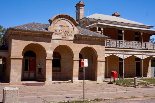 At the outback town of Wilcannia, we filled up with fuel, bought a few things from the poorly-stocked store, checked out a couple of the old historic buildings that line the main street, and then continued south, sticking again to the east side of the river.
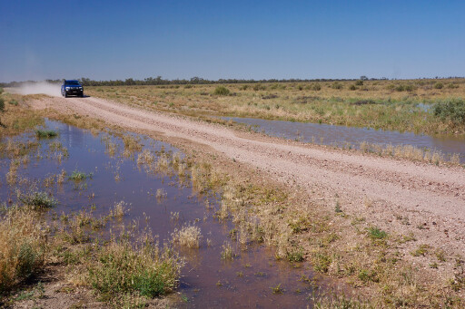
The gravel and graded road was much the same as before and it only rarely degenerated into a well-used and narrower track. It can be corrugated and chopped-up in some areas, depending on what the weather has done and when the graders were out last.
MORENew South Wales
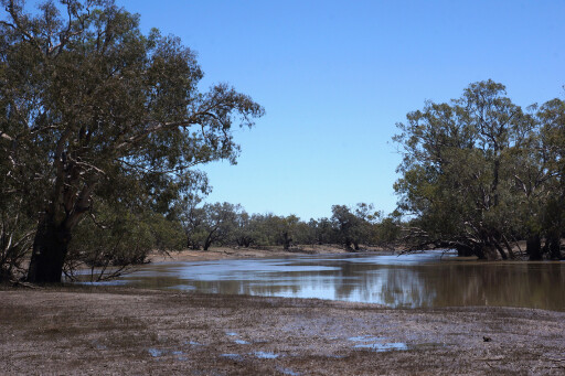
We pulled up for the night on the edge of Menindee Lakes, finding ourselves a camp not far from where the Burke and Wills expedition had set up a major camp back in the 1860s. Water was pouring into the lakes from the Darling, bringing life-giving succour to these huge man-made, or at least modified, pools that act as a vast shallow reservoir for Broken Hill, less than 100km away.
The next morning, we went exploring to see how many of the lakes were filling (it is all controlled by weirs and gates these days) and we were pleasantly surprised at how much water had already flooded into the system. Herons and pelicans paddled around in the stirred-up waters, waiting to feed on any stunned fish below each of the weirs.
 Copi Hollow, one of 10 lakes that flood from the Darling and probably the smallest of the lot, has long been the holiday destination of choice for many Broken Hill residents. It was brimming with water and, even without any more inflows; the lakes will have water in them for a number of years, which is great news for locals and visitors.
Four of the lakes a little further south-west are included in the expansive Kinchega NP that takes in the old Kinchega Station, which once covered one million acres and ran 143,000 sheep. We wandered the back roads of this outback park, checking out the impressive woolshed that has seen more than six million sheep lose their wool here over its 97-year history. The shed was once twice the size it is now and handled 64 shearers.
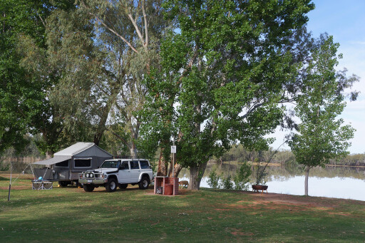
There are a couple of campgrounds in the park – one on the edge of Lake Cawndilla, which is a delight when there is water in the lakes, and another camp is closer to town on the edge of the Darling River where it pours into Lake Menindee. Still, we preferred our camp on the edge of Lake Pamamaroo outside the national park.
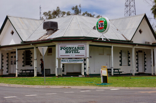 The next stop on our River Run was at the small town of Pooncarie, where the Pooncarie Hotel has been a long-time favourite for a cold beer and a meal. Nearby, there’s a variety of spots to throw down the swag or pull up the camper, while the segregated cemetery is worthy of a wander.
The following day we drove into Wentworth, where the Darling joins the mighty Murray. The town, the biggest we had seen since leaving Bourke, owes its existence to being an important camp on the overland route for droving cattle between NSW and Adelaide back in the 1830s and 1840s.
First known as Hawdon’s Ford, it was later called Darling Junction before taking on its Wentworth moniker in 1859, by which time it was the most important paddle steamer port on the two rivers.
This is where our river-run down the Darling ended, but it was one we enjoyed so much it probably won’t be the last. Give it a go: it’s a great outback trip, whether you have done it many times before or it’s your first excursion to Bourke and the Black Stump.
CONTACTS
Farm and station stays with camping and/or accommodation options include:
Warrawong Station: www.warrawongonthedarling.com.au
Kallara Station: www.kallarastation.com.au
Trilby Station: www.trilbystation.com.au
Nelia Gaari Station: www.neliagaari.com.au
Bindara Station: www.bindarastation.com
Mullingar Rural Retreat: www.visitwentworth.com.au/business/mullingar-rural-retreat
For the three national parks along this route visit: www.nationalparks.nsw.gov.au and search for the required park. Visit and camping fees are required.
Please enable JavaScript to view the comments powered by Disqus.
COMMENTS