Explore NSW
Gallery14
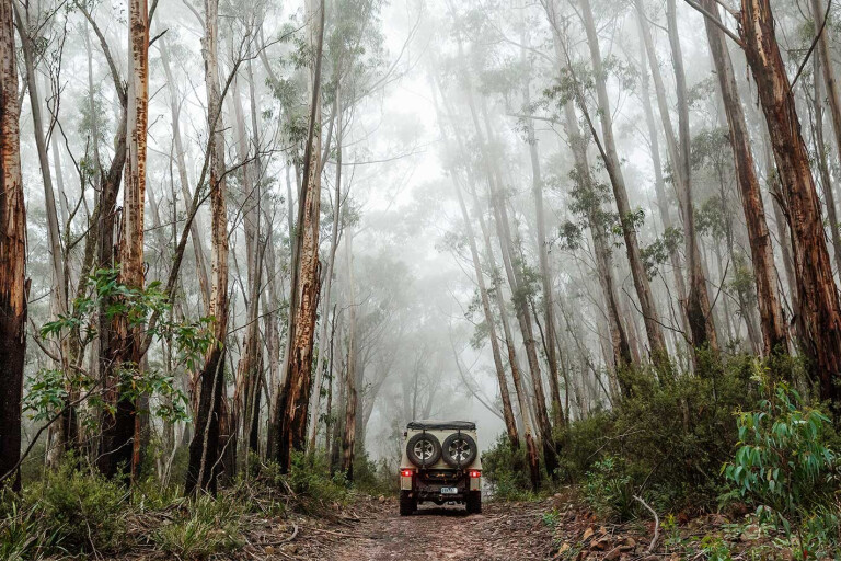
‘GEEZ,’ I thought, as I clambered out of the Patrol to clear another small tree from the track, ‘another bloody tree’. This one needed some axe work before we dragged the trunk clear and then hopped into our vehicles to proceed less than 50 metres, where we did it all over again. Sometimes, the going gets tough on our journey through South-east NSW.
Our route was taking us through Bodalla State Forest and for a while we tried our luck along an unnamed fire trail that the map showed joined up with Calle Road. We had already discovered that Calle Rd was virtually indistinguishable from the surrounding scrub, so we tried this faint track just a little farther to the south.
14
After 30 minutes of travelling less than a kilometre and spending most of the time removing logs and timber from the old trail, we decided discretion was the better part of valour and our convoy of four vehicles retreated, heading north on the main route of the Reedy Creek Road. That was pretty indicative of many of the trails we followed on our wanderings through the mountains inland from the southern coast of NSW.
The routes may seem to be well marked and named on a map, but in practice they proved to be little used and, while not greatly difficult in a 4x4 sense, the amount of fallen timber that needs clearing becomes a bloody bugbear.
Once again the Reedy Creek Road degenerated, but not to the point where we had to turn around; the forest closed in around us in parts, with tree ferns crowding the track on every moist gully we passed through.
Originally, this route was an Aboriginal footpath and then, in the early days of European settlement, it became a bridle trail as settlers followed in the Aboriginals’ footsteps. The trail heads from the coast near Wallaga Lakes and Bermagui, to the hinterland and isolated farms and small forest settlements along Reedy Creek, and then north to the wider valley and rich farmland of the Tuross River.
14
The Bega Valley and Eurobodalla shires upgraded the bridle trail to a formed road around the time of WWI, and they maintained them until 1958 when the Forestry Department took over. Today, the very southern section passes through Gulaga National Park before entering the Bodalla State Forest, with the northern part seeing very little traffic.
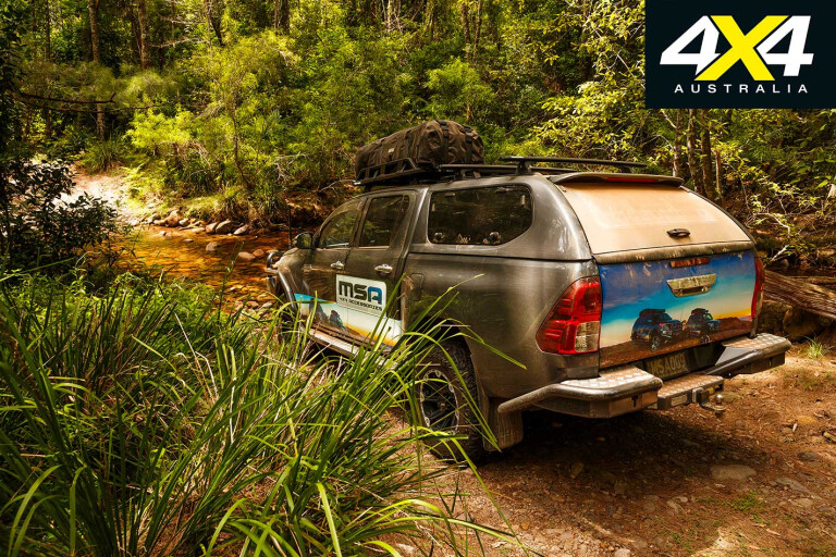
From Reedy Creek we turned south on the Tuross River Road before taking Red Creek Road deeper into the state forest. On Red Creek there was a small, little-used camping area and an easy sand-over-rock water crossing.
A short time later we arrived at the upper crossing of the Tuross River on the Peak Along Trail, but the rain over the past few days had turned the stream into a fast-flowing torrent. GT, our self-designated camp cook, VW tragic, salt lake racer and driver of the Hilux in our small group, volunteered to go into the water to investigate.

14
Hardly able to keep his footing, and with the water rising to his chest, we decided we’d pass on the challenge of trying to drive across. Would the crossing have been possible? Maybe, if you had to, but not without some serious preparation of the vehicles and recovery gear.
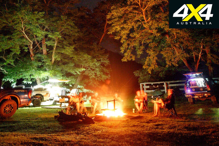
Still, we were tempted to set up camp on the sandy bed of the river, but we backtracked a short distance taking the Brass Knocker Track over the range and down into the Wadbilliga River valley near Yowrie. That night, we threw down our swags at the small but delightful Lake Creek camping area in Wadbilliga NP.
Our travels in south-east NSW to take in the delights of the coast and the far less travelled tracks of the nearby mountains had started a few days earlier when we had left Moruya and headed inland. Our route quickly took us into the Wandera State Forest and then on reasonable 4x4 tracks to the crest of Wandera Mountain and its expansive views over the surrounding mountains, forests, farmland and coastline.
14
Following the No Name Mountain Fire Trail we stopped on the edge of the Buckenbowra River at the rough and small campsite of the same name, in amongst a patch of temperate rainforest. In places, we passed through drier eucalypt forest dotted with scattered stands of Burrawang palms, a member of the ancient group of plants known as cycads.
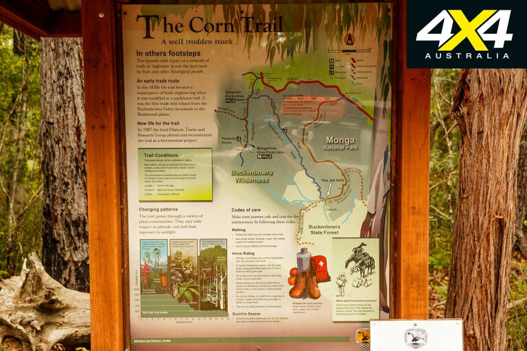
Through here and until you meet the main Braidwood Road (Kings Highway) you are on the historic Corn Trail, which was the first European link across the mountains joining the settlements along the coast to the remote settlements on the Monaro Plains.
The major crop of the valley back then was corn, hence the route’s name, but it was also used to bring cattle down from the high country to the coast – later, gold prospectors heading inland used the trail. When a new route was pioneered over Clyde Mountain in 1854 (which the main highway now follows), the Corn Trail fell into disuse and was soon overgrown.
14
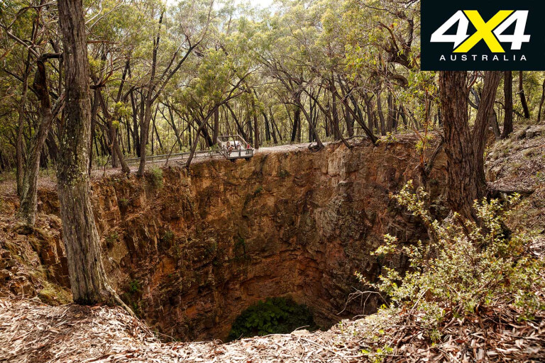
That evening we set up camp at the small, enjoyable Berlang Camp on the north-west edge of Deua NP. The next morning we took a short walk, first wading across the upper reaches of the Shoalhaven River and then climbing the gentle 1.5km-long slope to the Big Hole. It’s hardly an inspiring name, but the deep, circular rupture is a little more interesting.
From Berlang we headed south on Snowball Road before taking the Middle Mountain Trail deeper into Deua NP. This route is not recommended for anyone with a trailer (in fact, they are banned), but less than 1km from the main road there is a pleasant campsite on the edge of Currambene Creek, which can be reached with a trailer.
From here the trail winds through forest and climbs to the crest of Dampier Mountain and its trig point, before dropping steeply through a series of tight switchbacks to the valley floor and the first crossing of the Deua River.
14
This is the entrance to the magnificent Bendethera Valley, so named by the first European settlers here who in 1863 established their Bendethera homestead farther along the stream. Numerous cleared areas along the valley make for a great and popular camping area; certainly one of the best in NSW and one we always love to experience.
The grassy clearings are mown to park-like consistency by the large mobs of eastern grey kangaroos and the few swamp wallabies that inhabit the area. Wombats are common, we spied a feral pig, and the chimes and calls of the birds during their ‘morning chorus’ is a delight to wake up to.
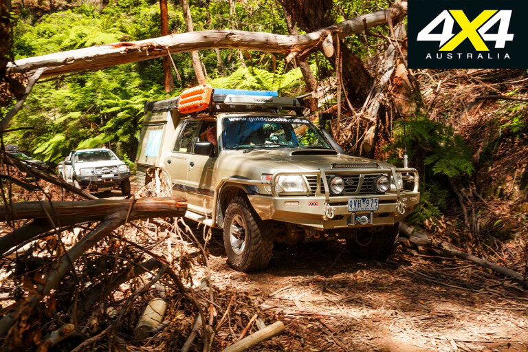
After a couple of nights in the valley we headed out via Little Sugarloaf Road, passing a vehicle towing a camper which was doing it easily and slowly. We quickly tired of the gravel roads which were getting better the more we got closer to civilisation, so we turned onto the little used North Bumbo Fire Trail and soon came to the first of the fallen trees.
14
We didn’t have a chainsaw (a bit of an oversight), only a small axe and an even smaller saw, but we eventually cleared it and pushed on, clearing a few other trees along the way. Meeting with the Western Boundary Rd, we had a brew to celebrate making it through and cruised onto the highway and the coast, pitching our swags that evening in the Brou Lake camping area of Eurobodalla NP.
The next day we headed to Wadbilliga NP via our fateful meeting with the Tuross River, before pulling up for the evening at the aforementioned Lake Creek. There are easier ways to get here than the circuitous route we followed, but we were having fun exploring and using rarely used fire trails.
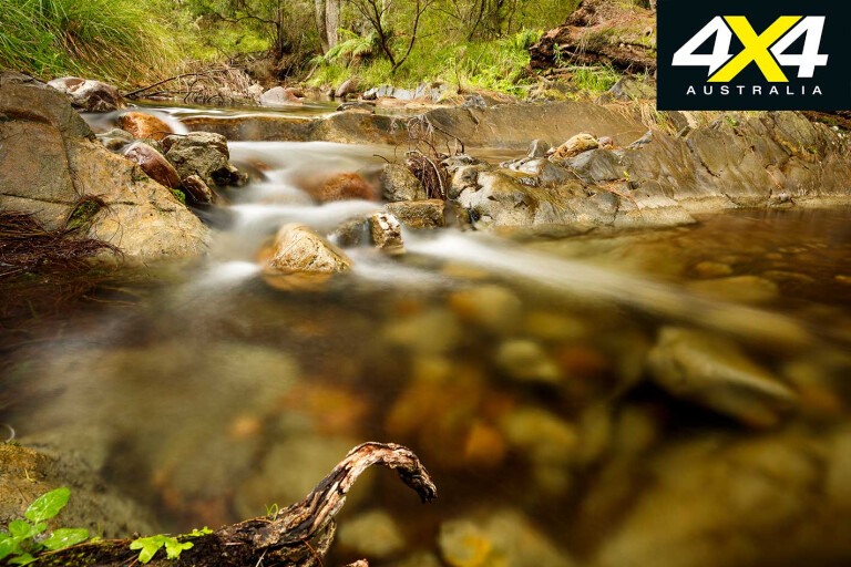
A little to the north we turned into the forest again and arrived at The Cascades, with three other vehicles there it was the most populated spot we visited away from the crowded coast. Situated on the Tuross River it is a short but steep walk down a series of steps to the river-worn boulders of The Cascades, and with the recent rain it was flowing quite well.
14
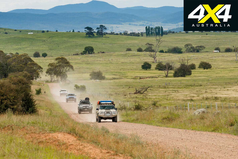
We then took Falcon Road and the Waila Creek Trail, the route marking the boundaries of both the Deua NP to the north and the Wadbilliga NP to the south. It’s an easy drive, with spectacular views as you drop off the high ridges down to the crossing of the Waila Creek. The farming land here is dotted with magnificent old trees and patches of forest, and it’s an easy, enjoyable run back to the coast via Belowra and Cadgee and the lower reaches of the Tuross River.
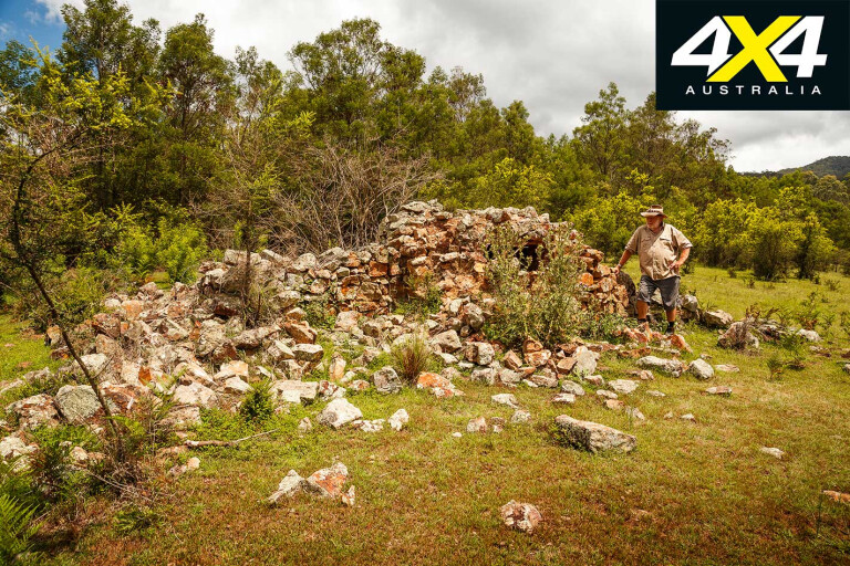
The following day the little-known Pambula Goldfields, just a few kilometres south-west of Pambula, was our next point for exploration. I had no inkling of this place until a friend took us to it some years back, but with any knowledge on how to get there now forgotten I touched base with Ron and asked him to again guide us into the old mines.
The area around Pambula was first settled by Europeans in the 1830s when the Imlay brothers grazed cattle on the river flats, with the town established in about 1843. By 1856 there were five licensed hotels in town catering for the thirst of farmers, graziers, loggers, bullock drivers and fisherman. Gold was discovered in 1888 and the resultant flurry of activity created a boom in the town, with shafts such as the Victory Mine, Top Victory and the Morning Star producing gold that was reported at times to crush at an incredible 40 ounces to the tonne.
14
The deepest mine in the area soon reached a depth of more than 300 metres, and within months of the discovery there were a number of crushing mills in the vicinity of the workings. Interestingly, only a little alluvial gold was ever won by individual miners working along the nearby creeks; while today, fossickers with metal detectors are having better luck. Most of the old goldmine shafts are fenced and all of the old mill sites have fallen into disrepair, with most of the equipment plundered or rusted.
Still, with some local knowledge you can find a number of ruins dating back to those days, including mill sites with the remnants of a five-head stamper, a huge flywheel from a steam engine along with assorted machinery, dams still holding water, and ovens used in the production of bricks for the many buildings that once graced the field.
With time to kill before we returned to our camp at Hobart Beach camping area on the southern shores of Wallagoot Lake, we headed along forestry roads into a section of the South East Forest NP and to the crest of Wolumla Peak. At 776 metres the peak, with its tangle of radio and repeater towers nearby, is the highest point for some distance and offers great views.
14
Descending from our eagle-like eyrie we took the rough and rugged Wolumla Peak Fire Trail west off the peak, passing through verdant forest before hitting the main road and turning north for our coastal camp.
Such is four-wheel driving on the NSW south coast: magic beaches in the morning or evening and a variety of trails during the day, spiced with rugged mountains and spectacular views. You can’t beat that for variety.
Please enable JavaScript to view the comments powered by Disqus.
COMMENTS