Explore NSW
Gallery1
THE storm was a tempest. The violent wind whacked and swirled the trees and leaves, and small branches flung from them like chaff from a giant thrashing machine. Thunder rumbled and reverberated, while lightening slashed across the blackened sky in long, single filaments that linked heaven and earth with brilliant ephemeral tethers.
Then the rain hit, thumping us with giant buckets of water in one continuous torrent and assaulting all our senses with noise, mayhem and restricted vision. For the next 10 minutes Mother Nature pounded us as we drove, albeit slowly, down a bitumen road absolutely covered in leaves, twigs and branches torn from the trees and dumped unceremoniously.
We hadn’t even arrived at the start of our little, self-proclaimed river odyssey. We had just turned off the Hume Highway and were heading into the Snowy Mountains when the first flashes of lightening heralded the approaching storm. By the time we got to Tumut just a drizzle of rain remained to remind us of the storm, but over the next week we were to find ourselves continually reminded of the tempest that had swept in from the west and battered the forest and trees along the great river we had come to check out.
We camped overnight on the edge of Blowering Dam, just one of the impoundments that control the short but mighty Tumut River, itself a major tributary of the Murrumbidgee River, which was the watercourse we intended to follow from its source to its junction with the Murray River.
Again we were battered by a thunder and lightening storm that evening, but the wind, though not as violent as before, was enough for us to keep a wary eye on the big trees around the camping area. It was a precaution which developed into somewhat of a phobia over the next seven or so days.
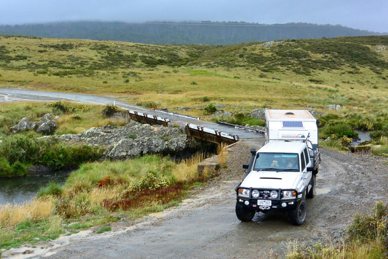
By mid-morning the next day we were on the Peppercorn Fire Trail which branches off the Long Plain Road in the heart of the Kosciuszko National Park, just north of the track to the historic Coolamine Homestead and delightful Blue Waterholes. A nearby camping area is a popular and enjoyable spot to spend a day or two, but on this trip we had other plans.
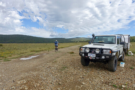
Knowing the Peppercorn Trail was closed to motorised vehicles I had brought my mountain bike along to follow this trail west to the source of the Murrumbidgee, just south of Peppercorn Hill.
My first foray along the track took me to a camping spot tucked in close to a copse of snow gums overlooking the boggy flats where the river gathers more water to make it more than just a trickle. The track finished here, which, as I had also discovered, can be accessed by vehicle – I called it Headwater Camp and it’s a nice, secluded spot to throw down a swag or set up the camper. From here I walked across the bog to the main channel of the nascent river and followed it up and downstream before heading back to the bike and backtracking to find where the Peppercorn Trail had diverted from the trail I had ended up on.
The fainter, less-used Peppercorn Fire Trail veers off the main track and descends the low hill and crosses the fledgling Murrumbidgee, about 2km west of the Long Plains Road. The river is about half-a-metre wide at the bridge, where a locked gate indicates the start of the Management Vehicle Only (MVO) track.
I pushed off west across the plain following in the footsteps of a mob of dingoes that had used the same track just a few hours previously. I saw no sign of them, but there were a few groups of wild horses around. This track enters the tree line and swings north climbing the low hills, before swinging westward again. From near here it’s a short walk through forest and across swampy ground to the mapped source of the river.
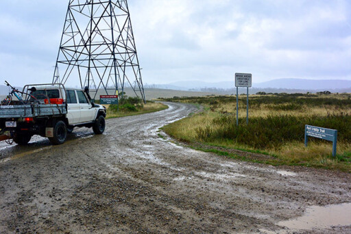
Back at the Cruiser I gladly traded two wheels for four and headed back out onto Long Plains Road, which crosses the Murrumbidgee a few kilometres south. We took the Port Phillip Trail as the ford across the backwaters of the Tantangara Dam is open to vehicles. At times the lake formed by the dam is too high, closing off access further east along the trail, though there was no such issue this time.
The green grass of the exposed floodplain of the dam was being cropped to lawn-like consistency by groups of wild horses, which seemed to be in very large numbers through here. If the NSW Parks & Wildlife Department are serious about ridding Kosciuszko of its feral horses, I can give them a tip: start around here!
With yet another crossing of the river – and it’s again a little bigger than previous – we came to the well-kept Currango Homestead and its 20 or so outbuildings. This historic homestead was built in 1895 and has been continually occupied since, with the homestead now offering pleasant rustic accommodation. The nearby open forest and snow plains are a delight, but camping isn’t allowed around the homestead – which is a bit of a shame, but there are a number of places nearby that cater for campers.
These high plains were first used by pioneer graziers in the 1830s, who brought their flocks of sheep and cattle during summer to these verdant grasslands. Homesteads and huts were built and the grazing continued until 1958, when all cattle and sheep were removed to protect the water catchment for the then fledgling Snowy Mountain Scheme – the Kosciuszko area having been declared a State Park in 1944.
Our route took us south along Pocket Saddles Road, which passes through some steep country before dropping down to another crossing of the Murrumbidgee, this time just below the Tantangara Dam wall. This is the first impoundment on the stream, used to control the flow of water of the river for irrigation and power purposes. Here we met up with a contract pig hunter who was scouring the area for feral pigs, which are now a major concern for the park’s management.
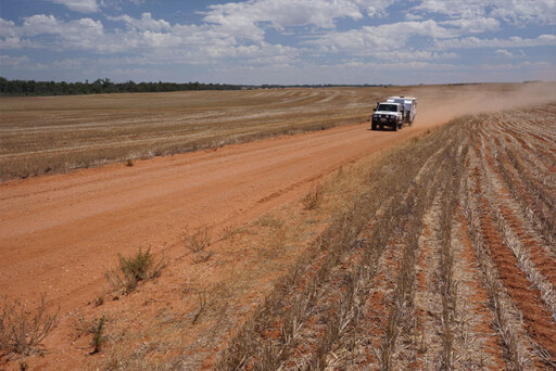
The river heads south-east after its expulsion from the dam, and we met it again north of Adaminaby where it was running through pockets of delightful farm land, some of it irrigated by the river itself – a sign of things to come further downstream. We travelled along bush roads, keeping as close to the river as possible. The area is alive with roos; in fact, while we had seen plenty of grey kangaroos in the national park, out here we had more variety including greys, smaller black (or swamp) wallabies and stocky euros to keep an eye out for and to dodge as they hammered across our track.
Later that evening we pulled up beside the Murrumbidgee, south of the small hamlet of Bredbo and the historic Bredbo Inn where you can enjoy free camping. Established in 1836 the pub is one of the oldest in Australia, and in the early days it was an overnight stop for the gold coach and a refuge from the bushrangers that once roamed the area.
The river was now flowing north as it paralleled the grey/green-clad ridges of the Namadgi NP, having changed direction suddenly as it cut through a gap in the Clear Range just north of Cooma. We crossed it again at Angle Crossing and followed the now defined and picturesque river valley northwards to the village of Tharwa, less than 40km from the heart of our nation’s capital.
This area is rich in Australian heritage. Aboriginal people were using the rich hunting grounds and fishing the rivers and streams a long time before Europeans arrived. In 1821 Charles Throsby, a pioneer settler and sometimes explorer, discovered and named the Murrumbidgee, which was an Anglicised version of the Aboriginal name for this river. Two years later Brigade-Major John Ovens and Captain Mark Currie explored the upper reaches of the stream. In 1824 Hume and Hovell crossed the river further downstream, south of present-day Yass, their journey to what was to be Geelong opening up a rich swath of country that was soon occupied by European graziers.
After climbing a hill north of Tharwa we came to Lambrigg Lookout, which overlooks the normally shallow stream and the farm once owned by the pioneer William Farrier. It was Farrier, who in the late 1800s and early 1900s set Australia on course as a major wheat producer by developing important new strains of wheat suitable for the drier country further west. His discoveries still reverberate through farming and agriculture today.
A little farther north we took the short diversion into the Canberra Deep Space Communication Centre at Tidbinbilla, now part of NASA’s Deep Space Network – Australia’s Tidbinbilla is one of three major tracking stations in the world. Here there are seven antennae including the biggest steerable antenna in the southern hemisphere, DSS-43. An information centre at the gate to the facility gives you a great insight into the work being carried out there.
The whole length of the river in the ACT is protected in the Murrumbidgee River Corridor which adjoins a number of other conservation reserves. While there are some very pleasant spots to swim, canoe and picnic along the river through the ACT, there is only one spot you can camp and that is at the well set-up Cotter Campground at the junction of the Cotter and Murrumbidgee Rivers. It’s a great spot to enjoy the river and to explore nearby Canberra.
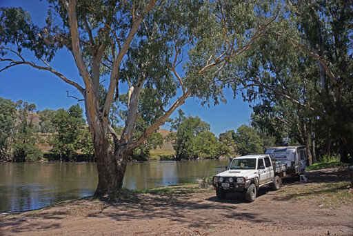
We pushed on and crossed the river where the stream enters the backed-up waters of the Burrinjuck Dam, the biggest reservoir on the Murrumbidgee and the first major dam built for irrigation in NSW (completed before WW1). We stopped for the night at the Burrinjuck Waters State Park, a well set-up and large camping ground on the edge of the lake that provides a top camping spot for those who want to water ski, paddle or fish the large expanse of water.
The mighty Tumut River, enhanced by other streams, joins the Murrumbidgee and the river flows strongly and steadily past the historic town of Gundagai. Captain Charles Sturt passed through here in 1829 before he set out in a whaleboat down the Murrumbidgee and Murray to the sea. Not to be daunted, he and his men then turned around and rowed back upstream to their depot.
Downstream from Gundagai are a number of reserves and state forests along both sides of the river, which make for great camping and ideal places to swim, canoe, fish or birdwatch. We stopped for the night in the Currawarna State Forest and made sure to be out of the way of any overhanging red gum branches, our phobia being fed by the sight of numerous large trees and limbs lying scattered over parts of the track and in camping spots. A low bank at one point on the river, even though a big gum had fallen and partially blocked access, was still a favoured launching spot for boats that the locals used to go fishing.
Our little expedition continued down the river, passing a heap of potential camping and fishing spots including Sandy Beach (near the small village of Wantabadgery), Berembed Weir (the south side of the river is best) and Five Mile Reserve east of Narrandera. The latter is actually on Bundidgerry Creek, an anabranch of the main river and an ideal spot for canoeing and birdwatching.
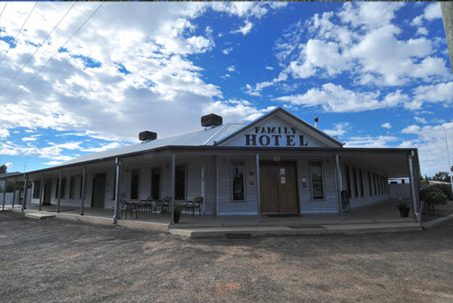
Downstream of Narrandera we explored the largest section of the Murrumbidgee River NP, which features a dozen or so sandy beaches and a boat-launching area, but again our explorations were curtailed by fallen trees. That evening we camped in the Willbriggie Reserve near the small township of Darlington Point, before continuing downstream past a heap of good campsites to the historic Carrathool Bridge over the Murrumbidgee. The town of the same name started its existence here, but when the railway came through in 1882 the town uprooted and shifted 6km north out onto the flat plain where it remains today. It was 10am when we drove into the small hamlet, but only a lazy dog snoozing under the veranda of the recently rebuilt Family Hotel lifted an eye to greet us.
The next day after checking out numerous sites along the river we came into Hay and found our way to Sandy Point, where the outskirts of the town and the north bank of the river are very popular free-camping spots. While there a ranger warned us about camping and stopping under old red gums – as if our steadily increasing phobia wasn’t already on high alert.
That afternoon we were in the small town of Maude, where the nearby Maude Weir and its waters make for yet another pleasant camp. We used to hunt pigs up this way and hadn’t been here for more than 30 years, so it was good to see the old Maude Pub still offering camping, good meals and ‘the best piss on the Bidgee’.
Our next overnight stop was in the expansive Yanga NP just south of Balranald. Up until 2005, when national parks took it over, this was one of Australia’s biggest and most prosperous sheep stations. Again it was a property we used to hunt feral pigs on, but such pleasures are strictly curtailed these days. Still, you now have the opportunity to explore the shearing shed, the outbuildings and the impressive 1850s pine log homestead. The must-see station is located on a high isthmus of land between the two bodies of water that make up the Yanga Lakes.
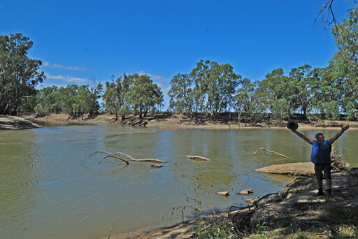
We were disappointed to find little public access to the Murrumbidgee farther downstream, with our route ending near the homestead that lies close to the junction of the Murrumbidgee with the mighty Murray. We opted to cut our losses and head back to the bitumen to cross the Murray into Victoria, where we found our way through state forest and tall, crowding red gums to the confluence of the two great streams – the Murrumbidgee oozed a darker, muddy brown plume of water into the already brown waters of the Murray.
We celebrated upon reaching our goal and then, after taking a furtive glance at the overhanging trees threatening the small campsite, we headed downstream and found our way the short distance to a great camp. First named by Thomas Mitchel as ‘Passage Camp’, it was here in 1836 that he stood on the cusp of everlasting fame as the discoverer of ‘Australia Felix’. The sandy beach that had greeted him is still a delight today, and with no one else around and no overhanging gums we had a perfect campsite and a fitting place to end our journey down the mighty Murrumbidgee. There’s no doubt we’ll be back, this time with a canoe, a fishing rod and a bit more time.
WHERE TWO RIVERS MEET
THE controlled waters of the Murrumbidgee, considerably depleted by hundreds of farms and thousands of hectares of irrigated land, is a far cry from Sturt’s day when he states in his diary: “...such was the force with which we had been shot out of the Morumbidgee, that we were carried nearly to the bank opposite...”.
Please enable JavaScript to view the comments powered by Disqus.
COMMENTS