Explore QLD
Gallery1
OFTEN I hear of great places that others explore and think, ‘one day I should do that’. So, with a little time up my sleeve, I headed to the outer skirts of the scenic rim in South East Queensland to traverse the Condamine Gorge area.
A two-hour drive south-west of Brisbane landed me at the quaint village of Killarney, a friendly town with a population of about 800. Basic supplies can be purchased here for further exploits. The plan was to head out to the Condamine Gorge area, check out the impressive local waterfalls – Daggs Falls, Queen Mary Falls and Browns Falls – and then continue on to the 45km Condamine River Drive loop.
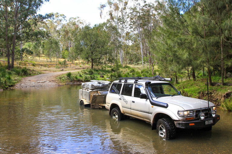
The Cambanoora Gorge, commonly known as the Condamine Gorge run, is part of the bicentennial trail and was once used to move supplies to the early settlers within the gorge.
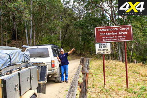 Cut through in the mid-1800s, it was also used to move timber to nearby Killarney where logs were loaded on the railway, but now it’s a popular 4WD trail as it crosses the Condamine River 14 times. Starting only a short distance from Killarney, the gorge drive is relatively easy in most high-clearance 4WDs and can take as little as an hour to drive. However, water levels will rise and make things more challenging after rain.
The fury in this area is evidenced by the amount of debris left high in the trees after big floods, while the steepness of the gorge walls provides beautiful views as you pass through. It’s almost prehistoric, with gnarly, twisted trees shaped by the floods, huge granite boulders, and sheets of basalt rock that have stood the test of time.
 In the summer months there are plenty of different swimming holes beside the track, so be wary of people swimming nearby. Dust and water-wash may also be a problem as you pass. Interestingly, the water here from the Condamine River eventually flows into the Darling River system, the largest water catchment in Australia.
The land on both sides of the river is private property, so camping isn’t possible without prior permission. However, the locals at Killarney pointed me towards a newly opened cattle station that allows camping: Cullendore High Country.
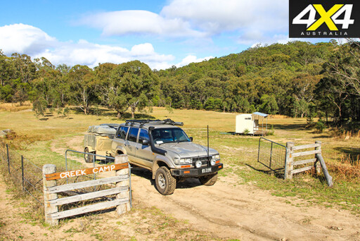 An easy 30-minute drive south-west along the Mount Lindesay Highway soon led me onto Cullendore Creek Road and towards the station. Cullendore is in the heart of granite country, and Cullendore High Country is a secluded station where you need to travel almost 3km to get to the office from the front gate – then a few more kilometres to get to the many campgrounds on the property.
Stuart, Wendy and their son Matt will welcome you when you arrive and go all out in typical country style to show you around; and Matt does a great job supplying firewood and will even deliver it to your campsite. A property map with named tracks and an information sheet is provided when you book.
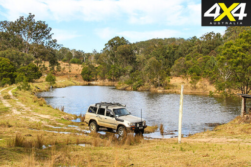
 Cullendore is a 16km² working cattle station, yet the owners have set aside nearly half of the property for camping, mountain-bike riding, canoeing and bushwalking. There’s also nearly 20km of 4WD tracks located on the property, but don’t come here expecting twin-diff-locked kind of tracks as this isn’t a 4WD park.
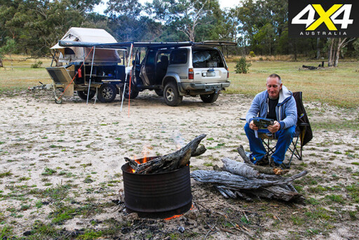
You’ll need to engage 4WD on some tracks, whether it be heading down to the Maryland River for a swim or heading out to the Lookout to take in the most stunning views. The owners have spent the past three years getting this property up and running with pristine campsites in several locations. They’ve also installed flushing toilets and hot showers, and with the popularity of this hidden gem they are soon opening more secluded camps with facilities.

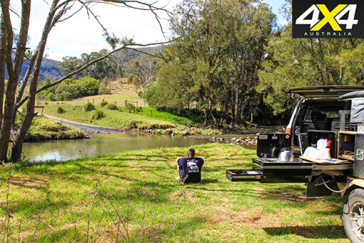
The River Track is the longest on the property (although there’s a plan for a full day loop) and should not be missed. Heading from the campgrounds it follows the western boundary along the ridge line past old loading ramps and the dams before it turn towards the bottom of the property. Down at the Maryland River the water is crystal clear as it filters through the granite sand and, interestingly, this river flows into the Clarence River system which is the second largest catchment in NSW.
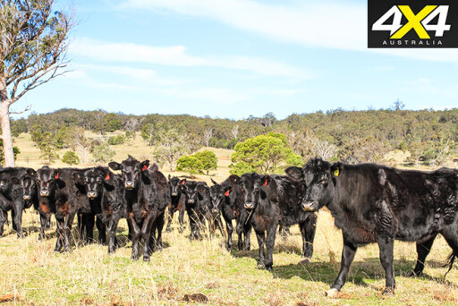
 There are groves of native Waratah trees where you’ll find yellow-tailed black cockatoos. On the property you’ll also find the rare spotted quoll, platypus, a massive amount of birdlife, wild pigs and Angus cattle.
If you’re still unconvinced about making the trip, the property adjoins the Maryland National Park, providing a further 23,000 hectares of walking and mountain bike trails. Spending several days in the great South East Queensland is never enough.
TRAVEL PLANNER
WHERE
CONDAMINE Gorge and Killarney are a little over two hours’ drive south-west of
Brisbane. The falls and gorge loop is around 45km long and takes a couple of hours to enjoy. Cullendore Station is another 30km south-west of Killarney, just across the NSW border on Cullendore Creek Road. Access is via the Mount Lindesay Highway.
 SUPPLIES AND FACILITIES
The quaint village of Killarney has most facilities and supplies fuel, food and workshop repairs. If travelling out to Cullendore, make sure you have ample fuel and food. Phone service is patchy around Killarney and Cullendore and there is none in the gorge.
TRIP STANDARD
The Condamine Gorge drive is suited for most high-clearance 4WDs, depending on water levels. Generally it takes an hour without stops. Cullendore Station has nearly 20km of trails and is suited for soft-roaders and 4WDs.
 CAMPING
Whether you have a camper, off-road van, tent or swag there are plenty of campsites available at Cullendore for groups. There are secluded sites in several different areas. Flushing toilets, fire bins and hot showers are supplied. Firewood is available from the office.
CONTACTS AND INFORMATION
Tourist information can be found at Killarney’s co-op, where you can pick up leaflets and current conditions. Also check volunteer website Killarney Queensland for local info.
For information on Cullendore Station, call Stuart or Wendy on 0459 901538, or visit: www.cullendore.com
Please enable JavaScript to view the comments powered by Disqus.
COMMENTS