Explore QLD
Gallery1
If you’ve ever enjoyed Fraser Island, you’ll love Moreton Island.
It has the same feel, but it’s only a quarter of the size. The best part of the island, though, is that, of its 420km of tracks, all are only accessible with a four-wheel drive. It’s not often you get to drive around an entire island that promises something new to look at around every corner.
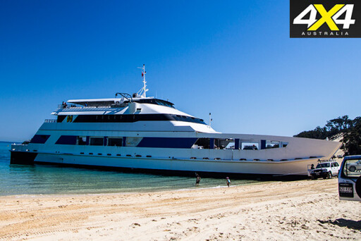
Jump on the MICAT Ferry from the Port of Brisbane to enjoy a 75-minute ride to the island – kick back and take in the view. This is also the best time to drop your tyre pressures, because the ferry delivers you straight onto the beach – you don’t want to be ‘that’ person who holds up everyone in the convoy while you end up buried to your belly in sand.
 The Tangalooma Island Resort is a five minute drive south on the beach or a 20-minute walk past the shipwrecks. The resort is the place to get money from an ATM, re-stock your supplies and arrange activities such as quad biking, parasailing and scuba diving. This is done through Tangatours, situated in the centre of the resort – bookings are essential.
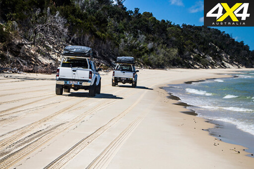
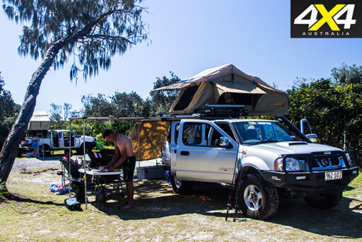
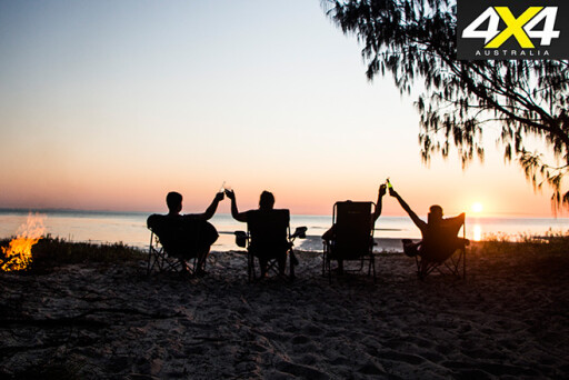
Only 1400 campers are permitted on the island at any one time. This saves it from getting over-populated, and it’s rare to see oncoming traffic on a single-lane beach track. You really feel like you’re alone, which adds to the relaxation and sense of being at an island hideaway.
 Direct access from the western beach to the eastern beach is via Middle Road, which basically cuts the island in half. This is a one-way track, so you won’t meet anyone coming from the other direction. One-way tracks are a good idea as the surface doesn’t get cut up during peak times.
Popping out on the beach, the aquamarine water slaps you in the face. It’s nothing like you’ve ever seen before. Add the white sandy beaches and you pretty much have paradise.
 Look north and you’ll spot the lighthouse in the distance. Follow the beach as far as you can and you’ll find an exit from the beach that leads you to an intersection. Turn right here and you can access the Information Centre car park at the base of the lighthouse. It’s worth the trip.
Walk up the stairs until you reach the viewing platform and you’re treated to a wonderful view of the island, as well as a view into the history of the family that worked and lived there – their graves explain the story.
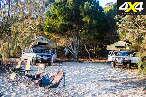
Back on the track, head west and you will pass the access point to North Point Camping area. This is a clean campsite with toilets, but no fires are allowed; Yellow Patch campsite, near North Point, does allow fires but check that no fire bans are in place and bring your own firewood. Don’t bring a chainsaw, as cutting wood on Moreton Island is prohibited and, as always, make sure fires are small, kept clear of vegetation, and are extinguished with water when unattended.
 Yellow Patch is secluded and set back from the beach. The seclusion means these sites can be enjoyed without other campers right beside you. Campsites such as site 14 are accessible, but you must drive through freshwater holes to get into it. There are four sites to choose from and walking the route first is best, as the holes can be deep.
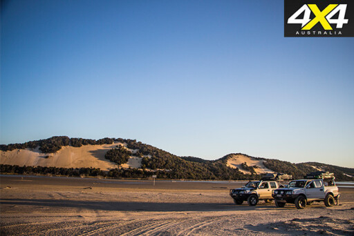
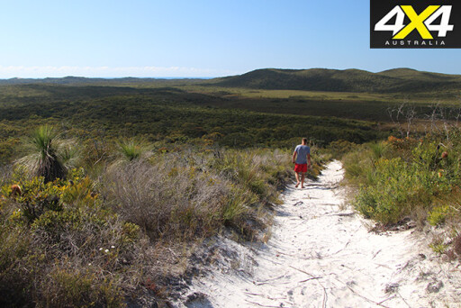
If you’re up for sightseeing, head to the Five Hills Lookout. It takes about 10 minutes to walk to the top, where there’s a good view to the northwest, with the lighthouse in the distance.
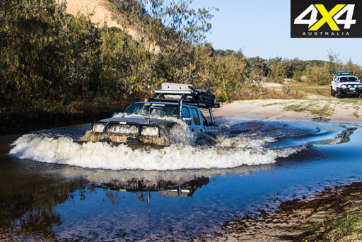
 The inland tracks can be unpredictable, with soft chopped-up stretches. This is where the right air pressures are vital; the wrong tyres with wrong air pressures churn the tracks and make them harder for others to drive. If you hit the chewed-up sections with too much speed, you’ll damage your suspension and you don’t want that when you’re on holiday.
Heading south past Tangalooma, the beach isn’t drivable for at least two to three hours after high tide. It’s also not very wide and there are a lot of dead trees, so you’ll need to weave your way through.
 The beach leads towards Kooringal, but before you get there you will drive past Toulkerie. You may not have heard of it, but you can buy the best oysters you will ever taste here! Make sure you drop in and grab some – you won’t be disappointed.
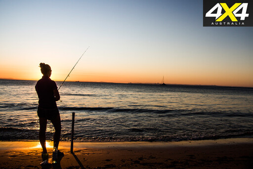
Put the oysters in the fridge and keep heading south, through Kooringal and on to Reeders Point, where you can soak up views to North Stradbroke Island, dip your feet in the water or wet a line to catch something to complement those oysters.
 Heading back north towards the lighthouse, about halfway up, Middle Road comes into view again. Take the turn and head west – not far along the track you’ll see signs to Mount Tempest. Hang a right and drive up to the entrance of the walking trail.
It’s about a 2km walk up the hill and it’s best tackled in the early morning or late evening – take water with you. At 285m above sea level, Mount Tempest is the highest sand dune in the world and gives you breathtaking 360-degree views of the island; you can even see the Brisbane coastline and the Sunshine Coast.
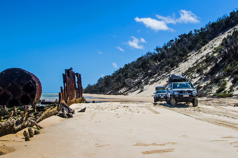
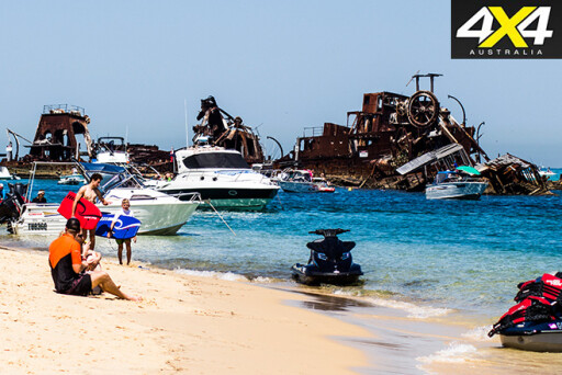
After you’ve made it back down to the carpark, keep heading west toward the western beach, then turn left towards the Wrecks at Tangalooma. What better way to cool off than snorkelling around these beauties, witnessing the abundance of fish that live in the wonderland below the water’s surface?
 This place truly is amazing; a real heaven for four-wheelers. Book a spot on the MICAT, book your camping and get a vehicle permit, then head on over to experience it for yourself.
Travel Info
Where
Moreton Island is situated 75 mins offshore. Tracks are only accessible by four-wheel drive. The MICAT Ferry departs from the Port of Brisbane.
Camping
$5.95 per person per night or $23.80 per family per night.
Moreton Island has plenty of different campsites, some with full facilities and others without any facilities.
 The campsites on the western side are more sheltered and offer calmer waters. The campsites on the eastern side are set back up in the dunes to protect you from the offshore winds, but the beach is pristine and has some of the best fishing spots.
Facilities
There are toilets and showers at most of the main campsites, which are clearly marked by the signs at the entrances.
Trip standard
The tracks can be soft and boggy, but after rain they become a lot firmer, making them easier to drive. Keep an eye on the tides, as the south-western side is impassable at high tide. The water crossings have firm bases, but walk them first to test their depths.
Maps and Guides
South East Queensland – HEMA
Restrictions and permits
A vehicle ferry permit needs to be booked through the MICAT website.
 The beach access permit and camping permit are both booked through the National Parks website.
Contacts and information
MICAT:
moretonislandadventures.com.au/ (07) 3909 3333.
National Parks:
www.nprsr.qld.gov.au
Tangatours:
www.tangatours.com.au
(07) 3410 6927
Click here to explore more of Queensland.
Please enable JavaScript to view the comments powered by Disqus.
COMMENTS