Explore QLD
Gallery17
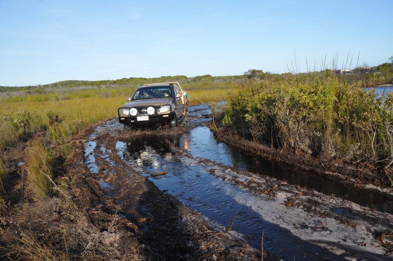
While many Cape York travellers rely on GPS for directions, it’s best and more accurate to plan long trips by studying proper maps of the region. The Hema Cape York Atlas & Guide book – or the Hema Cape York map – are both ideal. If you have one and want to avoid the PDR on the return route from the Tip – or the way north – there are alternate routes on the west and east sides of the PDR, most largely ignored by ‘Tick-off the Tip’ visitors.
When coming back from the Tip, one of the best East Coast routes can be taken by turning east on to the Port Stewart Road, 28km south of Coen. Consider visiting Indigenous-owned Silver Plains Station – if open to visitors. They had some great barra fishing and boar hunting there on my last visit a few years back, though it cost me a little.
While it’s named as a ‘port’, Port Stewart no longer functions as one. Previously it was used to unload mining equipment on the muddy foreshores of the Stewart River estuary, from where the machinery was dragged up the steep hills of the Great Dividing Range by horse and bullock teams to the Coen and Ebagoola goldmines beyond.
About 20km back from the boat ramp that now marks the Port, turn south along the coast to Lily Vale Station via the Running Creek track. It runs on private land and is subject to the whims of one owner because, at times, people have encountered locked gates. This was after he got pissed off by grubs leaving rubbish behind, illegal shooting and ignoring ‘no trespass’ signs. It only takes one mongrel to spoil it for all. Just remember that you are a guest in this country, treat it as such.
The Running Creek track terminates on the Musgrave-Lakelands Road. It’s not far to the roadhouse, as there’s no more fuel until you reach Cooktown if you plan to explore some of the most wonderful wilderness country on the lower Cape York Peninsula’s east coast.
17
RINYIRRU NATIONAL PARK
You may also wish to spoil yourself for a night at the Lotus Bird Lodge, 24km past the Running Creek track junction. To the east is one of the country’s great national treasures; totalling some 537,000ha, Rinyirru is the second largest NP in the state after the Simpson Desert National Park (now Munga-Thirri National Park). Previously called Lakefield, Rinyirru is amazing, and with eight major rivers running in to the Laura basin – Annie, Morehead, Hann, North Kennedy, Bizant, Normanby, Deighton and the Laura – there are plenty of fishing opportunities to enjoy.
Just remember to book campsites in the park, most are located on fish-rich river and creek pools fringed with verdant tropical vegetation alive with the noise of myriad birds.
The park has a mosaic of flood plains, sandstone escarpments, hills, open monsoonal woodlands, termite cities and stands of the spectacular gebang (Corypha utan) palms, one of our tallest palm trees. It lives for about 50 years before it blooms, seeds and dies. The rivers and creeks shadowed by gallery forests, a type of monsoon rainforest.
The landscape is associated with many Aboriginal cultural sites and myths. Previously the traditional owners were employed on cattle stations – Laura, Bizant, Breeza Plains and Lakefield – which were purchased by the state and declared a park in 1978, 100 years after cattle was first introduced to the region. The traditional owners jointly manage Rinyirru with the QPWS under the CYPAL Agreement.
The park, like others on the Cape, rarely opens by June and often much later. The reason is so that the tracks are not damaged when still damp and that campsites have dried out – at least that is the park management excuse. I personally reckon it’s laziness, as in most years the wet and the flood run-off are well and truly over by May.
The park is endowed with numerous campsites that are well-patronised from the time Rinyirru first opens until the closure of the barramundi fishing season, from November 1 until January 1 on the east coast. Bag and size limits apply. Only the Hann River crossing and Kalpower campsites have toilets.
The fishing is excellent in all freshwater streams. Some streams stop running late in the dry, and anglers must share the water with freshwater and saltwater crocodiles. Canoes and ’yaks are not recommended following a fatal attack on a canoeist in the Normanby River a few years ago. Some campsites are located on tidal arms and many local anglers camp on the tidal flats of Marina Plains, where many issues remain with traditional owners and it’s largely open slather camping, with toilet and rubbish disposal a huge problem.
But the park isn’t all about fishing, many 4WD tracks terminate at remote waterholes, lily-covered billabongs, swamps, old cattle yards and more. Bird watching, bush walking and just relaxing with a coldie under a tree watching crocs basking below the camp, accompanied by birdsong, is hard to beat.
17
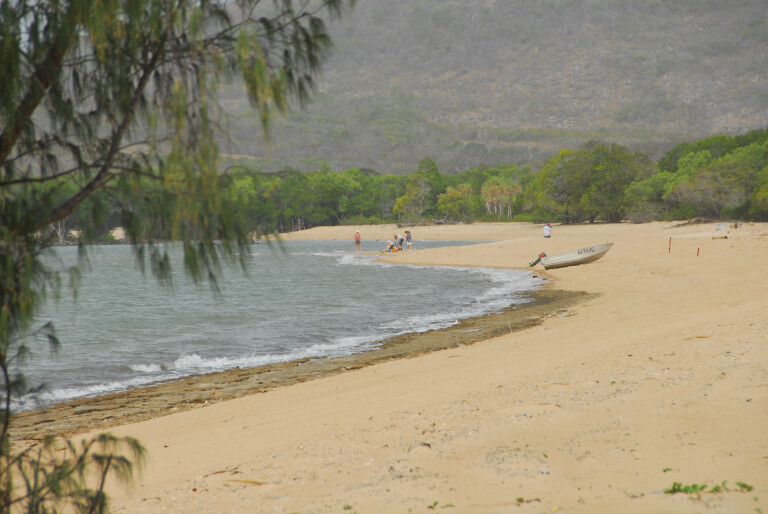
Ninian Bay is a great spot to relax – but don’t swim, crocodiles live here
BEYOND RINYIRRU
Accessed from Kalpower Crossing and worth visiting is Bathurst Head on Bathurst Bay. The rocks on the Head have amazing barramundi fishing late in the season.
No netting is allowed in Princess Charlotte and Bathurst Bays, so the chance of catching your own dinner is high.
This is part of Kalpower Station, visit them for details, though the nearby park headquarters may also have information. The station is Aboriginal owned and permission is subject to the whims of the traditional owners, as is the cost. Nothing is ever clear-cut in this region, or farther south at the Cape Flattery dune fields, when it comes to traditional management. Sometimes it becomes all too hard and frustrating …
Head east after crossing the Normanby River on Kalpower Crossing to Cape Melville National Park and Ninian Bay, both have good camping and fishing. Turn north at the abandoned Wakooka Station and follow the signs to the remarkable Cape Melville National Park. En route, visit beautiful Ninian Bay for the night, a sheltered cove with a lovely beach and a large paperbark swamp behind it. On calm days, it’s possible to fish along the seashore to the south and north with an estuary boat. The bay is part of the Cape Melville National Park and connected to Rinyirru by the Jack River National Park, with Kalpower Station lodged between them.
Once past Wakooka the track, or tracks, degrades, with corrugations, washouts and the odd tidal creek encounter. There are long stretches of sandy bits that will test the endurance of trailers, while deep washouts are problematic for many drivers. In some sandy sections several tracks run from the main one to unite farther on. The trick is to pick the right one to prevent yourself from being bogged. Just make sure the tyres are sufficiently aired down.
17
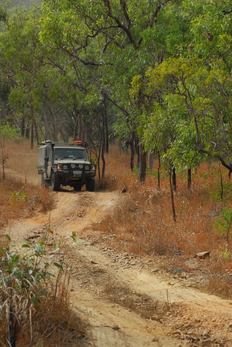
Side-tracks await to be explored along Starcke Track
CAPE MELVILLE NATIONAL PARK
Past the Muck River, the track swings east toward the narrow beach and verdant monsoon rainforest fringe that separates it from the rolling boulder-strewn Melville Range. If you were in awe at the Black Mountains, south of Cooktown on the Mulligan Highway, you will be gobsmacked by the majestic size of the house-size boulders that make up both the Melville and Altanmoui Ranges that fringe Bathurst and sections of Princess Charlotte Bay to the west.
Unlike the black-coloured rocks of the Black Mountain range far to the south, the Melville rocks are light-coloured. This is due to the lack of algae, which finds the Black Mountain rocks more to its liking due the reliable rainfall of the wet tropics. The algae is the black that grows in the pores and surfaces of the rocks, but underneath they’re light-coloured.
17
THE STORM
Cape Melville has a sad history and an unwanted record. On the evening of March 4, 1899, on a Saturday, the pride of the Torres Strait pearling fleet is at shelter in Bathurst Bay (northwest of Princess Charlotte Bay) and adjacent areas as the ships’ barometers plunged to alarmingly low levels. A storm is coming.
Nervous captains head for shelter with fear in their hearts. There are low, subdued talks as divers gather on deck, watching night fall and an ominous black sky above the Coral Sea alive with lighting and tumultuous, continuous moaning thunder.
The ships batten down, 124 in all: 109 luggers, six cutters, eight schooners, and the lighthouse ship anchored off northwest Cape Melville. To the south six cutters are anchored behind the Howick Island group while the schooner Wanetta accompanied by 11 luggers, is north of Princess Charlotte Bay – and missed the storm.
Torrential rain and high winds buffet the ships as they ride at anchor, even the thunder is drowned out by noise from the wind, spray and hugged waves that slam in to the ships. Sometime between 3 and 5am a tidal wave estimated to be over 15m lifts the ships from their anchors, carries them ashore and smashes them in to the rocks of the stony range behind the beach.
The only ship to survive the carnage is the aptly named Crest of the Wave, but she has lost all of her 13 luggers. Her Captain, W. F. Porter notes that the “glass is still falling at 4.30am on Sunday morning.” Daylight brings a grey, rainy blustered sky with only the dismasted Crest of the Wave riding lonely and alone in the bay. The fleet is no more, the shore littered with ships, broken masts and a handful people walking about in a state of shock.
17
Cape Flattery beach track is well-worth the adventure
THE AFTERMATH
The ships near the Howick group were also sunk and the legend of a Murray Island man, Douglas Pitt, endures in the Torres Strait. In those days, most captains and divers had their wives and families with them. Pitt and another man, along with their wives, struck out for Cape Melville. The men and women carried their children on their backs, but all were dead when they reached the mainland.
Many Aborigines who were camped along the Cape Melville beach were also drowned. No one knows how many, but some estimates say more than 60 died; that, along with the 307 ship crew lost, makes the Bathurst Cyclone the most damaging in terms of life in our history. Only a handful of Europeans were among the dead, all the others were mostly Torres Strait Islanders and local Aborigines.
The first ship to arrive on the scene was a steamer, the Duke of Norfolk. Her master refused to take on natives and left people behind floundering in a rolling sea or marooned on islets and rocks. He continued to Brisbane and signalled the bad news to the signal man on Cooktown’s Grassy Hill, but the signal was partly lost due to bad weather and it was not until the ship reached Townsville on March 8 that the tragedy became known to authorities. Help was on its way, but it was mostly body recovery …
The event and its history are largely forgotten by modern travellers who only become aware of it when they come across a small memorial that reveals the night of terror all those years ago. It’s located at the western end of the Melville Range and between its western first outlier, about 100m from the beach.
17
Take your rubbish out and don’t be a bloody grub …
CAMPING
There are no organised campgrounds on the beach, just pick a spot under the shady fruit trees that fringe it and crap in the wood beyond. However, be aware that when the fruit is ripe, fruit bats and birds will crap all over your camp and vehicle – day and night – it’s called ‘revenge crapping’ up here …
The fishing can be great or bad, but that is fishing all over, even on the Cape. There is a freshwater creek and a spring located on the base of the boulders on the west side of the range. It’s crossed before you reach the beach. The water from the spring is soft and drinkable and invites some swimming.
Take a hike along the base of the rocks and you may find trochus and pearl shell, pieces of ship’s timber, rusty metal and more, all that remains of the ships that were smashed on to the rocks by a 15m tidal surge, the highest ever recorded in Australia.
Cape Melville National Park is remote, wild, beautiful and often dangerous, with a crocodile attack that injured two people occurring a few years back – but don’t let that stop you going there.
17
HEADING SOUTH
Head south from abandoned Wakooka Station junction on to the Starcke Track to Cooktown. The track is rough with stony ridges, washouts and sections of challenging deep bulldust. There are campsites on the mouth of the Starcke River and a boat ramp. Note that security is a problem here.
Farther south, visit the amazing Cape Flattery dune field and en route camp on wonderful Elim Beach at Hopevale. The unmarked turn-off is at the Mount Webb National Park, a few hundred metres south of the oil palm plantation. The track to the beach has swampy sections and deep creek crossings before it ascends on to the 15km-long beach. People camp at the mouth of the Morgan River and on sheltered Connie Beach on the north side of Cape Flattery. Make sure your vehicle fits in the conveyor tunnel or you may lose the hood rack. Visitors are not welcome at the sand mine site and workers village.
Enjoy the wonderful beach camping at Elim Beach, via Hopevale, before heading back to civilisation.
At Cooktown you have a choice of heading home on the Mulligan Highway via Mareeba, or turn east past the Black Mountain National Park – and is the northernmost border of the 9000km² Wet Tropics World Heritage Area that ranges all the way south to just north of Townsville. Don’t miss beautiful Bloomfield Beach and the mouth of the Bloomfield River at Ayton. Here you have a choice of exploring the western edge of the Daintree Rainforest, via the CREB Track, or the coastal section from the Bloomfield Track. If it’s raining, forget about the CREB track and let common sense prevail.
But forgive me, did I mention all those side-tracks that divert from the routes we have just explored? Oh well, you will just have to go back another time and do it again. Just another excuse to come back … ya hear!
17
Plenty of creek crossings and swamps to traverse on Cape Flattery track
HEADING NORTH
Of course, you can start your Cape York adventure from Cooktown and follow the scenic Starcke Track, via the Battle Camp Track, north to Port Stewart, via Melville and Rinyirru National Parks. Just remember there are no facilities or fuel on this route until you reach Coen, or by diverting to the Musgrave Roadhouse and missing the Running Creek Track. You may have to carry extra fuel if you don’t have a long-range tank.
An alternate route is via the Battlecamp Road to Rinyirru NP on the PDR, if you wish to avoid the Starcke Track and the Cape Melville region.
Note: these tracks and directions may be confusing and it’s recommended to read this along with a Hema Cape York map, where all the tracks’ information is crystal clear.
Please enable JavaScript to view the comments powered by Disqus.
COMMENTS