Explore
Gallery20
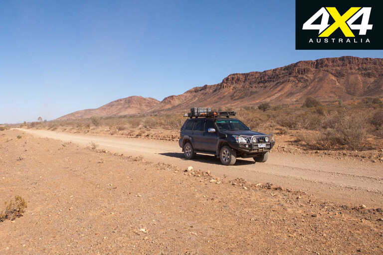
The bitumen runs out at Blinman, the highest town in South Australia, after which good gravel roads wind farther north through scenic gorges carved through the rugged red ranges and out onto the flat, seemingly endless plains surrounding Lake Frome. The lake’s pure white salt surface shimmers in the distance and, with a reflectivity of 70 per cent, when seen from space it is one of the brightest objects on earth.
For what it’s worth, Australia also has the darkest place on earth – Lake Argyle in the Kimberley – with five per cent reflectivity.
20
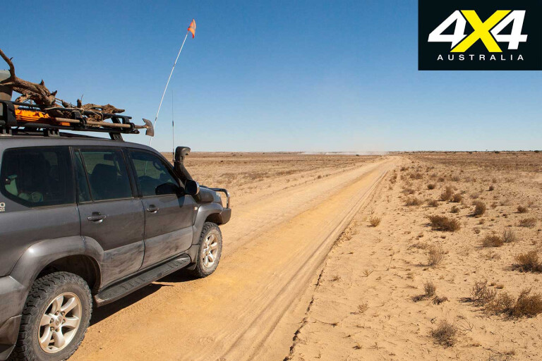
North of Arkaroola the road condition deteriorates and is subject to numerous dry creek crossings before meeting the Strzelecki Track.
Whether the Strzelecki is getting knocked around by more traffic or just seeing less maintenance these days (or more likely I’m just getting old and soft) it was a long, unpleasant drive to Innamincka. While the odd bulldust hole and heavy vehicle with dust trails that reduce visibility to zero are to be expected, the rough road surface can literally shake your 4x4 to pieces.
Despite a full mechanical check before the trip and driving conservatively, both headlight low beam filaments blew on the way to Innamincka, the fuel tank filler hose fractured and the bushes in both steering arms had to be replaced after the trip. These were minor concerns compared to also finding one of the two retaining bolts in the differential upper control arm had disappeared and the other was hanging by a thread.
20
The Diamantina River had been running for several weeks, flooding areas around Birdsville and, when there is enough water, some of it eventually finds its way into Lake Eyre.
Local sources before the trip assured us that the Warburton Track (our proposed route into the Simpson) wouldn’t be cut, but on fronting the Innamincka Store for our desert passes we discovered the track had been closed by floodwater just 24 hours earlier.
We overnighted at Cullyamurra Waterhole and, with the surrounding countryside bone dry, this huge body of water, Australia’s largest billabong, seemed out of place. It’s a delightful camping area; although, several days of unseasonably warm nights had allowed the fly population to explode and sunset was a welcome time of the day when they finally abandoned their persecution and disappeared for the night.
20
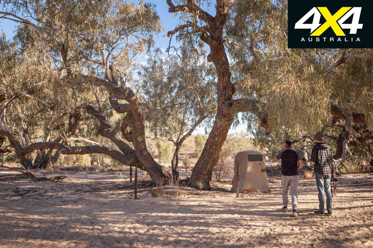
The current hadn’t been apparent at Cullyamurra because it is such a large body of water, but the next day we stopped off at the gravesite of Wills (of Burke and Wills fame), a little downstream of Innamincka, and were surprised at the strength of the flow where the Cooper was much narrower.
Walkers Crossing Track follows the Cooper west to the Birdsville Track, and with the vast flood plain stretching for kilometres either side of the creek, it gives some idea of just how much floodwater flows here on occasions. While the road surface of fine sand and silt generally makes for a smooth run, the dust gets into everything and just hangs in the air, ensuring a need to keep decent separation from other traffic.
20
Halfway to the Birdsville Track the road crosses the Cooper (there is also a bridge for use when the road is cut) and, while only 70km as the crow flies from where the creek was flowing strongly, at the crossing itself it was as dry as a chip.
The last half of Walkers Crossing Track passes through increasingly stony country as it nears the Birdsville Track and enters Sturts Stony Desert. The dark red gibber plains glint in the sun, but now dry bog holes suggest this to be a treacherous drive in the wet.
In places, gnarly, softball-sized rocks that had been knocked onto the track lay waiting for a moment of inattention, and sharp stones looking for a passing sidewall jutted from the sides of muddy wheel ruts now baked as hard as cement.
20
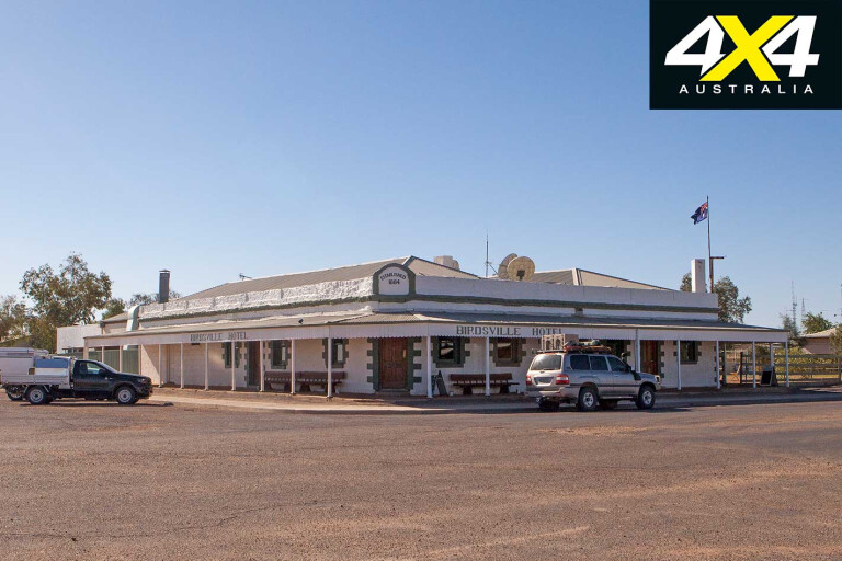
With the Warburton Crossing Track no longer an option, on reaching the Birdsville Track we headed north to the iconic outback town of Birdsville and the compulsory ice cold beer or three in the front bar of the local pub.
While there were many more tourists and blow-ins like ourselves than locals, the latter were easily identifiable by their weather-beaten complexion, laconic sense of humour and, of course, their wide-brimmed, sweat stained stockman hats. The rodeo was in town and the pub was jumping, so meals were a long time coming, but, as always, they were worth the wait and a pleasant change from campfire food.
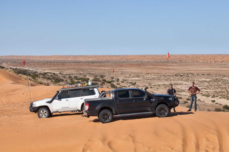
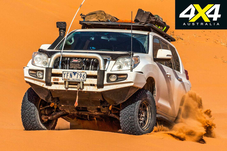
The first stop on our run out to Poeppel Corner was Big Red, which was initially deserted apart from a film crew and a highly modified Toyota that sounded and performed as if it had a motor that would be more at home in a Kenworth truck. It was the only 4x4 I’ve ever seen simply drive up Big Red’s steepest approach without even needing a run-up.
20
The drive from east to west across the Simpson is said to be the more difficult passage because the prevailing wind makes the eastern side of the dunes steeper than the west. That proved to be true and the drive to the Corner took seven hours, whereas the return journey (west to east) was an hour quicker (although this could have had something to do with thoughts of beer o’clock at the Birdsville pub influencing the right foot).
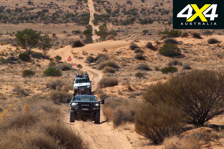
The seemingly never-ending QAA Line disappears into the distance, while the occasional chatter on the radio gives some idea of what oncoming traffic might be met over (rather than on top of) the next dune. The track was relatively busy, with a number of convoys small and large being met along the way.
20
The QAA, like all the Simpson’s tracks, was badly scalloped, with undulations perfectly spaced to resonate with a 4x4’s suspension, so that once over a certain speed (about 20km/h) vehicles would bounce ever higher only to land heavily – followed by a second crash, being the contents of the vehicle exiting freefall.
A stretch of a few hundred metres without scallops would see vehicles pick up speed only to be caught out by the next rough section. Some dunes were very rough from the over exuberance of previous drivers, and too fast an approach risked vehicles nosing into the sand.
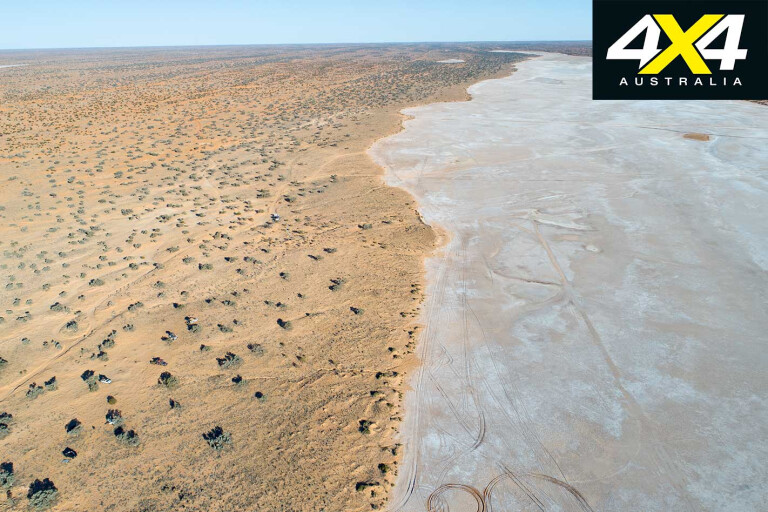
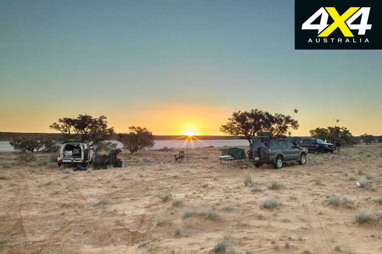
Just after entering the Northern Territory, the QAA crossed one of the many dry salt lakes in this area before following its shoreline south. The hard, smooth salt surface saw the speed demons put in an appearance and we rapidly closed on our overnight camp site at Poeppel Corner. Here, a dozen or so campsites were scattered over a large area along the edge of dry Lake Poeppel, each staking claim to one of the many Mulga trees that punctuate the sandy shoreline.
20
The surveyor, Augustus Poeppel, marked the border with a post in 1880 by using a chain to measure the distance from Hadden Corner 300km to the east. Unfortunately, the chain stretched slightly during this process and that original marker was incorrectly placed some 300m west of its true location.
One of the great joys of camping in the desert is watching the red ball of the sun sink below the horizon and the dusk sky gradually take on delicate hues of pink and purple as night approaches. Once the darkness is complete, there’s no better pastime than relaxing around a crackling campfire and watching the stars ablaze in the firmament above.

20
The journey back to Birdsville was uneventful apart from pilot error on the rough track which resulted in a brief attempt at flying. A carton of eggs failed to survive the subsequent landing and ensuing attack from several cans of beer, leaving the contents of the fridge a sticky mess.
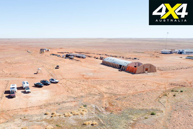
The return to Innamincka was by way of Cordillo Downs, one of 3.5 million hectares of station properties controlled by the Brook family of Birdsville, and famous for having the largest shearing shed in Australia. The shed was constructed from stone rather than wood due to the absence of suitable local timber, while the surrounding stony landscape provided a ready supply of alternative building material. The shed is no longer used for shearing, as dingos decimated early sheep flocks, forcing the station to restock with cattle.
20
The road from Birdsville to Cordillo Downs is notoriously very rough, but on this occasion it had been recently graded and proved an easy run. Farther south, after crossing back into Queensland, the freshly graded rich red clay road was wide and smooth enough to land a passenger plane.
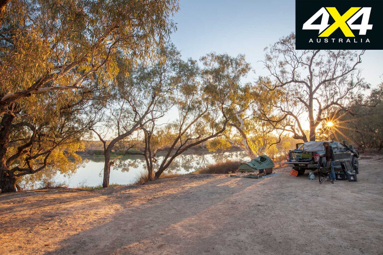
Having heard good things about Policemans Waterhole campground on the Cooper just to the west of Innamincka, we thought we’d check it out and were pleasantly surprised. Camped right on the waters’ edge under huge river red gums, you can kick back and watch the antics of pelicans as they paddle up and down the wide expanse of water.
It is incongruous in such an idyllic setting to think that 157 years ago Burke and Wills (the latter’s grave is close by) would have passed by within metres of this site shortly before they perished.
20
While the first motorised crossing of the Simpson happened less than 60 years ago, today thousands of 4x4s descend on the desert each year, and a trip that used to be classed as a serious adventure is now something anyone with an appropriate vehicle can complete in air-conditioned comfort in a few days. For some, the desert possesses a magical attraction that keeps drawing them back time and time again.
If you are yet to experience the joy of camping in remote places like the Simpson, you really don’t know what you are missing.
MORE4x4 Explore
Travel Planner
WHERE
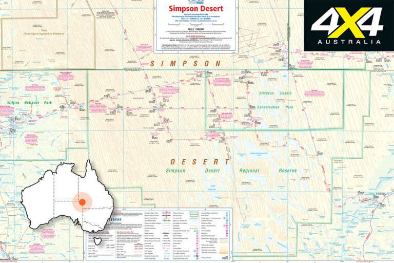
The Simpson Desert, 2000km from Sydney or Melbourne, is located at the juncture of South Oz, the NT and Qld.
20
WHEN TO TRAVEL
Desert summers are unforgiving with temperatures regularly in excess of 40ºC, making the cooler months of April to September the best time to visit. Expect daytime temperatures around 25ºC and single digit overnight lows.
STAYING THERE
Your vehicle needs to be in top condition. Vehicles are required to have a UHF radio and a 3m sand flag. Visitors require a National Parks Desert Pass – purchase it online.
SUPPLIES
Be self-sufficient with food, water and fuel – all of these can be purchased at Birdsville, Oodnadatta or Innamincka.
CONTACTS
- SA Dept of Environment & Natural Resources: www.environment.sa.gov.au/parks (08) 8648 5300
- Birdsville “Wirrarri” Information Centre: 1300 794 257
- Mt Dare Hotel: www.mtdare.com.au (08) 8670 7835
- Innamincka Trading Post: (08) 8675 9900
Please enable JavaScript to view the comments powered by Disqus.
COMMENTS