Explore WA
Gallery1
WHEN we first went to the Kimberley in 1976 there were few travellers and the Gibb River Road (GRR) was little more than a rarely graded track which had no fuel or supplies between Derby and Kununurra.
Even such well-known attractions as Windjana Gorge and Tunnel Creek had no one around for most of the time and we were nearly always on our own. Only once did we come across another traveller, even though we spent time mustering cattle on Mt Barnett Station (the fuel outlet and store were still a year away) and wandering the back tracks with an eccentric diamond prospector – which is a story in itself.
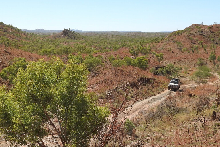
How things have changed. Now the GRR is a major thoroughfare in remarkably good condition for most of the time, with traffic streaming along it in the hundreds per day during the peak of the tourist season.
 The Kimberley is an expensive place to visit, and we often have people complaining to us about the cost of camping, the lack of free bush camping places, and the virtual absence of free overnight camps. It’s an issue that’s been around for a long time, but nobody seems keen to address it. With a bit of effort you can find a free overnight campsite, though finding a spot that’s worth staying for a few nights is another question entirely.
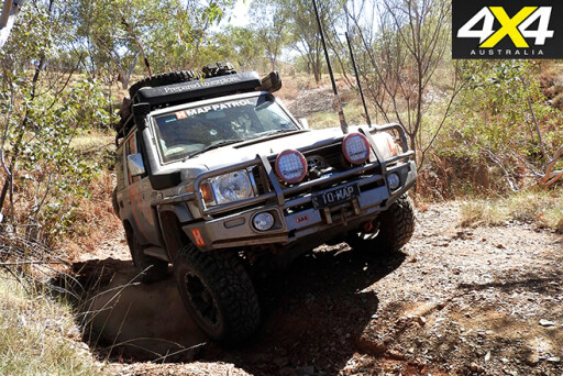
On our latest trip collecting info for the next edition of Hema Maps’ Kimberley guide, we poked down little-used tracks trying to find hidden gems known only to a few locals and long-time Kimberley travellers. Here are some we’ve found in recent times.
1. THE MAY RIVER
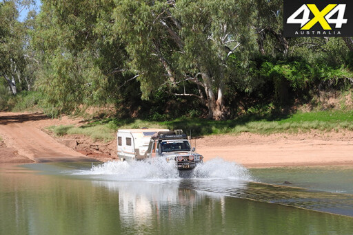
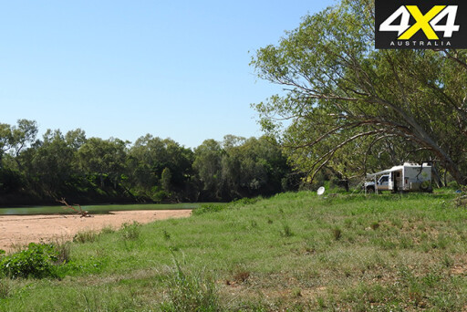
 THE May River, north-east of Derby, has a couple of spots worth investigating, especially if you’re into fishing for barramundi or cherabin. To reach the best of the camping spots, take the dirt road from the GRR (approx. 40km from Derby) and head north to Meda Station.
Travel six kilometres along this dirt road, veering right where the road forks to reach the wide crossing of the river.
This isn’t normally a problem in the dry season, though after heavy rain this black-soil route can be boggy. The best spot to camp is near the crossing (GPS 17°22’14.6”S 124°01’37.3”E), but with a bit of exploring you’ll find other spots worthy of throwing down the swag.
A rough track on the right – just before the crossing – leads upstream, but access to the long stretches of waterhole is difficult because the track is often washed away. Nearby is a monument to the Emanuel brothers, who first established this pastoral property, one of the first in the region, in 1882.
 The Blue Holes can be found closer to the mouth of the May River (GPS 17°06’23.5”S 123°40’30.8”E). It’s a popular spot for locals to launch a boat and fish for barramundi and a host of other estuarine species.
The access road can be found along the GRR, about 10km from Derby at the junction of the track to the Bungarun Aboriginal Community.
It’s approximately a 120km round trip from Derby to Blue Holes and Black Rock Light. There are some reasonable camping spots close to the track – west of the Blue Holes and around to and beyond the Black Rock Light.
There are no facilities and fresh water is non-existent, but there can be plenty of sandflies and mozzies. High tides can flood the tracks around Blue Holes and Black Rock Light, so take care as you don’t want to get bogged out here. Also be aware of saltwater crocodiles which inhabit this area and all the waterways in the region.
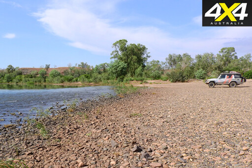
2. MYROODAH CROSSING
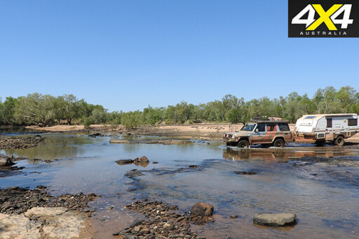
 THE Myroodah Crossing on the Fitzroy River has long been a favourite of ours. It can be easily reached via a good dirt road that leaves the Great Northern Highway, about 42km east of the Derby Junction.
You’ll cross the grassed flat plains of the Fitzroy River and then arrive at the crossing of the Fitzroy itself. There’s a small camp on the east side, but a better one can be found by crossing the causeway and taking the faint track to the east, about 400 metres from the crossing.
 This leads to a flat camping spot above the wide sandy banks of the river. The river is pretty shallow in these spots, with deeper pools up and downstream where you can catch barramundi, bream and cherabin.
Don’t be lulled into a false sense of security around water here though, as there are saltwater crocs aplenty.
3. MANARI CREEK & BEYOND
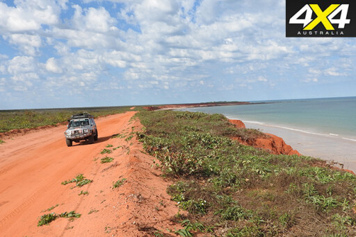 THE Dampier Peninsula is high on most people’s itinerary when visiting the Kimberley, and for good reason. There’s some great fishing, the coastline is spectacular, the birdlife is fantastic, whales can be seen for much of the winter months, and there is a rich aboriginal culture for everyone to experience, explore and enjoy.
However, there is very little bush camping. In fact, no camping is allowed at all along the Cape Leveque Road, while bush camping at Quondong Point is popular and often crowded with long-termers.
Still, with a bit of exploring you can find some good bush camps around Willie Creek and Barred Creek, south of Quondong. If these are still too busy for your liking, head north along the Manari Road past James Price Point (another good but popular bush camp) to Coulomb Point.
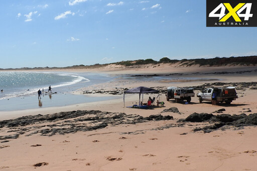 Here you can wind along the edge of a shallow creek to the beach for a long beach drive north (take care, as it starts to get remote) or a shorter one south where there are a couple of good camps right on the beach near an un-named rocky headland.
The track degenerates north of Coulomb Point and, once at the Manari Creek Crossing just a couple of kilometres later, it can be very challenging. You’ll find a campsite near the mouth of Manari Creek and another beach access point.
Rest assured that you’ll have the camp to yourself – apart from the occasional local who’ll be even more cheesed off than you!
4. THOMPSON SPRINGS & LAKE ARGYLE
 WHEN we “discovered” this spot on our last trip, we wondered why we had never found it before. It was a Sunday and two locals were skinny-dipping when we came across them – they were more surprised at our sudden arrival than embarrassed, but quickly moved on anyway.
The spring lies tucked up close to a rocky range; the access track leaves the main highway about four kilometres from the Lake Argyle dam access road at Golden Gate Creek. A track on the right veers west and leads just over two kilometres to Thompson Spring itself. This delightful swimming hole is surrounded by Pandanus palms and verdant vegetation, while there is a very small camping area nearby.
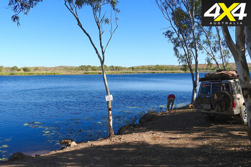
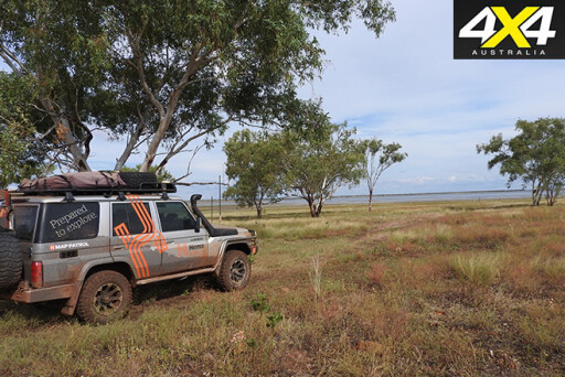 Back on the main dirt road the route south crosses numerous small creeks and washaways, and the going is slow but not too difficult. About 15km from the Thompson Spring track junction you come to a flat, grassy plain bordering the shallow backwaters of Lake Argyle. This is a vastly different scene to the one at the dam wall.
There are a number of pleasant camp sites under the trees before the edge of the water, and the birdlife can also be rich around here.
5. SANDY BEACH
 KNOWN as ‘Winyba’ to the local Aboriginal people, this spot on the Ord River is not well-known or often visited. While there are a couple of reasonable bush camps along the Ord below Kununurra, the track to Sandy Beach is found about 10km downstream from Buttons Crossing along Parry Creek Road. Buttons Crossing, just off the main road, is a good place to wild-camp on the edge of the river.
 Once at the junction to Sandy Beach the track winds across relatively flat grassy plains to come to the wide gravelly bed of the river. There’s a gravel bar here and the river is shallow, but deeper pools exist both upstream and downstream.
There is reasonable camping back from the water’s edge among the trees and scrub. You can launch a small tinnie here and there’s some good fishing, but be aware of the big crocs that inhabit the area.
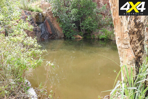
6. BRADLEY LAKE
 BRADLEY Lake was established when the Mt Bradley gold mine was in operation during the 1990s. Access was restricted during the mine’s operational days, but since the mine’s closed, a few prospectors have found their way to the water’s edge, which is now a haven for birds. There are a couple of great camps, and with a bit of exploring on the tracks that criss-cross the surrounding hills, you’d surely find more.
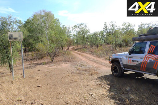
The easiest way to get to this enjoyable hidden spot is to head down the Duncan Road from Halls Creek. About 32km south of town, look out for a termite mound and a wheel rim on the west side of the road where a track strikes west; six kilometres later you’ll be on the backwaters of the dam. Where you actually end up depends on which track you take – poke around and you’ll find a good spot to camp.
 Nearby and a bit closer to town, the Duncan Road tracks lead to the old Golden Crown Mine and the Black Elvire River, where further exploration will unearth some pleasant camps close to waterholes. While most people rush through Halls Creek, I like wandering the rocky hills and finding top little spots to stop – and I don’t even prospect for gold!
Please enable JavaScript to view the comments powered by Disqus.
COMMENTS