Explore
Gallery36
The New England plateau came into being millions of years ago when there was a massive upheaval along the coast by mega volcanoes including the nearby Ebor Volcano.
In the process this created fertile farmlands, steep rugged valleys and separate micro systems.
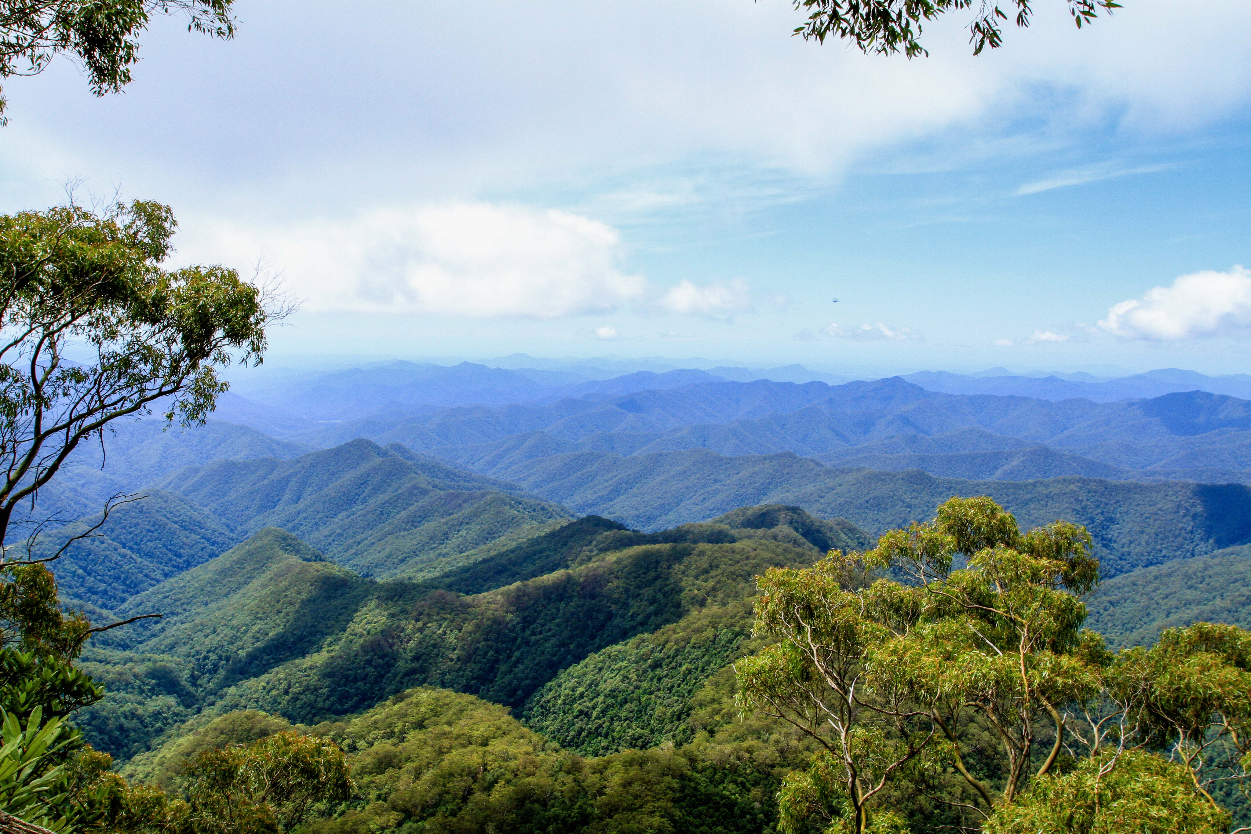
One area of particular interest is the Oxley Wild Rivers National Park that covers just over 145,000 hectares of some of the most beautiful and, in other parts, some of the most inaccessible areas in NSW. Situated 500km north of Sydney, it’s a great place to explore its history and natural beauty, and to get back to basics with simple camp options whether in a 4WD or 2WD.
Today, it’s a very protected National Park that was heritage-listed back in 2007 due to its significance with dry rainforest areas, rich bio-diversity and as part of the Gondwana Rainforest area of Australia that links it to other parts of the world.
36
Jump back to 1818 when explorer John Oxley passed through the area looking for pastoral land (and hence the name was dedicated to him) while he was trying to descend towards the coast but was constantly being stopped by huge, deep gorges until he finally found a way down with his party.
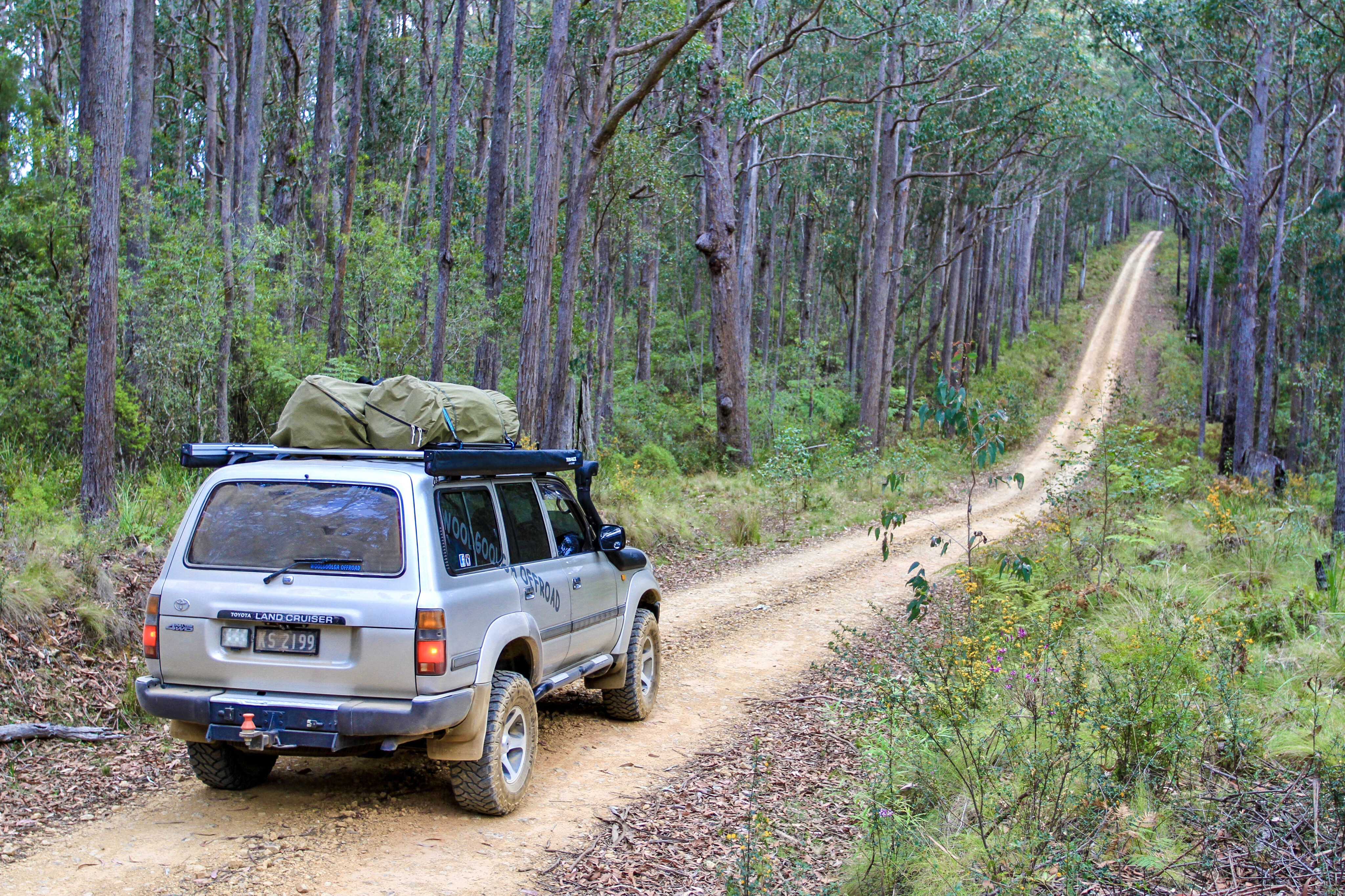
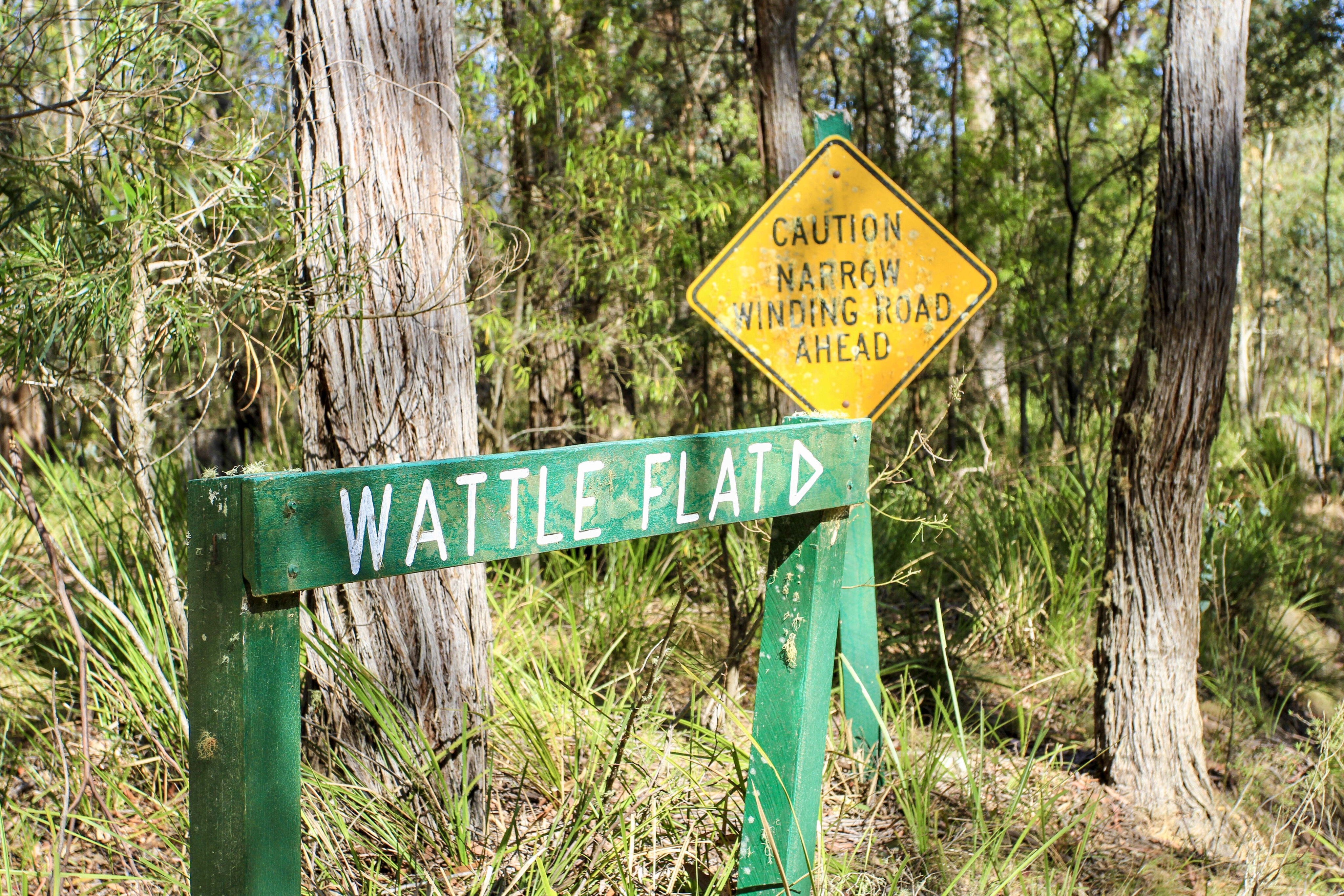
Due to the ruggedness, there are a few different ways into the park with different special features for both four-wheel drivers and those just with a soft-roader. For those with an AWD, you can skip around the outskirts of the park where there are a few waterfalls and easier camping areas to explore.
36
Cascades
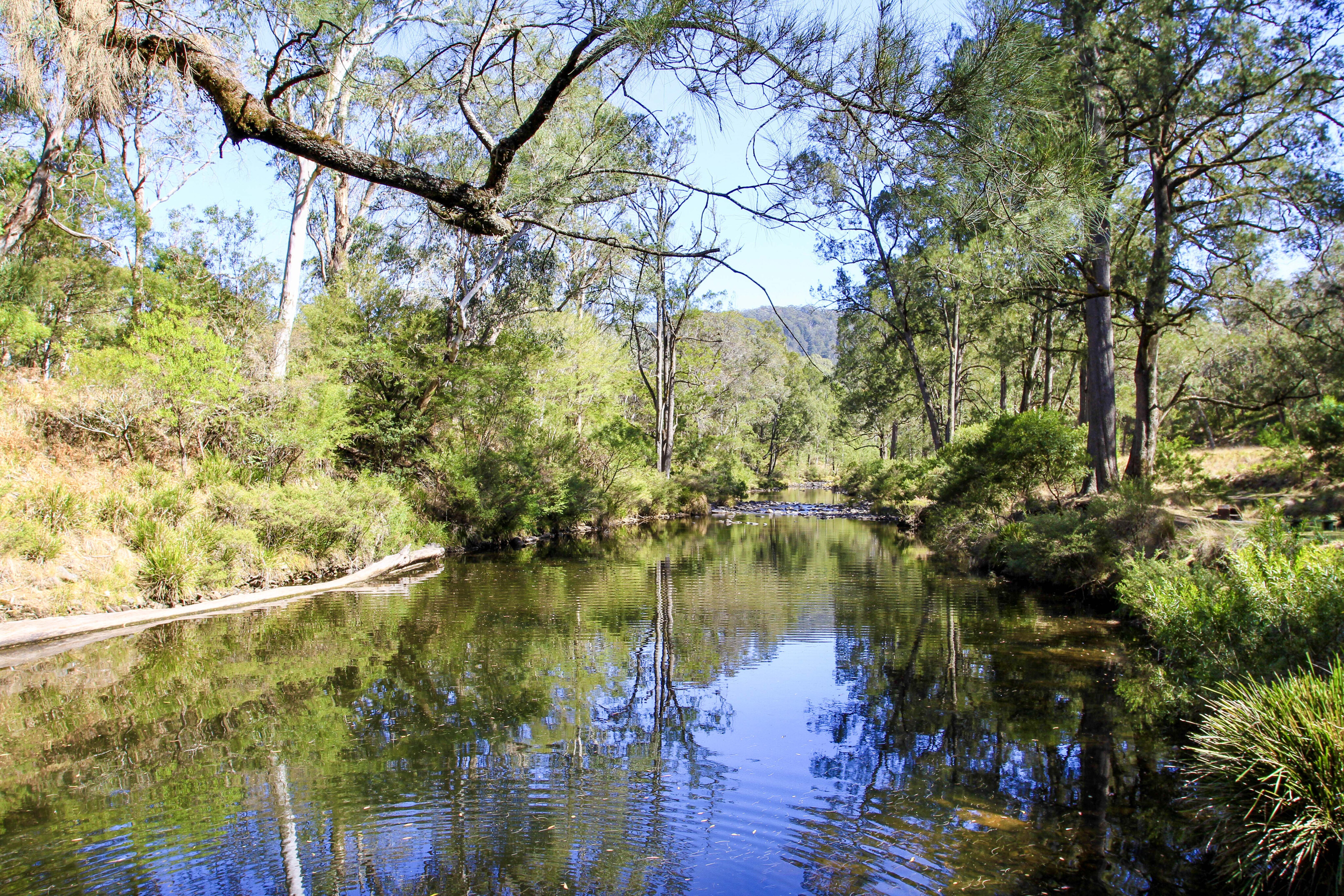
Places like Apsley Falls, Wollomombi Falls and Dangars Falls all are pretty easy to access to view the massive waterfall drops and the chance to set off on foot on one of the many walking trails, but if you like to explore the inner heart of the wild Oxley there’s a few days of exploring that can be had.
In 1976, the area was declared true wilderness due to the natural environment being untouched by man through any means whatsoever, and this works in the favour of having a 4WD to explore the inner parts of this spectacular place. While it’s one of the largest national parks in NSW there are no roads through the guts of Oxley Wild Rivers, only loop roads to campsites and into the gorge areas.
From the southern end of the park near Walcha, head out along Moona Plains Road and Buds Mare trail where you can access a campground down on the mighty Apsley River via a locked gate where the key is available through the NPWS office at Walcha.
36
If you can’t get the key, a free camp has been set up at the top of Buds Mare just before the steep track down to the river. The camp at the top is a pretty good set-up with all fresh facilities, views down into the craggy valley, and walking trails to a viewing deck and another 8km return walk to the river below.
Down beside the river, NPWS have set up the camp area with fire pits, eco-toilets, shelters and even a free gas barbecue.
Around on the western side of the park towards the town of Armidale, there's easy access to Dangars Gorge for those with an AWD and keen to tackle one of the many hikes in the area to the bottom of the valley and river areas. Some of the hikes are for experienced hikers only and go for days, popping out elsewhere in the park.
An advantage here is that you can set up base camp in the Dangars Waterfall camping area and then do the return loop.
36
Hillgrove
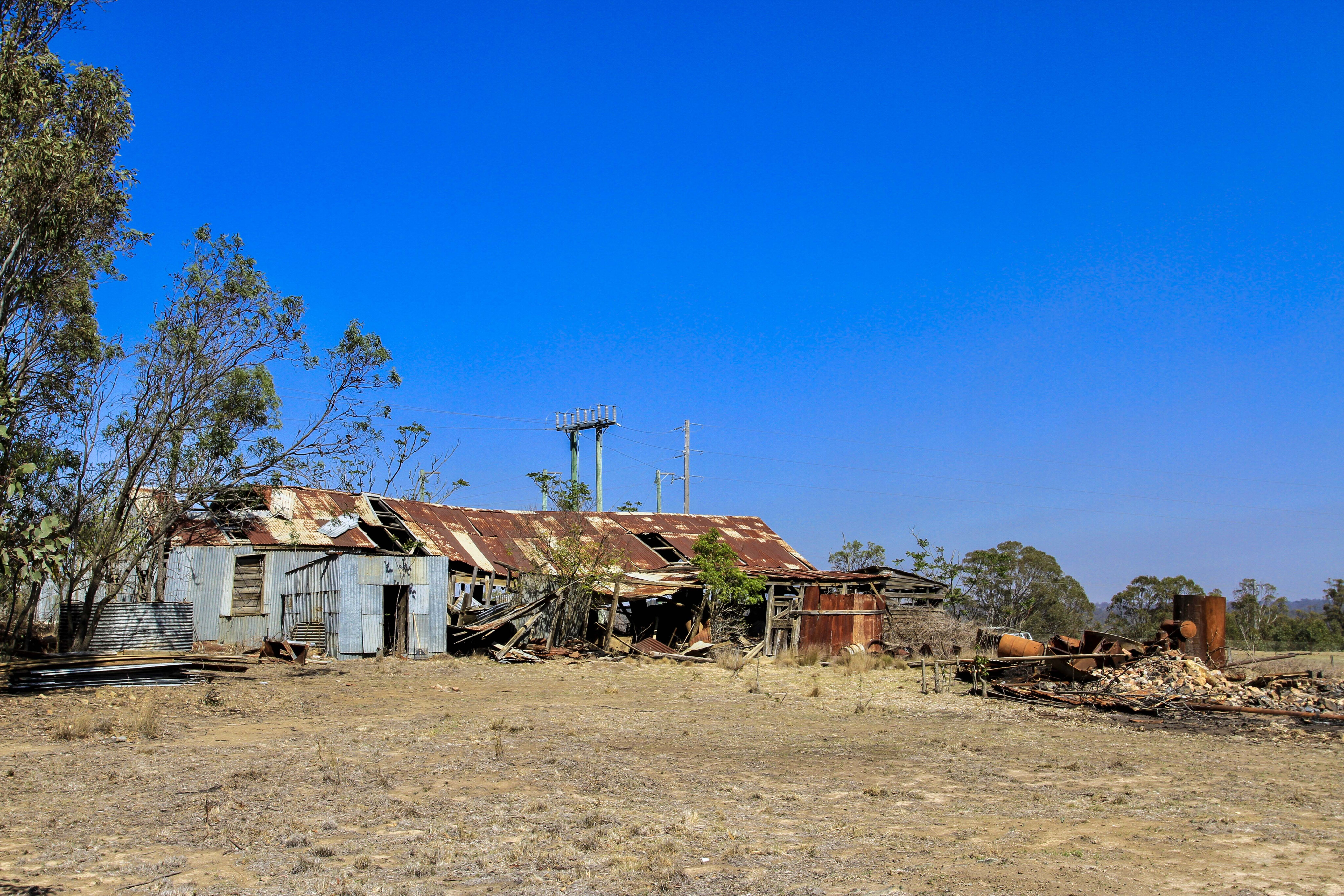
Getting down into the remote areas and away from the wandering crowds you’ll need to head 40km east of Armidale towards the historical town of Hillgrove. Before heading into the bush, check out the now-rundown old area of Hillgrove with a drive around the town. Once a rich gold-mining town it was established in 1884 when gold was discovered in nearby creeks.
Over the years it produced a massive 15,000kg of gold, 14,000 tons of antimony and 2000 tons of scheelite (ore-like material).
The mining has all but stopped these days, but points around the area at Bakers and Metz Gorge lookouts give you views down to the old mine sites where old brick chimneys, buildings and mine-entrance structures can still be seen.
Tramways were built to haul the rock from the mines deep below up to the town’s level for processing using steam-driven engines back in the mid- to late-1800s. In 1895 it was the very first town in Australia creating its own power from a hydro plant in the nearby Gara Gorge.
36
Around town, plaques and signs provide an insight to what used to be there, and even though it makes the mind wander, it’s pretty disappointing that none of the buildings are there anymore.
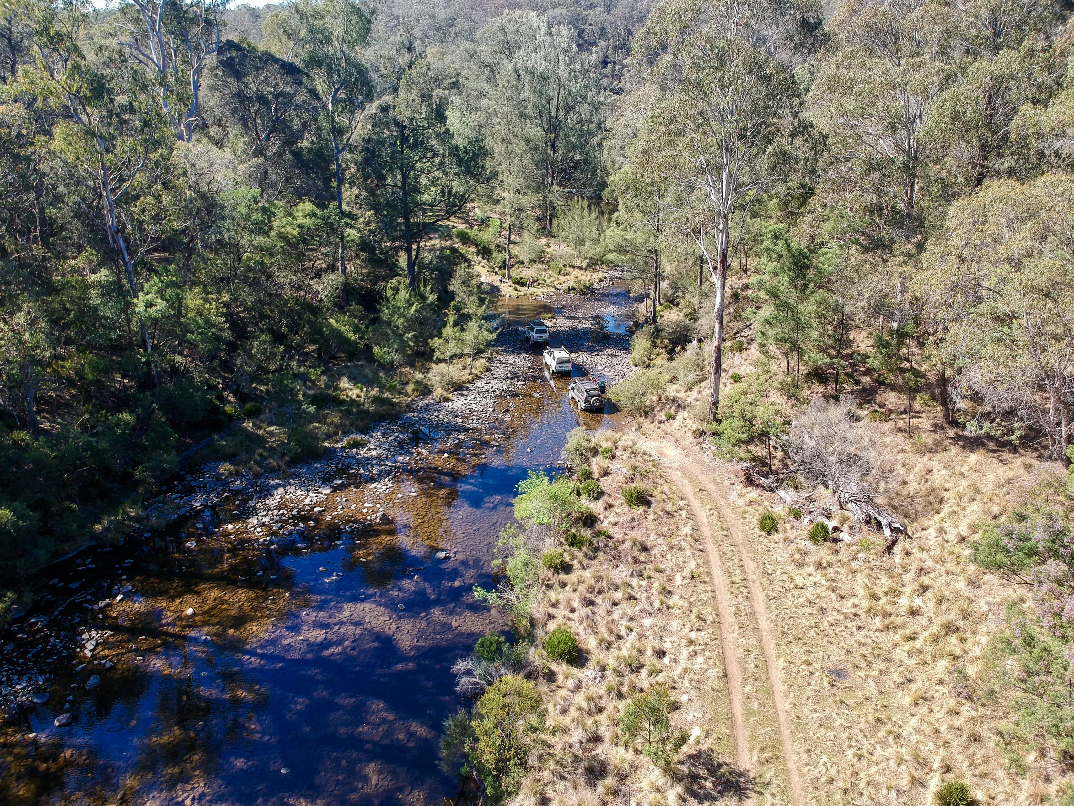
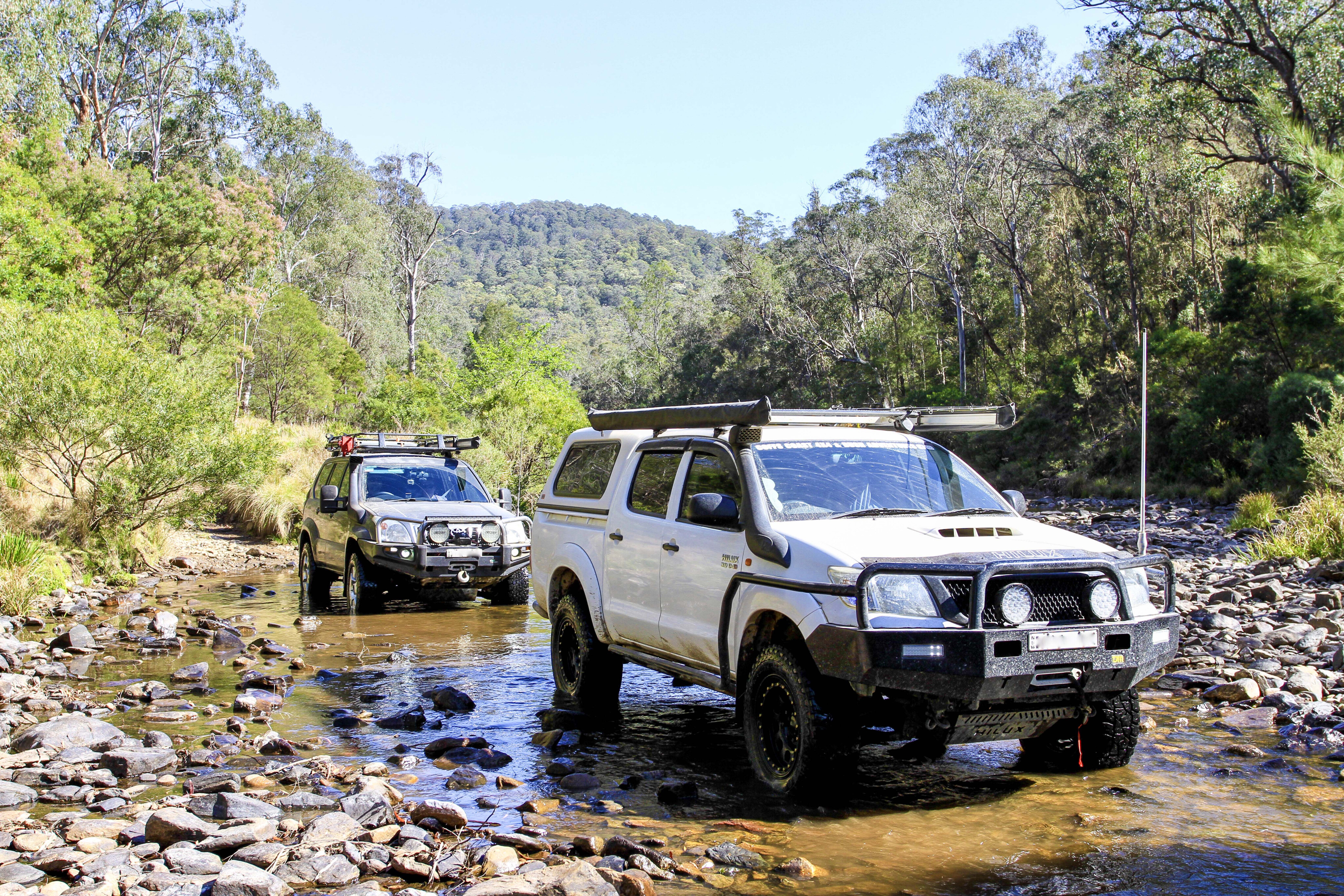
Heading out along the Long Point Road to the end, there is other remote camping and more walking tracks on the outer fringes of the park into the Chandler Valley; midway along swing down into the Styx River area for more remote and 4WD-accessible areas.
Down here are a maze of roads, so you’ll need a good GPS to show you the low-range tracks in the area with some of the best free camping spots. The water down here in the rivers can nearly be guaranteed due to the huge catchment areas in the park.
36
East Kunderang Station
Other spectacular areas to explore where you’ll need a key for access is down to the Halls Peak camping area, which is low-range territory with steep drop-offs and sheer cliffs. The camping area at the bottom has plenty of space with tables, toilets, barbecues and supplied milled wood.
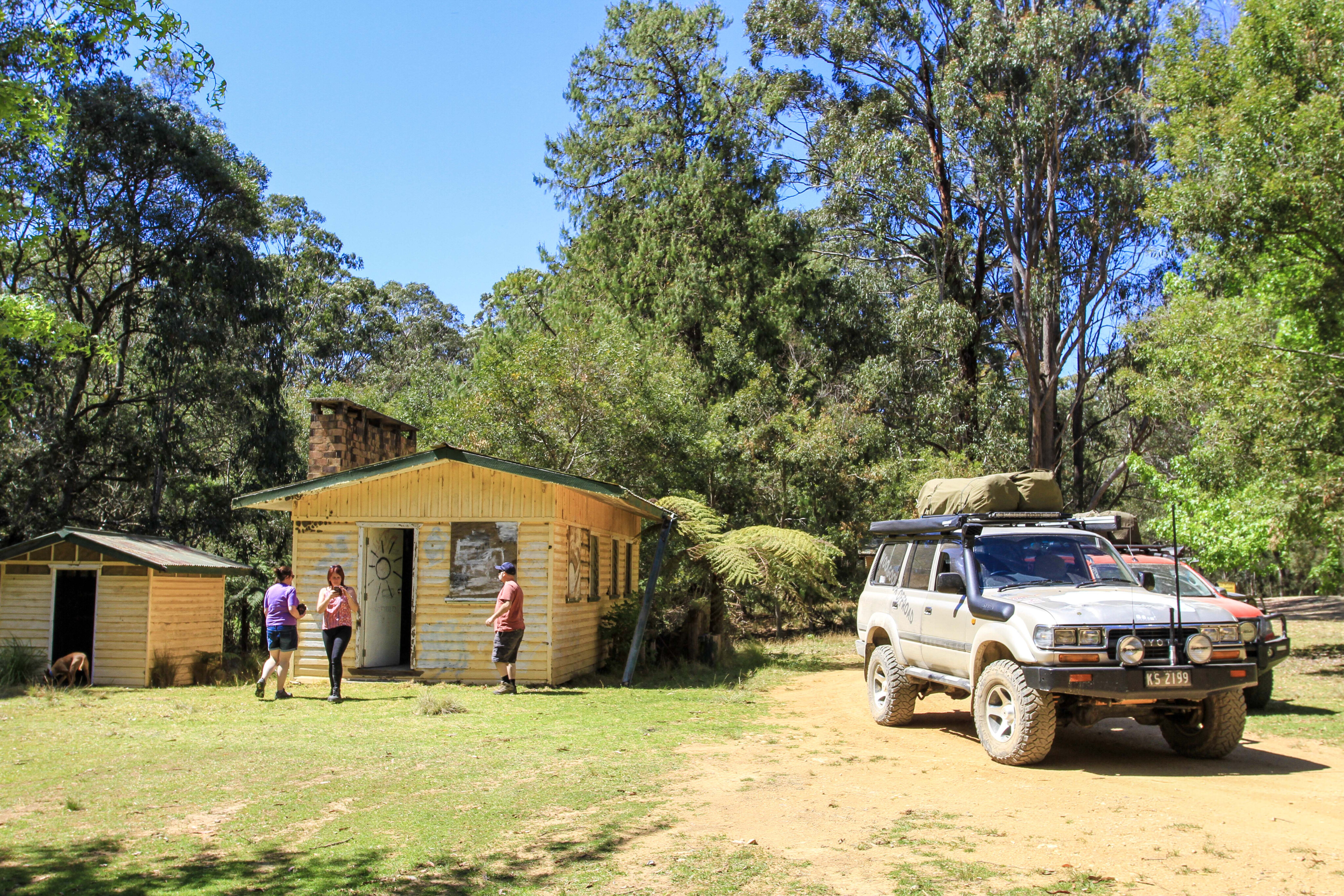
For a more civilised camping area head into West Kunderang Station where there are a choice of sites or rustic cabins on the property which is a working cattle station. NPWS runs East Kunderang Station where you can book online to camp in a stockman-like hut.
When the cattlemen rode for days in this area, they built what we know today as stockman huts. Throughout the Oxley NP there are huts in remote locations that NPWS have control over and manage their upkeep. The most popular being Youdales, while there are other nearby heritage-listed restored huts along the Green Gully walking track you can camp beside.
36
For history buffs, 12km southwest of Ebor, the Yooroonah Tank Trap Barrier is of significant importance. Strategically placed here back in 1942 in case the Japanese were to invade Australia, the barrier would have slowed progress to the tablelands.
There was a reported 75-post barrier (we saw about 50-odd – others had been burnt, attacked by white ants or been knocked over). There are eight triangle tetrahedra blocks placed on the higher ground to force the tanks into the marsh areas.
We found several rock lookout platforms and funk holes (where our troops would have laid if there was an attack). But an amazing find was the tunnel under the old road that would have been loaded up with 1.5 tons of explosives in steel boxes and ignited if the enemy was on the road.
The digging of the tunnel initially involved two shifts of two men each (working 15 hours per day, six days a week). It’s about 60 feet long with two arms branching off the end, and reports say it was 10-feet high (now about five) and it seems to be about four-feet wide.

36
This enemy deterrent was one of many along the East Coast. In fact, the steepness of terrain from tableland to coast, combined with the prevalence of deep gorges, the absence of navigable rivers and the heavily-forested nature of the surrounding countryside, meant the few easterly roads extant in 1942 were of critical strategic importance.
Now it’s listed by the National Trust, and there are several walking tracks around these points of interest – easy for the kids to walk too.
The cycle of wild Oxley changes the landscape with every weather event: weathering winds wear away at the sandstone outcrops; torrential rain causes landslides into the valleys below, making new pools or destroying thousand-year-old micro-systems; and raging floods create havoc along the banks, where severe erosion takes place either at the base of some of the highest waterfalls in NSW or along the many creeks along the way.
The Oxley Wild Rivers is one area that can’t be explored in just one visit.
Five points of interest
Oxley Wild Rivers National Park
Near Armidale in the NSW New England region you’ll find the awesome Oxley Wild Rivers National Park. This is a World Heritage-listed region containing Gondwana rainforest, dramatic gorges and spectacular waterfalls. This largely untouched natural beauty offers walking trails, hiking, camping, bike or horse riding, and fishing. For more information, click on: www.nationalparks.nsw.gov.au [↗]
The lookouts
Although Oxley Wild Rivers is an extensive park, there are a lot of areas that are easily accessible and lead to some fantastic views. Check out the viewing platforms at: Apsley Main Falls, Dangars Main Falls, Wollomombi Main Falls, Budds Mare, Gara Gorge, Chandler Falls, Dangars Falls View, Eagle View, Edgars, Wollomombi Falls, Apsley Chasm, Apsley Landslide, Apsley Lions, Apsley Lower Falls, Apsley Lower Pool, Apsley Slate Walls, Chandler River, Checks, Dangars Gorge, Dangars River View, Dangars Rockwall 1 and 2, McDirtys, Mihi, Oxley, Tia Falls, Tia Gorge View, Tiara, Tiara View and Dangars Falls lookdown.
East Kunderang Homestead
East Kunderang Homestead is an 1890s cedar slab homestead situated among the mountains and valleys of Oxley Wild Rivers National Park. The historic homestead has been restored to offer accommodation for up to 14 people. There are five bedrooms, a lounge and dining room, modern kitchen and two bathrooms. There’s swimming and paddling or a spot of fishing in the nearby river, as well as walking tracks, and the homestead’s wide verandah is perfect place for enjoying a sundowner or two. For bookings, phone: 1300 072 757 (13000 PARKS).
Camping and picnicking
Stay or lunch, there is a spot for everyone. Campgrounds include: Apsley Falls, Budds Mare, Dangars Gorge, Halls Peak, Long Point, Riverside, Tia Falls, Wollomombi, and Youdales Hut. For picnics, try: Apsley Falls, Blue Hole, Dangars Falls, Threlfall, Tia Falls, Wollomombi Falls, and Edgars.
Walcha
To access Oxley Wild Rivers NP from the southern end, head to the small town of Walcha on the Oxley Highway. Walcha includes most services and amenities, a NPWS office, plus a picturesque 18-hole golf course, and a racetrack. The Big Black Building in the middle of town is worth a visit, containing a stack of old-bush collectibles for sale as well as very good barista-made coffee. You can’t miss it, it is as its name describes.
Please enable JavaScript to view the comments powered by Disqus.
COMMENTS