Explore VIC
Gallery1
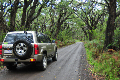
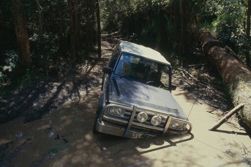
THE dirt road wound through the forest, which for a short distance seemed more like a scene from a Tolkien book, and I half expected a band of hobbits to appear through the wind-blown trees, gloomy clouds and drizzling rain.
This was first published in 4x4 Australia June 2012 issue.
Abruptly, the forest gave way to more open country, the weather cleared and we were driving alongside the wide, reed-covered expanse of the Aire River Inlet. Here in the river’s backwaters there are a couple of small lakes but they are more reed than water, while tucked up on the bank is a small and very pleasant campground.
 Further along, the road crosses the river on a wooden bridge and you arrive at the larger Aire River West campsite, which is a beauty, with plenty of flat areas to set up a tent or camper and good access to the water itself. It is pretty popular, not only with humans but also a varied collection of bird and animal life.
Just before you cross the bridge to the campground, a sandy track leads further along the edge of the creek to the beach at the river mouth. Vehicles aren’t allowed on the beach, but the track is about as close as you’ll find to a 4X4 track anywhere in the area. From the campground on the western side of the river, the Sand Road winds along the edge of the stream through the Aire River Wildlife Reserve to meet with the Great Ocean Road at Glenaire.
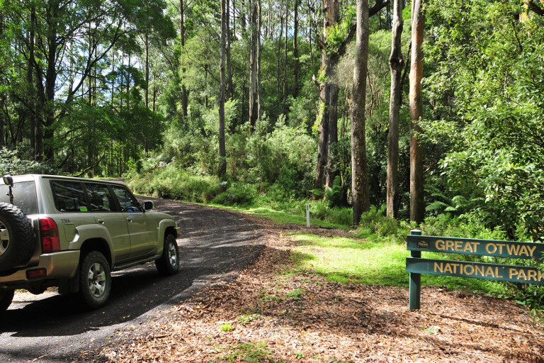
Both campgrounds are within the boundary of the Great Otway National Park, which stretches along the Otway Ranges inland from Torquay to west of Cape Otway, where it joins with the Port Campbell NP. In all, the park covers 102,500ha while the adjoining 37,600ha Otway Forest Park is the next biggest reserve in the region.
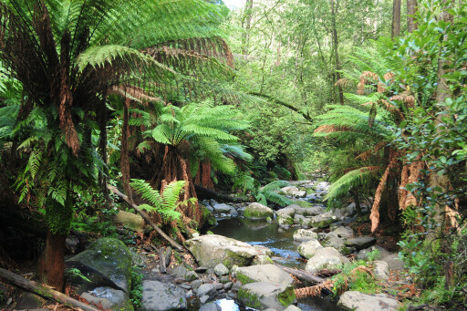
 The Surf coast, famous for Bells Beach, takes up much of the eastern coast of the Otways. The Great Ocean Road winds through verdant forest and along spectacular stretches of coastline to the magical Twelve Apostles and Port Campbell, so you’ve got to expect that you’ll never be too remote.
In fact, we were blown away by the number of people camping and caravanning, surfing the curling breaks, canoeing the placid rivers or backpacking the Great Ocean Walk. And it was mid-week, in autumn, and well and truly out of school holidays.
This is also the Wreck Coast. Tragically, the lists of ships that ended their days floundering on a reef or rocky headland number into the many dozens – more than any other similar stretch of coast in Australia. At Wreck Beach, near Moonlight Head, west of Cape Otway, the Marie Gabrielle was swept ashore in a south-west gale in 1869 while 22 years later the Fiji was wrecked just a short distance away.
 Today their anchors can still be seen, but if you want to see them save the trip down the steep cliff and the 366 steps for a relatively calm day and preferably at low tide.
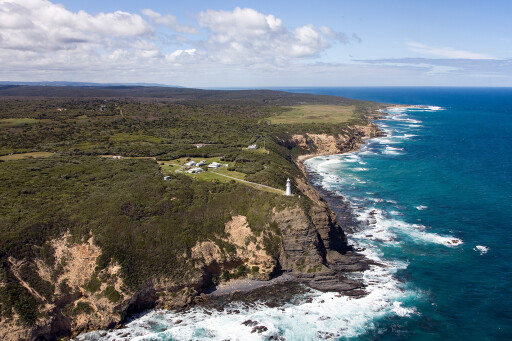
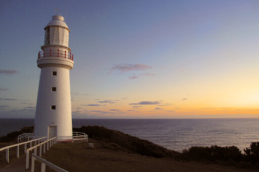
In an attempt to stem the flow of catastrophic wrecks the Cape Otway lighthouse was built in 1848, and is now the oldest surviving lighthouse on mainland Australia. Perched high on the cliffs above a turbulent sea where Bass Strait and the Southern Ocean meet head-on, it’s a great spot to visit to soak up the heritage and the wilderness aspect of this wild coast.
A little-known piece of history took place near here in 1802. The English were alarmed that the French navigator and explorer Nicholas Baudin, who mapped much of the western and southern coast of Australia, had landed and set up a camp.
 Thinking that their sovereignty was under threat the English quickly sent a crew to run up a British ensign to ensure their claim to this southern tip of Australia was intact. In their haste the English crew ran the flag up the makeshift flagpole, upside-down, much to the amusement of the French. A rough camp and an upside-down ensign today mark the very spot.
Just north of Cape Otway is one of our favourite camps. Tucked in among the tea-tree, right on the coast is the Blanket Bay campground. This spot is super popular, with sites going to a ballot for the summer and Easter holidays, but there’s pleasant swimming and snorkelling here, you can launch a small boat off the beach and there are many delightful walks to enjoy.
Away from the coast, though, it’s a lot quieter. For most of our sojourns into the Otways we travel Mt Sabine Road which winds along the spine of the mountains for much of their length, but the quickest way to get from Geelong to the southern tip at Cape Otway is through the small township of Forrest. There are a number of forest tracks of varying standard established for mountain biking around this small mountain hamlet.
 Further south, in another effort to turn the region’s economy from forestry to tourism is the Otway Fly Treetop Walk and Zip Line Tour near Beech Forest. For those adventurous enough to wander through the tree-tops or to take a fast flying-fox ride among the trees this is a cracker, but with howling southerly 60-70km winds during our visit, we chickened out.
MOREVictoria
From the Mt Sabine Road several lesser roads drop off the crest towards the coast or inland and while many have been closed permanently to four-wheel drivers, during the drier months a number of seasonally-closed tracks are opened to enjoy.
While much of the logging has stopped in the area since the State Forest was divided into state and national park, you may be surprised by the number of log trucks and timber crews you’ll encounter. Cutting timber from plantations on privately-owned land, the big trucks feed more than 1700 logs a shift to the remaining sawmills in Colac and elsewhere.
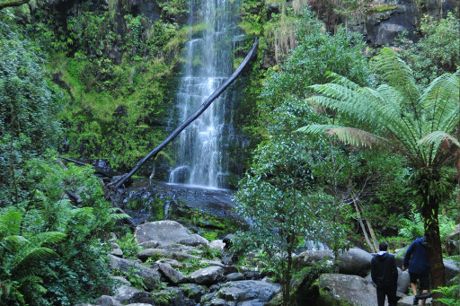 No trip to the Otways would be complete without at least one visit to a waterfall. There are around 40 waterfalls that warrant a name in the national park and adjoining state forest with probably the best known being the 30m plume of Erskine Falls, inland from Lorne.
If that’s a bit too touristy, head south to Sabine Falls, which makes up the tallest in the region with three separate segments plunging 130m over the escarpment at the head of Smythe Creek. Triplet Falls, with its elevated boardwalk passing through a mixed forest of mountain ash and myrtle beech, is south of Beech Forest and is well worth the 1.8km walk.
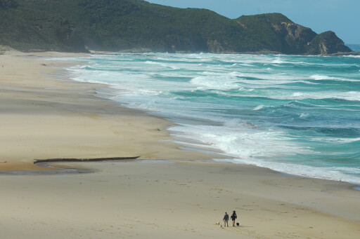 Our last port of call on our weekend trip was to a spot I hadn’t visited before. Johanna Beach is reached by either of two dirt roads – Red Johanna, or Blue Johanna (the latter having the most blacktop), off the Great Ocean Road west of Glenaire.
The beach here is often the replacement location for the Bells Beach Rip Curl Pro when the waves are too small at Bells, so there is always a good chance of a good surf break while the fishing can be pretty impressive as well. The campground tucked among the trees a short distance back from the clifftop is a beauty.
Somehow we managed to drag ourselves away from this spectacular coast promising ourselves it wasn’t going to be too long before we visited this magnificent region again. You should try it soon.
TRAVEL PLANNER
WHERE
The northern end of the Great Otway National Park (NP) is about 1.5 hours from Melbourne; the southern end, west of Cape Otway, is an easy three-hour trip via Forrest and Lavers Hill.
CAMPING: PARKS AND RESERVES
There are a host of campsites in the Great Otway NP, both in the mountains and along the coast. For more details phone 13 19 63 or visit: www.parkweb.vic.gov.au/explore/parks/great-otway-national-park
CAMPING AND ACCOMMODATION
There is also a lot of accommodation in and around the area, with campgrounds located in all the major towns. Apollo Bay, closest town to Cape Otway, has all a traveller requires.
THINGS TO DO
Surfing, diving, snorkelling, fishing, four-wheel driving, beach walking, bushwalking, day walks and birdwatching.
MORE INFO
visitgreatoceanroad.org.au
Please enable JavaScript to view the comments powered by Disqus.
COMMENTS