Explore WA
Gallery57
We are pretty lucky in Australia with so many ‘big things’, whether they be manmade or natural, so while on tour in our biggest state I thought I’d check out one of the biggest natural wonders in the world: Mount Augustus.
After fueling up, restocking and a quick service of the Cruiser at Carnarvon on WA’s mid-west coast, I headed east along the Carnarvon Highway towards Gascoyne Junction.
With a good 450km drive to the world’s biggest rock, I settled in for the long haul on what seemed like an endless sealed road running beside the Gascoyne River.
57
Taking a break at Gascoyne, I read up on the Kennedy Range, which was just 60km to the north, and where you can view stunning rock gorges and hike to natural waterholes.
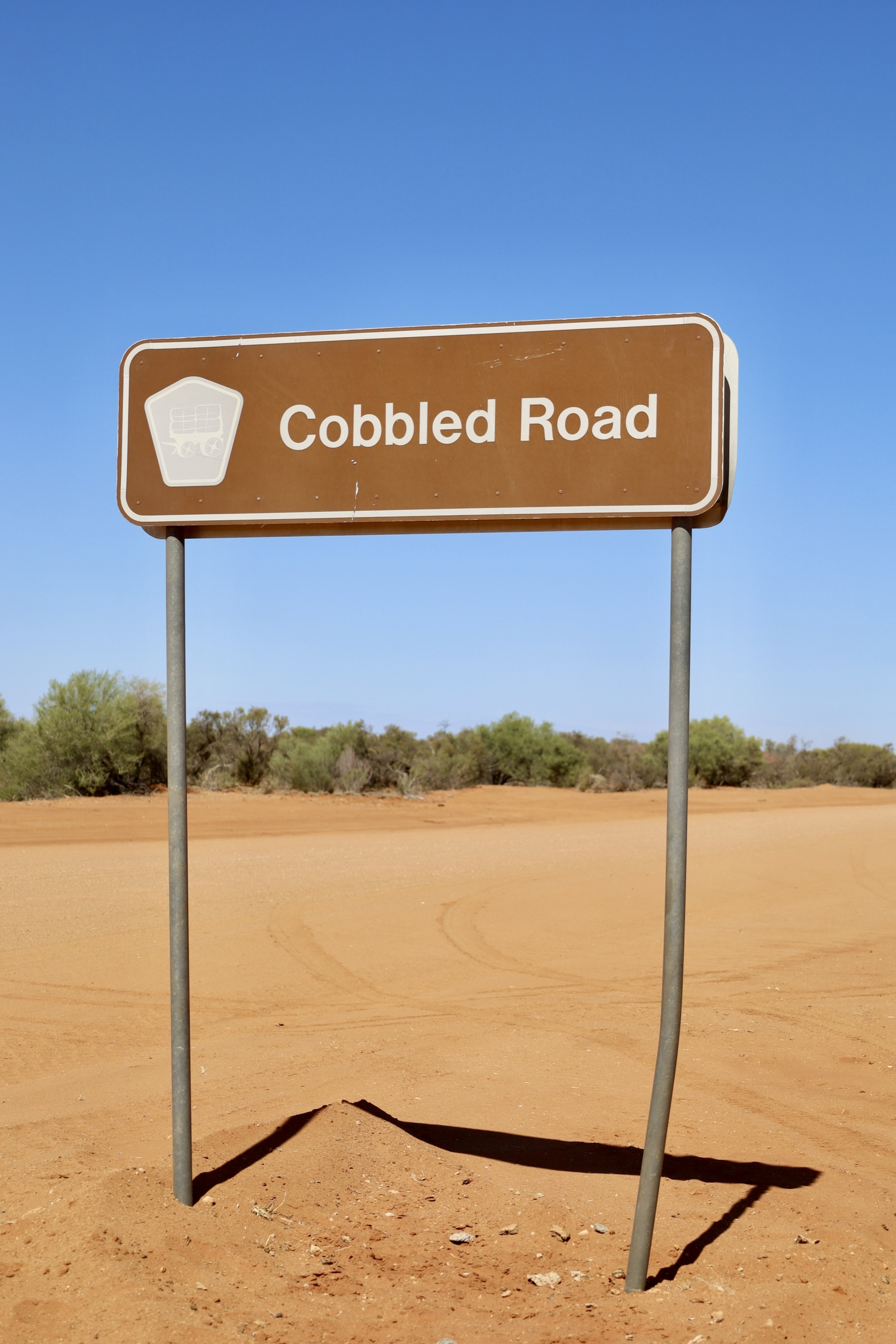
On the way to the Kennedy Range turn-off, there are remnants of an old cobbled road that early pioneers and drovers used. Constructed from local stone, the wool wagon pathway was built around 1920 for wagons on tracks that were little more than rough clearings through the scrub.
When it rained, all but the high or stony areas turned to mud, and when it was dry the sandy ridges were almost impossible to cross.
57
Kennedy Range
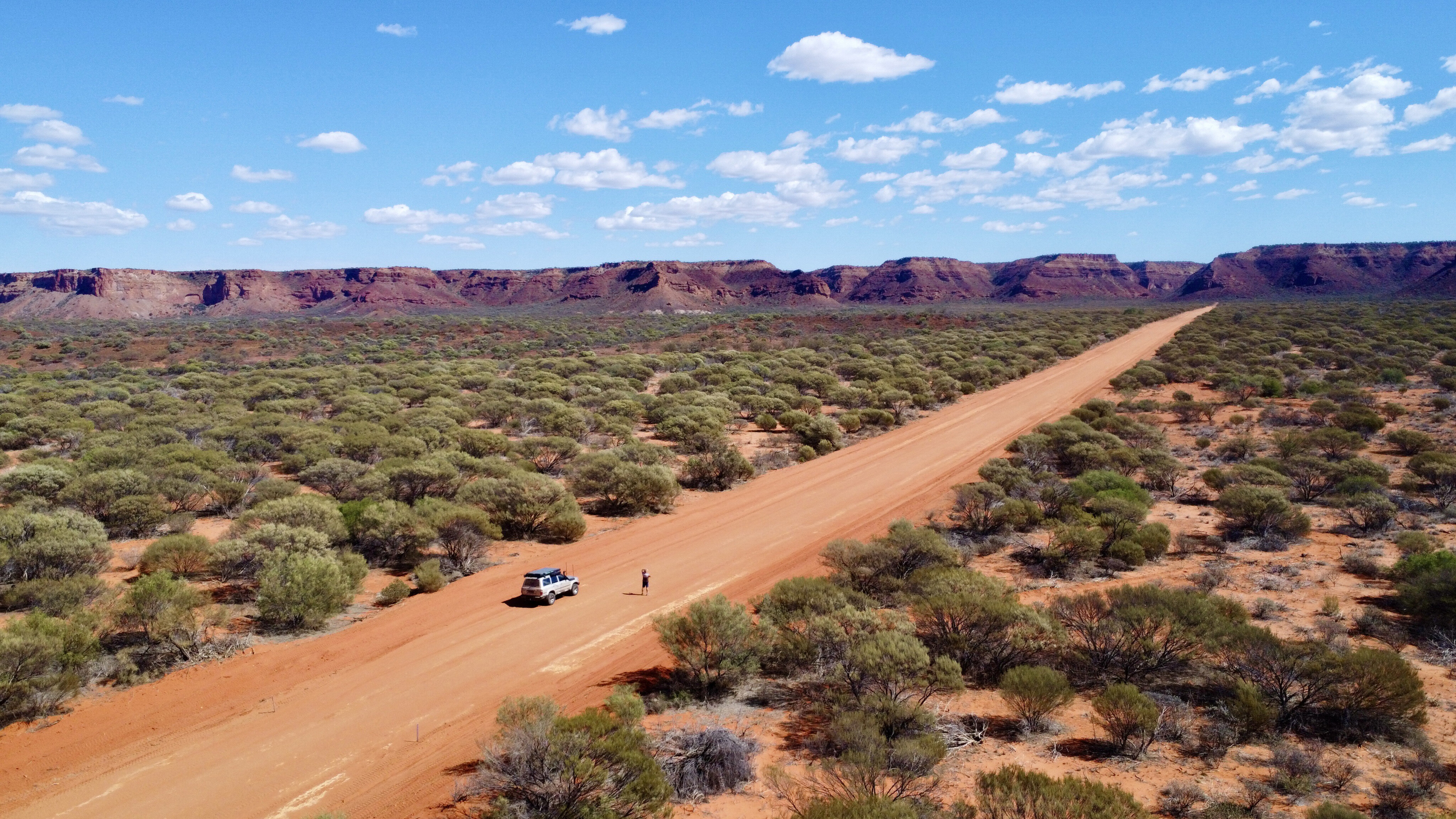
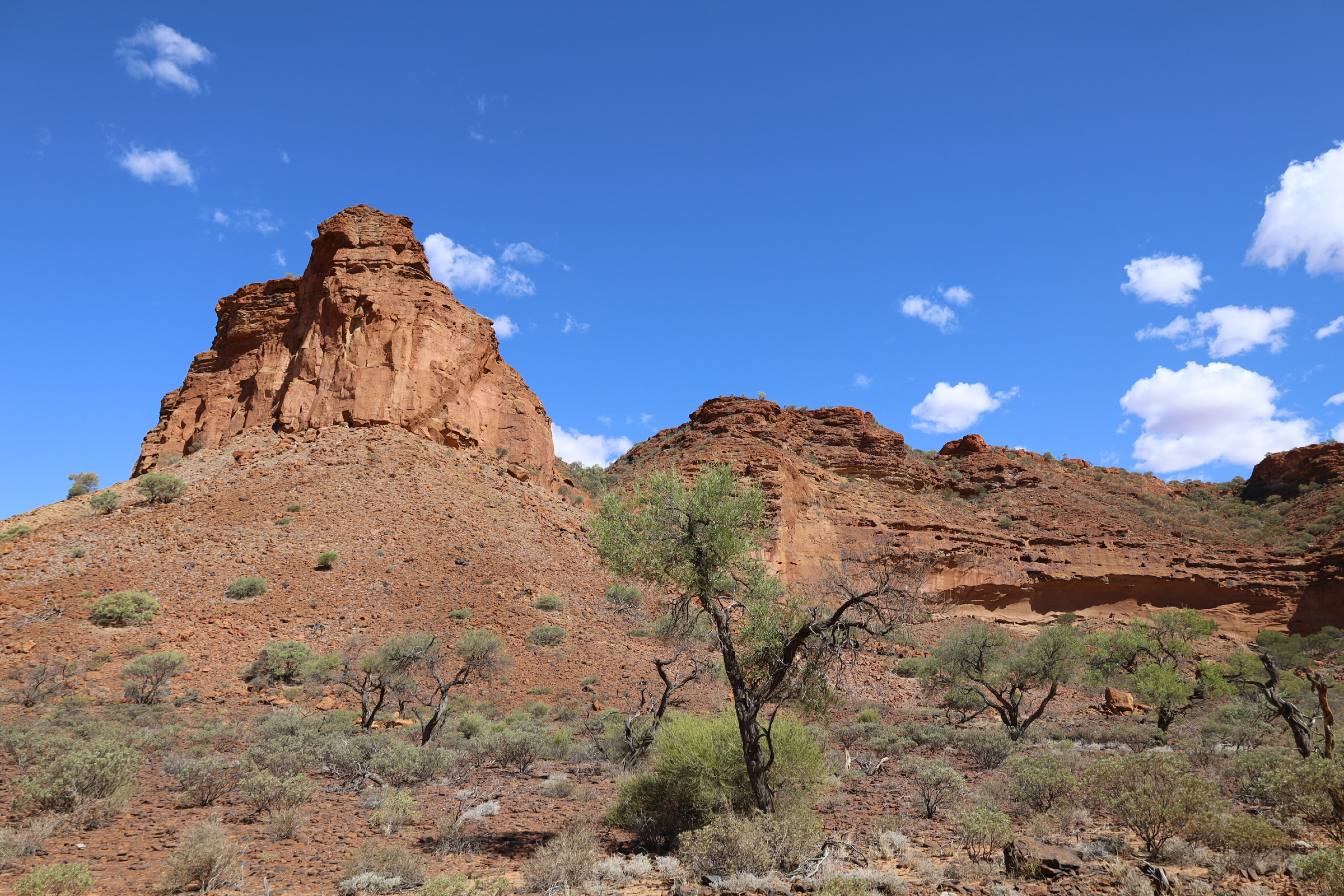
It’s a good dirt road into the park and straight away the eastern escarpment seems to loom above you as you head directly towards it, with its massive jagged outcrops and tall columns.
To describe it as an impressive sight would definitely be an understatement, as the 250 million year old weathered rocks glow in the sun no matter what angle you view them from.
Camping is allowed at Temple Gorge which is a good place to base yourself for the hikes into the ranges, whether it be the stunning Sunrise, Honeycomb, Drapers, Temple or the Escarpment trail.
57
Starting at the northern end of the park, the track heads into pastoral stations that have been bought to make up the 320,000ha park over the years.
Apparently this area was a shallow ocean basin over 200 million years ago and with the complicated movements of the earth and ocean receding, marine fossils can still be found in the sandstone throughout this huge mesa that measures an impressive 75km long by 25km wide.
Something else that caught my eye was the Kennedy Loop Track that covers the top of the range and is only suitable for high-clearance 4x4s. Starting at the northern end of the park, the track heads into pastoral stations that have been bought to make up the 320,000ha park over the years.
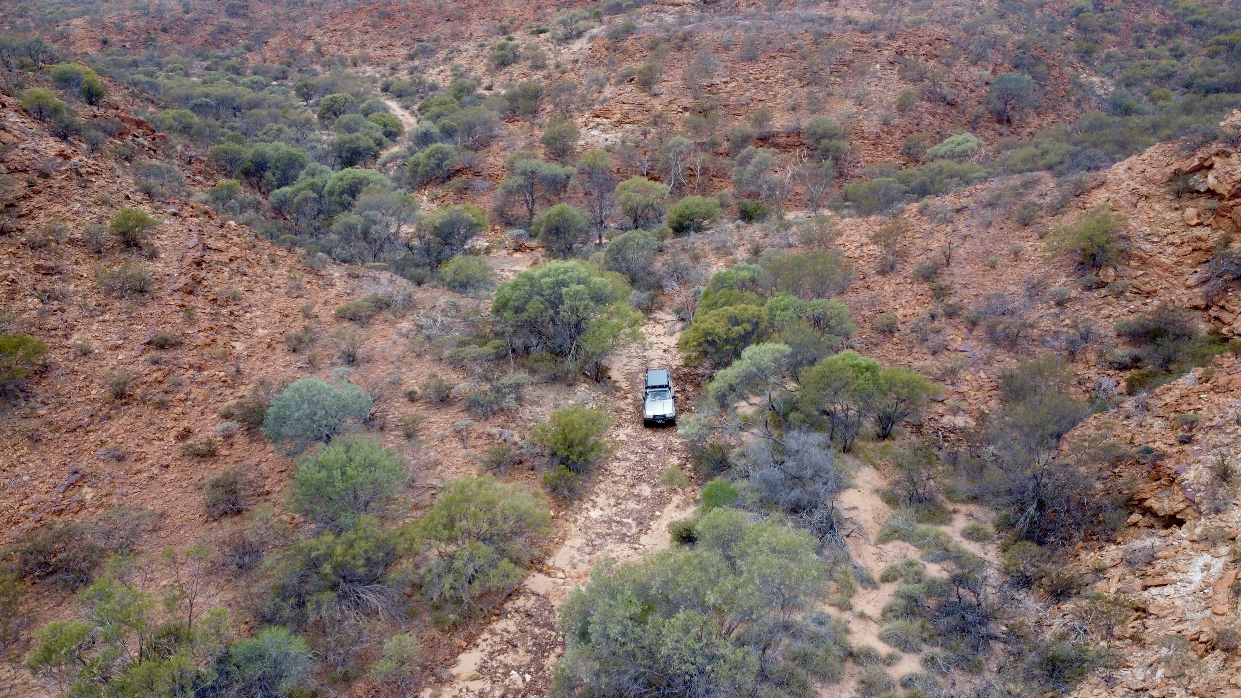
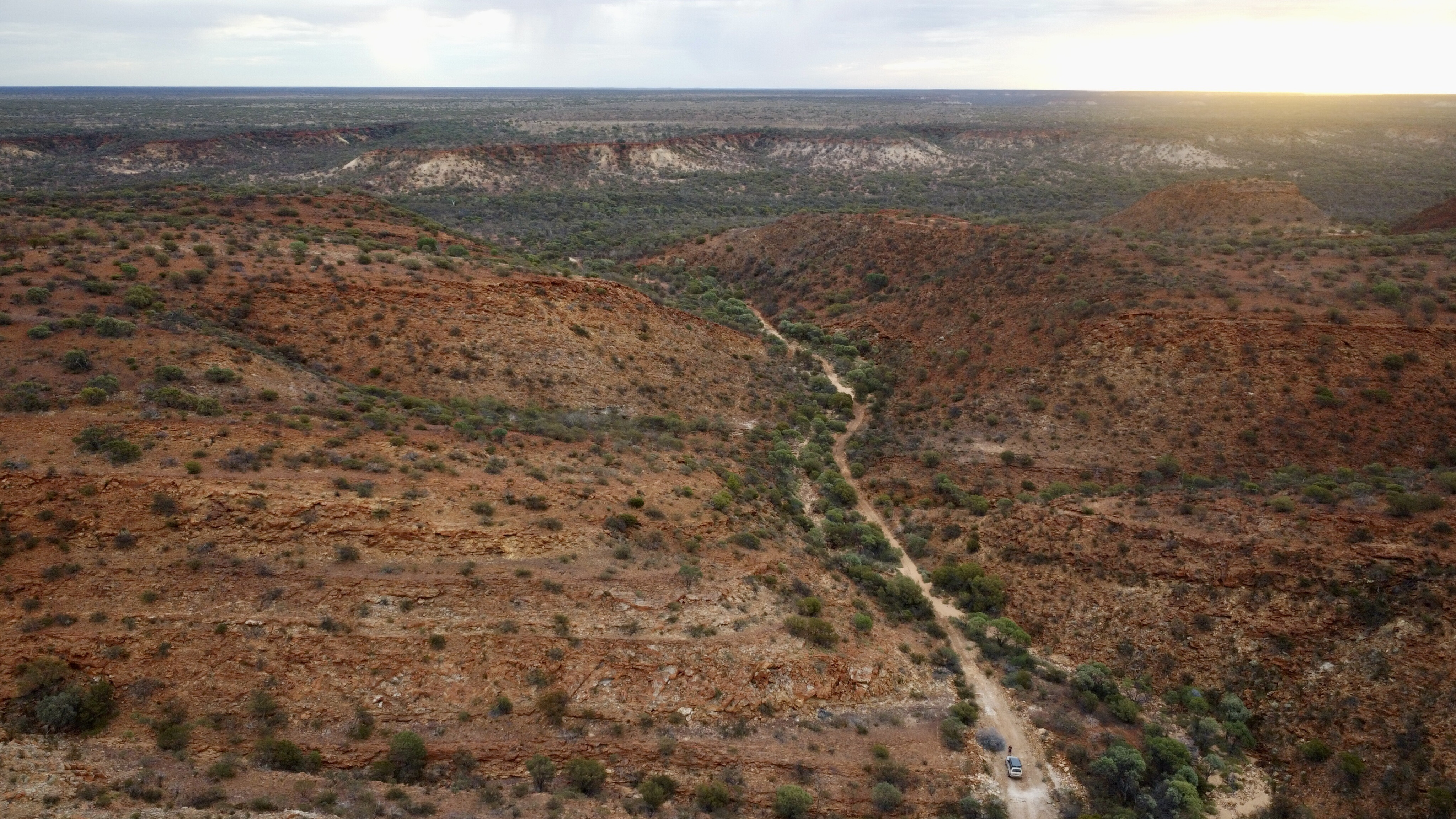
From the start the track covers a variety of terrain including rows of red dunes, narrow sections following steep cliffs with endless views to the east, and a maze of steep-sided canyons to drive through over sharp rocks and along washed-out creek beds.
57
All the way along the track the scenery is nothing short of spectacular with its ancient rock formations, huge slabbed rock and massive gums, and on the western boundary of the range a number of natural springs give life to little pockets of the park.
Free camping is allowed up here but not too close to the water, as the animals use it as their only water source, and to think it was formed by a substantial geological fault millions of years ago. More than 400 plant species, more than 100 different birds, and some 20 mammal species have been recorded across this unique plateau.
My drive along the Loop Track ended at the mighty Gascoyne River… and it should be noted that during the wet this river is totally impassable. I crossed it when it was relatively dry but it was still wheel depth, and then there was another 200m of dry river sand to cross out of the Gascoyne.
57
It would have taken decades of wet seasons and cyclone rain to carve the river to its current depth, even though it’s nearly 200km to the coast.
Just out of the Gascoyne River, new campgrounds have been opened up on Winnemia station. An old workers’ cottage has been converted for campers with toilets, but it’s still a remote camp and you’ll need to be pretty well set up and self-sufficient, as Gascoyne is still two hours away.
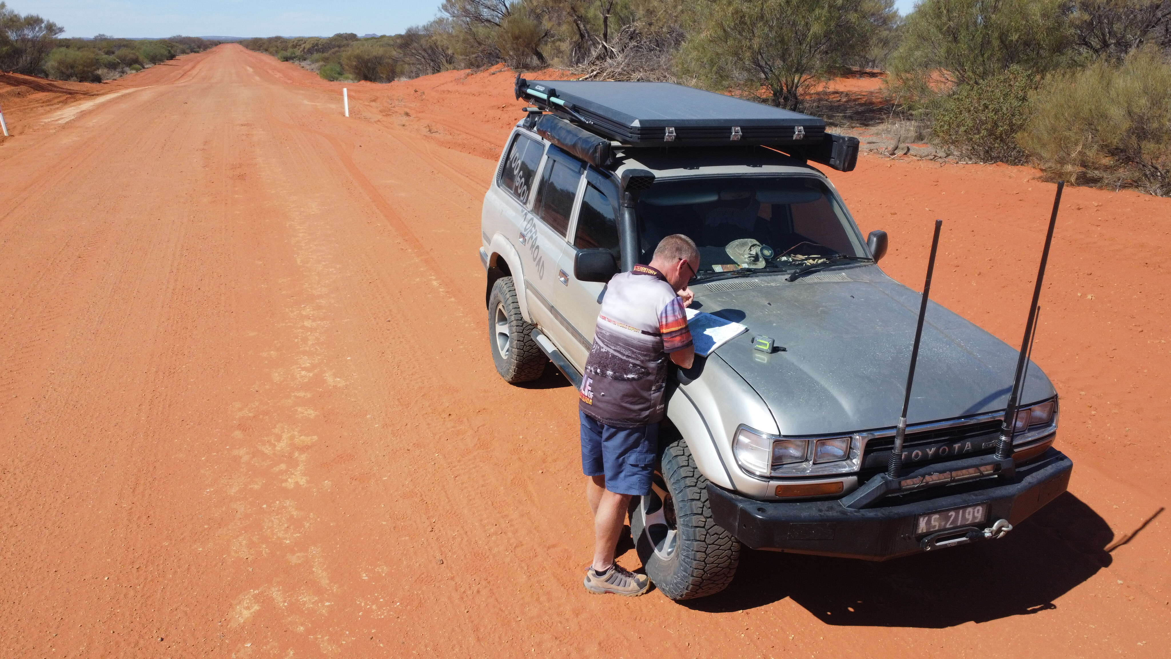
The Loop Track was about 100km long but with so much to see and do it took a good day to explore it. This is a remote and isolated track that should only be attempted by high-clearance vehicles and those who are confident with remote-area travel.
57
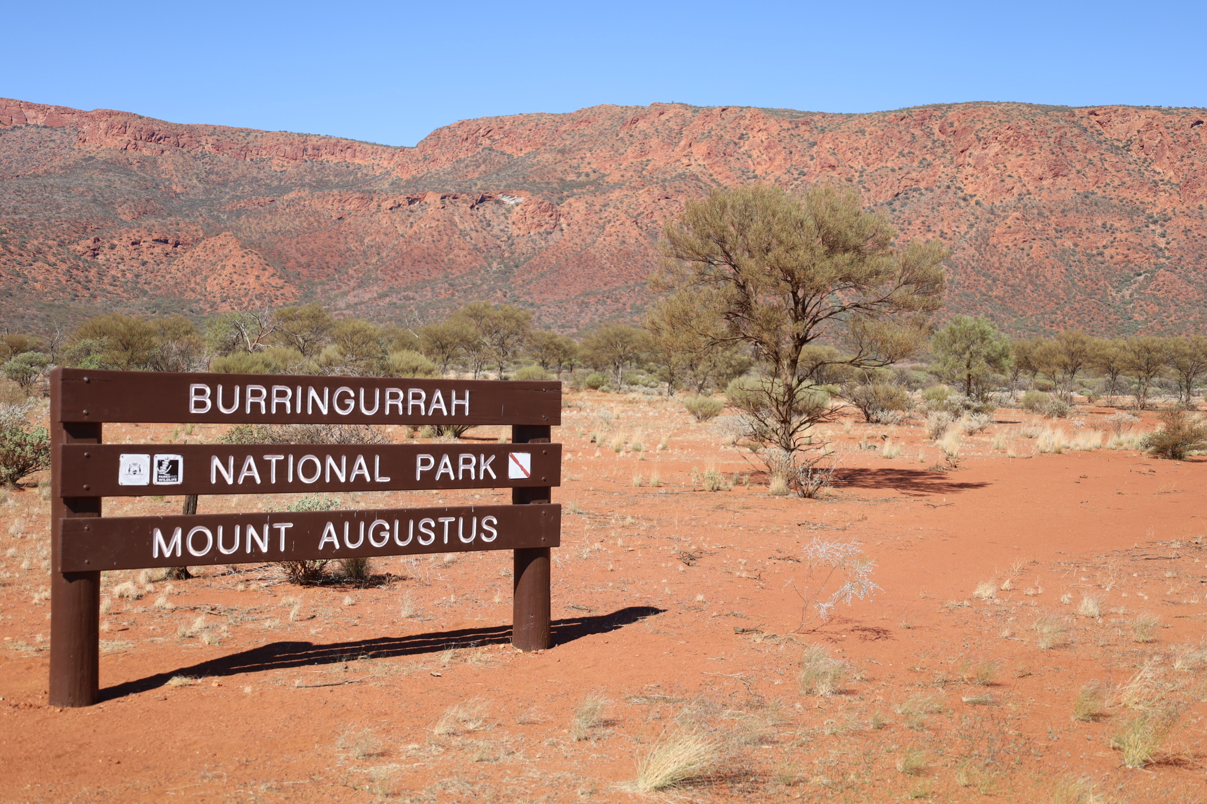
Mount Augustus
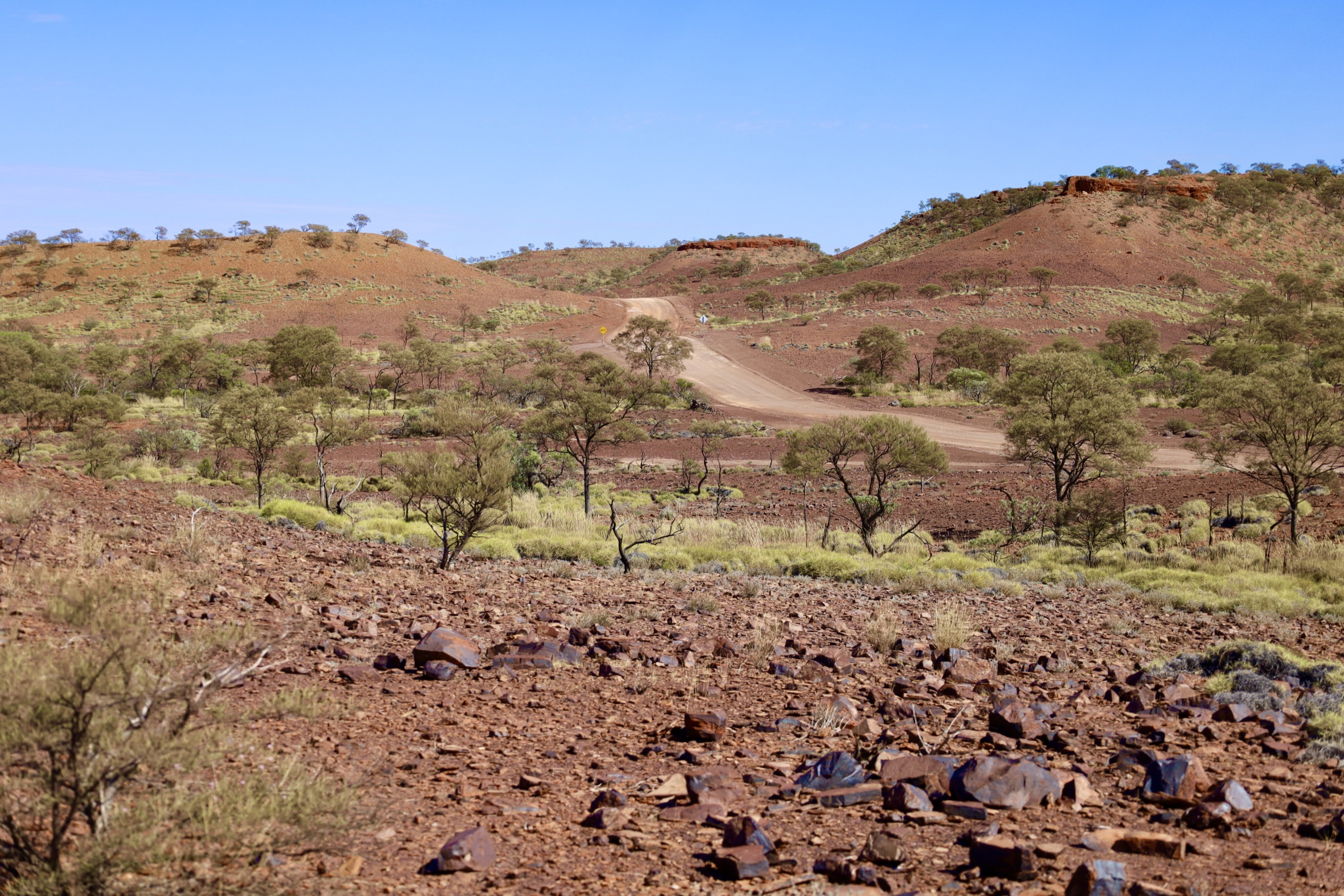
My priority on this trip was to head to Mount Augustus, which I did by heading back into Gascoyne Junction and taking the dirt Carnarvon-Mullewa Road and the Cobra Dairy Creek Road towards the rock for another 300km.
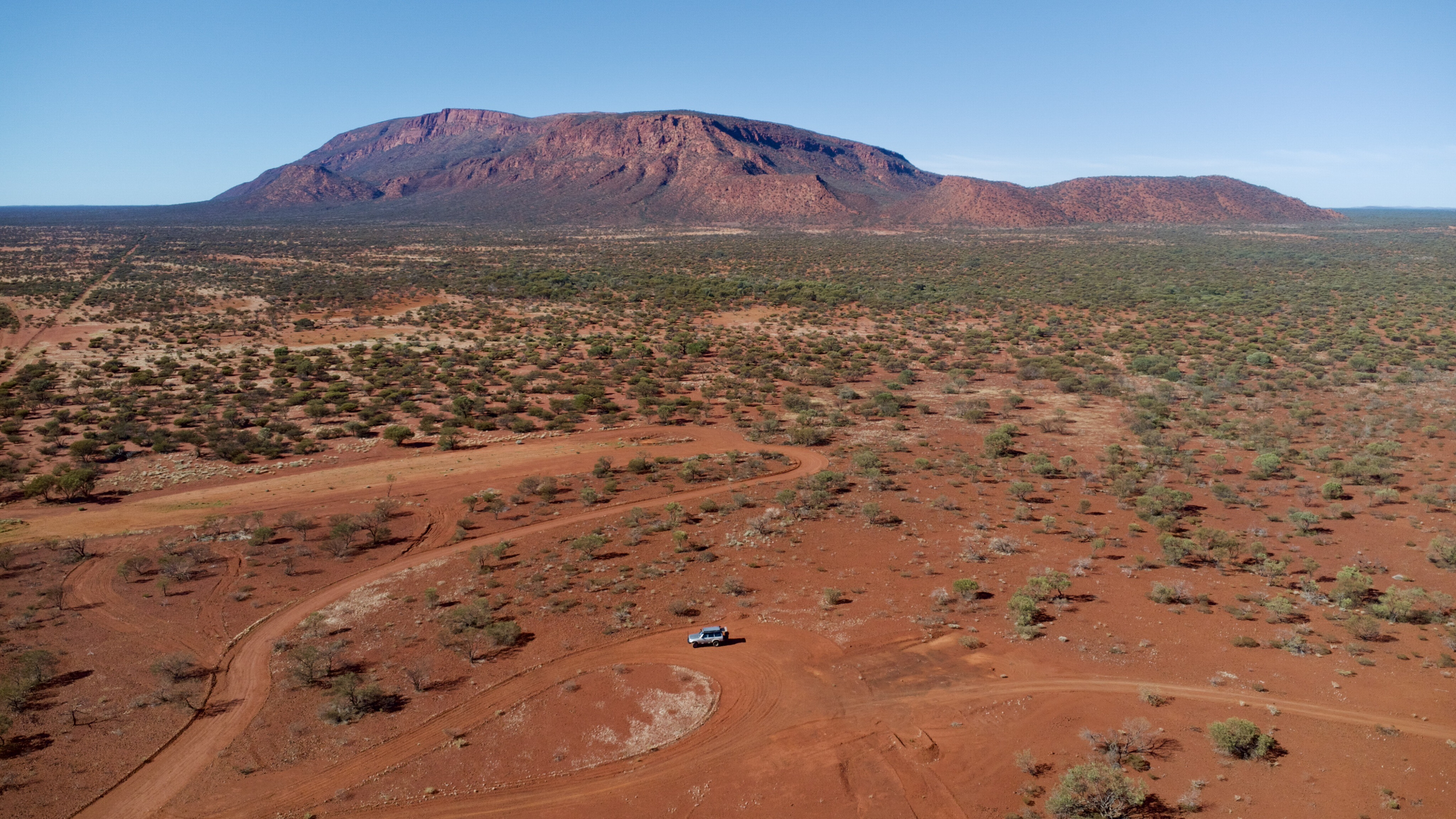
Of course, most people who have been to Uluru reckon it’s a pretty big rock but Mount Augustus is next level! It’s visible from 60km away and is two-and-a-half times larger than Uluru, and estimated to be over 1800 million years old.
Just like the Kennedy Ranges, it was formed by a complex process that began when the inland sea dried up, the earth moved and a weathering process started. Marine layers are still visible in the area away from the rock.
57
The only place to stay here is on Mount Augustus Station where you’ll have stunning views of the rock from your camp, especially at sunrise.
One of the best things you can do here is the 45km drive around the base of Mount Augustus to both view this huge monster from different angles and to explore the variety of hikes into and up the mountain. The hikes are graded 3 and 5, depending on their length.
Experienced hikers can attempt the summit walk but it’s an extreme and difficult hike; other smaller walks provide access to significant areas and are as short as 200m.
57
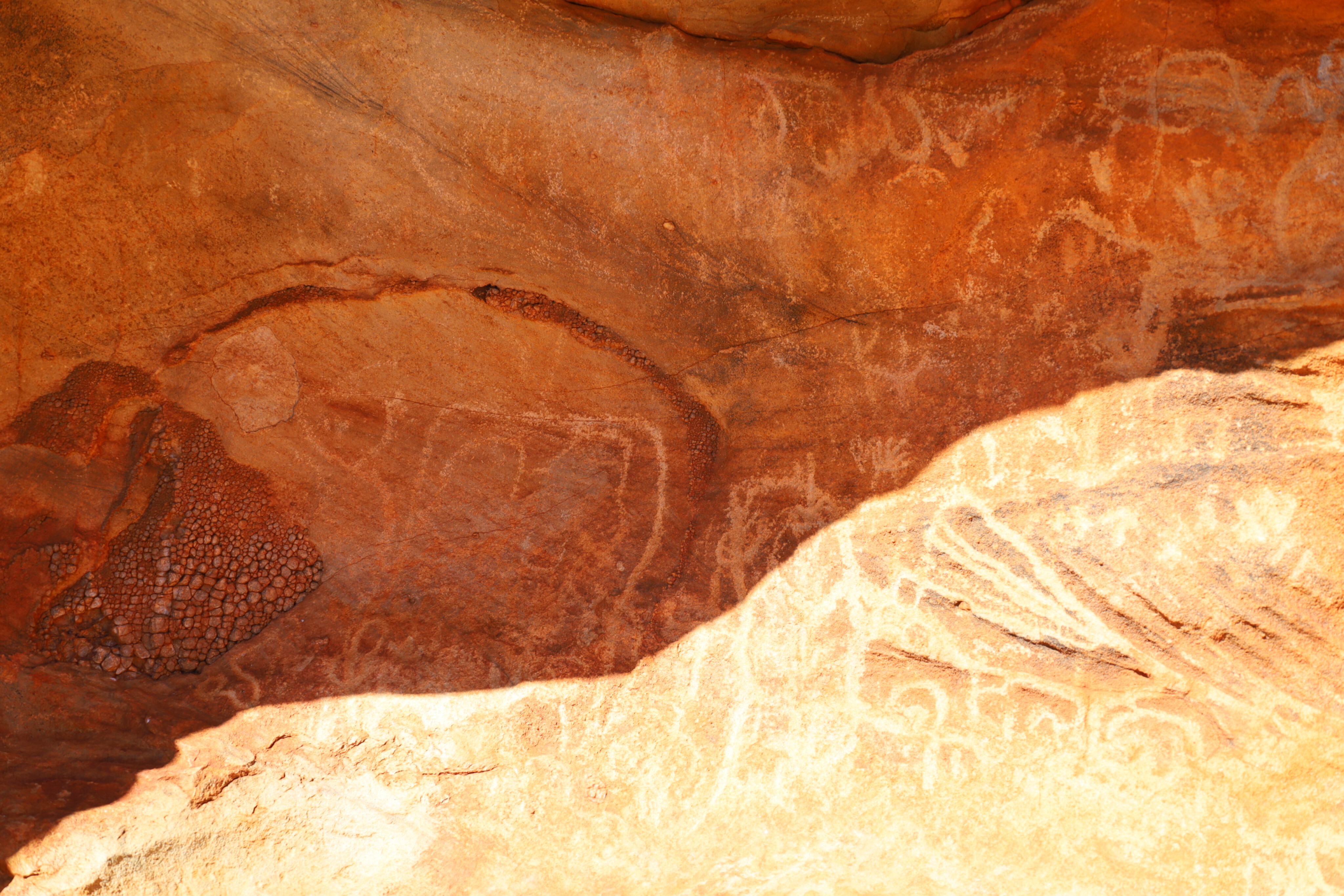
These petroglyphs depict an amazing array of animal, human and dreamtime engravings.
The Wajarri people call this area home and once upon a time they would roam across the Gascoyne region, rehydrating at the natural springs at the base of the mountain that always provided a reliable water source even in times of drought.
Some of the shorter walks around here lead to places where the Wajarri people left engravings in the rocks. These petroglyphs depict an amazing array of animal, human and dreamtime engravings.
There are plenty of areas to sit and ponder what the symbols mean, as well as who carved them and why they did so here. Other walks lead to cattle soaks and across dry waterways, and there are spectacular views across what seem like desolate plains.
57
Mount Augustus is an inselberg which means it’s an island mountain, just like one that would rise from the sea.
It bursts out of the arid landscape of mid-eastern WA and stands an impressive 715m high, surrounded by a mixture of wattles, spinifex and cassia.
While the underrated rock that is Mount Augustus might be figuratively overshadowed by that other rock called Uluru, it’s well worth the effort to visit this impressive landmark in the west, along with nearby Kennedy Range.
57
Top 5 things to see and do
- Camp at Temple Gorge is you are keen to tackle the many and variued walking tracks that lead up into the Kennedy Range.
- Drive the Kennedy Loop Track that covers the top of the range, but note that it’s only suitable for high-clearance 4x4s.
- Camp at Winnemia station where an old workers’ cottage has been converted for campers with toilets, but be aware that it’s still a remote camp
- Take the 45km drive around the base of Mount Augustus to view this huge monster from different angles and to explore the variety of hikes into and up the mountain.
- Check out the petroglyphs at Mount Augustus that depict an amazing array of animal, human and dreamtime engravings.
The Kennedy Range NP entry is just under 200km east of Carnarvon on a good sealed road and the Kennedy Loop Track is unsealed and very much unmaintained, so driving it is at your own risk.
Mount Augustus is a further 260km past Gascoyne on good unsealed roads, which may be closed in wet weather. Or you can drive in from Meekatharra which is 350km away.
57
A seasonal adventure
Camping is available at Temple Gorge in the Kennedy Ranges and at Mt Augustus Tourist Park. Don’t attempt exploring this area during summer, as the daytime temperatures can cause a variety of health issues including death. Drink plenty of water and be safe.
More information
Most information for this area can either be found online, through the WA parks and wildlife service in Gascoyne Junction, or by contacting the Carnarvon information centre regarding the Kennedy Range or Mount Augustus Tourist park, phone (08) 9943 0527.
Please enable JavaScript to view the comments powered by Disqus.
COMMENTS