Explore NSW
Gallery17
WE FOUND the hut sitting in a strip of cleared land, between rows of pine trees on one side and native forest on the other. Judging by the grass growing along the pathways and around the drooping gate, few people had been there in the preceding weeks. Wombat crap testified to a family of burrowers, who were busy undermining the stumps of the old building.
The building had eluded my search as I hunted for it for hours on the web, even though that is where I had first heard about it from a traveller’s blog – and while there was a photo there was no indication of where it was, apart from ‘southern NSW’.
17
I rang some 4x4 mates who lived in the region and who knew the area pretty well, but all had the same reply: “Never heard of it.” I then rang the National Parks office until I got to the Bombala branch, where I was shuffled around for a time before some older guy said he thought the hut was on forestry land and I should ring them.
When I did I was put through to the head forester and ‘bingo’ we had the info we needed. The forester explained where it was located, just a few kilometres south of Cathcart, inland from Merimbula on the south coast of NSW.
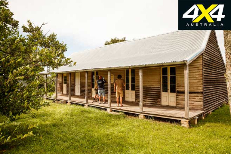
It was more than just a hut, though. Built in 1860 in the USA the building had been prefabricated and then shipped to Australia, where it was erected in 1861 on what was then the main coach route from the coastal towns of Eden, Tathra and Merimbula to the once booming but short-lived Kiandra goldfields.
17
In 1860 the High Country goldfields had more than 10,000 hopeful diggers searching for their fortune and, while some lucky ones hit incredible riches, most struggled to survive, especially when the snow and cold descended in winter.
The Woolingubrah Inn, as it was called, takes its names from the Aboriginal word for ‘windy place’, which is more than appropriate as the inn was located on an exposed ridge of the Big Jack Range, much of which is now included in the Coolangubra State Forest.
17
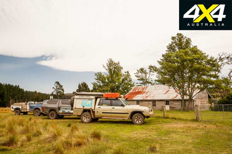
It is probably the only building of its type still standing in Australia, and was restored by NSW Forestry nearly 20 years ago. Consisting of a bar, dining room, kitchen and six bedrooms, we sadly couldn’t get into the building as it was locked – next time I’ll ask for a key.
Our journey had continued from where we had explored the remains of the Pambula Goldfield just inland from the coast and not far from the popular holiday destination, before heading inland over some spectacular peaks and along Big Jack Mountain Road.
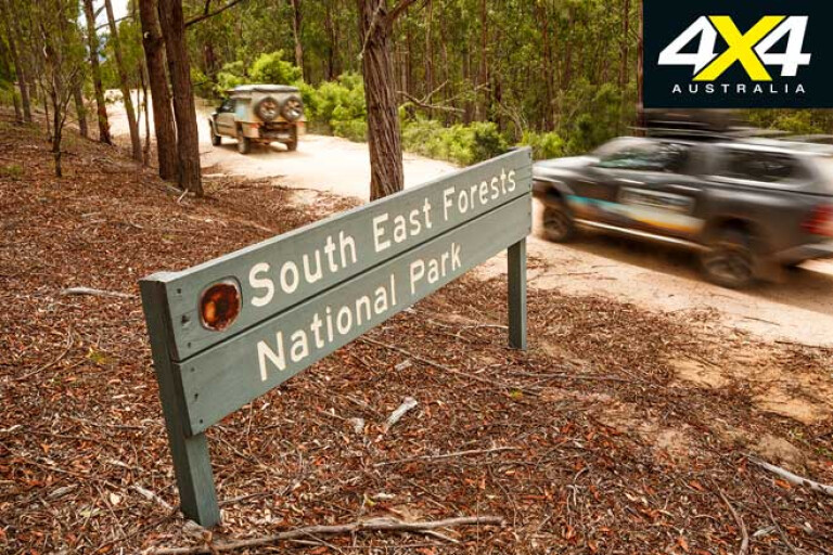
This route passes through the Coolangubra section of the South East Forests NP, before we took Tantawangalo Mountain Road into the Tantawangalo section of the same sprawling national park.
17
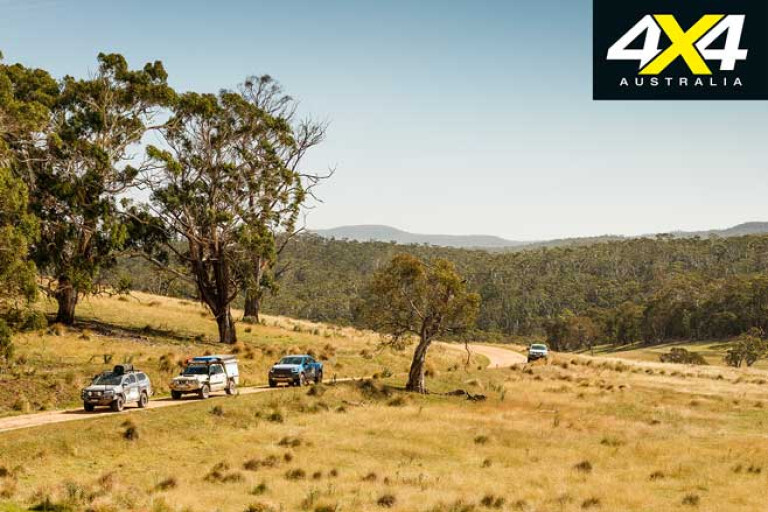
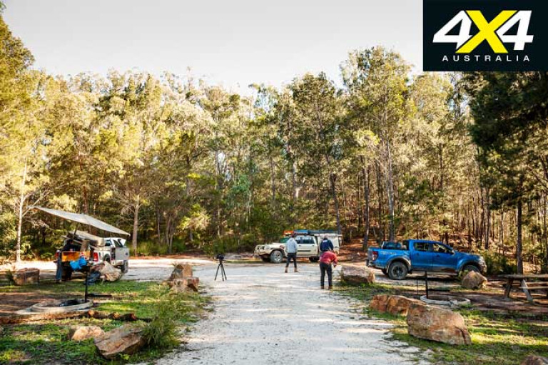
Once again we had vaguely heard of some camp spots in the northern section of the park but could find little on the park’s website; although, the Hema map on my iPad at least had them marked. Once again, though, Parks had closed a few of the tracks in the immediate vicinity and so our route took us through a variety of different landscapes, varying from grassy woodlands, dry forests, tall wet forests and natural grasslands to clear marshy areas around the Nunnock Swamp.
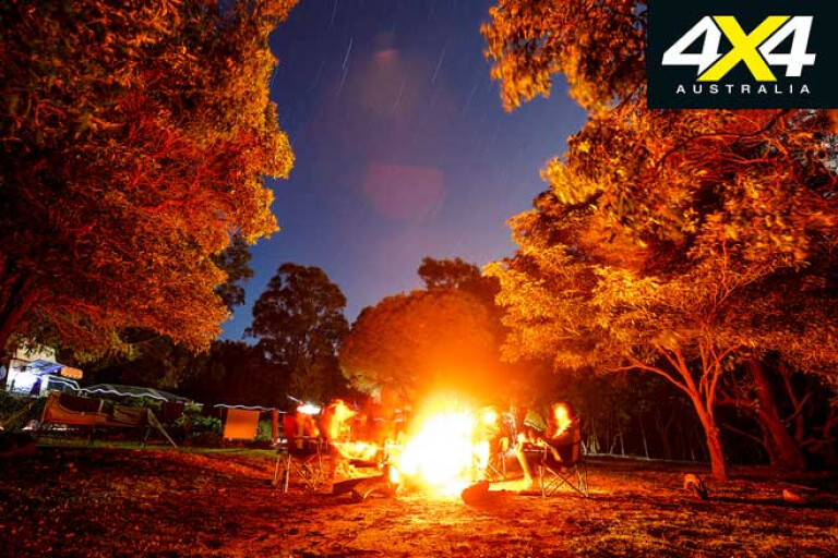
The little-used Nunnock camping area is located on the edge of a grassy clearing. We picked a spot away from the overhanging branches of the big gum trees that overlooked the camp and settled in for the night. Grey kangaroos and swamp wallabies grazed the grasslands and nearby scrub, while later that evening a rarer greater glider was seen checking us out from above our campfire.
17
The Nunnock camping area is a beauty, but Alexander Hut, just a short distance further on, is an absolute cracker. A hut was first built on these high plains in the 1890s by cattlemen bringing their stock up during the summer for the rich, verdant grazing.
In 1922 Alexander Robinson took over the lease and continued the tradition of summer grazing and built the slab hut from local timber, hessian and corrugated iron. Still, bringing cattle to these leases and living here was no walk in the park. In the tough times, especially during The Great Depression and WWII, rabbits helped sustain families by providing not only food but also cash flow brought on by selling the skins – the skin was used in the manufacture of the famous Slouch Hat.
17
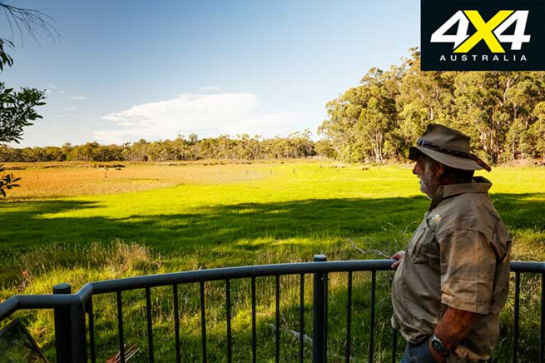
The hut, now included in the national park, is surrounded by natural grasslands where kangaroos and wombats are common, while eagles and other birds of prey glide on the thermals overhead. Near the hut is a small camping area and, while extremely pleasant in good weather, it can be a bit exposed when the weather turns foul.
Tearing ourselves away we headed south through tiny Cathcart to finally find the Woolingubrah Inn. We celebrated our find by heading to Bombala and having a pie and coffee in the local bakery, before heading back into the forest for another unexpected highlight of our travels.
17
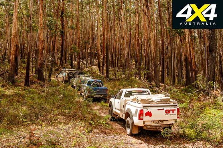
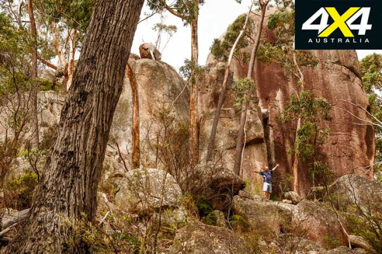
We poked our way towards Pheasants Peak where the Wog Wog Trail, as marked on all the maps and now renamed Pheasant Peak Trail, began. And what a trail it is, showing very little use by the amount of timber down and the lack of wheel marks. It’s one of the things that continually surprises us with these trails in southern NSW, as we are more used to the well-populated tracks in the Victorian High Country.
This route climbs up on a narrow trail before dodging around and between great castles of boulders that dominate each and every crest, until you finally reach the sheer rock maze and ramparts of Pheasant Peak. We spent an hour exploring here, some of the more agile in our party making it to the very pinnacle of the rock towers while the rest of us were content to explore the crevices and mini-canyons lower down in the labyrinth.
17
That evening, after following Wog Way and Wallaby Road, we camped beside the Wallagaraugh River at Newtons Crossing close to the junction of Imlay Creek. It’s not a bad camp, but finding level ground can be an issue and our group of four vehicles struggled to fit in most of the campsites.
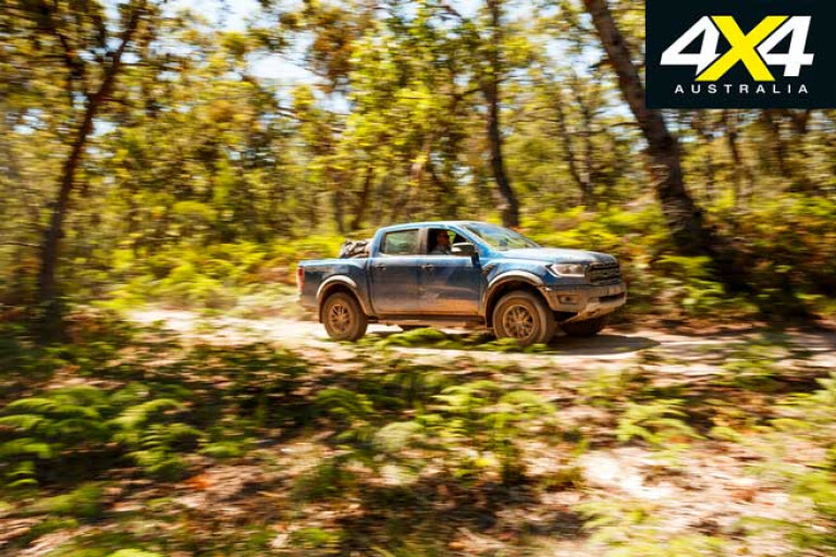
For a change from our forestry rambles we headed for the coast at Wonboyn Lake and the mouth of the river of the same name near Bay Cliff. The road beyond the small hamlet is poorly maintained, and while it was no problem for our group of four-wheel drive vehicles others might find it a bit daunting.
17
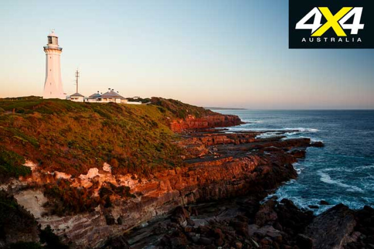
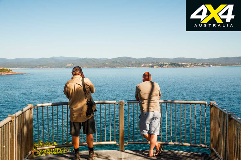
Once on the beach we wandered along the long strip of sand to Bay Cliffs before clambering over the rocks and along the cliff-lined shoreline. It’s a magical piece of coast and we wished we could have stayed longer, but in the distance and almost directly east of us was our planned destination for the day: the low bluff of Green Cape adorned with its white marker of a lighthouse.
With a lot of the tracks marked on the maps closed by Parks, we had to backtrack a little. Then, once we got into Ben Boyd NP, we had to pay an entrance fee while planning to pay for our camping fee with a not-so-good Wi-Fi connection.
17
It seems crazy that you can pay an entrance fee with cash at a drop box at an entry station, but you must book your campsite via the web in places where it’s impossible to get a web or phone connection. I often wonder if the city-based people who plan these systems have ever been camping … I’d hazard a guess and say ‘no!’
Long-term readers of the magazine would know I’m a bit of a tragic when it comes to lighthouses, and the Green Cape Lighthouse is grist for the mill. It’s set in a dramatic setting surrounded by magical country, while playing testimony to our nation’s history. The spectacular building was built in the early 1880s and in its day was the largest concrete structure in Australia.
17
Today you can stay in the lighthouse keeper’s quarters, with the role of a warning light taken over by a nearby ugly steel tower with a cylinder stuck on top where a bright light flashes from its highest point. Luckily, it’s pretty easy to ignore this monstrosity.
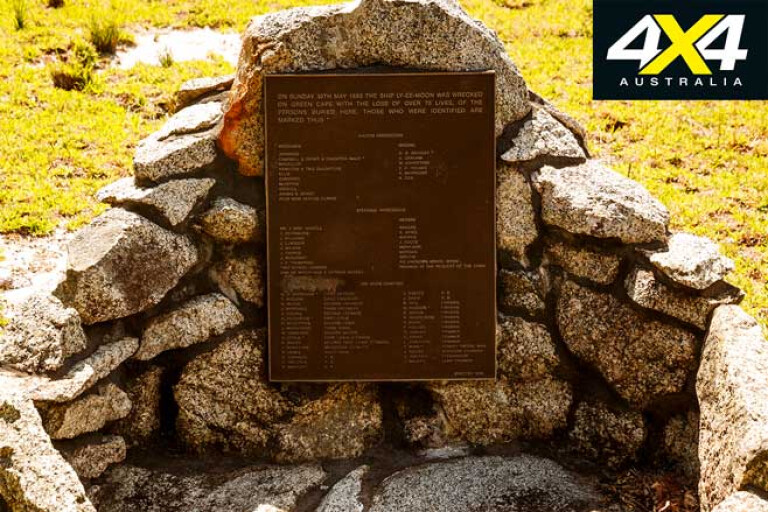
The start of the Light to Light walking trail, which can take you 30km to Boyds Tower, begins a little further along the coast. However, we opted to take the short stroll to the cemetery of the 71 victims of the Ly-ee-Moon disaster. Wrecked in 1886, this ship was one of many that came to grief along this stretch of coast, the last in 1994 when a fishing vessel was wrecked with the loss of two lives.
17
That evening we threw down our swags at Bittangabee Bay, a spot I hadn’t visited for more than 30 years. It was as stunning as ever, while the camping area was a little more formal and a lot bigger.
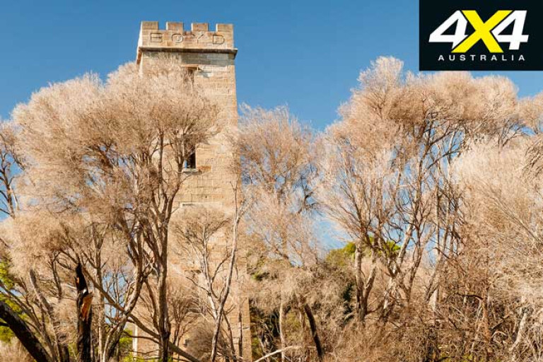
Luckily there were only a few other campers in residence and we enjoyed the late afternoon in the protected bay. Kangaroos were everywhere, and that evening around the campfire possums and bandicoots paid us a visit. The next day we drove north on roads that were extremely dusty. We then took the short walk to Boyds Tower which stands on Red Point and has a fine view of the surrounding coast.
17
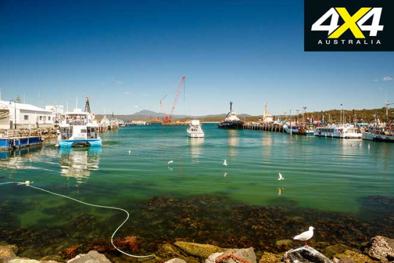
Our last night on the south coast of NSW was spent in Eden and, over a few beers, there was a realisation that we had only skimmed the surface of places to see and things to do along this remarkable coast and hinterland. Will we be back? You better believe it.
Boydtown's whaling history
17
In the 1840s Ben Boyd arrived at Twofold Bay (named by George Bass in 1797) and established his empire of wool, timber and whaling. Building a town called Boydtown, in 1846 he had built the tower that still bears his name.
From here his whaling teams looked for whales which they hunted and processed nearby. By the late 1840s Boyd was broke and he did a runner to the USA, leaving behind a legacy that is still remembered and highlighted today.
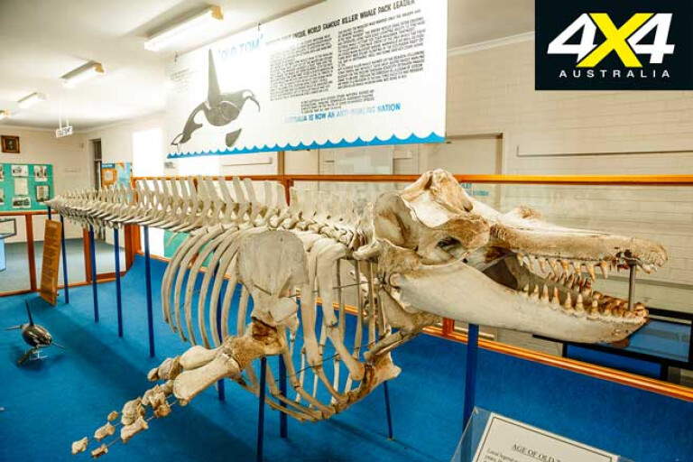
Later, during the Davidson era of whaling at the beginning of the 20th Century, his men manned the tower and competed with other whaling crews for the rich bounty that continued to swim past. Later, with a pod of killer whales assisting them, the Davidson crews became the only whaling team still operating from the bay.
17
When the leader of the killers, Old Tom, died in the 1930s the whaling era here came to an end and the last shore-based whaling station in the country closed. The story of the unique partnership between men and killer whales is graphically told in the book, Killers of Eden, while the Eden museum is one of the best local museums in the country with the skeleton of Old Tom on display and a fine exhibition on whaling and the history of the town and area.
Travel Planner
17
For info on the many national parks in the area and the latest alerts and info go to: www.nationalparks.nsw.gov.au
For info on the forests in the region and the camping and four-wheel drive opportunities, see: www.forestrycorporation.com.au
A useful guidebook to the 4WD tracks in the area is 4WD Touring South East NSW and East Gippsland, by Craig Lewis & Cathy Savage.
Please enable JavaScript to view the comments powered by Disqus.
COMMENTS