Explore NSW
Gallery10
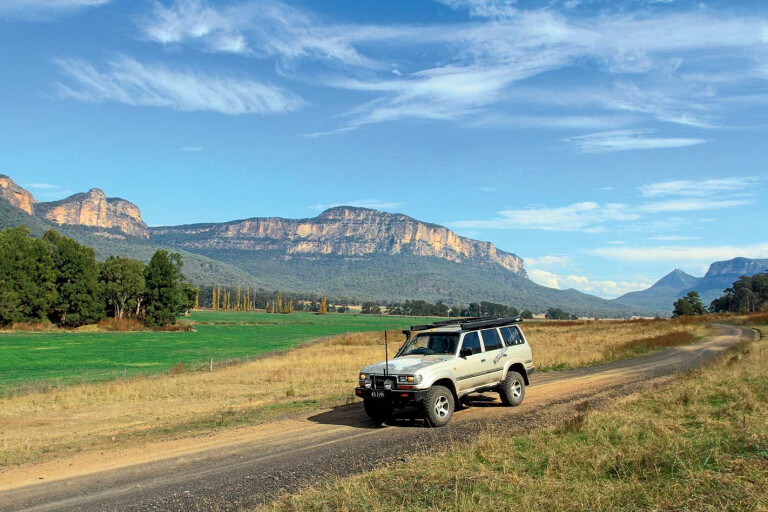
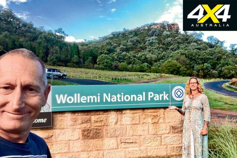
WOLLEMI National Park is a natural wilderness area in the upper reaches of the Blue Mountains and the Hunter region of NSW covering 5000km² and located only a few hours’ drive west of Sydney.
It’s claimed to be the largest wilderness area in NSW and is home to significant Aboriginal features, rare plants (Wollemi Pine was found in 1994 in a remote valley) and numerous animals. The park has many entry points, but as it’s rugged and remote there aren’t a lot of roads that actually run directly through it.
10
Some of the park’s best features can be found on the Lithgow side, as that’s where the early explorers – like Allan Cunningham, who passed through in 1822 – entered from. The entire area is a natural wonderland with key landmarks including basalt structures formed over millions of years and the Capertree Valley which is the second largest canyon in the world – it’s 1.6km wider than the Grand Canyon, but not as deep.
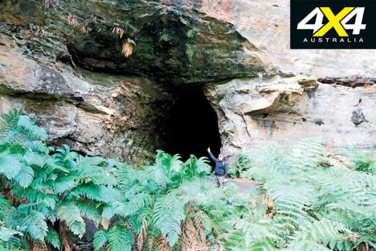
Indigenous Australians have been living in the area for about 40,000 years, and many sites and caves have been found with handprint and animal stencils; in fact, bush walkers found 200 different shapes in one remote cave.
With so many places to explore in the region it’s essential to put aside more than a couple of days, and our adventure started as soon as we heard about the history of the area’s several abandoned industrial areas and old rail tunnels.
After sourcing local information from Lithgow we headed 45km north along the Castlereagh Highway towards Capertree, and, 35km later – deep in the Capertree Valley – the surrounding mountains started to close in and give way to sheer cliffs. The last 10km of the valley road is unsealed and leads to the now desolate village of Glen Davis.
10
Given the info we received we headed straight to the NP campground of Coorongooba, located beside the Capertree River and within an amphitheatre of huge cliffs. It’s free, you can light a fire, it has pretty good pit toilets, and it’s located on several acres so there’s plenty of room for all.
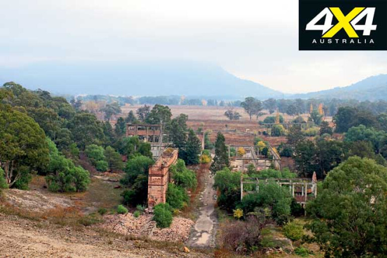
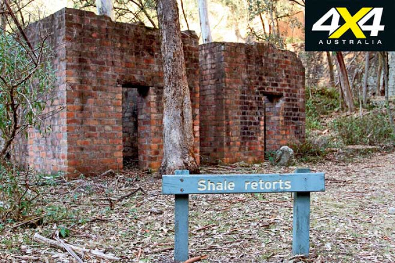
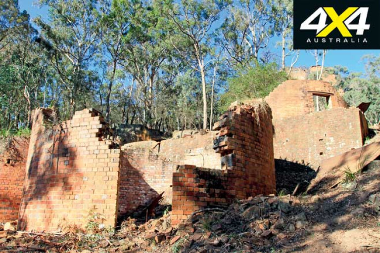
After setting up camp we headed back to the mining ruins just up the road. Signposted as Glen Davis Lookout, a path leads to a view of the works and some stunning sights and, while the Glen Davis operation was fenced off due to OH&S, we were free to wander around other areas and relics. It was a massive operation, with washing plants, workshops and storage bins for the products produced.
However, it’s not until you get to the top of the lookout and see the amount of ash dumps that you realise the enormity of this place – a cableway was used to move ash up to five kilometres away from the worksites.
10
We spent hours ambling around the ruins, finding mega amounts of steel, relics and building foundations that were all left when the receivers came in and gave the company a few months to close up. When Glen Davis was operating at full steam it was producing 5,000,000 gallons of petroleum per year and the town, with shops, several schools and many churches, was bustling with hundreds of people.
At the time of production a pipeline was built over the mountain some 58km away at Newnes Junction, to huge storage tanks ready to be railed to Sydney. Unfortunately the government at the time pulled the pin for subsidies (around the time of WWII) and the plant slowly closed down. It was estimated there was £4,000,000 worth of gear to be auctioned off after only 20 years of operation; most of it is gone, but there’s still huge amounts of gear to be seen.
10
Glen Davis wasn’t the only shale-mining operation in the area, though, as Newnes was also set up to pull shale out of the ground. Newnes may only be a few kilometres away as the crow flies, but it’s a 100km trip by road to get there.
Backtracking to Capertree and down into the Wolgan Valley the drive is nothing short of spectacular, with farmlands hugging the base of the gorge mountains. The road finally ends after 34km at the Newnes camping area, where again the camping (with basic facilities) is free.
Newnes was set up in 1906 when pockets of shale were found in the adjoining cliffs, but by 1940 operations had shut down. From the campsite there are a few areas that can be explored to highlight the amount of work that went on here; the Pipeline Track, for example, heads along the Wolgan River past many freestanding old chimneys, hospital ruins and outhouses, and then down past the mechanical workshop and along to Shale Mine Number 2.
10
The history boards state there was a plan to tunnel all the way across to the Glen Davis refinery, but unstable conditions put an end to this. The Pipeline Walking Track eventually leads across the top of the mountain, but be prepared for a six-hour hike.
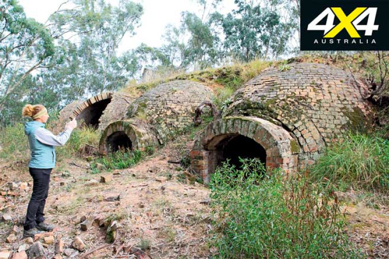
The industrial ruins of Newnes, found by crossing the river, are impressive, with millions of bricks used in buildings, holding tanks, coke ovens, stabilisation walls (up to 60-feet tall), workshops and stairs. A history trail with information boards is the best way to navigate the area as it highlights the best parts: 90 huge coke ovens, 70-metre chimneys (now fallen), workshops with pits, narrow gauge tramlines, water-separating plants, and even a paraffin plant for candles. A day can easily be spent exploring the ruins and the surrounds here.
Another engineering feat achieved at Newnes was a 50km-plus rail line to Lithgow, built to move goods to and from the mine. Due to the ruggedness of the area, however, the rail needed to hug cliffs, have steep inclines and possibly include several tunnels.
10
Due to heavy loads and the steep inclines, four Shay engines full of torque were shipped from the USA and they were able to stop and start on the severe inclines. The old rail line isn’t visible anymore as steel was pulled up and deployed overseas when WWII was declared, but you can still follow where the line was and see stone walls in place that were needed to prevent the earth from sliding away.
The rail line is a 7km walking trail into the next valley, where you can walk through one of two tunnels that contain millions of glow worms. Those who may find this a bit of a mission can drive within 1km of the tunnel, but unfortunately it’s another 100km loop around to the next valley.
Instead of heading back up the mountain to Lithgow and onto the Glow Worm Tunnel track, we followed Blackfellows Trail to cut off a few kilometres. Popular with local four-wheel drivers we found it was a little busy but for good reason, as it cuts its way past massive beehive-shape rocks, through sharp switchback corners, and meanders along ridgelines.
10
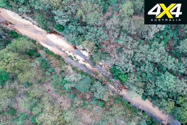
Turning left onto Glow Worm Tunnel Road and the going got significantly worse with an increase in traffic, but a curved 400-metre tunnel a few kilometres down the road makes this route worthwhile. The only right of way through here is first in, first through, and you’ll definitely need your lights on.
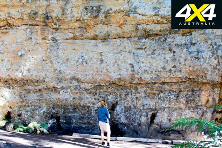
A one-kilometre walking track (which is part of the old rail line) follows a ridgeline, down through rock cutouts and across washed-away bridges. The path, surrounded by tree-fern forests, eventually leads to another 400m long curved tunnel where, without a torch, you’d be mad to enter. It’s pretty rough underfoot, as water trickles through and it’s downhill all the way to the other end. When you’re halfway through, turn off any lights and you should see millions of glow worms lighting up the walls and roof.
10
More tree ferns line the creek and the rock overhang on the other side. If you have a little more time, walk the sheer cliffs along the track and try to imagine the shale train hugging the rocks. About 300 metres later, the track curves around the cliff to provide monumental views into the Wolgan Valley.
Considering it’s only a few hours’ drive from Sydney, Wollemi NP should be on everyone’s bucket list.
MORE4x4 Explore

10
Please enable JavaScript to view the comments powered by Disqus.
COMMENTS