Explore SA
Gallery16
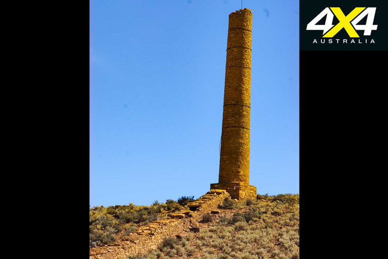
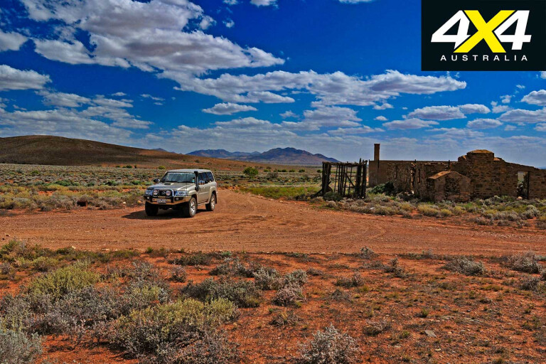
A TALL smelter stack perched on top of a hill is like a beacon that can be seen for miles across the flat saltbush plains east of the rugged spine of mountains we know as the Flinders Ranges. It’s the most obvious sign of what remains of the Waukaringa Goldfields, which were first discovered in 1872 and most recently worked on in the 1990s.
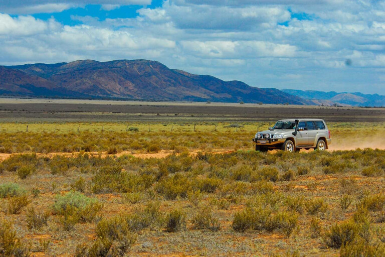
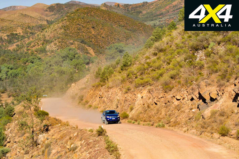
We had come up from Victoria through the Danggali Conservation Park, meeting the main Barrier Highway at the small hamlet of Yunta, west of Broken Hill. For those heading to the northern Flinders, the dirt road route from Yunta is the shortest access to the Gammon Ranges or Arkaroola Resort. Most people hurtle north with little care for the surrounding landscape, but there are a few spots along the way worth checking out.
16
For those keen on fossicking for gold, Waukaringa and the nearby smaller goldfields of Teetulpa, Manna Hill and Nillinghoo are worth a visit, but Waukaringa is by far the best to explore. Just 35km north of Yunta, the ruins of the old Waukaringa Hotel are the most obvious remains of the old town, while a short distance away, along the line of a low hill, the smelter stack can be seen – one of two chimneys to be found here.
Nearby are the diggings and shafts of the Victoria, Alma and Alma Extended mines, with the main shaft reaching down more than 300 metres. The field produced gold worth more £300,000 in its first 20 years, so it was hardly a rich strike when compared to the golden hordes found elsewhere in the country. Still, that didn’t stop more work being done here in the 1930s, 1950s and again in the 1990s; the most obvious sign of which are the bulldozer scrapes scattered across the hillside.
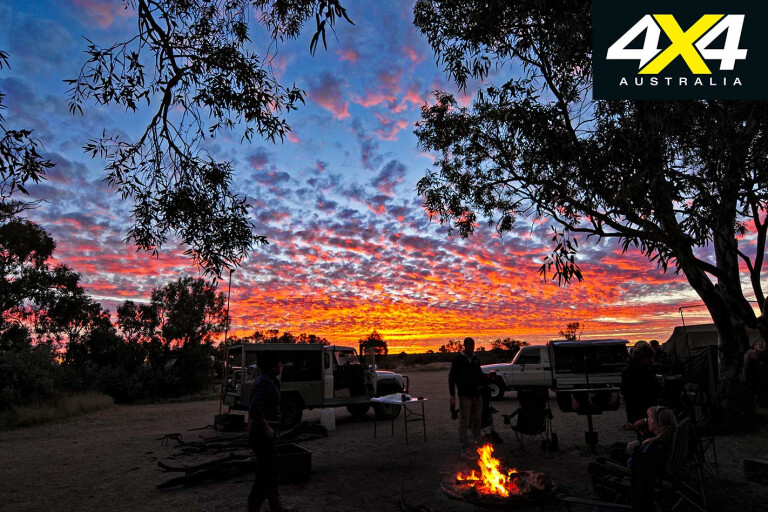
Camping here is possible, but it’s hardly idyllic; we’ve always pushed on, passing through the wire barrier of the Dog Fence a couple of times close to the Frome Downs Homestead, before the route swings west and then north-west to parallel the south-western shores of the hard-to-see Lake Frome.
16
A road junction at Teatree Outstation means you can continue north to Balcanoona, the Arkaroola resort and the Gammon Ranges NP, or you can swing south-west to one of the better camps close by at Chambers Gorge. Along the access track into the gorge you’ll cross Mt Chambers Creek a few times, before arriving at a number of designated campsites and reaching a carpark where you need to leave your vehicle to explore farther into the gorge.
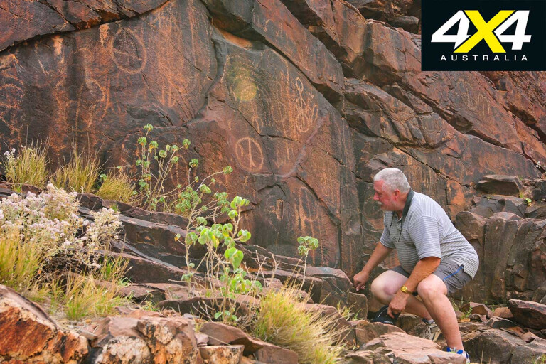
A short, easy walk along the creek brings you to the start of the gorge proper and a low but prominent bluff. By following the small creek north you’ll find, with a little exploration, some of the best Aboriginal rock art, not only in the Flinders but in all of SA, in the form of petroglyphs. For those who want to explore further it’s about a 1.5km walk from the carpark to the far end of the gorge, which ends at the impressive Windsor Pillar on the edge of the Frome Plains.
16
Heading north from Teatree and you’ll land at a major road junction close to Balcanoona Homestead, which is the headquarters for the surrounding Gammon Ranges NP. Turning west here leads through Italowie Gorge to the Aboriginal community of Nepabunna and the first Indigenous Protected Area (IPA) to be established in Australia, back in 1998.
There are a couple of access routes into the IPA, and a permit is required to access and camp in the area. Of the three places you can set up the camper or throw down the swag, the best is Moro Gorge. The normally small trickle of water in the gorge serves as a focal point for the area’s wildlife and you’ll often see a variety of birds, kangaroos and wallabies, including the delightful and uncommon yellow-footed rock wallaby.
Just west of the Aboriginal community is Angepena Homestead and, with permission from the people there, we headed south on bush tracks through Mudlapana Gap. About 19km from the homestead is Diggings Bore and then Windy Creek, where you’ll discover the main diggings of the Angepena Goldfields.

16
With permission from adjoining Warraweena you can travel on backtracks to the Warraweena Private Conservation Reserve, a long-time favourite for four-wheel drivers and history buffs. There are some great drives through the surrounding ranges and some enjoyable campsites along the creek, west of the homestead.
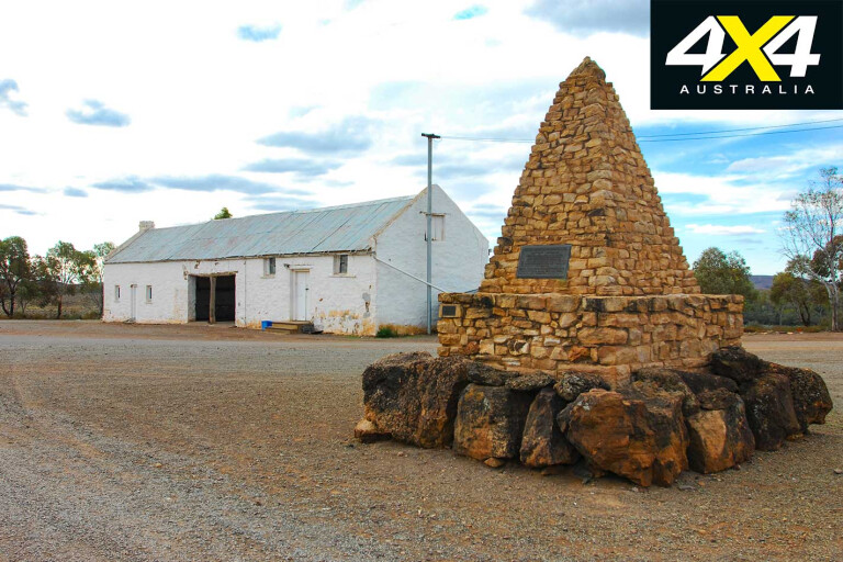
The ruins at Cadnia (Sliding Rock) are well worth investigating; the mine here, discovered in 1870, was once one of the richest copper mines in the whole of the Flinders. A town quickly sprang up and was on the way to some sense of permanency when disaster struck and the mine was suddenly inundated with massive flows of water. A steam pump was rushed to the area to no avail and the mine was soon abandoned. The town quickly followed.

16
West from the ruins, along the main access track to Warraweena, is the historic and semi-ghost town of Beltana which was established to service Cadnia. In 1872 a repeater station for the OTL was set up here and in 1894 the Smith of Dunesk Mission was inaugurated, where the Rev John Flynn worked before establishing the Australian Inland Mission and his vision of a ‘mantle of safety’ across the Australian outback.
Nearby is the famous Beltana property, established in 1854, which was, by 1860, the headquarters of Sir Thomas Elders’ vast pastoral empire. With its number of historic buildings the property now offers accommodation, camping and a variety of 4x4 tracks to enjoy.
16
With time running away from us we turned south on the blacktop, but quickly escaped the hum of the bitumen north of Hawker as we again turned west onto dirt and headed for the crossroads, a solitary ruin and a forlorn cemetery which was once the township of Hookina.
From Hookina, another interesting back road of the Flinders heads west and then south, taking you past the tumbled-down ruins of Warrakimbo Woolshed. The route then crosses what was the railway line to the Leigh Creek Coalfield and edges a little closer to the bulk of the ranges, with the prominent peak of Mt Arden (named by Matthew Flinders in 1802) directly to the east.
At a small monument just north of Depot Creek, a track heads east towards the hills and to another monument, this one to Edward John Eyre who was the first European to explore this region in 1839. An easy walking track leads to Eyre Depot and a small dam that was once the main water supply for Port Augusta, which is just 32km farther south.
16
The town, at the head of Spencer Gulf, sits at the crossroads of Australia; north takes you to Alice Springs, west leads to Perth, south to Adelaide, and east eventually to Sydney. It’s a fitting and handy spot to start or end a trip on the back roads through the Flinders.
MORE4x4 Explore
Angepena Goldfields
THIS short-lived goldfield was founded in 1892, but, as the story goes, only about 20 of the 300 diggers who rushed to this isolated spot ever found more gold than just wages. More recently, locals working with metal detectors and machinery have found gold nuggets up to an ounce in weight. Nearby are a couple of other small goldfields, while a couple of good camping spots can also be found.
Hookina
16
ESTABLISHED around 1860, Hookina was a stopping point for the bullock wagons heading north or south from copper mines around Beltana and Blinman. Up to 130 teamsters camped overnight here, which is hard to imagine these days. Harder to conceive was the harsh drought of the 1890s; the pub – the ruins of which still stand today – was nearly covered in drifting sand, which meant the pub, having lost the teamsters to the railway a few years previous, shut its doors in 1897.
Travel Planner
16
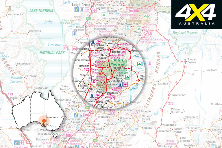
BEST MAP
Hema Maps’ The Flinders Ranges.
SUPPLIES
TWO state forests, three national parks, one IPA, seven conservation parks, three Public Access Routes and a host of private properties that offer four-wheel driving and camping make the Flinders Ranges an ideal and enjoyable destination for the adventurous 4x4 traveller.
CONTACTS
Arkaroola Wilderness Sanctuary: www.arkaroola.com.au
Nantawarrina IPA: nepabunna.com.au
Beltana Station: www.beltanastation.com.au
Gammon Ranges NP: www.parks.sa.gov.au
Please enable JavaScript to view the comments powered by Disqus.
COMMENTS