Explore SA
Gallery43
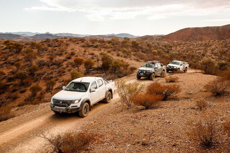
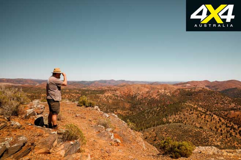
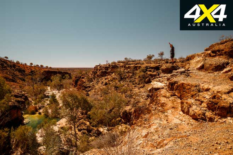
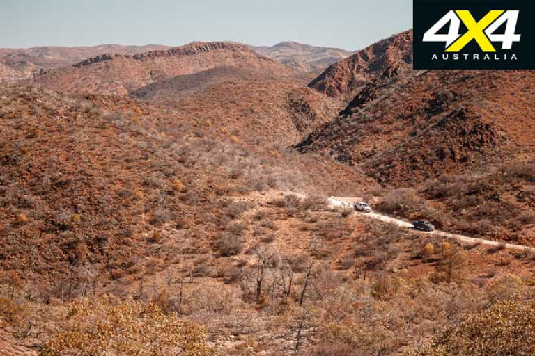
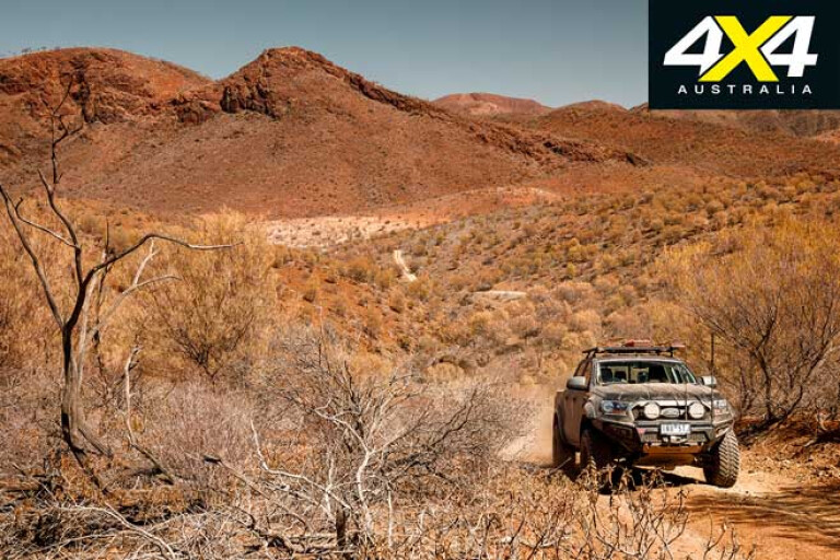
It was one of the best ridgeline drives I’ve ever done. The long, relatively easy drive up the wide crest of the mountain we were on was interspersed with lumpy, rocky steps that demanded you tear your eyes from the view and concentrate on the wheel marks wandering between the rocks and boulders on the little-used track. At the crest it was just a short walk to the lip of the cliff that made for one hell of a viewing point.
To the west was the shiny white expanse of a distant Lake Torrens, while closer to our eerie-like vantage point, and in much the same direction, were the low peaks of Mt Deception, Termination Hill and Mt North-West. These were all named by Edward John Eyre on his attempt in 1840 to break through what he thought was a continuous ring of salt lakes that encircled the northern end of the Flinders Ranges.
Looking south you could see the sawtooth ramparts of Wilpena Pound and, a little nearer, the shark-fang peak of Patawarta Hill poked above a closer line of lower, less dominant but still quite rugged hills.
43
To the north-east Mt Hack obscured the craggy ranges farther north, while to the east the outlook was one of jagged country between the peaks of the Cocks Comb and Ben-Lomond. It was a grand view, while at our feet the ridgeline dropped away in a series of sheer, dizzying high steps to the valley below.
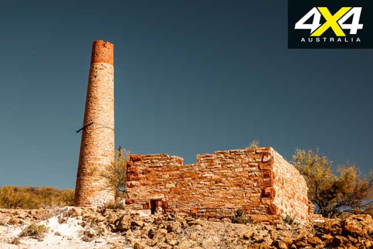
We were on top of Mt Gill, which at 914m is the second-highest peak you can drive to in the Flinders Ranges. Located in the Warraweena Private Conservation Reserve, the property offers some great camping, and we had thrown down our swags the night before not far from the ruins of the Sliding Rock mine on the edge of Sliding Rock Creek.
43
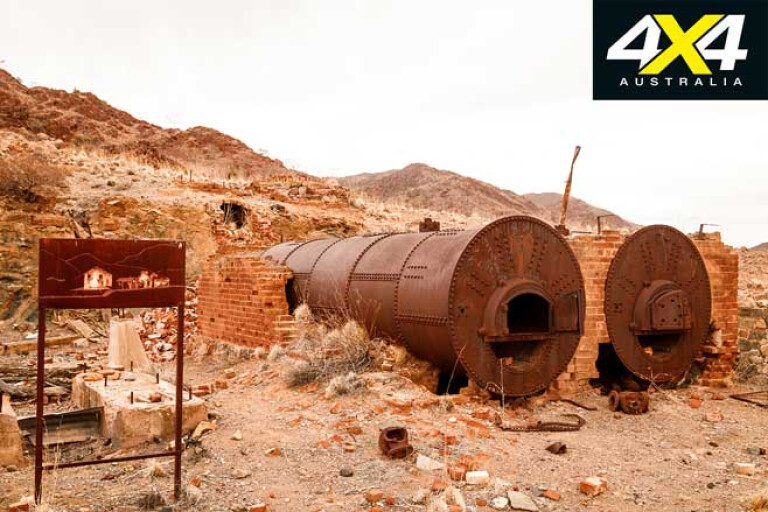
Picture: The Sliding Rock mine ruins on the Copper Track
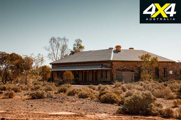
From our high vantage point we had returned to the homestead and then headed out via the near-deserted township of Beltana through Puttapa Gap to Copley, where we propped for the night enjoying the amenities of the camping ground and the pub next door.
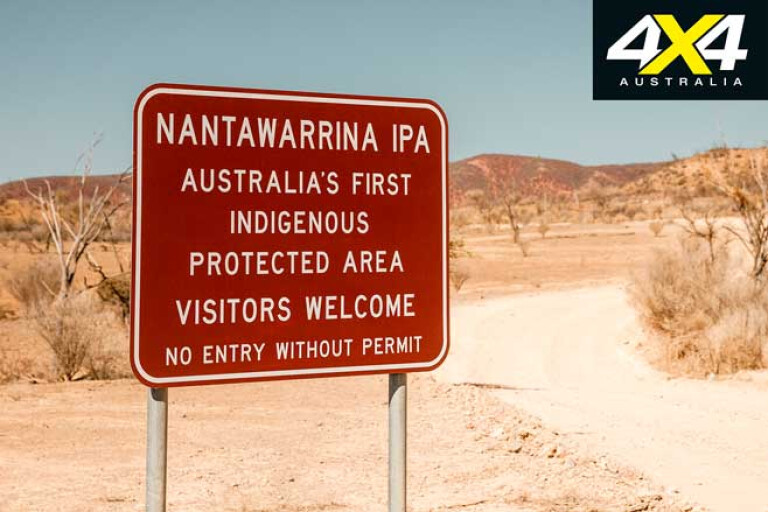
From Copley our route took us east and into the Nantawarrina Indigenous Protected Area (IPA), which offers a couple of camping places and a couple of 4x4 tracks that essentially lead through the park and/or to Moro Gorge on the eastern extremity of the reserve.
43
At the gorge we took to shank’s pony and wandered down the creek, which was surprisingly trickling with water – a rare sight indeed in these dry times and, in fact, it was the only water we saw in a creek while in the northern Flinders on this trip. Yellow-footed rock-wallabies can be seen here, and while their scats were everywhere it was way too warm in the middle of the day for animals to be out and about – except crazy four-wheel drive animals.
After a night camped at Irish Well Hut on the southern boundary of the reserve – it has a good shelter shed, firepit and even a flushing dunny, but it’s not high on my list of camping recommendations – we headed for Chambers Gorge.
43
The gorge, running through the Wearing Hills, an outlier of the main range, rarely has water in it and, while it offers pleasant enough camping along its wide sandy creek, its major attraction is the Aboriginal rock art that can be found here.
Located in a side canyon a few hundred metres from the carpark, the art adorns a large sheer rockface with hundreds of chipped engravings spread over it. A sign at the start of the side gorge told us what the symbols meant, or could mean; the pecked circle being a symbol for a camp. Certainly the engravings of animal tracks were easier to relate to, with emu and kangaroo tracks dominating.

43
Picture: Timeless. The rock art at Chambers Gorge is said to be at least 20,000 years old.
Elsewhere other rock canvases carry more art, but it is this large rockface that is the main attraction. Such petroglyphs, as they are called, are extremely hard to date, but many people believe they are at least 20,000 years old. Certainly they point to a time when these people who probably predated the current Aboriginal peoples had time on their hands to partake in such time-consuming art.
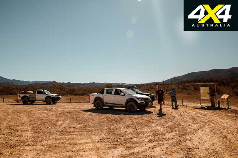
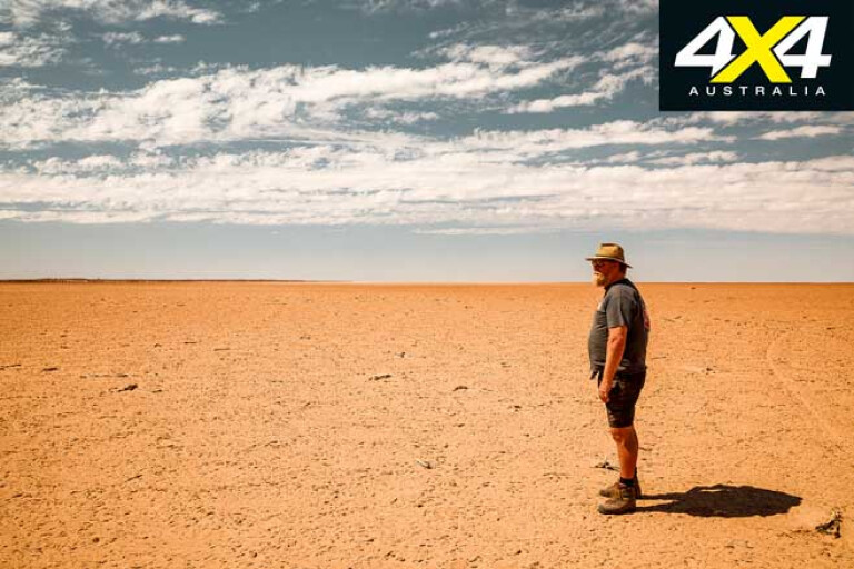
From Chambers Gorge we headed to the Gammon Ranges NP, and once at the park headquarters at Balcanoona we turned towards the great salt expanse of Lake Frome. Once there we were a little disappointed as there was no great white expanse, instead just a mud-covered pan stretching away to the horizon.
43
Soil and minerals have washed down from the nearby mountains and carried out on to the plain and into the lake; this is one reason why this lake bed is a regional reserve (where mining is allowed) while all the other salt lakes in SA are national parks. Just up the road from here is the Beverley Uranium Mine, its operation vastly different to most mines, as the uranium oxide is recovered by an in situ leaching process.
Disappointed, we hurried back to Balcanoona and then onto Grindell’s Hut, which lies in the heart of the Gammons and is a top spot to camp. The hut and associated buildings are on a low rise above the Balcanoona Creek, and the campsite is on the edge of the creek shaded by big red gums. Here we had a couple of yellow-footed rock-wallabies pay us a visit – something these normally shy animals don’t do. However, the ravages of drought here have seen waterholes dry up and food become far less plentiful. Now they scrounge around the campsites looking for any edible scraps.
43
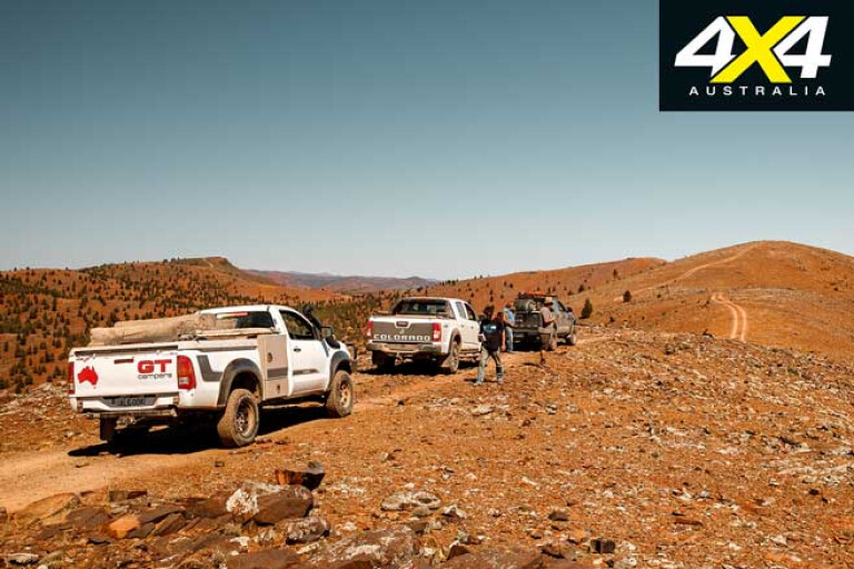
The next morning we headed north through Illinawortina Pound to Mainwater Well and onto the deserted homestead of Idninha, the track through the park breaking up into some long sections of bulldust. From the homestead we took a recently opened and slow track through to the Bolla Bollana Smelters which lies right on the northern boundary of the park.
Stopping briefly at the ruins we continued on to the ruins of the old copper smelter at Yudnamutana, along the way passing some of the old mines that once fed the processing works with ore. Just down from the mine is a small, poignant cemetery with one of the graves here belonging to a woman who was shot by her husband on Boxing Day. This is an incredible spot surrounded by rugged hills, and it’s a favourite of mine. You can camp here but need permission from Mt Freeling Station to do so.
43
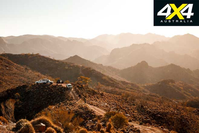
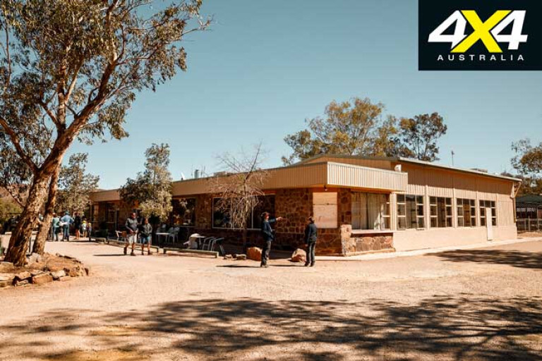
That night we threw down our swags at the well-established Arkaroola Resort, one of the places not to miss when in the northern Flinders. With good facilities and all the supplies a traveller needs, Arkaroola offers some great tracks to drive, tours to do and a couple of amazing star-gazing experiences which will blow you away.
With a full timetable planned for our all-too-short stay, we headed out on the Echo Camp Backtrack early the following morning. This self-drive track is just 41km long and will take you approximately four to six hours, and it is worth it to take your time as there are plenty of impressive places to stop, admire and enjoy.
43
Once again, waterholes that not so long ago were considered permanent (or near so) were as dry as a crisp, and as such the owners, the legendary Sprigg family, have instigated water points and feeding locations to help keep the yellow-footed rock-wallabies alive. It wasn’t something that was undertaken lightly, as current owner Doug Sprigg explained: “We’ve spent the last 50 years bringing these animals back from the brink of extinction,” he said. “Now in these exceptional circumstances, we must do something to keep them surviving.”
I could only agree.
43
That afternoon we headed out on the Sillers Lookout Track, which is where the resort runs its famous Ridgetop Tour. We were privileged to be able to drive it ourselves, but the narrow track, steep grades and sheer roughness of the route, along with the expense of the continual maintenance, means that traffic is kept to a minimum. But whatever you do, take the guided trip out to the lookout which is arguably the most spectacular in the whole country.
It was late when we got back to the resort, where a cold beer and a hot meal from the restaurant beckoned. We had been in a rush to fit everything in and it had been a long day, but it had been worth it. Once again we had sampled some of the best country in all of Australia and, while I have been here numerous times, this trip won’t be my last!
Warraweena
43
A private conservation reserve, established in 1996 when Wetlands & Wildlife acquired the property, it has been run and managed by Stony Steiner since. Covering 35,500ha the property is beautifully diverse and rugged, with 10 peaks over 1000m in height and Mt Hack at 1086m being the highest.
Wildlife is common, while yellow-footed rock-wallabies can be seen at certain places. Many historic sites are dotted across the landscape including the impressive ruins of the Sliding Rock mine, smelter and townsite.
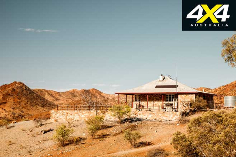
Accommodation includes the shearers’ quarters, the homestead and a number of bush huts set in remote and idyllic settings. For those wanting a bush camp, there is a wide choice of well set-up sites dotted along the creek.
43
The property offers mountain biking, bushwalking and three excellent 4x4 tracks, as well as a Public Access Route (PAR) to Mt Hack. While the Mt Gill track is one of the most spectacular routes in the whole of the Flinders, the Copper Track takes you from the ruins of Sliding Rock to the equally impressive ruins of Nuccaleena.
For pricing and more information visit www.warraweena.com, or contact Stony on (08) 8675 2770.
Nantawarrina IPA
43
The Nantawarrina Indigenous Protected Area (IPA) in northern South Australia covers more than 58,000ha of Adnyamathanha Aboriginal ancestral land. It was the first IPA established in Australia and has been copied all over the country. A couple of 4x4 tracks give access to some pleasant camping areas and Moro Gorge, which is the highlight of the area, generally sports some water flowing through it. Self registration pay stations give you a permit for access.
For more information and costs visit https://nepabunna.com.au/nantawarrina
Arkaroola Wilderness Sanctuary
43
Established as a private wildlife reserve in the late 1960s by the Sprigg family, the sanctuary is run by Doug and Vicki. It is the pièce de résistance of the northern Flinders Ranges, offering good accommodation and camping along with a restaurant, bar, swimming pool, store and fuel.
Located 600km north of Adelaide and 130km north-east of Copley, the reserve joins the Gammon Ranges NP which in turn connects with the Nantawarrina IPA, securing more than 610,000 acres of contiguous protected land. Arkaroola covers 61,000ha of rugged mountain country strewn with granite peaks and cut by magnificent gorges sheltering hidden waterholes. Geologically it is a unique masterpiece, so much so that in 2012, under a government-declared special act, it now lies at the heart of the Arkaroola Protection Area where mining and fossicking have been banned.
43
Bushwalkers will revel in the area’s remoteness while 4x4 drivers will love the tracks, such as the Echo Camp Backtrack and the route to the ruins of the Yudnamutana mines and smelter. The Ridgetop Tour to Sillers Lookout is a trip everybody should do and, while a guided tour, it is well worth it. Three astronomical observatories also make Arkaroola one of Australia’s largest privately owned space observatories, offering some of the best viewing conditions in Australia to tour the universe and to check out the stars.
For more info and bookings visit www.arkaroola.com.au
Please enable JavaScript to view the comments powered by Disqus.
COMMENTS