Explore
Gallery63
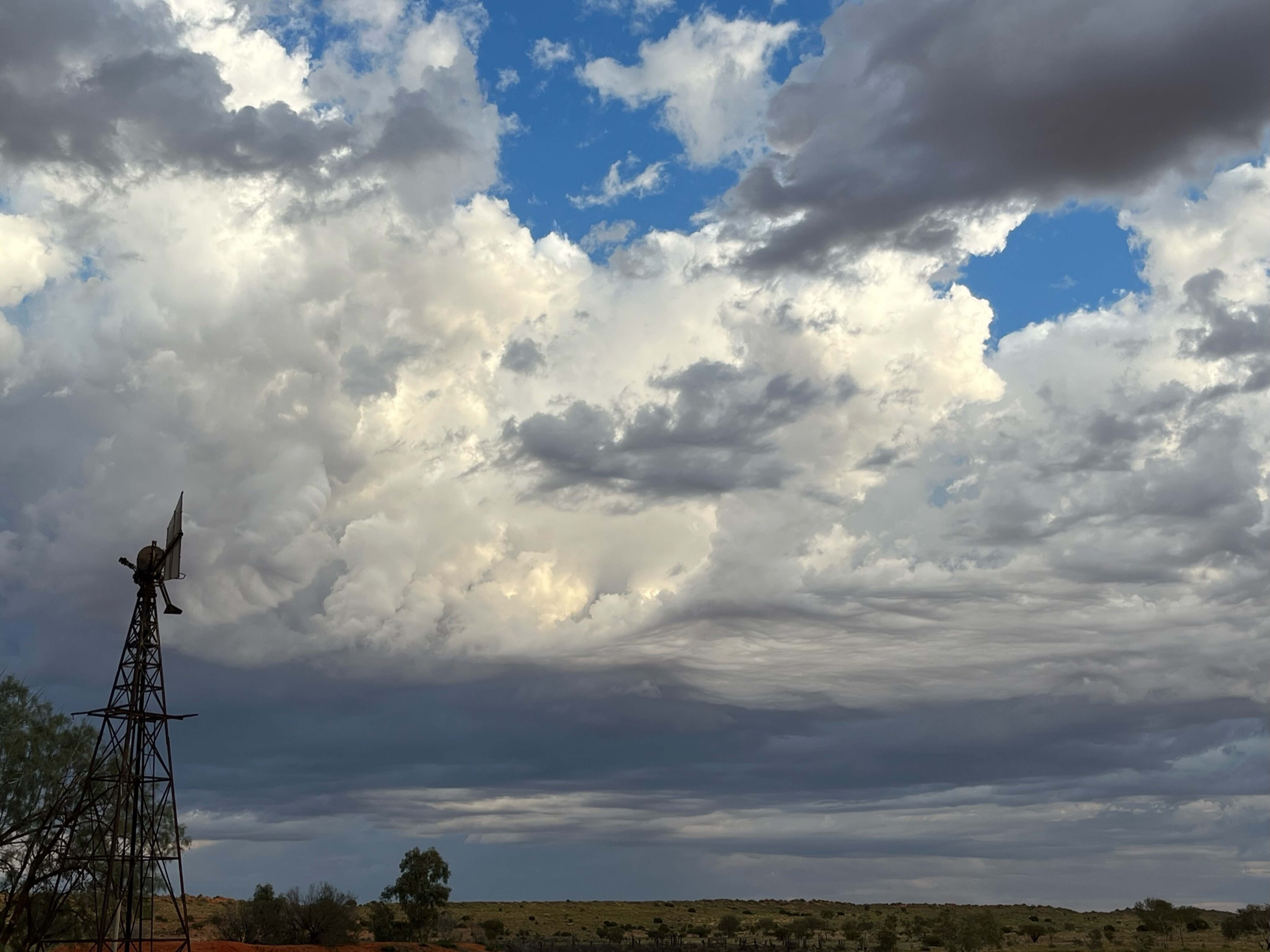
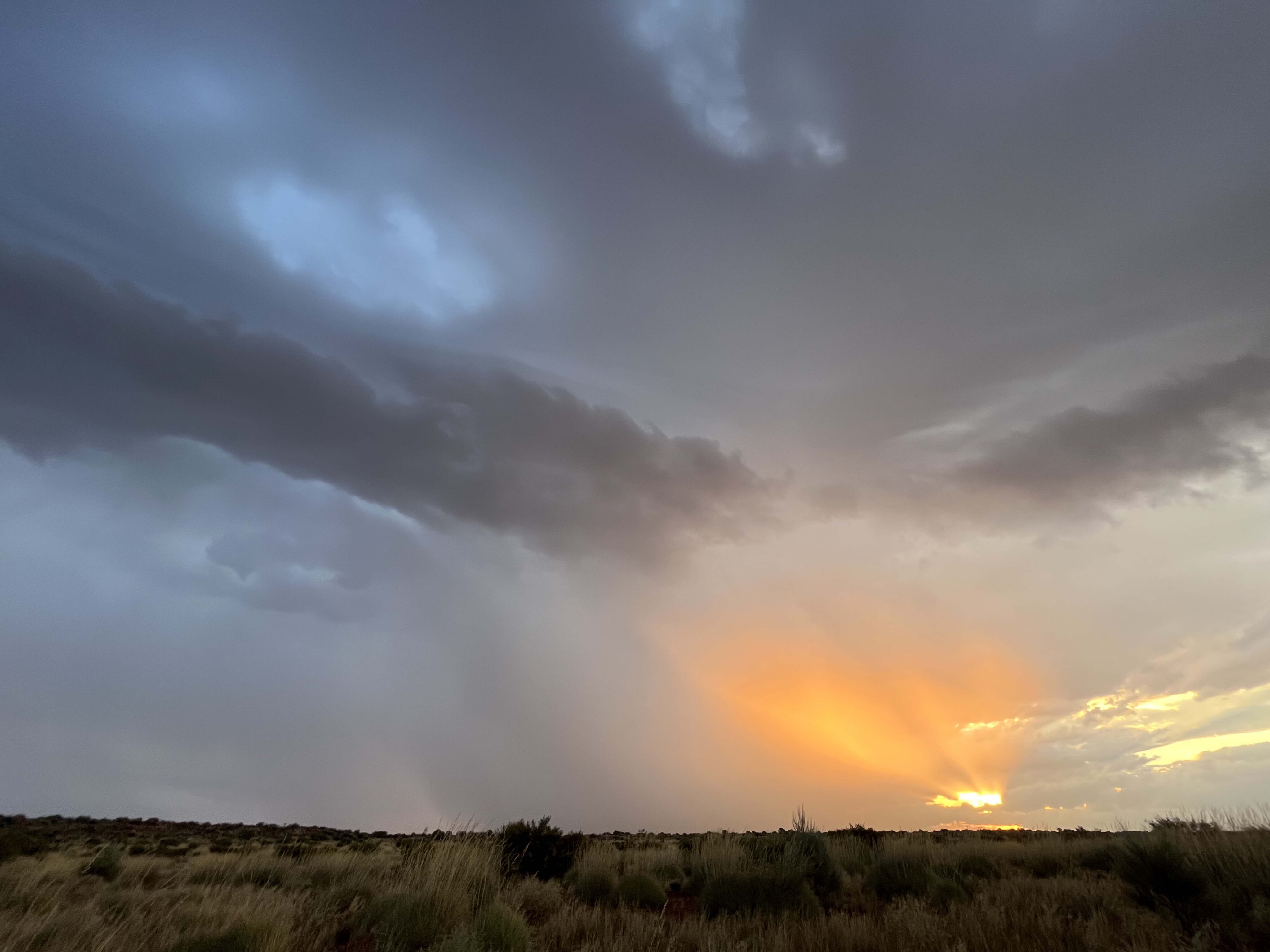
A weather change was looming and ominous clouds were rolling in. The wind had shifted markedly to the north-west at dusk the day before.
We had camped at Old Andado Station, a time capsule of a bygone era, standing testament to the mettle of Molly and Mac Clark. The massive flock of galahs were unsettled, their barren trees offering no protection. They knew the change was coming; the ants too, were moving to higher ground.
“It will rain at 08:00,” said Marc, our fearless leader, “We need to get moving before it buckets down”. We’d not long despatched our morning walkers for their daily sojourn along the track.
63
The sky confirmed the Metvuw weather forecast (www.metvuw.com [↗]) he’d downloaded just days before. Today would be their test…
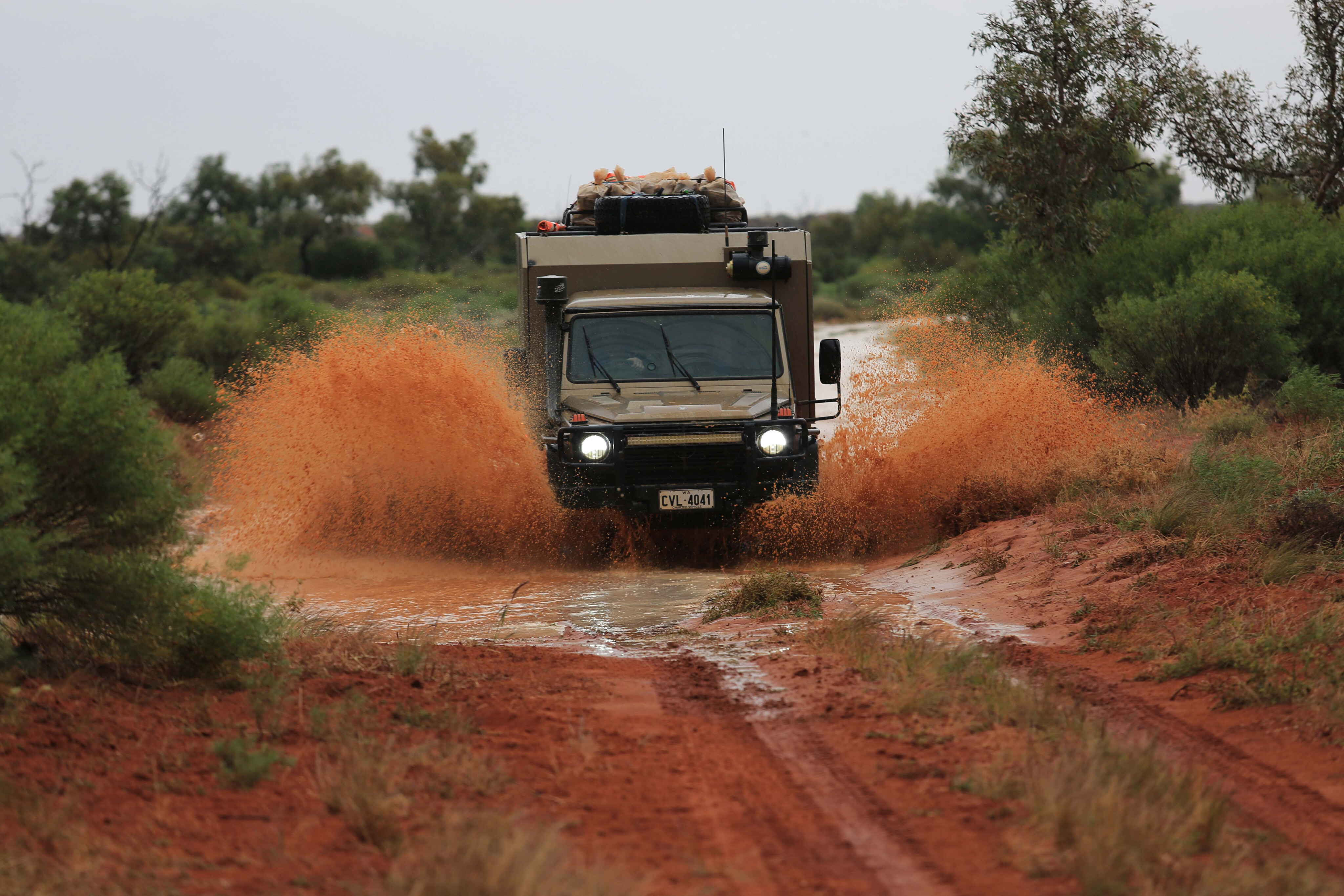
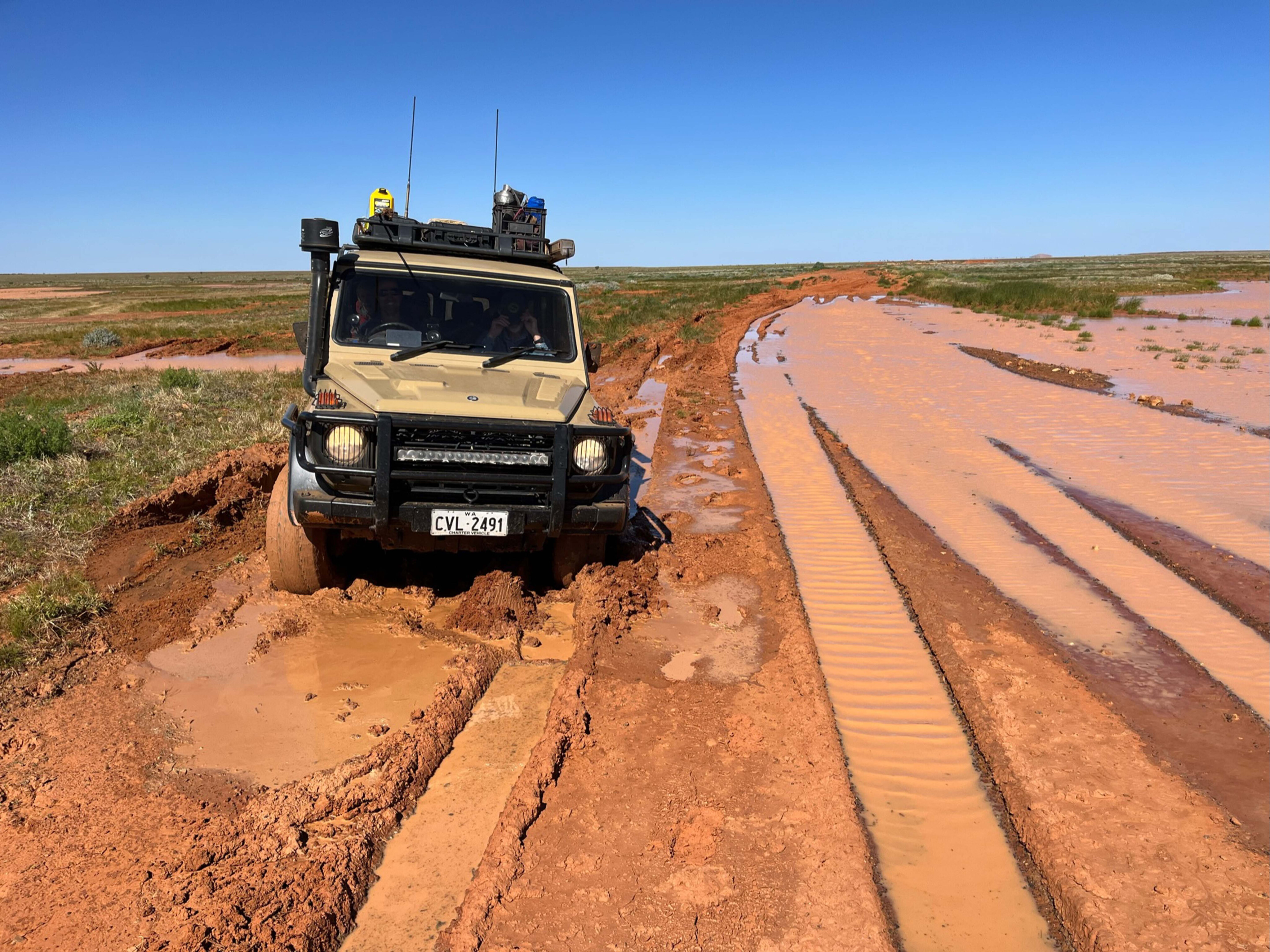
The scattered drops began as we were ‘locked and loaded’, with radios checked, tyres deflated and raincoats at the ready. Our walkers hadn’t made it far, the clay-capped dirt road already sticky.
At 8:03 it began to rain, slowly getting heavier. “You’re three minutes late!” Ian shouted at the sky; our stockbroker guest was impressed by Marc’s accurate forecasting.
63
Pressing on
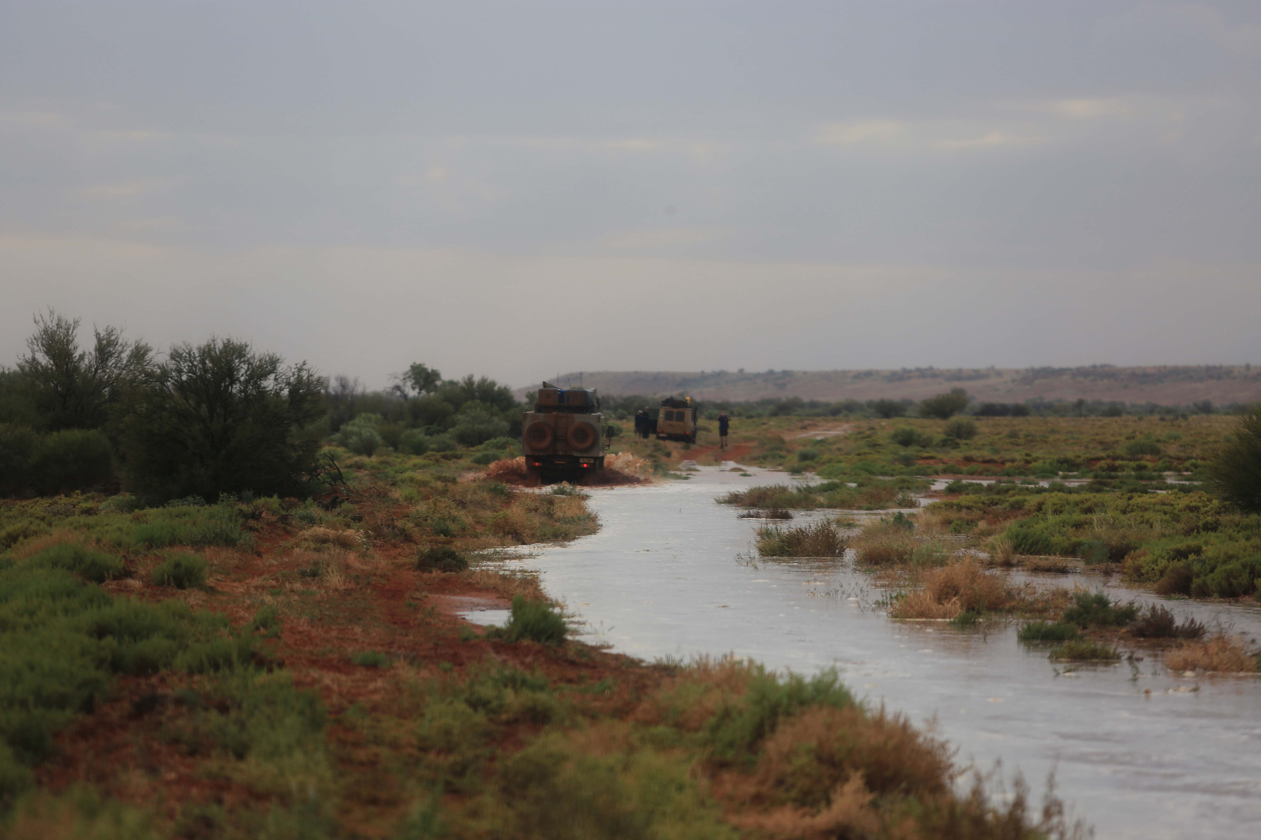
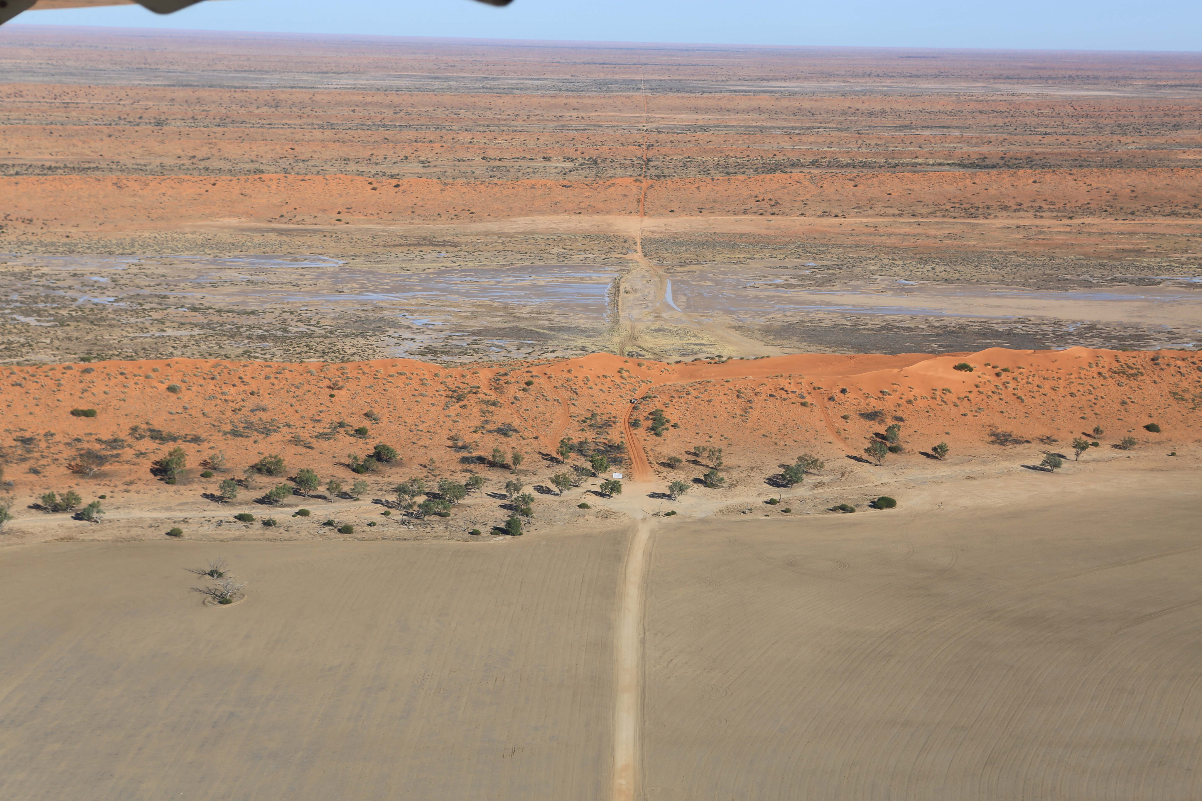
We had to cross the gibber plain before the rain set in and we would then be safe on the sand and rocks soon after.
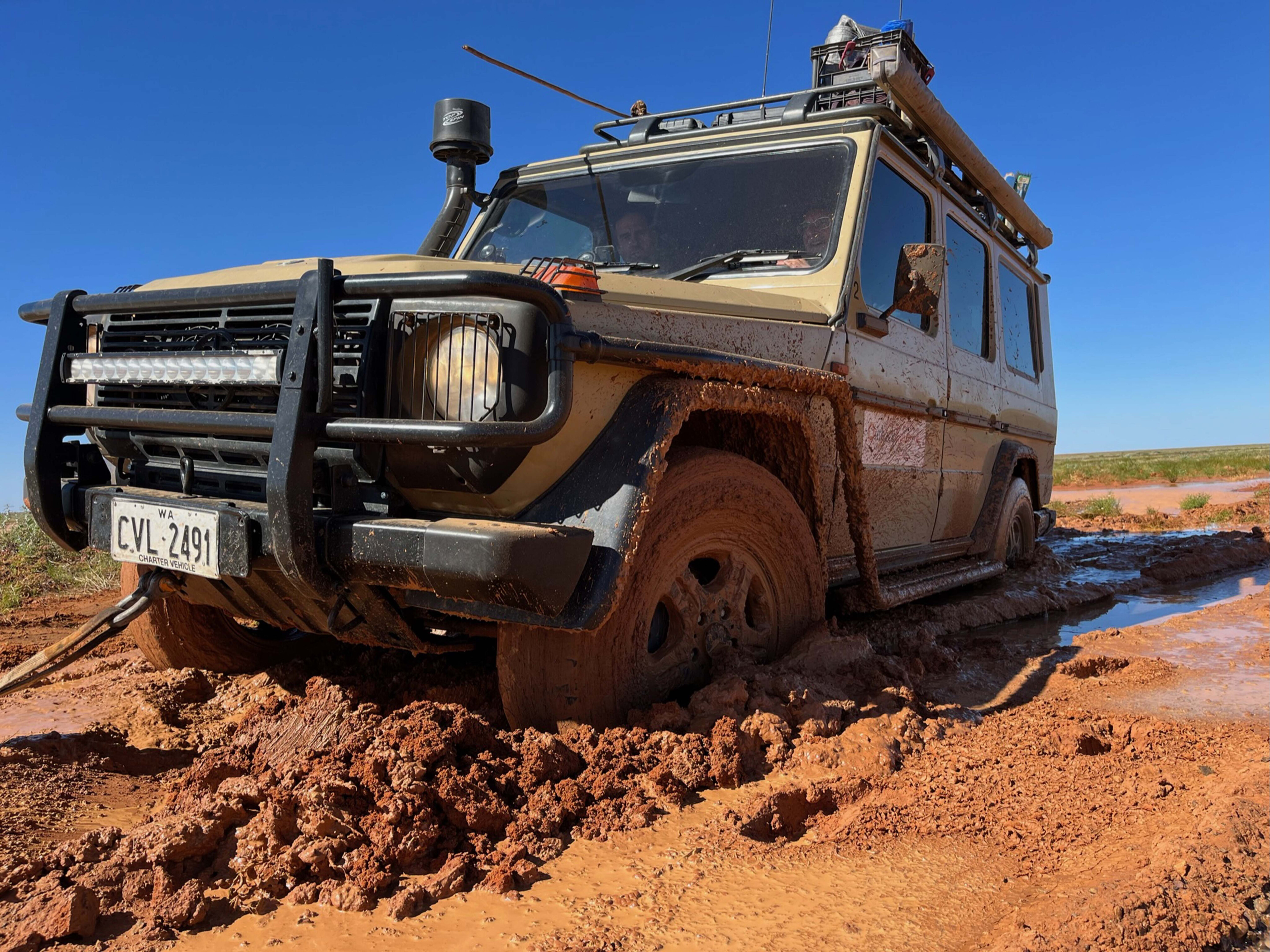
It was day three of our 12-day Simpson Desert adventure from Alice Springs to Birdsville and back again. We were heading east along the Madigan Line with four fully loaded G-Wagens in convoy. Our 6x6 supply truck weighed seven tonnes so once committed, there’d be no turning back!
We continued past the Binns Track, our alternate exit to Alice Springs now blocked, as the storms steamed in from the north-west. We swung east across the gibber plain as the lightning flashed and the horizon disappeared. Then down it came – the heavens opened and the track was soon awash with water, like a tropical tide had just rushed in.
63
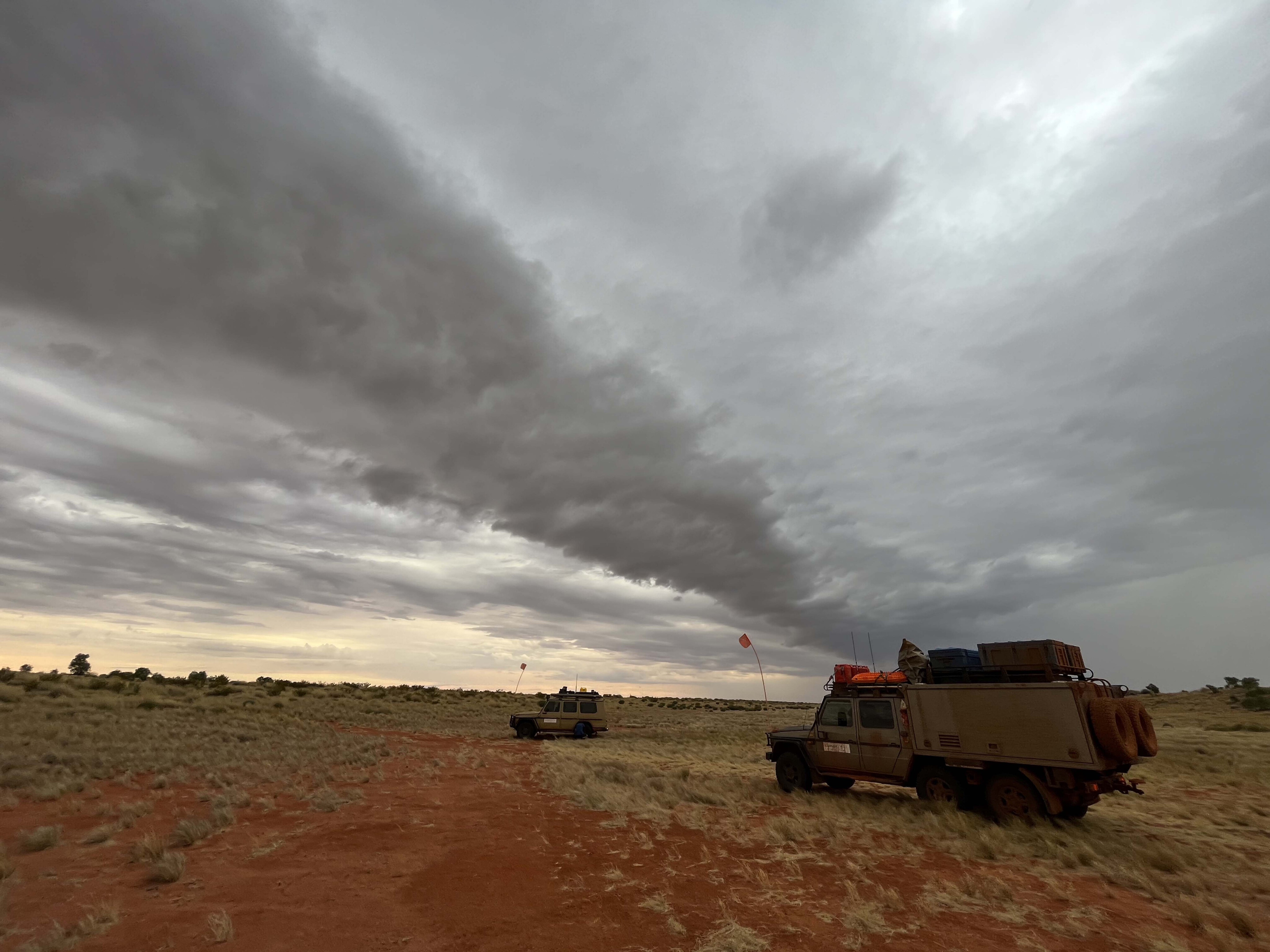
Visibility dramatically dropped. “Just keep moving and follow the truck in front,” called Marc on the radio, his taillights barely visible. At least we’d been this way before!
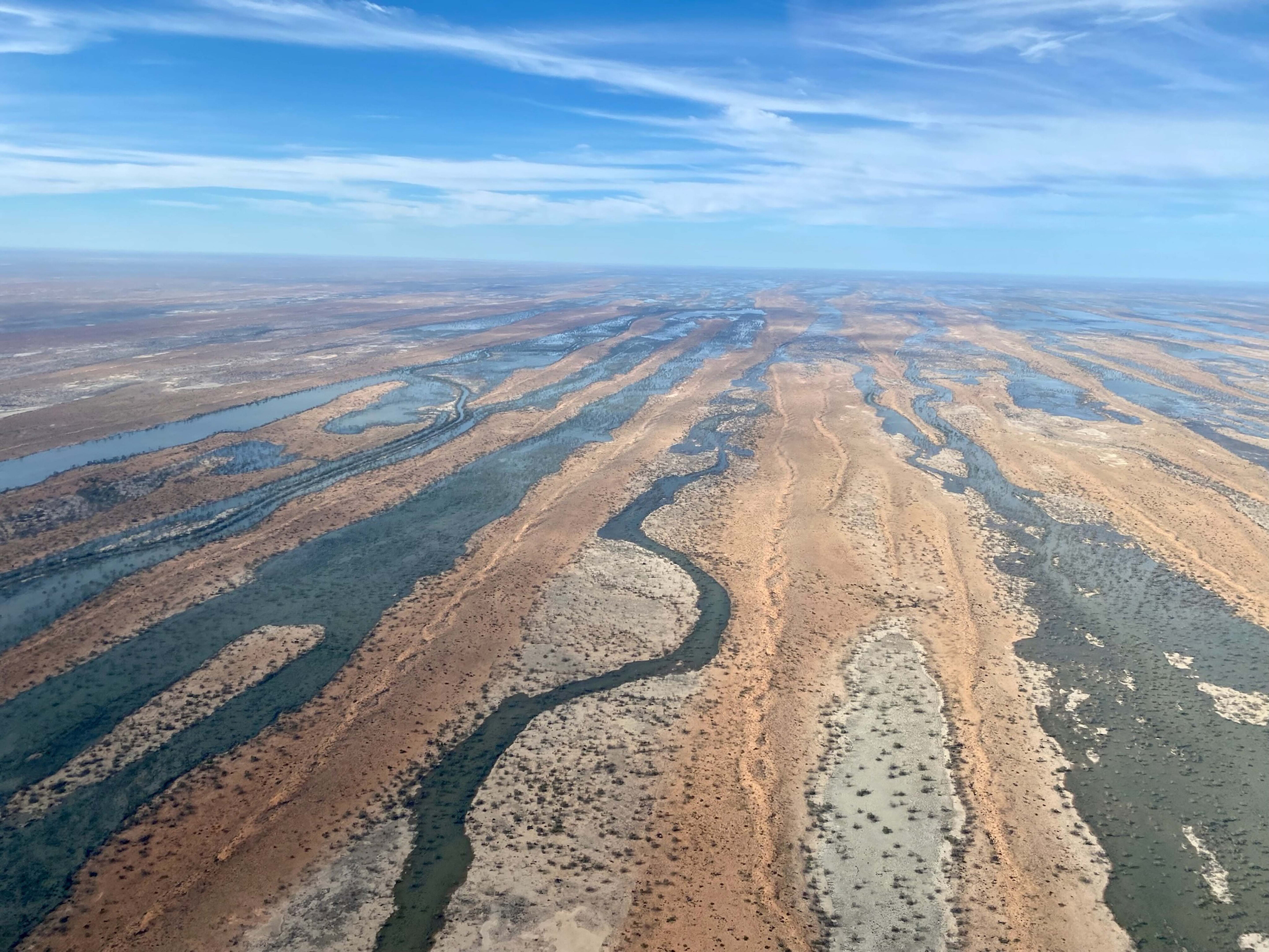
Back in February, a tropical low (TL16U) dumped record rains around Camooweal, Qld and the Gulf region. The floodwater was making its way down the Georgina River channel country, past Bedourie, and through Lake Mipia before snaking through the sand ridges and past the tipping point into Eyre Creek.
With follow-up rain in April, it ballooned to a 15km-wide inland sea, moving slowly south towards Lake Eyre, and blocking both eastern exits to the Simpson Desert until late July.
63
By land and air
Hundreds of peak-season Simpson Desert crossings were cancelled or delayed but for us it was not so simple.
We had tours booked from April to September and cancelling them would have meant no income, and no work for me or our crew. Many of our customers had booked pre-Covid, and for some it was their last ‘once in a lifetime opportunity’.
Normally we would resupply with fuel and water in Birdsville but that was not an option. The flooding in Eyre Creek had blocked all eastern exits and entries including the Madigan and QAA lines to the east and the Warburton Track to the south. The Hay River Track to the north was still open but it’s rough and not nearly as interesting as the thousand dune crossings further south and returning west along the French and WAA Lines.
63
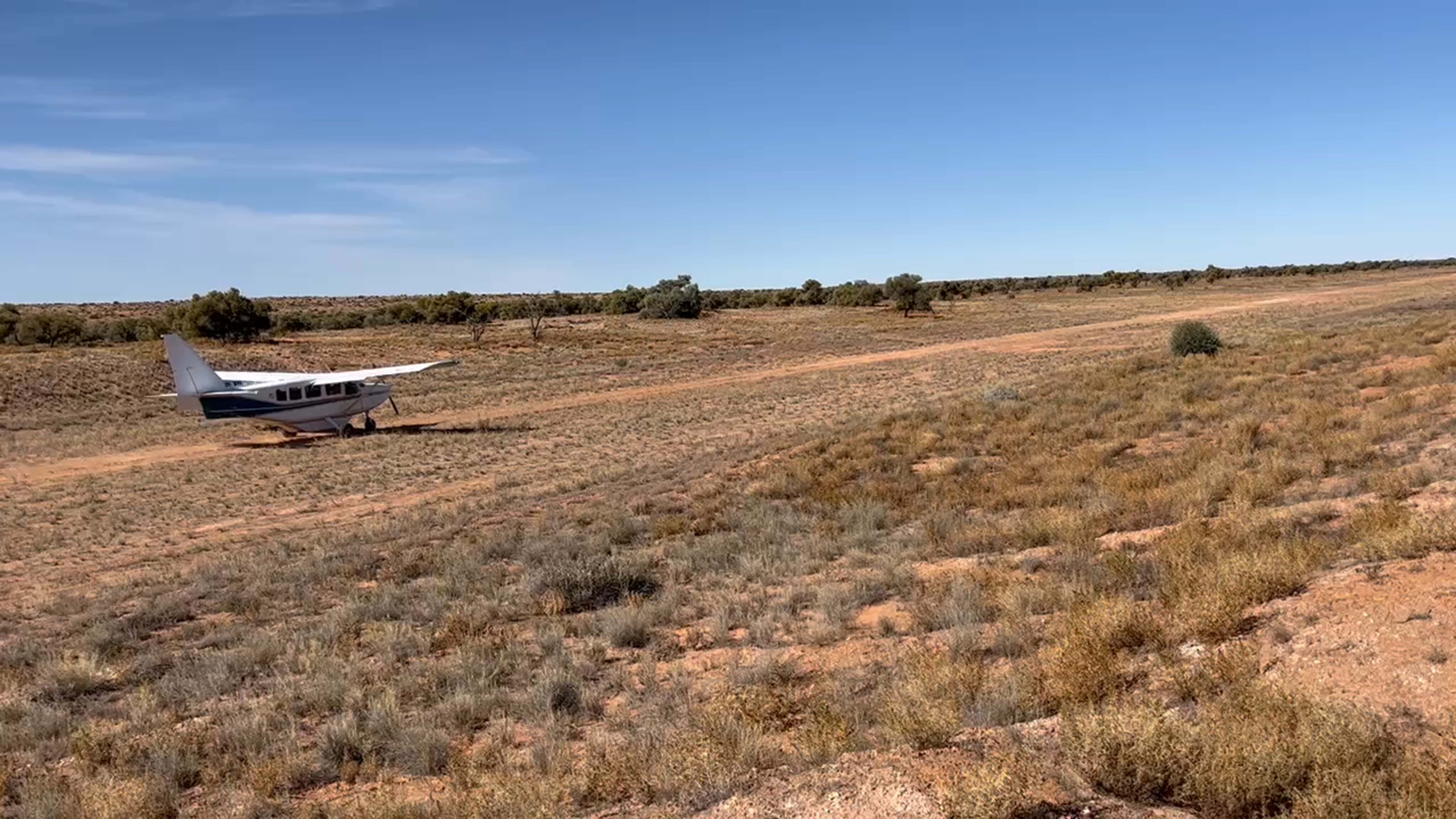
We’d hatched a plan to make it to Poeppel Corner and fly our passengers onto Birdsville.
They’d still complete their crossing, get two nights in Birdsville, a beer and feed at the pub, and get to see the desert and flooded channels from the air. But this meant an 1100km round trip without a resupply – 1200 litres of fuel and 1400 litres of water, plus food and drinks for a dozen guests for 10 days!
It was worth it, though. We had the desert all to ourselves (for three straight months) passing only the occasional group heading north on the Hay River Track or spending a few days east of Mount Dare on the French Line, before heading back the same way.
It’s sad that there’s so much focus on crossing and conquering the Simpson, rather than just enjoying the serenity, the sky, the space, the sunsets, and its vast and timeless beauty.
63
Living heart
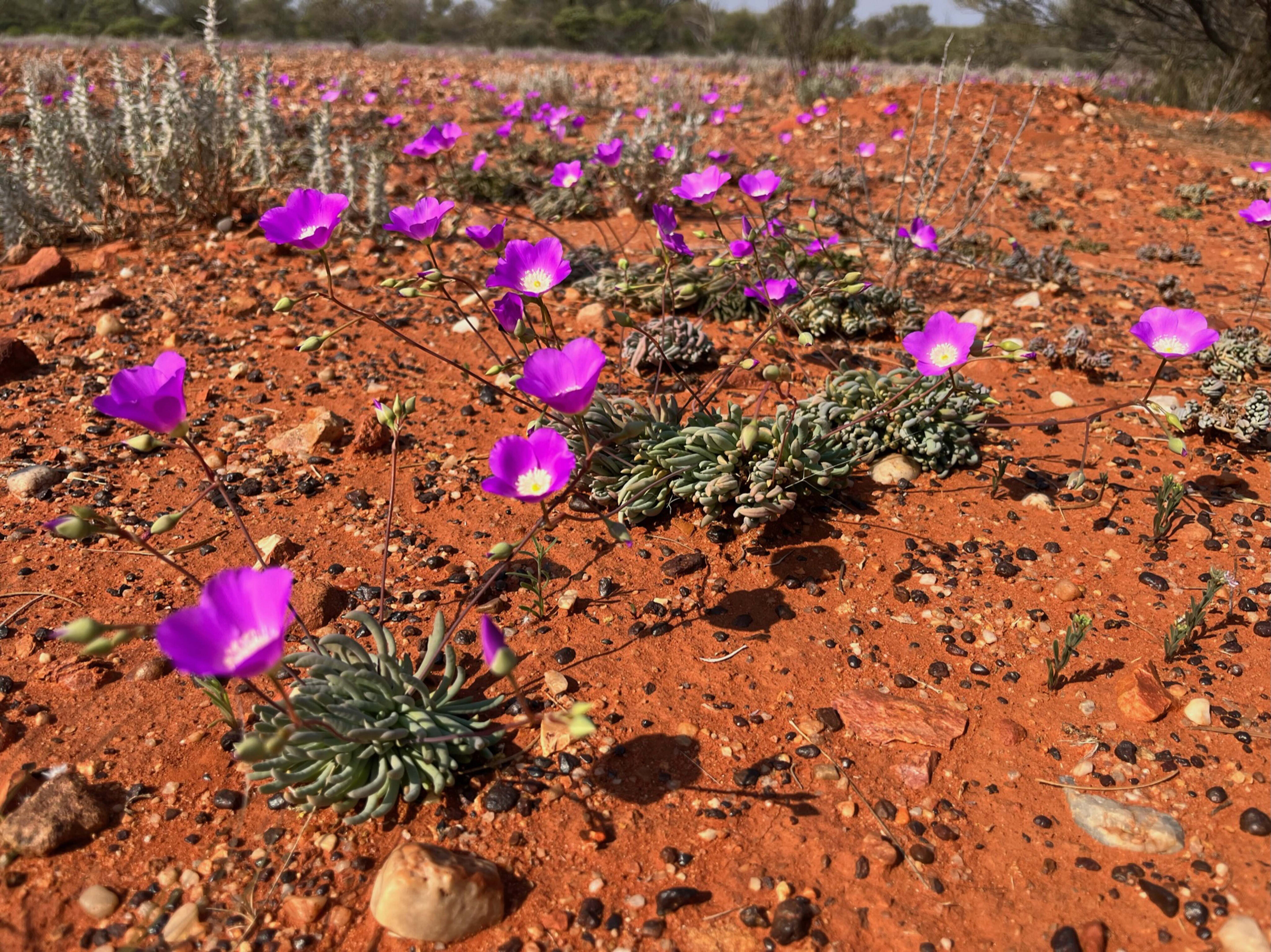
From Newman, WA to Birdsville, Qld our deserts were a thousand shades of green.
Triggered by La Nina, a string of major rain events combined to make the 2022/23 northern wet season the sixth highest on record (since 1901) with 690mm recorded from October 2022 to April 2023.
The frequent rains had brought the wildflowers out early. Everything was green, growing, booming, and blooming, especially in the northern Simpson which had received the most rain.
63
With that came abundant birdlife, especially budgies and other tiny birds. The camels were thriving too, their feed so plentiful they didn’t need a drink for months.
There were too many feral cat prints for my liking but great to see so many dingoes this year, even if they were missing their campsite leftovers.
The increased humidity brought its own delights; deep orange sunrises and sunsets, rainbows, heavy dews and frosts, and even an early morning fog.
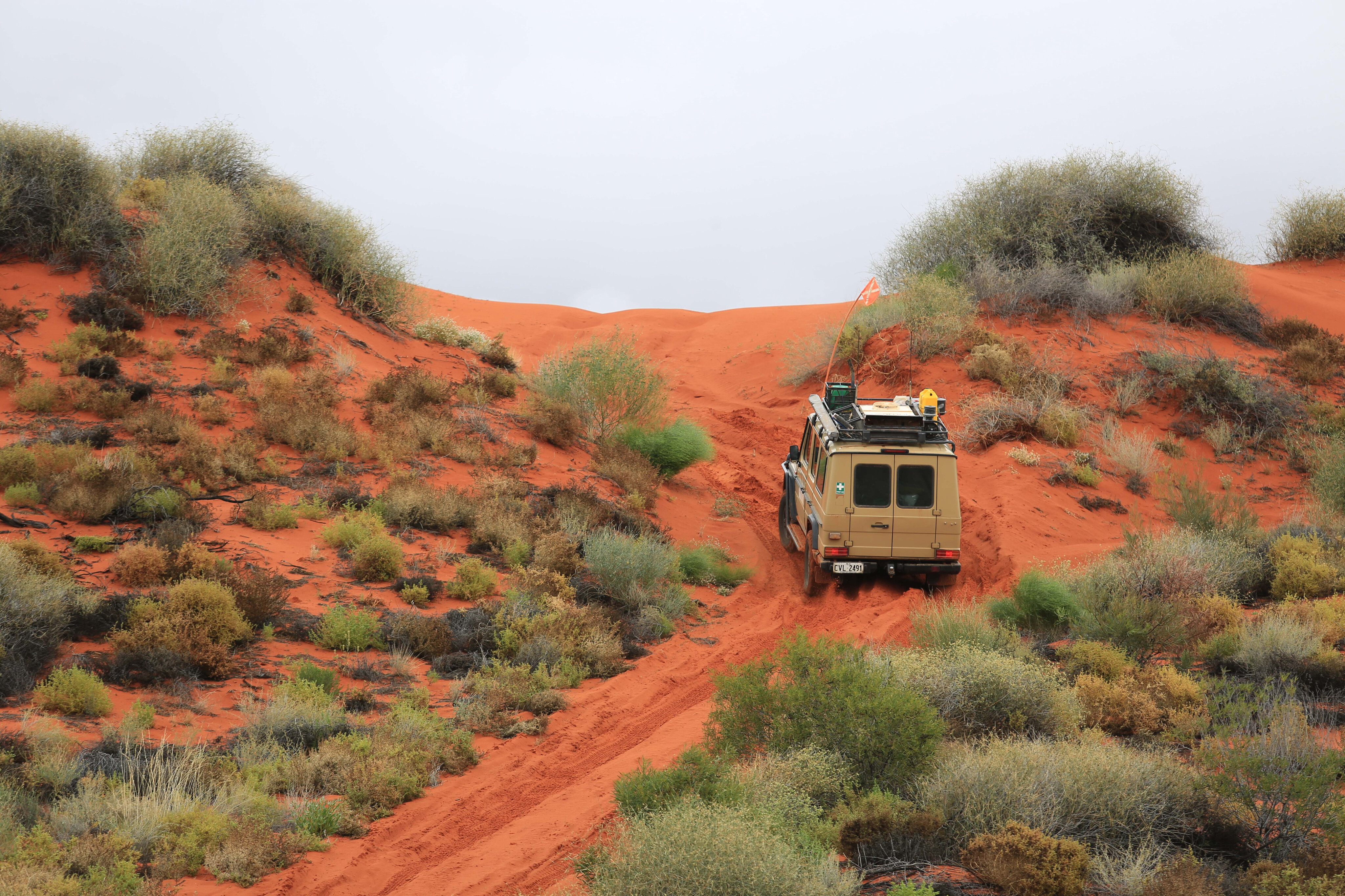
The sand driving too was easier with firmer, smoother dune climbs a respite from the usual chopped-up madness.
63
No exit
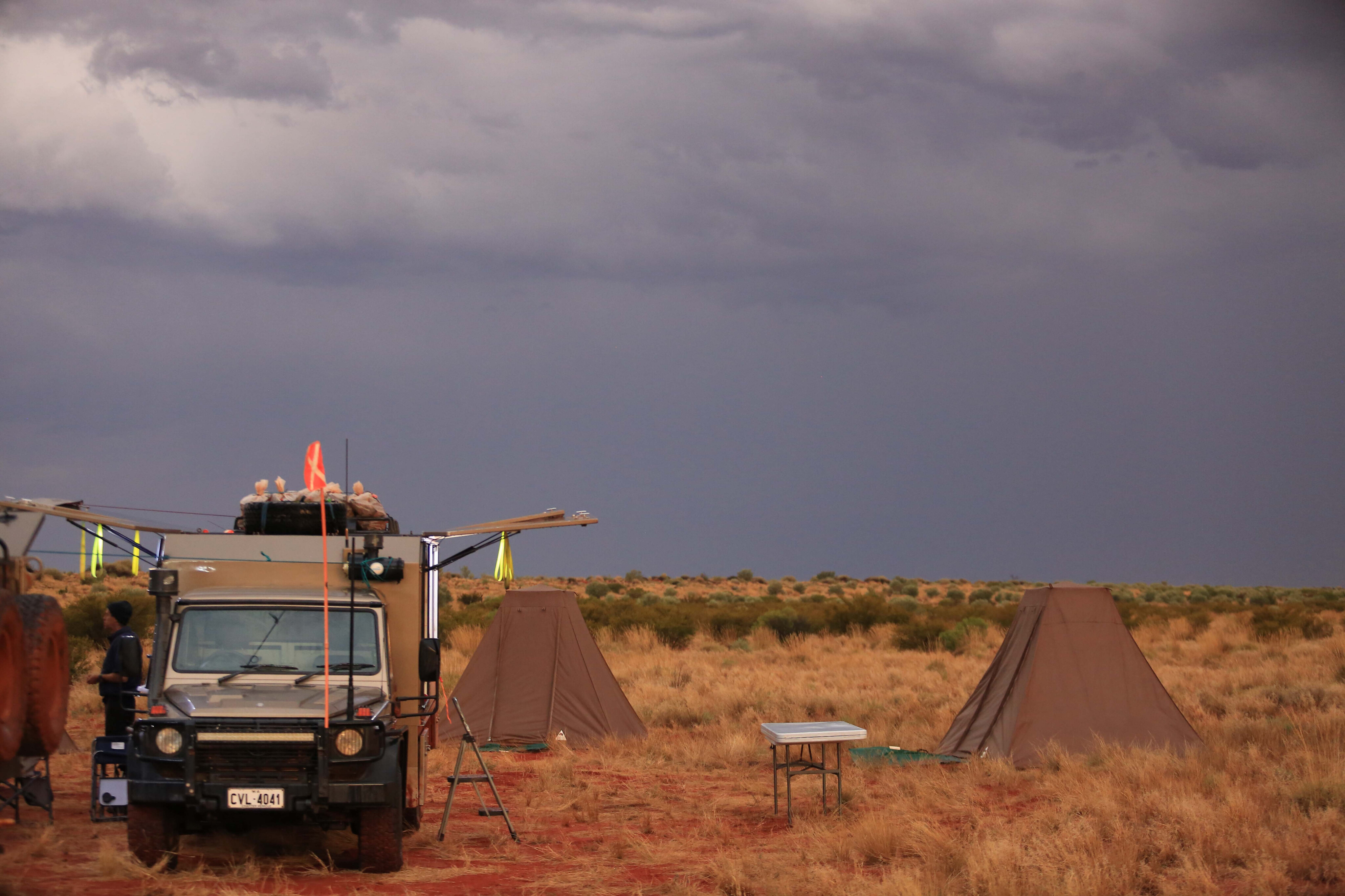
But we still had to get to Mount Dare and with the weather closing in again that would prove difficult, including a wet camp pack-up for the remainder of the trip and no warming campfires once in Witjira National Park.
We also had to cross the Spring Creek Delta to get to the campsite at Dalhousie Springs. It too was awash with water dumped by the same storms we’d escaped a week earlier. All exits and entries were now closed!
We waited it out for a couple of days playing cards at Dalhousie, and growing taller with muddied-boots, until the roads dried out enough to push through to Mount Dare Hotel, where we were warmly welcomed with hearty home-style meals, cold beer and a warm, dry bed.
It was a fitting place to celebrate our wet desert adventure and share our stories of survival before the 480km trek back to Alice Springs the following day. As always, the challenges enrich the adventure and galvanise the expedition team, and somehow make all the post-trip cleanup seem worth it.
63
The G-Wagen
Each G-Wagen in the Outback Spirit fleet is fit-for-purpose, with its own personality too.
The kitchen truck carries all the food and cooking gear, complete with eight 60L Engel fridge/freezers. It even has one with ice-cream! The ensuite truck has twin toilet-showers complete with diesel hot water system and 1200L of fresh water to keep guests and crew both clean and relieved.
The gear truck sports a monster-size canopy that fits enough tents, stretchers, sleeping bags and luggage for up to 24 passengers and crew.
63
The 6x6s are standard Aussie military-spec, each with coil-spring live-axle suspension, full-time six-wheel drive and triple axle diff-locks. And with a GVM of 6.5-7.2T they can each carry a serious payload and take it just about anywhere.
The 4x4s are the hose-out G-Wagen Professional spec but with an extended rear body, seating six adults in coach-style comfort. Whilst not as limousine smooth as the 6x6s they have the same powerful drivetrain but with 2.5T less weight.
And how do they really perform? The 6x6s are the most comfortable and capable off-road touring vehicle I’ve ever driven – I just wish they were fitted with more reliable Japanese electronics.
63
Desert crossing alternatives
With several ways to cross the Simpson Desert, there is usually an option that’s open albeit much longer in distance and time.
Heavy rain will often close the French and QAA Lines first as they have the most salt lakes and floodplains to cross, and a flooding Diamantina River near Birdsville will close Warburton Crossing downstream.
But assuming Warburton Crossing is open, the eastern end of the Rig Road is reasonably well maintained and mostly sandy further west, but you still have to cross the Spring Creek Delta near Dalhousie.
63
You could do a south to north crossing via the K1 Line and Hay River Track, but the most reliable wet-weather route is via the Madigan Line east of Old Andado and then north via the Hay River Track to Jervois on the Plenty Highway.
Just remember you’ll need a separate permit for the Madigan Line, allowing one-way traffic from west to east, plus you’ll need extra fuel and water for the 740km trip.
The road to Big Red from Birdsville was sealed in 2023 (for the Big Red Bash) so even if the Simpson Desert is completely closed you can still climb this desert icon.
Simpson Desert crossing alternatives
| Route | Distance | Time | Fuel 20L/100km + 20L |
|---|---|---|---|
| French Line (Mt Dare to Birdsville) 500 km 5 Days 120L | 500km | 5 days | 120L |
| WAA Line (Mt Dare to Birdsville) 550 km 6 Days 130L | 550km | 6 days | 130L |
| Rig Road (Mt Dare to Birdsville via Warburton Crossing) 600 km 5 Days 140L | 600km | 5 days | 140L |
| Madigan Line (Finke to Birdsville) 730 km 6 Days 166L | 730km | 6 days | 166L |
| Madigan Line & Hay River Track (Finke to Jervois via Madigan Line) 740 km 6 Days 168L | 740km | 6 days | 168L |
| Hay River Track (Mt Dare to Jervois via French Line) 810 km 8 days 182L | 810km | 8 days | 182L |
| Hay River Track (Birdville to Jervois via Poeppel Corner) 635 km 5 days 147L | 635km | 5 days | 147L |
| Plenty Highway - Jervois to Birdsville (via Boulia) 844 km 2 days 189L | 844km | 2 days | 189L |
Check conditions
For all the latest Simpson Desert road conditions check out:
Mt Dare: www.mtdare.com.au/outback-track-and-road-conditions-including-simpson-desert [↗]
Birdsville Hotel: birdsvillehotel.com.au/getting-to-birdsville/roads-weather/ [↗]
Parks SA: www.parks.sa.gov.au/know-before-you-go/closures-and-alerts [↗]
Metvuw weather forecast: metvuw.com [↗]
Please enable JavaScript to view the comments powered by Disqus.
COMMENTS