Explore TAS
Gallery9
SAYING goodbye to the white sand and turquoise waters of the Friendly Beaches was difficult, but our schedule was tight as our wounded Cruiser limped towards a repair shop, while the rest of our convoy headed through Sorrell and across the wide expanse of the Pitt Water for a quick visit to the heart of Hobart.
We spent that time wandering Salamanca Place and the old wharves of the celebrated port that has seen some of the first ships to sail to Australia, as well as some of the latest and slickest watercraft on the planet in the annual Sydney to Hobart sailing classic.
With our quick capital city foray over, we headed out to the Lark Distillery (there’s a retail outlet in Hobart’s Salamanca area), situated just outside Cambridge. Lark had been established in 1992 when the state relaxed its distilling laws, after having banned such evil pursuits back in the 1850s!
MOREEpisode 1
MOREEpisode 2
MOREEpisode 3
We tasted a wee dram and wanted to try their rum as well, but sadly it’s no longer produced as whisky and the odd bottle of fine gin are taking up all the plant’s capability.
9
‘WILD’ RICHMOND
FROM there we headed to Richmond and the delights of this picturesque 1820s town situated on the Coal River, where amongst a plethora of fine old buildings, the bridge over the river is the pièce de résistance. We checked the old bridge out while grabbing a bite to eat and in that short time, two separate bingles occurred in the car park, albeit a small and busy carpark; we were lucky to escape the carnage!
Next day our wanderings continued and with a permit and key from the national parks people in Glenorchy we headed for the Montrose 4WD Trail that cuts up behind the Wellington Range which dominates the backdrop to Hobart and passes through Wellington Park.
The park is known for its 500 native plant species and 67 bird species while also being home to the long-nosed potoroo, the ubiquitous pademelon, the rarer bettong, and southern brown and eastern barred bandicoots. Other natural inhabitants include eastern quolls, echidnas and swamp rats, along with various species of bats.
9
Still, in the often dense forest that surrounded us, we hardly saw a bird or any living creature although one of us near sat on a small, very black scorpion; they can sting, but they are rarely dangerous … or so we’re told.
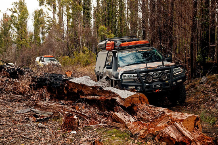
Once beyond the gate the track is rough and rocky and had only been recently reopened after extensive dozer and grader work. Still, it’s not technically difficult but with many sharp-edged rocks disturbed by the dozer work, I did manage to slash a tyre on one of the bloody things along the way.
The Montrose Trail becomes the East-West Trail and skirts around the rocky prominent bluff of Collins Bonnet where you can get great views of the surrounding country. From there it descends to Jeffreys Track which leads south through some eroded corners and smallish bog holes to the small farming community of Crabtree where a group of Scottish Highland cattle inquisitively watched us from behind their fence as we sorted gear and reinflated tyres to highway pressures.
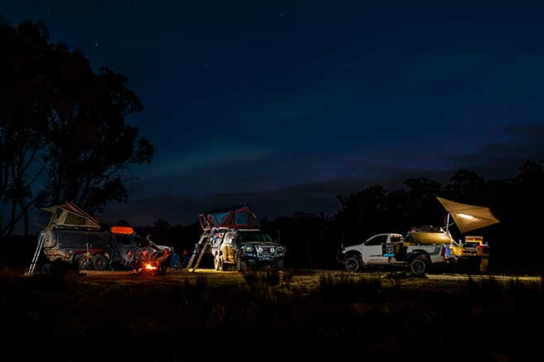
HUON RIVER CAMPING
THAT night was spent at what turned out to be everyone’s favourite campsite, at Rivers Edge Camping Ground, on the magical Huon River near Lonnavale. With platypus in the river, pademelons and quolls in the bush and a multitude of birds chirruping in and around every camp, it would be a delightful place to pull-up for a few days.
Sadly, all we had was overnight before we hit the road again to wander through the forests to the southernmost road accessible point in Australia. Or at least, that was the plan!
Back in January 2019 this region of forest was devastated by some big fires which among other things closed down the famous Tahune AirWalk. For us it made a frustrating morning as we headed down forest roads only to find them closed, clogged by fallen trees or blocked by ongoing forestry work.
9
In the end we gave up on our forest jaunt, headed to Geeveston, had a coffee and drove south on the main road, which was open. At Dover our little party got sidetracked when the local garage owner was discovered to be a closet car nut and had a pretty good car collection – some outside, some hidden in a shed.
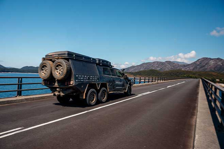
Not far south of Dover the road changes to dirt as it hugs the coast, skirting some magical white sandy beaches that are a delight to the eye before arriving at Cockle Creek. As you rattle across the bridge here you are at the southernmost point you can drive to in Australia. True, the road continues for another 500m, but it swings north as it does so and finishes just a short distance from the Whale Sculpture on the picturesque shores of Recherche Bay.
This beautiful bay was named after one of the ships of the 1792 French expedition led by Bruni d’Entrecasteaux. In all, this expedition spent 50 days camped here and among the scientific endeavours and studies they planted a garden, the site of which has also been rediscovered and the area is now listed on the National Estate.
9
As most of the camping areas along the coast near here were pretty crowded, we headed back up the road taking the 4WD track into Southport Lagoon where amongst the scrub and close to the shores of the lagoon is a small camping area.
The track into the lagoon was once a tough and boggy one, but it’s a bit of a doddle now, although you’d need an SUV at the very least to get into the camping area and boat launching spot. And there’s not much to do here unless you have a kayak or a boat, which would make the place a whole lot more attractive to staying longer.
CENTRAL HIGHLANDS
Next morning we rolled out of our swags, packed and headed off back the way we had come before finding our way through Hobart and turning west. The main road then follows the Derwent River Valley through the quaint and historic villages of New Norfolk and Hamilton, both established before most of Australia’s mainland cities and towns had even been thought of.
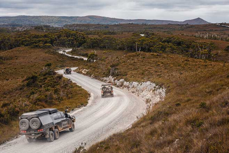
On reaching the small enclave of Ouse we turned onto the more minor C173, climbed through some low, rounded hills where the bitumen gave way to gravel as we climbed up onto the Central Highlands of the island state.
The Central Plateau, as it is otherwise known, is centred around the Great Lake, but includes dozens of other smaller bodies of water and takes in about 12 per cent of the land mass of Tassie. It’s worth more than a cursory look, which sadly was all we got on our quick jaunt around the state. The waters of these lakes have been harnessed for hydro-electricity generation and, in fact, were the site of Australia’s first hydro power station at Waddamana on the Great Lake in 1916.
9
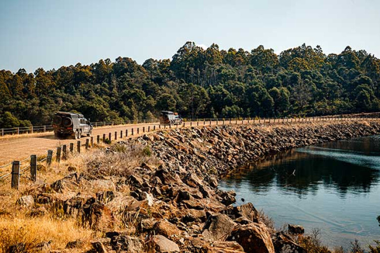
Once we got to Dee Lagoon we set about finding a spot to camp. The lagoon itself was created in 1955 as a water storage for the Tungatinah hydro power station situated farther south with water from the Dee River being diverted via a tunnel to Bradys Lake just to the west, before plunging through the turbines of the power station.
Dee Lagoon is an excellent trout fishing location (as all of the lakes of the Central Highlands are) with a self-sustaining population of brown trout, while rainbow trout are regularly released to keep the population sustainable. There are four boat ramps around the lagoon and these are pretty basic you gotta say, but even so there were a couple of boaties out chasing a trout or two.
We first checked out the eastern shore along Lake Echo Road but there wasn’t any spot that proved to be inviting for a large camp so we backtracked, crossed over the Dee dam wall and headed along the southern shore through the hamlet of Dee itself, which is nothing more than a few fishing shacks close to the lake.
9
Just west of Dee we found a great little spot for our five vehicles to set up camp on a bit of a low bluff overlooking the water and a kilometre or so off the main road. Nearby was the manmade outlet of the lake and the inlet for the tunnel, a big wire fence keeping us well away from the downdraft of water feeding through to Bradys Lake and the power station. A few scattered gums provided shade during the rest of the day, while that evening a campfire kept the chill at bay.
From there we wandered along the blacktop (there’s little choice really) through Derwent Bridge, stopping to admire ‘The Wall’, a modern masterpiece depicting the history of Tasmania in carved and sculptured Huon pine. No photos are allowed of ‘The Wall’, the artist adamant that cameras be left outside and phones in pockets while publicity is purely, word of mouth; it seems to work!
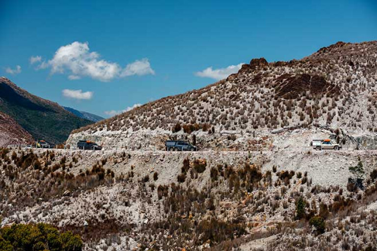
West of Derwent Bridge the road winds across button grass plains and crosses the headwaters of the famous Franklin River before traversing Burbury Lake, yet another hydro dam famous for its trout fishing. The road then climbs the Coast Range, more famous for Mt Lyell and Mt Read and all part of the 200km-long 500-million-year-old Mt Read Volcanics, which has made this stretch of mountains a world-class ore body.
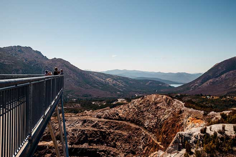
IRON BLOW LOOKOUT
Near the crest of the range and just off the main road is the Iron Blow Lookout, which gives an expansive view of the surrounding mountains and the scars wrought upon it by man’s never ending quest for the rich lodes of copper that the earth hides here.
The Mt Lyell Copper Mine was once the richest in the area, having been worked for more than a 100 years between 1893 to 1994. Sadly, during that time, the mine wastes and tailings were disposed of directly into the King River, the environmental consequences of which are still being felt today.
Nowadays though, the Prince Lyell mine produces a wealth of copper from its 1000m deep operation, the ore being crushed underground before being lifted to the surface, while waste material is disposed of much more effectively and in a much more environmentally thoughtful manner.
9
From the Iron Blow the main road descends steeply to Queenstown, with impressive views over the surrounding country, more picturesque since the smelter closed in 1994 and stopped belching poisonous fumes and denuding all the hill for miles around.
When I first visited this area in 1984, the smelter was still operating and the hills were stained different shades of yellow, orange and brown and were denuded of absolutely all vegetation by the belching sulphur fumes; it was a macabre sight. Nature has now reclaimed much of the manmade devastation and the green of vegetation is slowly covering the hillsides once more.
Queenstown was our next stop, this historic mining town one I always enjoy visiting. Born out of hard work and a tenacity to survive this town, perched on the edge of Tassie’s famous south-west wilderness, caters for an ever growing band of tourists as well as its more rugged mining roots.
9
When you are there, take the time to enjoy the West Coast Wilderness Railway which runs between Queenstown and Strahan. This famous and unique steam-powered Abt train, chugs through delightful rainforest and across numerous streams, following for much of the way the much maligned King River.
It then comes to the shores of Macquarie Harbour the whole unique experience giving a comprehensive appreciation of the history and endeavours of the early pioneers to this wild west coast of Tasmania. Kids, steam buffs … everyone … will love the trip!
For our group of modern-day adventurers the route down the mountain to the shores of the vast harbour was a little less spectacular but still enjoyable as we made our way to Strahan, the tourist ‘capital’ of the West Coast. We weren’t planning on staying long as more remote and obscure places were beckoning … as we were to discover.
TRAVEL PLANNER
In and around Hobart there are many delights and some good 4WD tracks to hold you for a week or more. The best guide to 4WD touring/camping in Tassie is, 4WD Tracks in Tasmania, by Chris Boden.
HISTORIC HOBART: www.discoverhobart.com/hobart/historical_buildings.html
LARK DISTILLERY: larkdistillery.com
RICHMOND: www.richmondvillage.com.au
MT WELLINGTON PARK: Permits and key from Tassie P&WS, Glenorchy. Phone: (03) 6233 6560.
RIVERS EDGE CAMPING, LONNAVALE: riversedgecamping.com.au
TAHUNE AIRWALK: tahuneadventures.com.au
COCKLE CREEK: www.campingtasmania.com
SOUTHPORT LAGOON: parks.tas.gov.au/explore-our-parks
THE WALL IN THE WILDERNESS: thewalltasmania.com.au
QUEENSTOWN: westcoasttas.com.au/field-guide/queenstown
Please enable JavaScript to view the comments powered by Disqus.
COMMENTS