Explore TAS
Gallery13
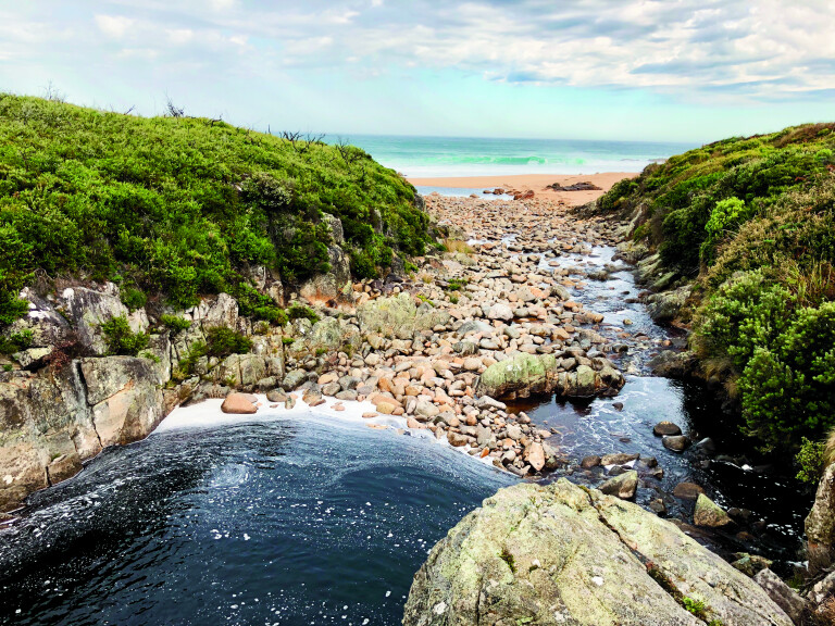
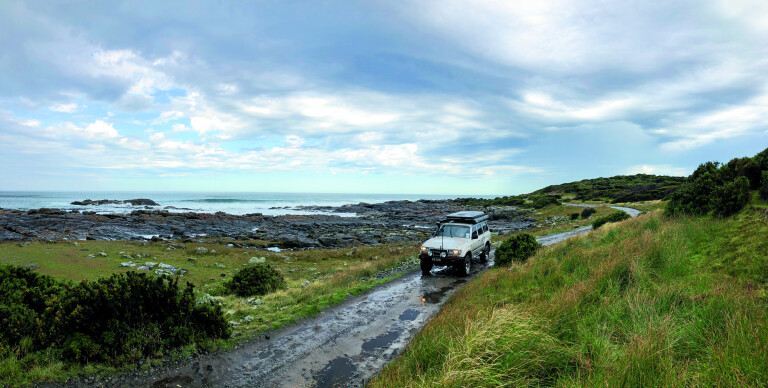
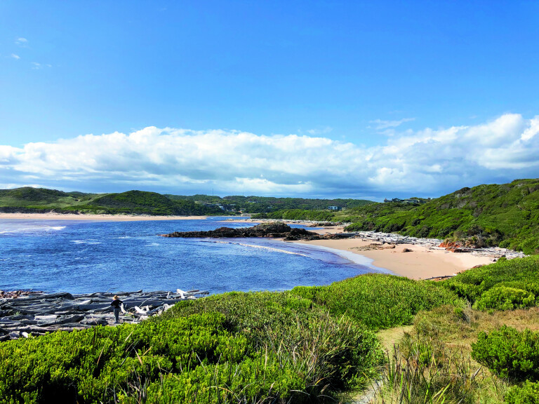
The contrast of Tasmania’s West Coast to the rest of the island needs to be seen to be believed, where it’s often wet and cold but the perfect place to escape your comfort zone. The ‘Wild West’, as it’s regarded, is open to the westerly squalls off the open ocean, where the next piece of land is literally tens of thousands of miles away. But it’s out here where you can explore to your heart’s content in remote areas, track along some great touring trails, and explore the history and get lost in some of the most awe-inspiring scenery the island has to offer. There’s plenty of debate on who actually discovered or sailed down along the West Coast, but it was in 1827 when a skilled bushman and surveyor by the name of Henry Hellyer trekked across the island and reached Arthur River, naming it after the governor at the time. These days, a plaque on the coast declares this place as ‘the end of the world’ due to the prevailing, blustery and at times icy winds from the gale-force Roaring Forties. Arthur River is the western-most town on the island and, until 50-odd years ago, it was so isolated that no serviceable roads were connected and the only way in and out was by air, rail or the treacherous ocean.
13
ARTHUR RIVER
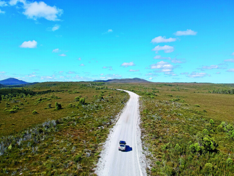
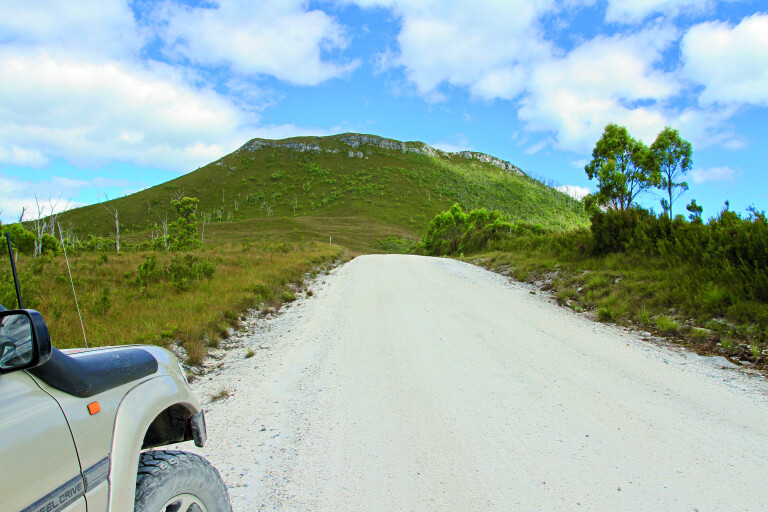
One way to explore this remote region is to head south from the coastal town of Arthur River (where we restocked) along Temma Road, then follow Rebecca Road and turn right at Norfolk Road to the start of the Western Explorer Road (WER). As part of the Tarkine region, the WER meanders through an array of different landscapes, cutting through the world’s largest remaining piece of temperate rainforest, where high rainfall and cool weather has created diverse and stunning areas. If looking for a side track, keep an eye out for the turnout to Couta Rocks. This is true West Coast ruggedness, with sweeping ocean views along the rocky coastline and from the lighthouses that dot it.
13
Arthur River serenity
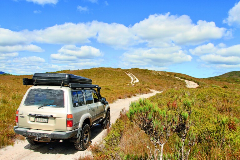
This touring trail can be tackled by most SUVs, but it’s the side diversions where you’ll need a decent 4WD to overcome the bog holes, mountain-ridge climbs or attempt any of the wild beach drives. Most of the hardcore drives along here state you’ll need to travel in convoy, be experienced and have recovery gear – it’s pretty serious stuff. At the start of the WER is a viewing area across the button grass plains, with history boards and road information signs here for you to get a little insight on the area and what to expect. Signs suggest the drive can take just a couple of hours, but, trust me, you won’t see much if you don’t get off the main road. For the first part of the drive, the button grass plains are contrasted by coastal tea trees that dominate the area due to the wet, swampy black marshlands.
13
Fresh water trickles through the boulders to the wild West Coast
BALFOUR
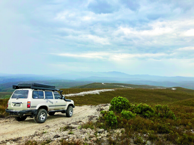
One of the first stops is at the iconic Balfour Track, which is a pretty serious Tassie 4WD trail where attempting it solo isn’t a smart move. From the warning sign, the mud holes are long and deep and the side trails look no easier; however, across the road are a couple of 4WD tracks towards the old town of Balfour. Originally mined for copper, tin and iron pyrite, it’s now a rundown area that was abandoned just before WWI, where mine relics and mines, a few headstones and building foundations are all that remain. Continuing along the WER, the Norfolk Range will soon came into view, with stands of huge eucalypt trees blackened due to fires. As the road winds its way around the range, mountains tower over the landscape, with Mount Edith standing taller than the others at 740 metres.
13
Rugged Mount Edith looms large
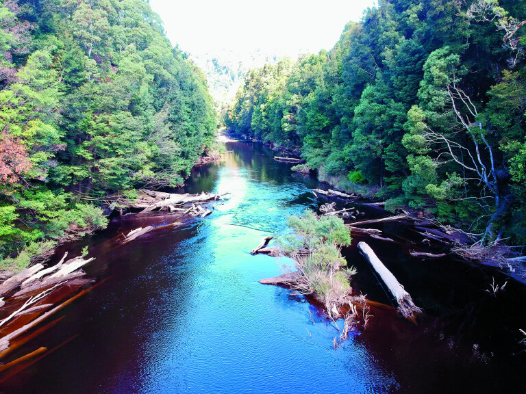
On the eastern side of the WER the Badger Plains fade into the distance towards the centre of Tassie. Part of the mighty Tarkine wilderness, this vast area is being preserved due to its vast range of threatened and/or endangered plants and animals. Heading farther south and crossing the Savage River, the whole environment changes into thick, near impenetrable forest. In fact, when the early explorers were trekking through the area they called this ‘savage country’ due to the interlocking branches and trees. The sun doesn’t penetrate the ground here and it’s constantly damp, but this allows for thick carpets of moss to grow over everything. The rivers aren’t clear around here either, but are coloured like weak tea because of the tannin leeching out of the button grass plains.
13
CORINNA
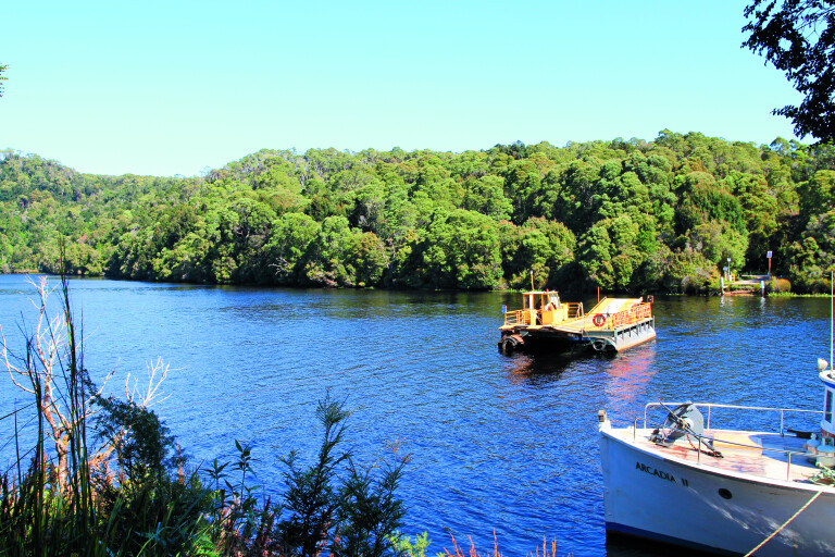
The quaint township of Corinna comprises only a few buildings, but it’s a good base for wilderness walks, kayaking up the Pieman River or heading farther afield. The Petaanidik Aboriginal people lived here for thousands of years before white man explored the area, with gold found in vast quantities in 1879. It wasn’t long before word spread and, just 12 months later, nearly 500 people arrived and a town started to grow. By 1900, gold wasn’t profitable and the area started to shut down. Through the forest, water races were used to provide a constant flow of water to the mines, and it was in 1883 that Tasmania’s largest gold nugget weighing in at 7kg was found. The Corinna Goldfields were so remote supplies were brought in by boat on the SS Dorset for many years.Life out here revolved around mining and drinking, and with a hotel on either side of the river, a punt was used to frequent the two. But when the owner of the Star Hotel passed away, many miners drowned trying to cross the river for the burial, as not many were sober – the night was full of brawls, until the police shut the town down. Today, the punt has been replaced by a car ferry, but only operates in daylight hours.
13
The Pieman River car ferry at Corinna
Around town there’s the historic Graves Track; the Corinna Hotel, which is packed with memorabilia from the past 100 years; and a few walking tracks along the river and into the wilderness.If you miss the ferry, take the chance to head farther east to Waratah, just an hour away along Corinna and Waratah Roads. Winding through thick scrub, you’ll soon enter the Savage River mining area. This is no ordinary town, as it was built for the workers who operate the huge iron ore mine. Established in 1877, it has operated ever since and now a pipeline connects the mine to Burnie, 100km to the northeast, for export. The iron ore is pelletised for its journey through the pipe and on to the ships.
13
WARATAH
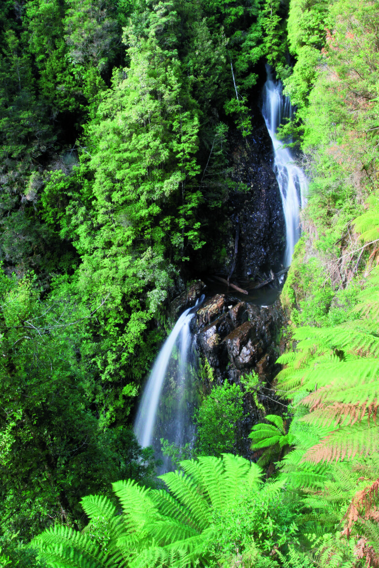
Farther down the road at Waratah, this sleepy village holds interesting history. Once laying claim to having the largest tin mine in the world, there are a few cool things to explore in the town. Just on the outskirts of Waratah, a good natural wonder is Philosopher Falls that James Smith discovered in 1871 when he was looking for new areas to prospect in and found tin nearby – the boom was on at Mount Bischoff. The walk down into Philosopher Falls is nothing short of stunning, where tall tree ferns and moss-covered trees line the path. Water races were also used in this area and it’s amazing to see just how they were hand-cut as you follow them along. When they were dug, a worker was commissioned to walk them daily to ensure there was a constant flow of water and no obstructions along the way. Getting tin out of the area was achieved by a horse-drawn trolley on a timber tramline, until the railway was built in 1884. Another feat of the Mount Bischoff mine was that it was the first in Australia to be run by hydro electricity. Soon after, St James Church in Waratah was the first church in Tassie to be lit by electricity.Today, Waratah is like a step back in time – buildings have been restored to their former glory, and there’s a heritage walk around town and plenty of mine relics to explore. A working water wheel still operates at the top of Waratah Falls in the heart of town, while across the road a kids’ playground has been designed from old mining gear including several carts, half a water wheel and a trommel (a huge tumbler used to separate material).
13
A main attraction is the Kenworthy Stamper mill, which was owned and run by Dudley Kenworthy who used it until he passed away. The mill set-up was bought and meticulously pulled apart, transported and set up exactly the way it was at Mount Bischoff, all under a huge new shed. With a gold-coin donation, visitors can enter the shed and, with the push of a button, the stamper fires up and the shaker works just like the way it was used back in its working day. The Waratah Museum has a stack of old photos and memorabilia such as the mock-up hut next door to replicate the one that James Smith lived in when mining in Waratah. Up the road, the 100-year-old Bischoff Hotel still operates; while not the original, it was rebuilt after the first two burnt down. Other spots to check out are the water tunnels just on the edge of town, where huge amounts of water were diverted from the swamps to the mine for the stampers – this area receives nearly two metres of rainfall each year. The West Coast is a unique, rugged and stunning area, but to truly understand the area it’s highly recommended to slow down and explore the little towns along the way. There’s nowhere else in the world like the West Coast of Tasmania.
13
Arthur River mouth and the township beyond
TOP FIVE PLACES TO VISIT
1. The Tarkine2. Arthur River3. Couta Rocks4. Corinna5. Waratah
Please enable JavaScript to view the comments powered by Disqus.
COMMENTS