Gear

Gallery6
MOST vehicles bought from the showroom floor these days come with an embedded satellite-navigation system of some sort – of varying levels of competency.
The problem when it comes to our lifestyle is that manufacturer sat-nav systems will lack the functions and features for proper off-road use. Sure, some will come with off-road features, but for guidance when it comes to ‘real’ off-roading you need to trawl the aftermarket industry.
MORESatellite Phones
“As any keen four-wheel driver will understand, stock vehicles are a great base to build upon for a more purpose-specific off-road setup,” explained Adam Jane, editor at HEMA Maps. “In the same way that drivers might wish to upgrade to more capable tyres, suspension and lighting, it’s often a good idea to step up from the generic in-car GPS system to something purpose built.”
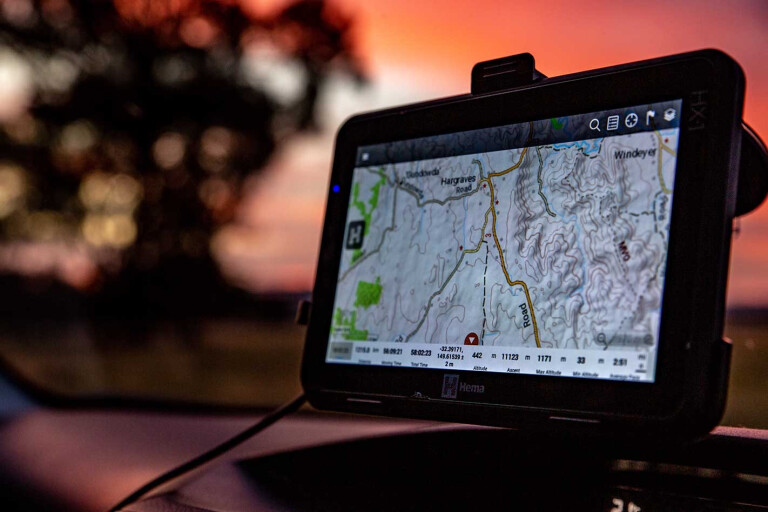
A purpose-built sat-nav system for 4x4 use will feature topographical maps (detailed and accurate two-dimensional representations of features on the Earth’s surface), precise mapping of remote tracks and the ability to function when off-the grid – as well as a bunch of useful tools like POIs (point-of-interests), the ability to sync waypoints and save favourite off-road routes.
6
Another key reason to scrap the manufacturer sat-nav system in favour of an aftermarket device is the ‘update’ factor. Due to map updates releasing regularly it’s important to have a model that can update hassle-free, multiple times a year.
And, as Matthew Thomas, Garmin Australia’s general manager, reminded us: “Updates can be expensive and can usually only be done when service is due. It is not unusual for vehicle manufacturers to charge $500 for a single update.
“Garmin units usually have at least four updates a year and, for some models, it will notify you on the Garmin connect phone app if you have an update,” he added.
Two key players in the 4x4 GPS world are HEMA Maps and Garmin, so we had a chat with them to learn more about the devices saving heaps of Aussies from getting lost in the scrub.
OFF-ROAD ESSENTIALS TO LOOK FOR
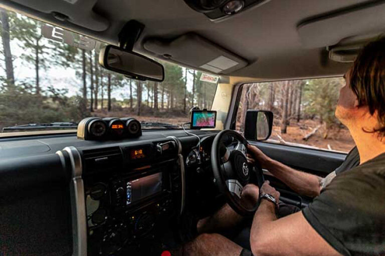
TO BE suitable for proper off-road, remote-touring use, an adequate sat-nav system needs to tick a few boxes. Not only does it need to have adequate mapping database for offline use and the ability to work when you’re hundreds of kilometres from the nearest town, it needs to be built tough.
“A good off-road GPS unit needs to be tough enough to withstand the Aussie outback and reliable enough to trust in the middle of nowhere. A good mount, solid construction and an intuitive operating system will make life a whole lot easier,” Jane said.
6
Matthew Thomas from Garmin Australia agreed: “GPS units used for off-roading will be subject to much harsher vibrations than driving on sealed roads, it will also be subjected to more extreme weather conditions such as dust and moisture.”
As mentioned, topographical mapping is essential, with Garmin units in particular using topo maps from various sources (including HEMA). The benefit of units from HEMA and Garmin is that they’ll feature POIs (point-of-interests) like campsites, dump points, rest areas, water points and fuel stops. Also look for GPS units that have the ability to record your trips, add geo-tagged photos, sync waypoints, and save and share favourite routes.
Outside of the core essentials of a sat-nav unit, there are some other features that are handy and make off-road travels that little bit more comfortable and/or fun.
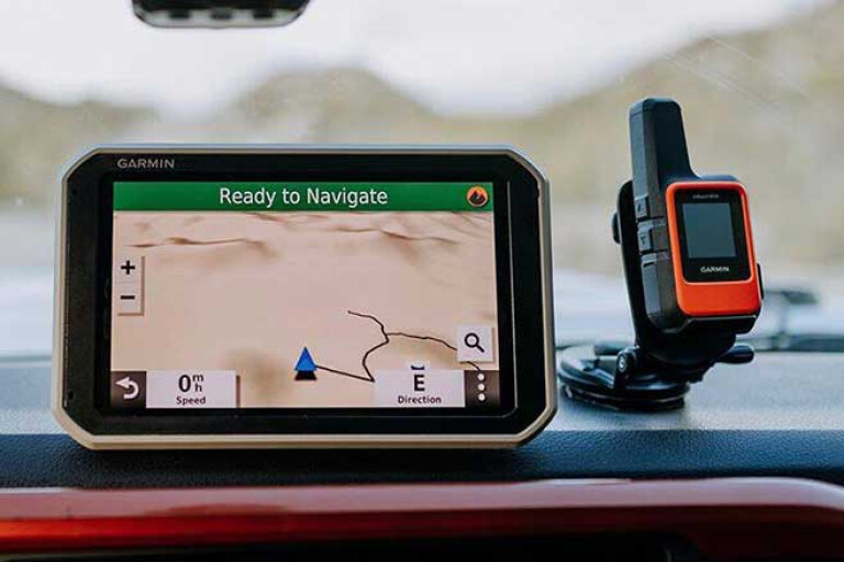
Garmin Overlander units, for example, feature a pitch-and-roll function, as well as a digital compass and barometric altimeter for accurate bearings and elevation data. Plus, the units can be paired with Garmin inReach devices for two-way text messaging, interactive SOS and weather forecasts.
“Get yourself a sun visor to keep the glare off the screen. The Hema HX-1 sun visor is a no-brainer if you’re heading into the desert,” Adam Jane advised.
STANDALONE UNIT OR SMARTPHONE APP?
THERE are pros and cons of using either a smartphone app or a standalone unit (either inbuilt or portable) for sat-nav guidance, as HEMA’s Adam Jane explained to us.
“Our phones are so much a part of our lives these days that it’s easy to have a good app on hand. The fact that a phone is almost permanently connected to the internet means it’ll keep everything up-to-date, but can mean the app is useless when the signal drops out,” he said. “Apps such as Hema Explorer and CamperX have offline modes, which enable users to access information without being connected to data networks.
“A standalone unit allows you to plan out your trip before leaving and then you just let it run while you’re out there. This way, your GPS unit is a GPS unit, and that keeps things nice and simple, it avoids distraction and makes the process of navigating a whole lot more reliable.
“A standalone unit is designed for the purpose of GPS navigation, whereas an app on your phone can be more like a secondary function.
6
“On the flip side, your phone may also be your camera, your stereo system, your communication device and a torch – you could even have it Bluetoothed to your tyre-pressure monitors or connected to your UHF radio – all this means you’re constantly switching apps and moving it around,” Jane said.
Unlike a dedicated standalone unit, a smartphone isn’t built solely for sat-nav duties. It’ll lack in the durability stakes and its battery life will drain at a far faster rate than a quality sat-nav unit. Plus, as Matthew Thomas explained: “Many GPS phone apps only work when there’s mobile reception.”
In contrast, standalone units – including the Overlander device within Garmin’s range – feature more than 36,000 HEMA verified POIs built-in, so you can search what you need and find the closest to your location without mobile phone reception. As well, dedicated GPS units include features such as trip logs, off-road mode, route planning, and speed camera and school zone locations. “Plus, our RV/Overlander/Dezl devices also allow users to enter their vehicle dimensions for routing that take this into account (e.g. bridge heights, road weight and length limits),” Thomas said.
Hence the reason why standalone units are often the preferred – and recommended – devices by tourers with a bit of experience and grey in their beards.
HOW MUCH DO THEY COST?
THERE ARE smartphone apps on the market which are free to purchase, including the Newtracs app, though you’ll still have fork out some cash for premium content; and HEMA sells the CamperX app for only $9.95, which features topographic mapping, full offline mode, more than 100,000 POIs, and access to plenty of campsite information.
Spend a few more pennies on the app store and you could be the owner of the more comprehensive HEMA Explorer App on both iOS or Android ($49.95).
6
Then there are premium products, such as the Garmin Overlander (RRP: $999), which comes loaded with key features including pitch and roll gauges, navigation sensors, the Garmin explore app (allows syncing to smartphone and desktop), and it comes preloaded with iOverlander POIs and HEMA 150K top maps of Australia – all in a sturdy, seven-inch screen.
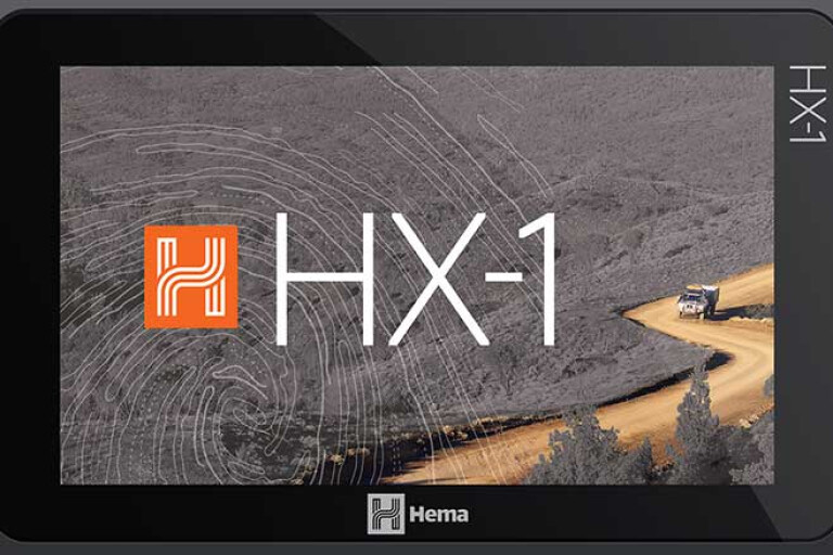
Another premium product is the HEMA HX-1 (RRP: $699), which contains topographic mapping, trip planning and trip recording tools, and more than 45,000 POIs, among a host of extras.
Clearly there are considerably more products on the market, but this should give you a heads up on what prices you’ll be looking at.
More info: www.hemamaps.com; www.garmin.com.au
WHAT SHOULD I AVOID?
CONSIDERING you’re trusting a sat-nav system to guide you to a remote campsite beyond the black stump, it’d be a worthless piece of scrap if it didn’t do the job it was intended for – and, let’s be honest, the results could be disastrous.
“It might sound dramatic, but you may be trusting your life to the gear you take out into the remote parts of Australia,” says HEMA’s Adam Jane. “There’s no point taking your chances on a cheap knock-off; just save up a few more pay cheques and invest in a proper device. That way, you can be confident it’s backed by a good reputation and is serviced by a reliable warranty. One less thing to worry about means more time to enjoy yourself.”
With a plethora of units on the world-wide web only three clicks away from arriving in your mailbox, it’s important to remember that not all units are built to the same quality.
The biggest concerns found with inferior products include the sub-standard quality of the device, and the accuracy (read: inaccuracy) of the mapping. “You need to be careful when buying from international sellers that the device has the correct Australian mapping,” Thomas said.
There are other important factors to take into account including warranties and technical support, or the lack thereof. If you’re eyeing off a second-hand unit, battery deterioration and how old the map version software are important considerations.
SMARTPHONE RECEIVERS
MOBILE phones or tablets have inbuilt autonomous receivers which can utilise multiple Global Navigation Satellite Systems (GNSS), but this is dependent on the internal GPS hardware (single- or dual-band frequency chip) capability of said device.
Newer devices (such as the Oppo Reno) have dual L1 and L5 frequency chips allowing access to more satellites. This ensures there are more available to them in the event of interferences (infrastructure, vegetation, topography, etc.) in turn providing better accuracy and precision.
SAT-NAV PHONE APPS
IN ADDITION to HEMA and Garmin’s extensive range of phone apps and standalone units, there’s a rising number of phone apps on the market, specifically for four-wheeling.
Apps like Gaia GPS have free, membership-based and premium offerings, while an app gaining popularity is Newtracs, which gives “up-to-date 4x4 track conditions using world-first crowdsourcing technology”.
Only available on the iOS platform – coming soon to Android – the app provides detailed track ratings, with specific track obstacles. For example, it’ll pinpoint steep sections and areas other users have encountered problems. You can also log trips, drop pins and access tracks offline.
HEMA MAPPING
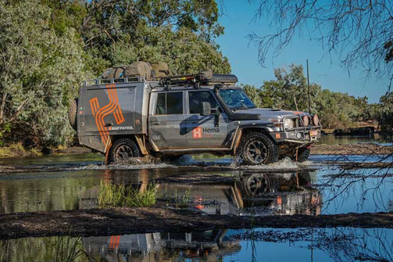
HEMA has GPS-mapped more than 690,000km of tracks and 545,000km of unsealed roads throughout Australia, ensuring the HEMA Maps’ database is continually up-to-date and accurate. It is the job of the fields’ team, known as the ‘Map Patrol’, to collect and update the data which is used to navigate thousands of adventurers to remote campsites every year.
6
HOW DOES A GPS UNIT PINPOINT YOUR LOCATION?
1. GPS receiver, working with time signals, needs at least four satellites to acquire a position.
2. The receiver calculates the distance from four or more satellites (trilateration).
3. This triangulation deduces/pinpoints your location.

Please enable JavaScript to view the comments powered by Disqus.
COMMENTS