Explore NSW
Gallery25
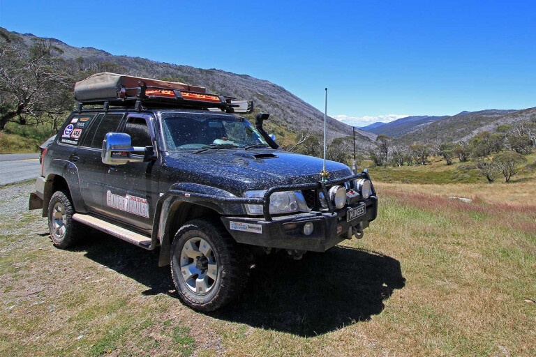
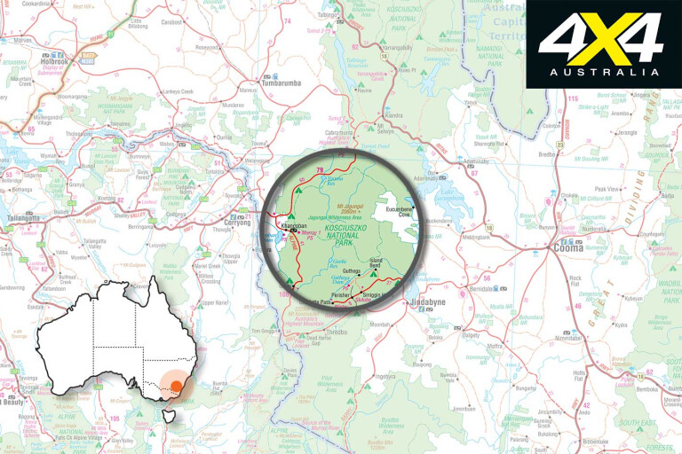
As far as bragging rights go, Kosciuszko National Park (690,000 hectares) is the largest of the alpine national parks and reserves that stretch from eastern Victoria to the Snowy Mountains of New South Wales and through the Brindabella Ranges of Canberra. It is the biggest national park in NSW and has the highest mountain on the Australian mainland – its namesake, the 2228-metre Mount Kosciuszko.
This feature was originally published in 4x4 Australia’s September 2012 issue
Blanketed in metre-deep snow between June and October, spring delivers a dazzling carpet of wildflowers and an invitation to explore the environment of glacial lakes, alpine meadows, snow gum patchwork forests and beautiful rivers.
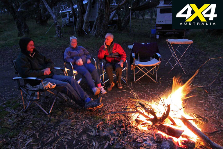
 The wilderness experience attracts a cross-section of adventure junkies including 4X4 enthusiasts, hikers, kayakers and mountainbikers. Fishing, camping, rafting, and caving are all popular.
Aborigines lived throughout the mountains for thousands of years, although the extreme winter conditions of the alpine area made life difficult. According to the NPWS website, during the mating season of the Bogong moth, Aborigines would hunt the insect across the mountains as part of ceremonial rituals. Even today, there are still many areas within Kosciuszko of special Aboriginal importance.
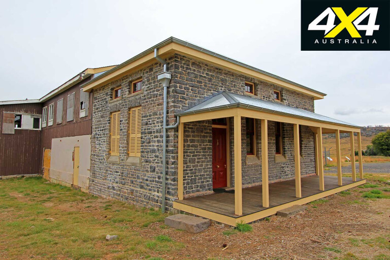
Other evidence of historical significance are the cattlemen’s huts and the pioneer and mining ruins. While cattle graziers were the pioneers of the area, a short gold boom between 1859 and 1860 turned Kiandra into a bustling community of 4000, with 14 hotels. Nowadays it’s a ghost town with only a couple of buildings left standing.
25
A self-guided heritage walking trail starts at the restored bluestone courthouse and explores the former township with interpretive signs providing an idea of what life was like in that era.
With the removal of cattle from the national park in the 1950s and 60s, mountain huts were abandoned, yet have survived thanks to the efforts of volunteers such as the Kosciuszko Huts Association and various four-wheel drive clubs.
The huts provide emergency accommodation for adventurers caught out in extreme weather conditions. There are a number of huts scattered through Long Plain with horseholding yards, opening-up the northern boundary to horseback riders.

25
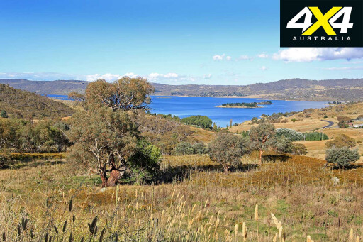
The park is accessible via two major arteries that cut through the park; the Snowy Mountains Highway and the Alpine Way, connected via the Link Road. The Alpine Way services the snowfields further south, connecting Jindabyne to Khancoban, whereas the Snowy Mountains Highway links Tumut to Cooma.
There are also several backroad options, such as the Snowy River Road from Victoria that crosses the border at Willis adjoining the Barry Way; and the Boboyan Road that cuts through Namadgi National Park south from Canberra and joins the Snowy Mountains Highway just out of Adaminaby.
25
North of Adaminaby, the Snowy Mountains Highway meanders towards Tumut, passing the Providence Arm of Lake Eucumbene. About 40km from Adaminaby, take the left turn onto the Link Road to access the camping area at Three Mile Dam, a short 5km drive up the road. You can’t miss the mining relics on the right-hand side. Scouring the surrounding landscape reveals a series of races cut into the earth to supply the sluicing operations.
The alluvial gold was found in ore coated in thick clay. The preferred method of the day to extract the gold was via hydraulic sluicing using high-pressure water, supplied by the Three Mile Dam, to wash away the clay. The downside of this approach was the local area sustained significant erosion as a result.
Free camping is available on both sides of Three Mile Dam. The western side has a peninsula that stretches out into the middle of the water with some snow gum shelter. There are a couple of fire pits, a picnic table and a pit toilet out near the road. Water is available from the dam, although the Parks website recommends boiling if for five to 10 minutes before use.
25
The surrounding landscape is largely grassy plains with scattered snow gums. A 3km loop walking trail, known as Goldseekers Track, begins opposite the western entrance to Three Mile Dam. It passes through snow gum woodlands to reach an ore-crushing battery relic before looping back.
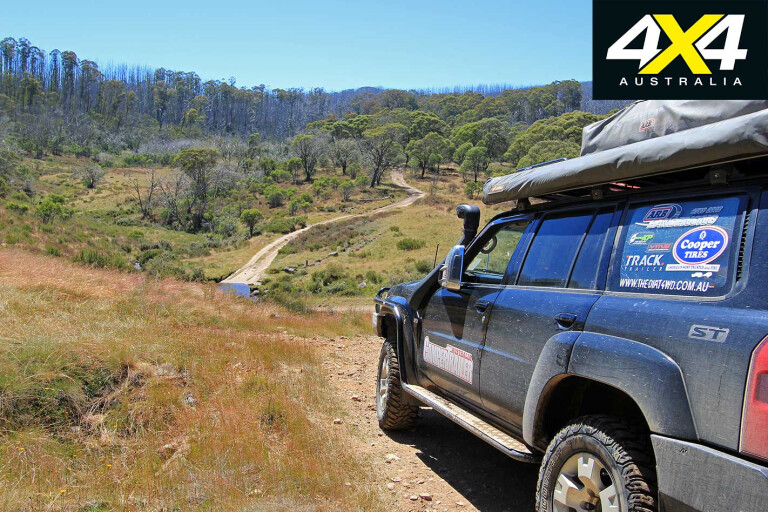
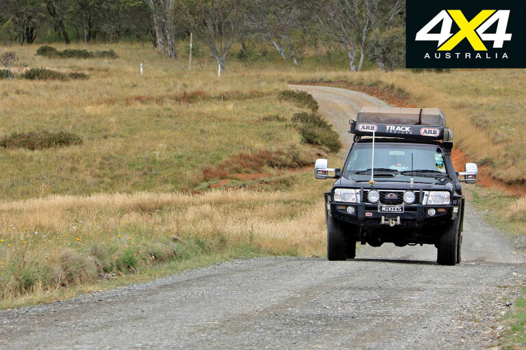
Further north, there are plenty of cattlemen’s huts to explore along Long Plain. The Long Plain Road leaves the Snowy Mountains Highway to the right about 20km north of Kiandra. The unsealed road weaves across the grassy woodlands as it heads north towards the Goobarragandra Wilderness area. Keep an eye out for wild brumbies along this stretch, hiding among the trees.
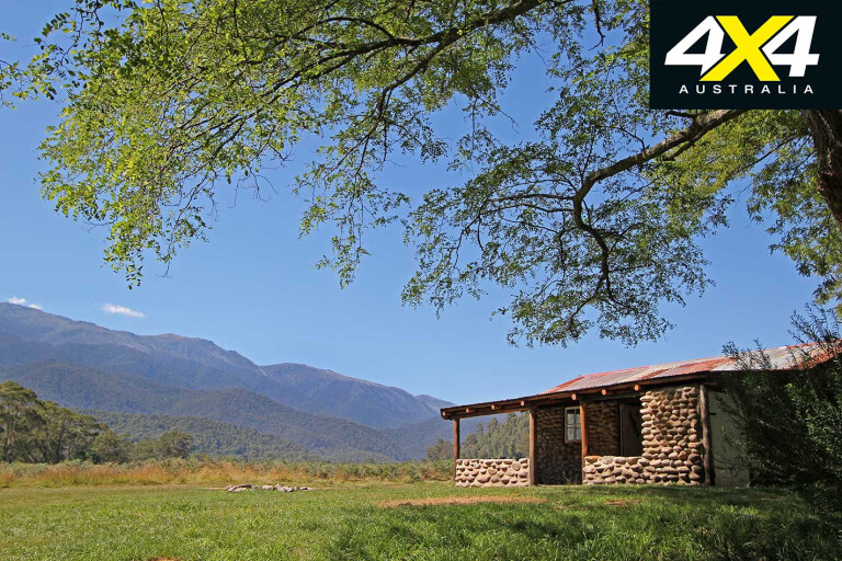
There are neighbouring campgrounds at Long Plain Hut, Cooinbil Hut, Coolamine Homestead and the Blue Waterholes. The Coolamine Homestead site features four buildings including a log cabin, referred
to as the Cheese House, built to store food, while Southwell House and Campbell House are classic slab and weatherboard homes. Horse hair was used to insulate the roof and newspapers line the walls,
now protected from vandalism by plastic sheeting.
25
It is interesting to see what went in a 1939 newspaper: advertisements for the Ford V8, Malvern Star and Metters Automatic gas cookers.
Beyond Long Plain Hut, Long Plain Road heads north following the path of an old stock route to link up with forestry roads. Access to Brindabella National Park is possible via a rather long detour along Broken Cart Trail, Boundary, Bramina, Barnetts and Brindabella Roads. Access is not guaranteed and wet weather will close the roads.
A better bet is to explore the area around the Blue Waterholes accessed from the Blue Waterholes Fire Trail. Walking tracks explore the gorges, caves and waterfalls. Bring a torch and good walking shoes as you cross the creek a number of times. Walks range from 2.5km to 6.3km.
Backtrack along the Long Plain Road to the Port Phillip Fire Trail junction and turn left. This road navigates to the Tantangara Reservoir which is part of the Snowy Mountains Hydro-electric Scheme. When water levels allow, you can cross the reservoir to the Pockets Saddle Road and explore the nearby huts on foot.
25
Pockets Saddle Road returns to the Snowy Mountains Highway, near the top northern Providence Arm of Lake Eucumbene. Still in the northern end of the national park, Yarrangobilly Caves are in a pretty
pocket of bushland east of Talbingo Reservoir.
As the name suggests there are a number of caves to explore (free) either self-guided or guided, plus bushwalks, a large thermal pool (27°C), or just eyecatching natural surroundings in which to enjoy a picnic.
Wood-fired barbecues are available here but you need to bring your own wood. There is no camping but heritage-style accommodation is available at Caves House. The closest camping is at Yarrangobilly Village, a further 8km along the highway towards Tumut.
25
The Lobs Hole Ravine Road is another good touring track (37km) that kicks off from the Snowy Mountains Highway about 5km past Yarrangobilly Village. It loops back to the Link Road just west of Three
Mile Dam. The crossing of Yarrangobilly River designates the trail as 4X4 only. There are several walks to pioneering ruins along the way and good views of the Yarrangobilly arm of Talbingo Reservoir as you descend into the valley.
The trail leads to Lobs Hole Ravine, once the site of a village and copper mine, evident by the mining relics. The last point of interest is Wallaces Creek Lookout, before you hit the Link Road. A detailed
trip description recounting the history of the area is included within the Guide to Kosciuszko National Park.
Fuel is available at Cabramurra, Australia’s highest town at 1480m. The road from Cabramurra links to Khancoban and the Alpine Way, which services the ski fields and the magnificent camping areas
of Geehi, Tom Groggin and a number of smaller sites along the Thredbo River. The Cabramurra to Khancoban section is only open in summer.
25
Leaving Cabramurra the road drops down to the Tumut Pond Reservoir, another component of the Snowy River Scheme. The road continues to climb up and down many more steep, narrow and winding mountain ranges, periodically offering a glimpse of the surrounding wilderness from the rooftop of the ranges.
Camping permits are required in the southern section of Kosciuszko NP. You can buy these online, by phone or stop in at any of the Parks offices or agents. The NSW Parks Office in Khancoban has an
ATM to purchase tickets after-hours with a daily ticket valid for 24 hours.
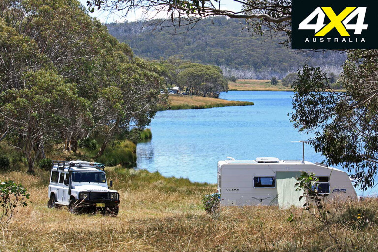
The Geehi Camping area is one of the best in the region offering camping for all vehicles on the banks of the Swampy Plains River. There are pit toilets, a couple of picnic tables and a few very cool huts,
made from river stone.
25
Follow the track to the Swampy Plain River crossing and the Geehi Hut. If the depth and the flow of the river are okay, 4X4s can cross to Behrs Flat and follow the loop track to the other huts. Keebles
Hut (also known as Nankervis Hut with a picture of a big trout on the door) is a particularly spectacular location, with plenty of shade, a deep swimming hole and views up the valley to Mt Townsend
and the snow-capped peaks during the cooler months. The track leads on to the Old Geehi Hut.
Tom Groggin, on the banks of the Murray River and the Victorian border is a larger, more open grassed camping area, popular with kangaroos. You can cross the river into Victoria at the ford and take the trip up to Davies Plain Hut or Mount Pinnibar.
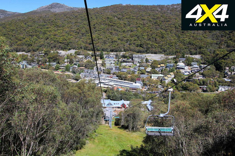
The Alpine Way ascends steeply from Tom Groggin and is not recommended for caravans. Thredbo village is open all year round with plenty of activities to keep you moving. Summer day passes provide the best value, bundling the scenic chairlift, bobsled, a round of golf, tennis court hire, access to the leisure centre for $45 per adult or $90 per family. Equipment hire is available at an additional cost.
25
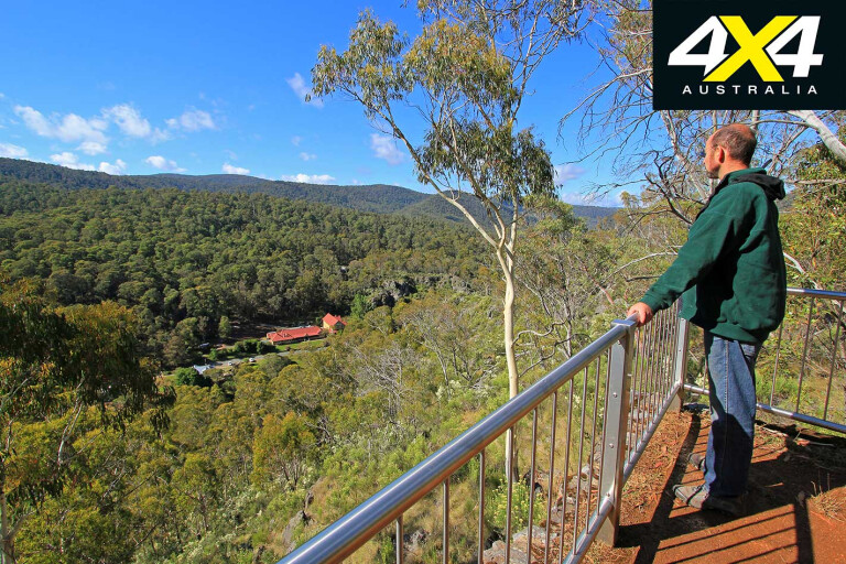
The scenic chairlift rises 560m over 1.8km taking 15 minutes each way and offers spectacular views of the surrounding landscape. You can continue up the gentle rise on foot towards the Kosciuszko lookout
(4km return) or the summit (13km return) past the glacial Lake Cootapatamba.
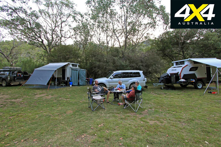
Back down at Thredbo village, continue along the Alpine Way to discover the campgrounds on the banks of the Thredbo River. Thredbo Diggings is the best offering for camper-trailers; the others are loaded
with bollards flagging their intentions as tent-only camping areas. It’s a further 22km to Jindabyne to enjoy the expansive views over the lake.
That concludes our Kosciuszko National Park experience. It’s always sad to leave an area knowing you have only scratched the surface with so much more to enjoy. Yet that’s the Achilles heel of being the
biggest alpine national park in the region – there will always be more to come back to. Not such a bad thing when it is as good as it is.
Travel Planner
25
WHERE
Kosciuszko National Park is 190km south of Canberra and is flanked by Jindabyne, Cooma, Tumut and Corryong.
CAMPING
There are campgrounds scattered throughout the national park. Camping fees are included in the vehicle entry fees, where applicable.
SUPPLIES
Tumut, Cooma, Jindabyne, Corryong. Basic provisions only are available from Adaminaby, Cabramurra, Khancoban and Thredbo Village.
TRIP STANDARD
Easy to medium. In summer, most tracks are easy-going but can quickly change after rain. River crossings will pose the biggest threat and should be walked to ascertain flow and depth. More technical trails, such as the Victorian Davies Plain and Mount Pinnibar, will require additional care. Check with Parks offices on the latest track conditions before you travel.
MAPS & GUIDES
Hema Snowy – Kosciuszko Map, second edition, 1:200,000. Kosciuszko visitor guide is here.
CONTACTS
NPWS Parks Contacts:
Jindabyne 02 6450 5600
Khancoban 02 6076 9373 or 02 6076 9382
Tumut 02 6947 7025
Yarrangobilly Caves 02 6454 9597
NSW national parks website
PERMITS AND ACCESS
A vehicle entry fee is payable in Kosciuszko NP. From the long weekend in June to the long weekend in October – $27/day.
Thereafter, $16 per day. Short breaks or annual passes available. Contact NPWS.
Yarrangobilly Caves: $3 vehicle entry; cave tours from $15 adults; $10 concession; $38 families (two adults, three kids).
Please enable JavaScript to view the comments powered by Disqus.
COMMENTS