Explore NSW
Gallery18
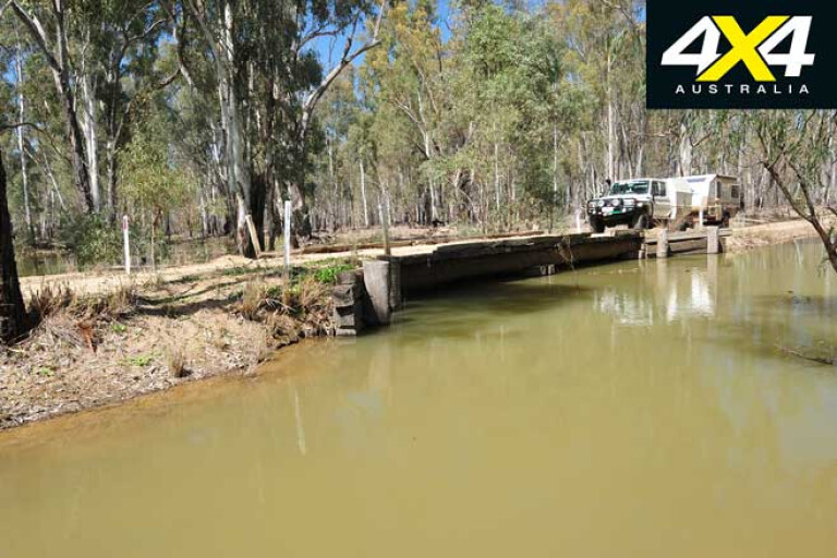
We had turned onto the Toupna Crossing Road on our second attempt to get to the Millewa River Road, our first effort thwarted by a small creek that had oozed across the track and was about 30 metres wide with lots of sloppy mud on either side.
Earlier, we had been turned back by ‘Road Closed’ signs in another indication that the Murray River, so tantalisingly close, was running at its normal high Spring water level and limiting access to several spots along its length.
18
We were in what is now the Murray Valley National Park on the NSW side of the river, east of the town of Mathoura and downstream from Tocumwal. While by far the most extensive area of park is centred around the red gum forests just east of Mathoura, outliers of the park dot the river up nearly as far as Mulwala, about 110km east.
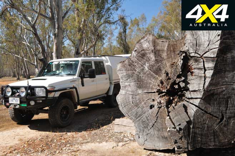
In all, the park covers nearly 42,000ha of red gum country and, with the adjoining Barmah National Park of more than 28,000ha on the Victorian side of the river, forms the largest river red gum forest in the world.
The Murray Valley NP was, up until 2010, a state forest, where logging helped sustain many of the communities along the river, especially Mathoura. Certainly from our drive through it, the park needs better management, with the most obvious issue being the thinning of the many red gum saplings that have sprung up since logging was banned. These dense stands demote the growth of big trees that supply nesting hollows and, in the end, are nothing but an increased fire hazard.
Interestingly, the forest as we know it is a relatively recent phenomenon. About 60,000 years ago a series of seismic events changed the course of the river, while a fault line – the Cadell Fault – can easily be seen along the Cobb Highway between Echuca and Deniliquin. This ridgeline blocked the flow of the stream to form the Old Barmah Lake, and about 8000 years ago the Murray was probably flowing north via what we know as the Edward River and Gulpa Creek.
18
Recent research, and long-standing Aboriginal folklore, indicates that only 550 years ago or so, Aboriginal people carved a channel through a sandbar which allowed the Murray to flow in its present course and formed what we know as The Narrows, or The Cutting, downstream from Picnic Point.
This damming of the river allowed the formation of a delta and the wide expanse of the red gum forest, and ongoing Aboriginal management of the region with fire-stick farming kept the forest regrowth down, in turn forming a rich mosaic of grassy country and open forest.
When Charles Sturt came through this region in 1830 he was struck with the cleared country and recorded two instances of the Aboriginals burning the land to keep it that way; he complained there were many dense reed beds but few trees.
18
When white settlement arrived in the early 1840s the sheep and cattle they brought with them helped keep the country open, and the red gums formed an open forest. From 1853 paddle steamers started plying the river, the boilers relying on the dead timber along the rivers for fuel.
Logging of the forests started in the early 1860s and within 15 years the rapid decline in timber being harvested led to the government of the day imposing a ban on logging. After that, good management sustained the logging industry until its forced closure in 2010.
The situation on the southern side of the river was much the same, with the National Park being gazetted in April 2010. However, like their NSW brethren, many of the locals aren’t impressed with the situation or the management of the area’s 500 or so feral horses. Parks Victoria earlier this year drafted a plan to cull numbers to 100 within three years and to totally eradicate them by some later date. Both locals and horse lovers aren’t happy!
18
Rather surprisingly, locals have said that the number of visitors to the area around Mathoura has dropped since it was gazetted a National Park. Some of my friends who used to regularly go up there hunting and fishing have stopped visiting altogether.
And most of the good camping is now restricted to the adjoining regional parks, along with a plethora of private campgrounds on both the NSW and Victorian sides of the river – so the National Park status has added little to the area’s attractions, it seems.
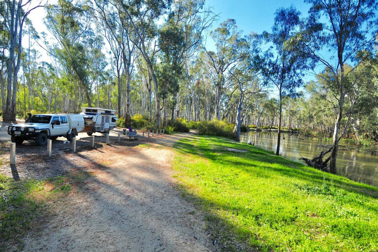
Where does that leave the keen four-wheeler and camper? Well, on the NSW side of the Murray you’ll find an excellent spot at Edwards River Bridge in the regional park, and this is where we camped for our first night in the area.
18
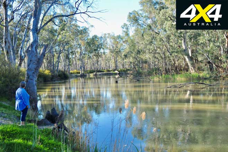
It’s a very pleasant spot with only six or so camps along a long stretch of water, while a day-visitor area has gas barbecues and associated facilities. Being a regional park, you can walk your dog. On the other side of the river, tracks lead to a few more riverside camps.
The Edwards River is an anabranch of the Murray and flows north towards Deniliquin, and there are a number of tracks giving access to the river, along with a designated camping spot at the Benarca campground just outside Deniliquin.
The Edwards is narrower than the Murray, with less current and more trees and obstructions, making it ideal for those who want to go for a paddle; there is an excellent launching ramp for paddlers located at the Edwards River day-use area.
18
There’s another designated camping area a little south of Mathoura at Swifts Creek at The Narrows, where the Murray River is at its most confined. Farther upstream is the Woperana campground, west of Tocumwal, and the excellent Quicks Beach near Barooga. Upstream from here is Mulwala campground (also known as Hinches Beach campground), located just downstream from Yarrawonga.
Elsewhere in the park there are smaller, less-developed spots to camp, but we found access difficult to much of the river with high, steep banks making life arduous. Back near Mathoura, Picnic Point offers a large caravan park close to the Murray, where there is also a good boat ramp and pleasant barbecue facilities.
This whole region of red gum is a Ramsar-listed wetland of international importance, where more than 200 species of birds have been recorded, with many such as the eastern great egret, the cattle egret and straw-necked ibis nesting here. The area is also home to 35 species of mammals, 28 species of reptiles, 10 species of amphibians and up to 550 species of plants.
18
A few of the native animals are declared threatened including the blue-billed duck, fishing bat and squirrel glider. There are also, by all accounts, 40 threatened plant species including the Moira grass; and while Parks Victoria reckons its threatened because of wild horses, others blame the high water levels brought on by irrigation and environmental flow requirements.
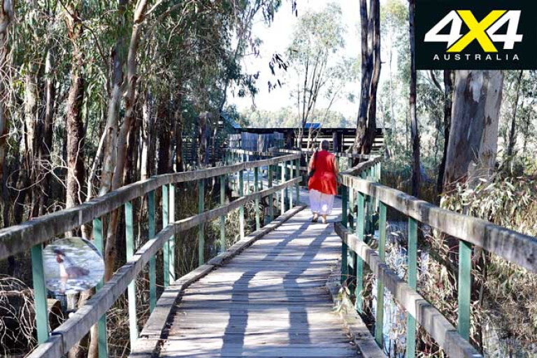
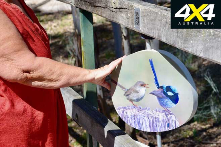
If you’re into bird watching the Reed Beds Bird Hide, passed on the way to Picnic Point or the Edwards River Bridge camping area, is a favoured spot to look for our feathered friends. This whole area is great for bird watching with ducks, cormorants and swans on the waterways, ibis and spoonbills in the shallows, and colourful wrens and treecreepers flitting in amongst the scrub.
Galahs and corellas screech from the treetops, while kookaburras laugh from dead branches, magpies stroll around on the grassy areas and herons wait patiently for a fish to swim by. At one point a magnificent white-breasted sea eagle took off from a branch directly above me; I don’t know who got the biggest fright!
18
Rather surprisingly we only saw one ’roo for the whole time we spent in the forest, even though there was plenty of green grass for them to feed on, or so it seemed to us. Maybe the encroaching spindly stands of gums are keeping them away?
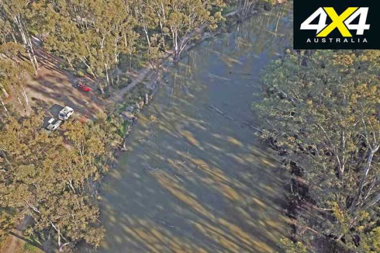
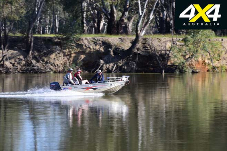
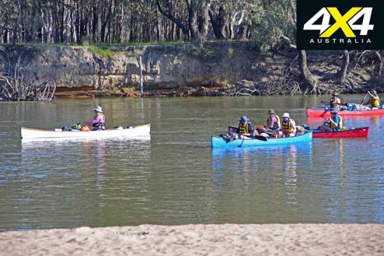
With our meander along the river road bearing little fruit and our exploration of the smaller sections of the park eastwards offering little to stay our wanderings, we crossed the river into Victoria and headed for Carters Beach, one of three popular riverside camps west of Tocumwal and in the Murray River Reserve. Others include Doctors Bend and Ulupna Creek East, and all are located on sandy bends of the river. These wide, sandy beaches are ideal for swimming, fishing or just lazing around, and, as it’s outside the National Park, you can bring your dog.
There were a few campers in residence when we arrived and, with a reasonable dirt road giving access, a few ’vans and campers were dotted along the shore. A group of young canoeists arrived and I spent a lively half-hour with them talking about the delights of paddling such a great river as the Murray, something I had done many years previously on a number of occasions. I highly recommend it.
18
The next day we cruised into the heart of Barmah NP and, while we have camped here on numerous occasions in the past, this was the first time we have been here since it became a National Park. Once again access was restricted because of local flooding, so we contained ourselves to the area around the Barmah Lakes camping area, which is easily reached from the small hamlet and supply point of the Barmah township itself.
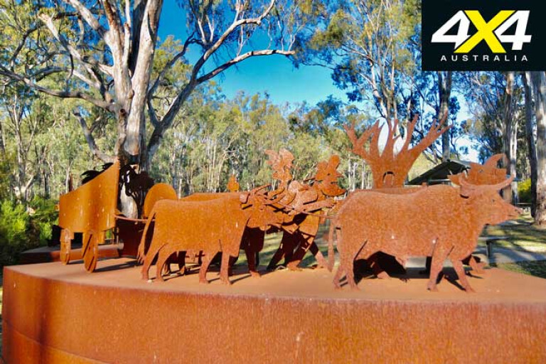
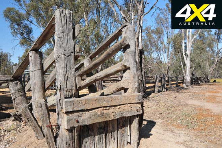
We settled into our camp, the area around the shallow waters of the lake dotted by some big red gums, and we made sure to stay away from them when setting up the camper. Then we wandered off and explored around the nearby area and the old heritage-listed mustering yards, which gives an idea of the cattle-grazing tradition of this area that’s often overshadowed by the forestry operations. The forest had been grazed since the 1880s and, even in the last year of grazing, 30 families were still mustering cattle here.
18
The history of the cattlemen is being kept alive by the Barmah Muster, which these days is more of a social event with friendly competitions, trail rides, entertainment and the like, but it’s still held every year. By all accounts it’s a great family occasion and one we must put on our calendar of things to do.
There is an easy walking trail near the Dharnya Centre with informative signs, which among other things take you to an Aboriginal cooking mound and a canoe tree, both graphic indications of the people’s long-term association with the country. We also found a nice campsite just outside the National Park in the adjoining Murray River Reserve, just before you cross Broken Creek north of the Barmah township. With easy access to the water and a few open areas right beside the creek, it’s a top spot and one we’ve added to the memory banks for our next visit.
Our time exploring the red gum forest around Barmah and beyond had come to an end, and it was with regret we packed up and headed back home. Next time, I’ll be back with a canoe and maybe even a fishing rod!
Travel Planner
18
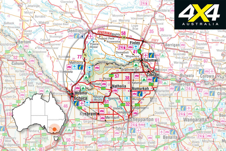
The red gum forests are approximately 260km north of Melbourne. It pays to check the relevant park websites to see road closures. Fines can result from driving on closed roads.
Murray Valley NP: www.nationalparks.nsw.gov.au/visit-a-park/parks/murray-valley-national-park
Barmah township: www.murrayriver.com.au/barmah
Mathoura: www.murrayriver.com.au/mathoura
Barmah Muster: www.barmahmuster.com.au
Please enable JavaScript to view the comments powered by Disqus.
COMMENTS