Explore SA

Gallery1
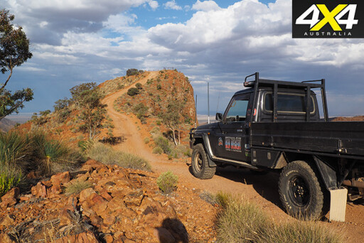
SILLERS Lookout, at the terminus of the Ridgetop Track in Arkaroola Wilderness Sanctuary, must be one of the best views in the Australian bush. It takes in 360-degress of the spectacular Flinders Ranges, a jewel of outback South Australia.
Sillers can only be reached in one of Arkaroola’s open Land Cruiser tour vehicles, and it can’t be driven by the general public, but it’s a place that shouldn’t be left off the itinerary of any adventure.
 The Ridgetop Track was blazed in the late 1960s by Exoil Ltd, as part of more than 150km of tracks that were carved out of the rock that is Arkaroola, in the company’s thirsty quest to find uranium. It was all for nothing, as the uranium had been leached out of the hills many millennia ago and deposited on the plains to the north, where one of the planet’s richest bodies of the metal now lie.
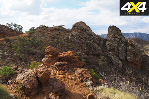
The track follows the ridgetops as it winds its way towards its final destination at Sillers; a craggy elevated lookout upon which the act of turning around a car requires a great deal of skill and bravado. Exoil Ltd chose the ridges as they offered the line of least resistance, and from there all of the tracks radiate to the far extremities of the property.
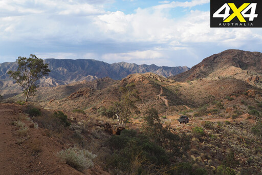 To get to the ridges means a lot of steep climbs and descents, and that’s what makes the Ridgetop Track so challenging.
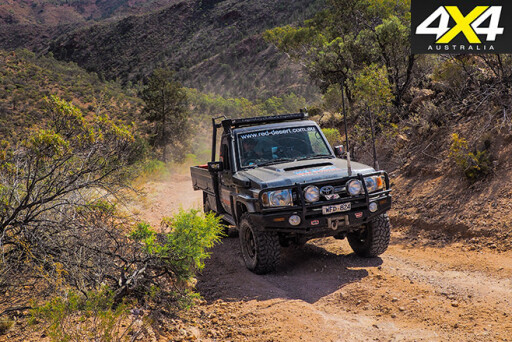
The journey begins as you leave Arkaroola campground and spend the first five or so kilometres travelling through Whywhyana Creek. The surrounding geology exposed in the rock walls shows the forces at work that created what we now know to be the Flinders Ranges.
 It’s not until you reach the locked gate that you feel true adventure is about to begin. A steady climb out of a very rough gully takes you past a geological fault that in itself is amazing, before taking you to a lookout that features a 360-degree view of the surrounding countryside.
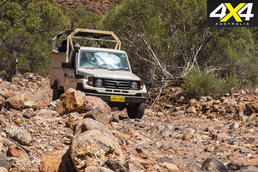
The track then meanders through country that owners would once have classified as arable, but to the untrained eye looks like wasteland. Very soon the track takes a sinister turn, with eroded and seemingly impassable sections that would test the articulation of any vehicle – deep, chassis-twisting, bottomless potholes appear mid-descent and would frighten the bravest of drivers.
 All along the journey there are places to marvel at. The yucca plants at Split Rock, and the ancient underground geysers that once lay hundreds of metres below the surface, are now are exposed to the world. Those familiar with Sir Douglas Mawson’s work know he spent every spare moment researching these hills.
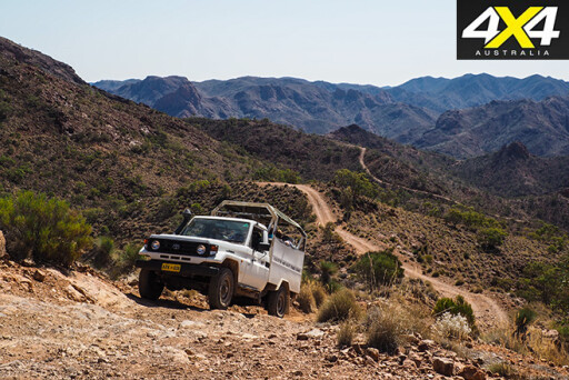
 The jewel in the crown is Sillers Lookout. A steep narrow ribbon of track has the word foreboding written all over it, and it appears out of nowhere. Cresting a rocky and extremely off-camber piece of track, the zenith appears and it’s these moments as a driver that make you gulp.
It looks devilish and it can make you doubt your vehicle. This is the last place you’d want to score a flat tyre or broken driveline component, and it’s the point in the drive where many are glad not to have driven their own 4x4 vehicle up here.
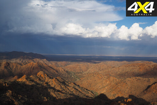 It is one of the most spectacular views you will ever see, and it makes you feel so insignificant when a continent is laid out before you in its rawest form.
The Arkaroola Ridgetop Tour should be on any tourer’s bucket list!
TRAVEL PLANNER
WHERE
Arkaroola Wilderness Sanctuary is located approximately 300km north of Yunta, which is on the Barrier Highway. The sanctuary can also be accessed from Leigh Creek, 130km to the west. This road weaves through the heart of the Vulkathunha-Gammon Ranges National Park.
 CAMPING & ACCOMMODATION
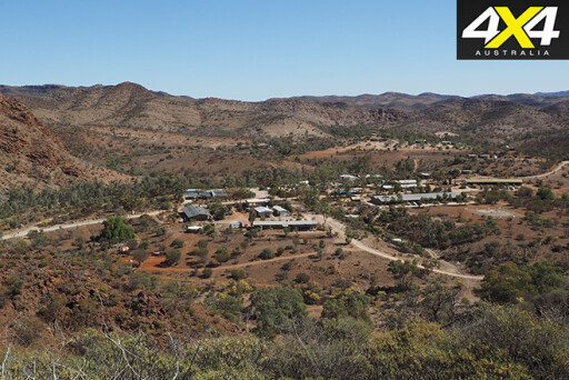
Arkaroola has a large camping ground with powered camping and caravan sites. There are dozens of bush campsites situated along the banks of Whywhyana Creek and its tributaries. Firewood is in short supply and you’re encouraged to bring it in with you. There are also bunkhouses and air-conditioned suites available.
SUPPLIES AND FACILITIES
A sturdy pair of hiking boots is a must-have. There are a number of self-drive tracks ranging from novice to pro, so pick up a mud map at reception. The sanctuary sells most everyday essentials in its supermarket. It’s advised you come fully self-sufficient for food needs, but the fully licensed restaurant operates seven days a week. Unleaded and diesel fuel are available, but LPG isn’t. Gas bottles can be refilled. Plenty of drinking water is available, with the main campground well-serviced. If you need a bigger shop, head to Leigh Creek.
 TRIP STANDARD
Both roads into Arkaroola are well-maintained dirt roads, but are prone to corrugations and bulldust patches. Creek crossings can become scoured out after heavy rain and stock can cross the road at any time. The tracks range from novice to expert. More info is available from the guides at reception.
CONTACTS AND INFORMATION
Arkaroola Wilderness Sanctuary: Visit www.arkaroola.com.au; or contact (08) 8648 4848.
PERMITS AND MAPS
No permits required to visit Arkaroola Wilderness Sanctuary, but permits are needed if you camp in the adjoining national park. These self-registration permits can be found at the entrance to any campground. Hema Maps’ Flinders Ranges map will get you there.
Please enable JavaScript to view the comments powered by Disqus.
COMMENTS