Explore NSW
Gallery16
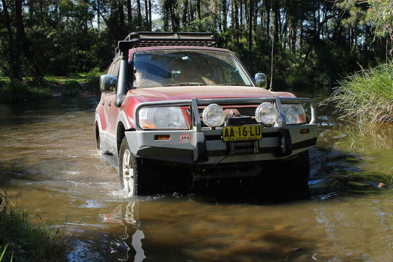
YOU CAN feel it in your bones: it’s just before you wet your tyres in Washpool Creek and the range looms above your line of sight. It’s usually an easy crossing, barely sill depth, and flowing clear and clean over a stony bed.
There’s a rich history here, which you begin to experience as you pass a small cluster of buildings that are all that’s left of the township of Lionsville. Farther into the bush, the names of other towns long vanished and reclaimed by the bush are Malara and Solferino.
 The track roughly follows the route of the old packhorse mail run between Grafton and Tenterfield, which began about 1883. This mail took up to three days to complete one-way, depending on the weather.
The mail went from Grafton to Lionsville, over the range to drop down to the Rocky or Timbarra River, before climbing up to Poverty Point where gold mining was carried out until recently. From there, the next leg was to Tenterfield.
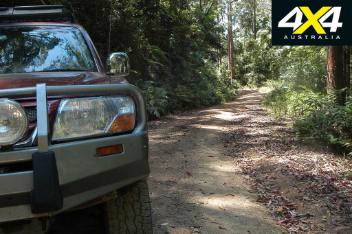
From the crossing at Washpool Creek the Lionsville road climbs steadily up the escarpment, where the changes to the flora become noticeable. The dry sclerophyll forests at the lower levels are replaced by dense gullies and tall trees that stretch to the sunlight, with a profusion of tree ferns and elk horns thrown into the mix. It’s nearly always damp here because the sun seldom reaches the lower reaches.
The bush, as it always does, has reclaimed its own here. However, you may occasionally come across a lump in the scrub, which, on closer examination, may be the remnants of a shaft.
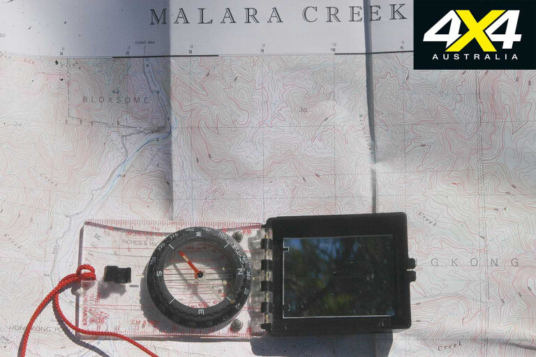
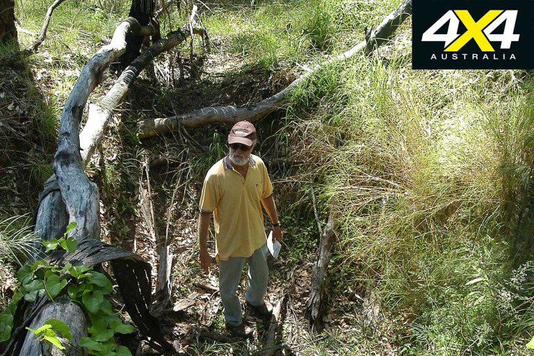
We followed a track that branched off from the Lionsville road not far from the Jerrawarra Flora Reserve sign. According to the 1:25,000 Malara map, it looked to head in the direction of where we thought the old Solferino township might lie. We eventually reached a point where options for turning around were limited, so we proceeded on foot.
16
After less than a kilometre the track became overgrown and we soon arrived on a small plateau. All around is evidence of the area’s mining past, and, without knowing for certain, we assumed this amount of mining activity would have meant some sort of township nearby. Could this have been the site of Solferino? Finding history about this place was never going to be easy, with the bush wasting no time in reclaiming the efforts of human endeavour.
Partway up the trail is the Jerrawarra Flora Reserve. The name comes from the local Aboriginal name that means “small hairy man” – clearly the Yowie legend may well have had its roots here.
16
A local once told me the Aboriginal people believed this creature lived in the trees and would swoop down and grab either the first or second man in a line going through the bush.
There’s no way to know if this is true, but it’s also said that when the cedar cutters came here the local Aboriginal people would put the white man either at the front or the back of the line when they showed them where the cedar grew. The white fellas thought this a mark of respect, but they had not heard the stories.
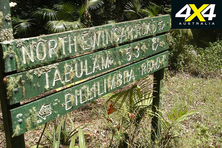
At the top of the range – about 700 metres above sea level – is the Billilimbra Road T-intersection. After turning left here you’ll follow the track to its intersection with Letterbox Road; its name handed down from when the previously mentioned Grafton-to-Tenterfield packhorse mailman came this way.
16
The track basically follows the route he took. Letterbox Road eventually joins the Malara Creek fire trail – you used to be able to follow this track and cross the Rocky River, but the landholder at the Rocky River end has locked it due to the actions of an irresponsible few. You can still follow the track, though, but it’s a one-way trip only.
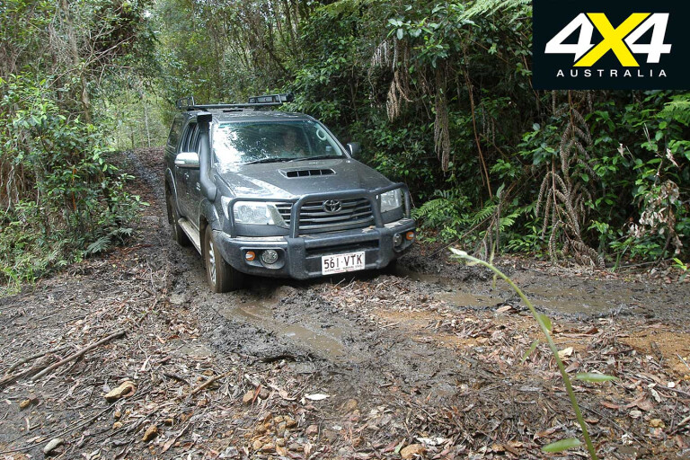
The scrub closes in on both sides as you proceed along Billilimbra Track, and it’s advised to fully retract your vehicle’s radio aerial. I didn’t and lost mine. You could previously follow this track all the way across the range to Grafton Road, but, with the creation of the Washpool NP, the track ends rather suddenly at Berry Creek.
16
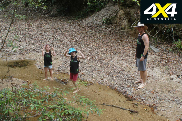
This is a pretty good place to stop and have a look around, as the crystal-clear, icy cold creek flows over rocks and cascades downhill on the western side of the range. Once done, you must turn back and retrace your tracks.
This is a region of huge interest for the avid explorer, as old logging/management tracks often spear off into the scrub, meaning it could take days to check them all out. Some go in a loop and rejoin a track you have already been on, while others end without ceremony or any particular reason. If you intend on doing any exploration, a chainsaw would be worth the investment.
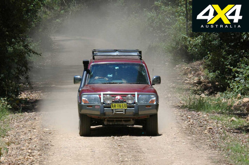
Backtracking to the T-intersection allows you to continue along the main Forest Road, where you must keep an eye out for Elkhorn Road to your left as it meanders down to Ewingar Creek. This is alluvial country and the glitter you may see in the sandy bottom is mica, not gold.
On a hot day, a place like this is great for a rest stop, especially for kids, who will enjoy a splash in the creek and can explore farther up or downstream from the crossing.
16
Once you’ve dried off at Ewingar Creek you can continue on Elkhorn Road to the intersection with Bulldog Track, which will take you past some unusual rock formations, oddly enough resembling the profile of a bulldog. However, some reckon it looks more like a Murray cod in profile.
MOREExplore
Either track will eventually bring you to Plains Station Road, where you will be on bitumen all the way back to where it joins the Bruxner Highway. From here, it’s an easy run back to Ballina or Byron Bay.
Fast Facts
 This is an easy day-trip out of Ballina, Byron Bay or nearby Grafton, but a fair bit longer if you’re coming from the Gold Coast. There is free camping along the banks of the Washpool Creek or, alternatively, free camping along the Clarence River at Alice, where there is a low-level bridge.
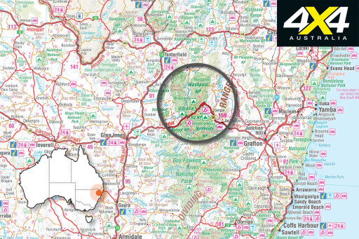
Good maps for this area are the CMA Malara Creek and Bulldog Rock sheets. They are 1:25,000 and show all tracks mentioned.
There are no major towns a reasonable distance from the Washpool, but limited supplies and fuel can be had at Tabulam. This means being self-sufficient.
 Four-wheel driving isn’t difficult, but if it gets wet it can become challenging and it’s best not to tempt fate. There’s always the chance of a tree clogging the track, too, so don’t forget an axe or chainsaw.
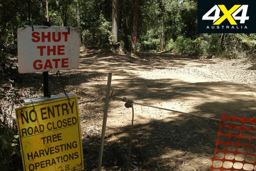
This is still an active forestry area and if logging is underway some tracks may be closed. Log trucks use the main forest roads so keep an eye out for them and don’t stop for long in the middle of a used road.
GETTING THERE
 Heading south along the Clarence Way you will come to the Aboriginal settlement at Baryulgil. Take the right turn here and head towards Lionsville after crossing some braided channel of the Clarence. Once through Lionsville you’ll see some cattle yards on your right, as well as the track that goes to the crossing of Washpool Creek.
CRYSTAL CLEAR
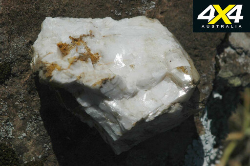 Paulo Marcolini is best known for his part in the discovery of the Garibaldi Crystal Mine in about 1912. His miners struck a wall that sounded hollow, so they put a charge in and when the dust cleared were amazed at the sight of all this crystal. A local tourist attraction, it came to the attention of a Dr Stroebel in 1924, and great quantities of the crystal were shipped to Germany for the manufacture of optical lenses.
Please enable JavaScript to view the comments powered by Disqus.
COMMENTS